Hennepin County (/ˈhɛnəpɪn/ HEN-ə-pin) is a county in the U.S. state of Minnesota. Its county seat is Minneapolis, the state’s most populous city. The county is named in honor of the 17th-century explorer Father Louis Hennepin. The county extends from Minneapolis to the suburbs and outlying cities in the western part of the county. The county’s natural areas are covered with extensive woods, hills, and lakes.
As of the 2020 census, the population was 1,281,565. It is the most populous county in Minnesota, and the 34th-most populous county in the United States; more than one in five Minnesotans live in Hennepin County. Hennepin County is included in the Minneapolis-St. Paul-Bloomington Metropolitan Statistical Area.
| Name: | Hennepin County |
|---|---|
| FIPS code: | 27-053 |
| State: | Minnesota |
| Founded: | March 6, 1852 |
| Named for: | Louis Hennepin |
| Seat: | Minneapolis |
| Largest city: | Minneapolis |
| Total Area: | 607 sq mi (1,570 km²) |
| Land Area: | 554 sq mi (1,430 km²) |
| Total Population: | 1,281,565 |
| Population Density: | 2,313/sq mi (893/km²) |
| Time zone: | UTC−6 (Central) |
| Summer Time Zone (DST): | UTC−5 (CDT) |
| Website: | www.hennepin.us |
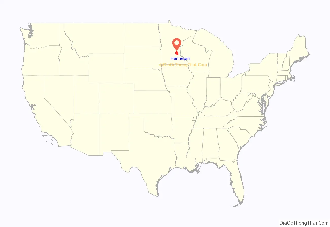
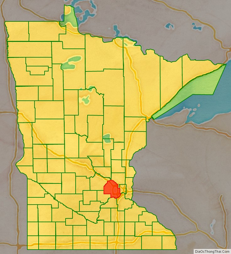
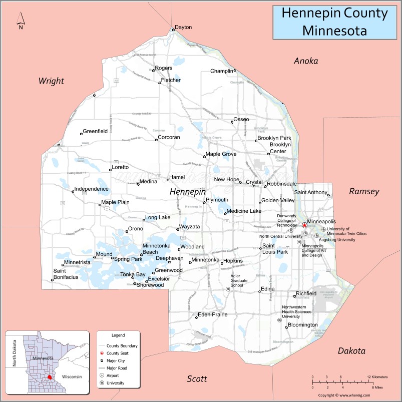
Hennepin County location map. Where is Hennepin County?
History
The Territorial Legislature of Minnesota established Hennepin County on March 6, 1852, and two years later Minneapolis was named the county seat. Father Louis Hennepin’s name was chosen because he originally named Saint Anthony Falls and recorded some of the earliest accounts of the area for the Western world. In January 1855, the first bridge over the Mississippi River was built over St. Anthony Falls.
Water power built the City of Minneapolis and Hennepin County. The water of streams and rivers provided power to grist mills and saw mills throughout the county. By the late 1860s, more than a dozen mills were churning out lumber near St. Anthony Falls and the population of the county had surpassed 12,000.
In many ways, the power of the falls served as the vital link between the central city and the farmsteads scattered throughout the county. Farms produced vegetables, fruits, grains and dairy products for city dwellers, while Minneapolis industries, in turn, produced lumber, furniture, farm implements and clothing.
By 1883, railroads united Minneapolis with both the East and West coasts, and technical developments, especially in flour milling, brought rapid progress to the area. The major Minneapolis millers were Washburn, Pillsbury, Bell, Dunwoody and Crosby. For a decade, the “Mill City” was the flour-milling capital of the world and one of the largest lumber producers. Minneapolis, with a population of 165,000 by 1890, had become a major American city, and by 1900, was firmly established as the hub for the Upper Midwest’s industry and commerce.
Hennepin’s farm economy also was substantial. In 1910, farmland in Hennepin County totaled 284,000 acres, or about 72 percent of the county’s total area. The principal crops were wheat, corn, garden vegetables and apples. The number of acres in production remained at a high level for the next 30 years. However, by 1950, the amount of land devoted to agriculture had been reduced to 132,000 acres as development progressed in the suburbs.
During the 1950s and 1960s, many suburbs grew rapidly as housing developments, shopping centers, large school systems and growing industrialization had replaced much of the open farm land. By 1970, the suburban population of Hennepin County outnumbered that of the city for the first time. The population of Minneapolis actually declined by 10 percent from 1960 to 1970, while the suburban population grew by nearly 50 percent.
Another wave of immigration — which began after the Vietnam War in the mid-1970s — marked a major change in the ethnic makeup of the county’s immigrant populations. This wave peaked in the 1980s when hundreds of refugees from Southeast Asia, often aided by local churches, resettled in Hennepin. The population of Hennepin County surpassed the one-million mark in 1989.
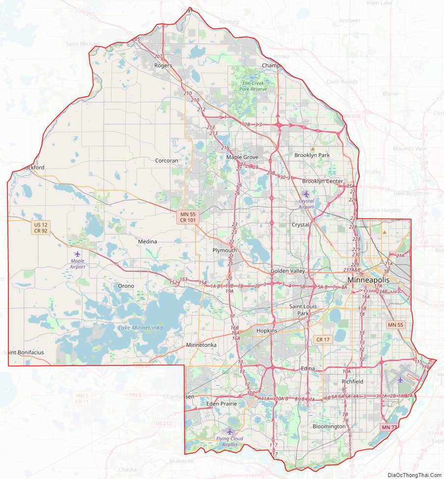
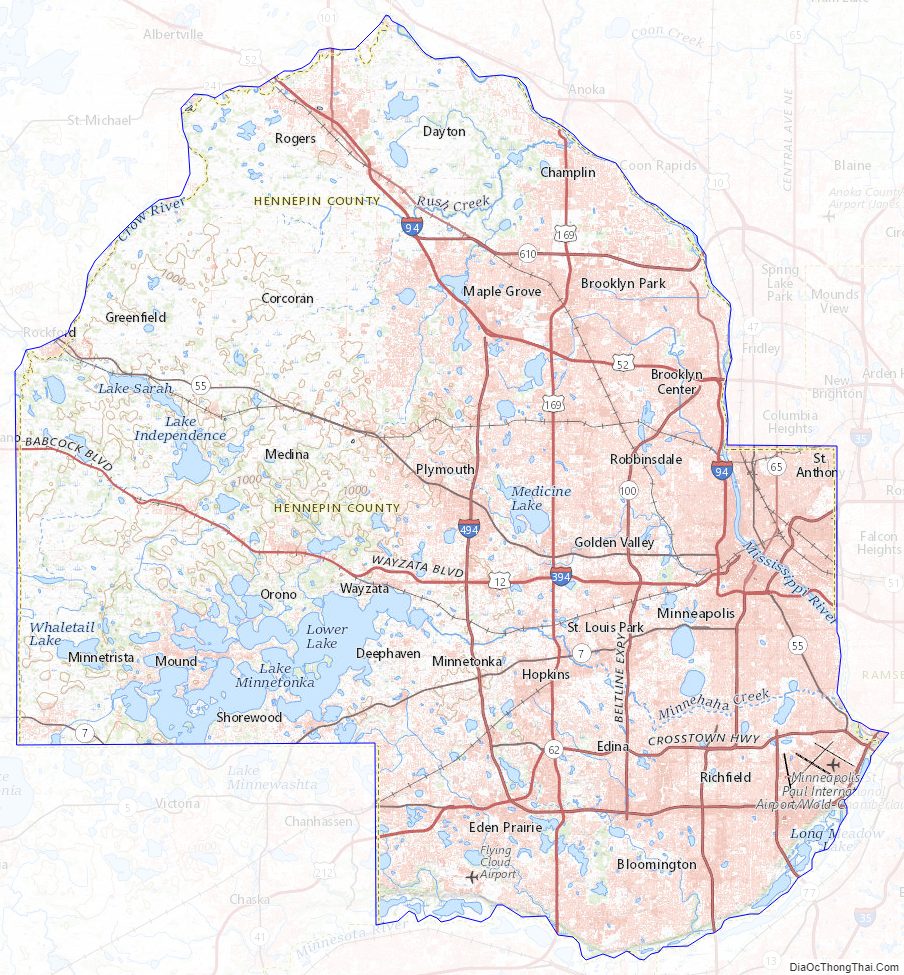
Hennepin County Road Map
Geography
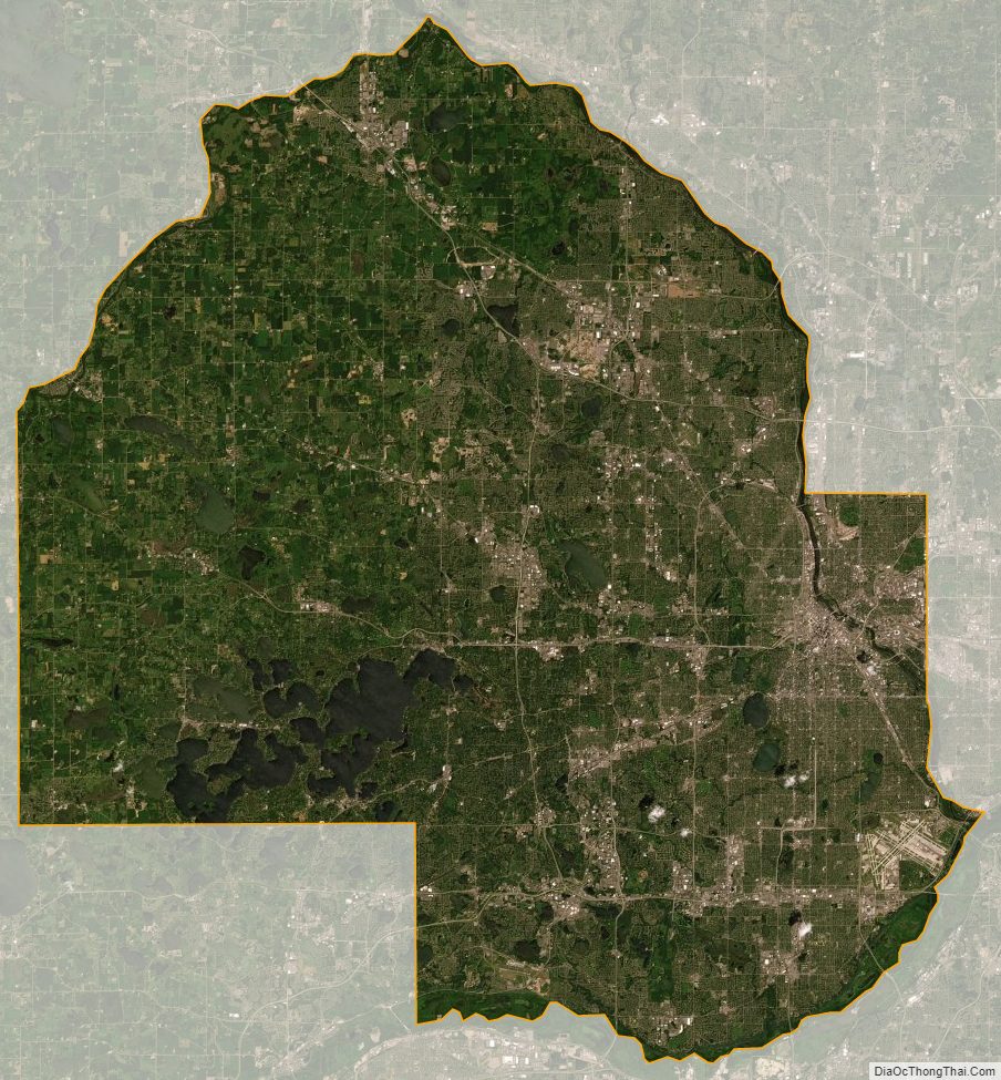
According to the United States Census Bureau, the county has a total area of 607 square miles (1,570 km), of which 554 square miles (1,430 km) is land and 53 square miles (140 km) (8.7%) is water. Hennepin is one of 17 Minnesota counties with more savanna soils than either prairie or forest soils, and is one of only two Minnesota counties with more than 75% of its area in savanna soils (the other is Wright County).
The highest waterfall on the Mississippi River, the Saint Anthony Falls (discovered by Louis Hennepin) is in Hennepin County next to downtown Minneapolis, but in the 19th century, the falls were converted to a series of dams. Barges and boats now pass through locks to move between the parts of the river above and below the dams.
Adjacent counties
- Anoka County (northeast)
- Ramsey County (east)
- Dakota County (southeast)
- Scott County (south)
- Carver County (southwest)
- Wright County (northwest)
- Sherburne County (north)
National protected areas
- Minnesota Valley National Wildlife Refuge (part)
- Mississippi National River and Recreation Area (part)
Hennepin County Topographic Map
Hennepin County Satellite Map
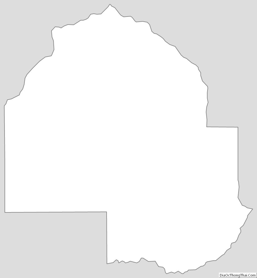
Hennepin County Outline Map