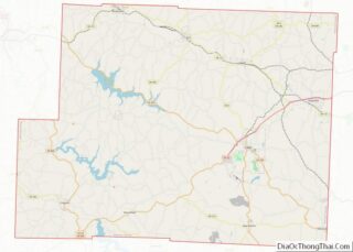
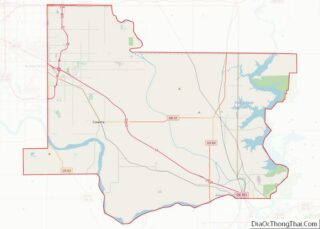
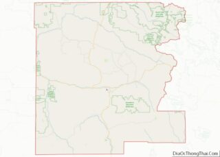
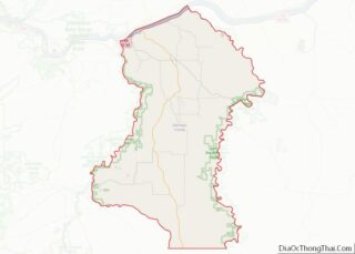
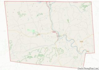
Map of Ravalli County

Map of Ravalli County, Montana

Ravalli County is a county in the southwestern part of the U.S. state of Montana. As of the 2020 census, the population was 44,174. Its county seat is Hamilton. Ravalli County is part of a north–south mountain valley bordered by the Sapphire Mountains on the East and the Bitterroot Mountains on the West. It is … Read more

Map of Adams County

Map of Adams County, Nebraska

Adams County is a county located in the U.S. state of Nebraska. As of the 2020 United States Census, the population was 31,205. Its county seat is Hastings. The county was formed in 1867 and organized in 1871. It is named for John Adams, the second President of the United States. Adams County comprises the … Read more

Map of Cheyenne County

Map of Cheyenne County, Nebraska

Cheyenne County is a county in the U.S. state of Nebraska. As of the 2010 United States Census, the population was 9,998. Its county seat is Sidney. The county was formed in 1871 and named for the Cheyenne Native American tribe. In the Nebraska license plate system, Cheyenne County is represented by the prefix 39 … Read more

Map of Furnas County

Map of Furnas County, Nebraska

Furnas County is a county in the U.S. state of Nebraska. As of the 2020 United States Census, the population was 4,636. Its county seat is Beaver City. The county was named for Robert Wilkinson Furnas, the second governor of the state of Nebraska. In the Nebraska license plate system, Furnas County is represented by … Read more

Map of Johnson County

Map of Johnson County, Nebraska

Johnson County is a county in the U.S. state of Nebraska. As of the 2020 United States Census, the population was 5,290. Its county seat is Tecumseh. The county was formed in 1855, and was organized in 1857. It was named after Richard Mentor Johnson, who was Vice President of the United States from 1837 … Read more

Map of Nuckolls County

Map of Nuckolls County, Nebraska

Nuckolls County is a county located in the U.S. state of Nebraska. As of the 2020 United States Census, the population was 4,095. Its county seat is Nelson. In the Nebraska license plate system, Nuckolls County is represented by the prefix 42 (it had the 42nd-largest number of vehicles registered in the county when the … Read more

Map of Sheridan County

Map of Sheridan County, Nebraska

Sheridan County is a county in the U.S. state of Nebraska. As of the 2010 United States Census, the population was 5,469. Its county seat is Rushville. The county was formed in 1885, and was named for General Philip H. Sheridan. In the Nebraska license plate system, Sheridan County is represented by the prefix 61 … Read more

Map of Douglas County

Map of Douglas County, Nevada

Douglas County is a county in the northwestern part of the U.S. state of Nevada. As of the 2020 Census, the population was 49,488. Its county seat is Minden. Douglas County comprises the Gardnerville Ranchos, NV Micropolitan Statistical Area, which is also included in the Reno–Carson City–Fernley, NV Combined Statistical Area. Douglas County overview: Name: … Read more

Map of Cheshire County

Map of Cheshire County, New Hampshire

Cheshire County is a county in the southwestern corner of the U.S. state of New Hampshire. As of the 2020 census, the population was 76,458. Its county seat is the city of Keene. Cheshire was one of the five original counties of New Hampshire, and is named for the county of Cheshire in England. It … Read more

Map of Hudson County

Map of Hudson County, New Jersey

Hudson County is the smallest and most densely populated county in the U.S. state of New Jersey. It lies west of the lower Hudson River, which was named for Henry Hudson, the sea captain who explored the area in 1609. Part of New Jersey’s Gateway Region in the New York metropolitan area, the county seat … Read more

Map of Cibola County

Map of Cibola County, New Mexico

Cibola County is a county in the U.S. state of New Mexico. As of the 2010 census, the population was 27,213. Its county seat is Grants. It is New Mexico’s youngest county, and the third youngest county in the United States, created on June 19, 1981, from the westernmost four-fifths of the formerly much larger … Read more

Map of Otero County

Map of Otero County, New Mexico

Otero County is a county located in the U.S. state of New Mexico. As of the 2010 census, the population was 63,797. Its county seat is Alamogordo. Its southern boundary is the Texas state line. It is named for Miguel Antonio Otero, the territorial governor when the county was created. Otero County includes the Alamogordo … Read more