Bradford County is a county in the Commonwealth of Pennsylvania. It is part of Northeastern Pennsylvania. As of the 2020 census, its population was 59,967. Its county seat is Towanda. The county was created on February 21, 1810, from parts of Lycoming and Luzerne Counties. Originally called Ontario County, it was reorganized and separated from Lycoming County on October 13, 1812, and renamed Bradford County for William Bradford, who had been a chief justice of the Pennsylvania Supreme Court and United States Attorney General.
Bradford County comprises the Sayre, Pennsylvania micropolitan statistical area.
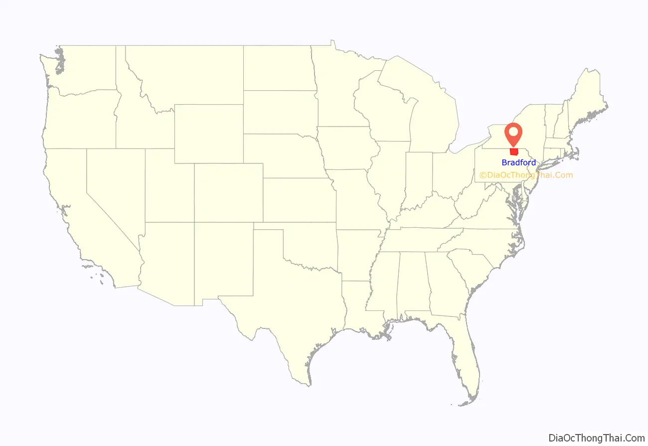
The county is not to be confused with the city of Bradford, which is in McKean County, 141 miles to the west via U.S. Route 6.
| Name: | Bradford County |
|---|---|
| FIPS code: | 42-015 |
| State: | Pennsylvania |
| Founded: | February 21, 1810 |
| Named for: | William Bradford |
| Seat: | Towanda |
| Total Area: | 1,161 sq mi (3,010 km²) |
| Land Area: | 1,147 sq mi (2,970 km²) |
| Total Population: | 59,967 |
| Population Density: | 52/sq mi (20/km²) |
| Website: | www.bradfordcountypa.org |
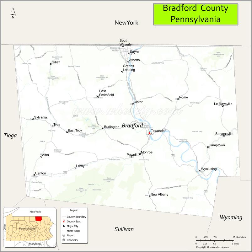
Bradford County location map. Where is Bradford County?
History
As noted above, Bradford County was originally named Ontario County. The county was reorganized and renamed in 1812, but a section of north Philadelphia in which major east–west streets are named after Pennsylvania counties retains an Ontario Street, between Westmoreland and Tioga Streets. Two short Bradford Streets are in northeast Philadelphia, about 4 miles from Ontario Street.
Bradford County is the ancestral home of the Tehotitachsae indigenous people of North America. Their principal village, Gohontoto, was on the site of the present Borough of Wyalusing.
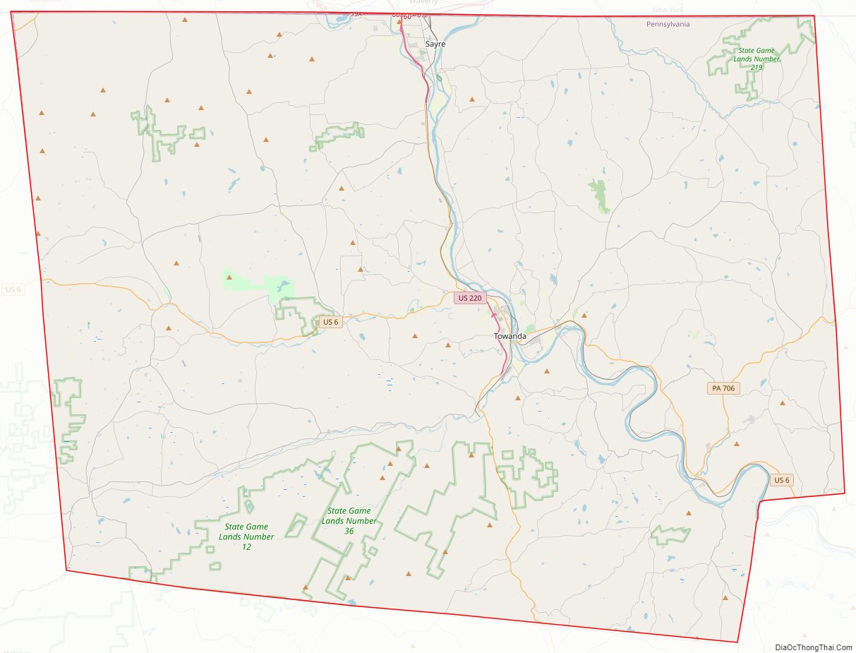
Bradford County Road Map
Geography
According to the U.S. Census Bureau, the county has a total area of 1,161 square miles (3,010 km), of which 1,147 square miles (2,970 km) are land and 14 square miles (36 km) (1.2%) are covered by water. It is the second-largest county in Pennsylvania by land area and third-largest by total area.
Climate
Bradford has a warm-summer humid continental climate (Dfb) and average monthly temperatures in Towanda range from 24.5°F in January to 70.6°F in July. [1]
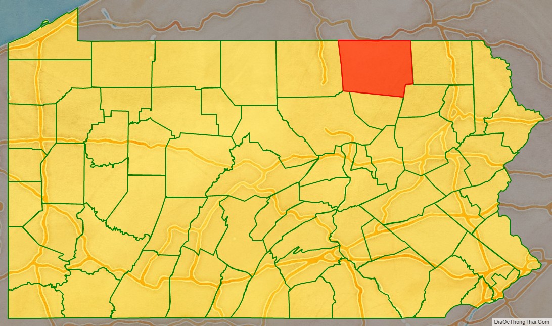
Adjacent counties
- Tioga County, New York (northeast)
- Chemung County, New York (northwest)
- Susquehanna County (east)
- Sullivan County (south)
- Lycoming County (southwest)
- Tioga County (west)
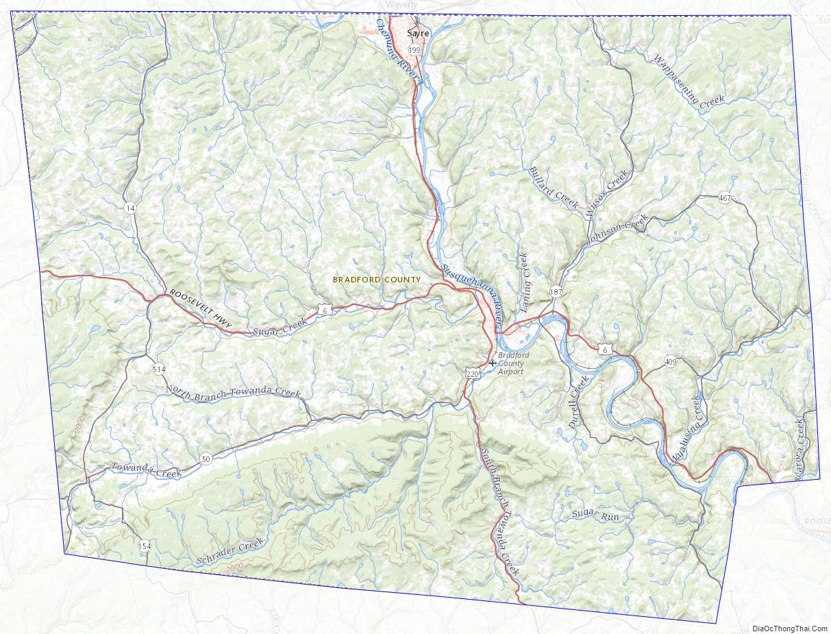
Bradford County Topographic Map
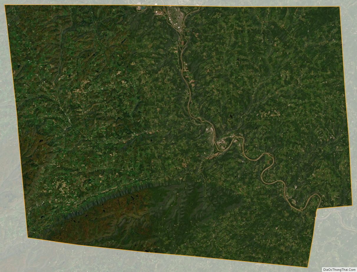
Bradford County Satellite Map
Bradford County Outline Map