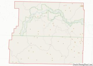
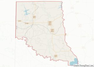
Map of Berks County, Pennsylvania
Berks County (Pennsylvania German: Barricks Kaundi) is a county in the Commonwealth of Pennsylvania. As of the 2020 census, the population was 428,849. The county seat is Reading. The Schuylkill River, a 135-mile-long (217 km) tributary of the Delaware River, flows through Berks County. The county is part of the Reading, PA metropolitan statistical area (MSA), ... Read more
Map of Berks County, Pennsylvania
Map of Delaware County, Pennsylvania
Delaware County overview: Name: Delaware County FIPS code: 42-045 State: Pennsylvania Founded: September 26, 1789 Named for: Delaware River Seat: Media Largest town: Upper Darby Total Area: 191 sq mi (490 km²) Land Area: 184 sq mi (480 km²) Total Population: 576,830 Population Density: 3,000/sq mi (1,200/km²) Website: delcopa.gov Delaware County location map. Where is Delaware County? History Delaware County lies in ... Read more
Map of Delaware County, Pennsylvania
Map of Lehigh County, Pennsylvania
Lehigh County (Pennsylvania Dutch: Lechaa Kaundi) is a county in the Commonwealth of Pennsylvania. As of the 2020 census, the county’s population was 374,557. Its county seat is Allentown, the state’s third largest city after Philadelphia and Pittsburgh. Lehigh County and Northampton County to its east combine to form the Lehigh Valley region of eastern ... Read more
Map of Lehigh County, Pennsylvania
Map of Snyder County, Pennsylvania
Snyder County is a county in the Commonwealth of Pennsylvania. As of the 2020 census, the population was 39,736. The county seat is Middleburg. Snyder County was formed in 1855 from parts of Union County. Snyder County comprises the Selinsgrove, PA Micropolitan Statistical Area, which is also included in the Bloomsburg–Berwick–Sunbury, PA Combined Statistical Area. ... Read more
Map of Snyder County, Pennsylvania
Map of Providence County, Rhode Island
Providence County is the most populous county in the U.S. state of Rhode Island. As of the 2020 census, the county’s population was 660,741, or 60.2% of the state’s population. Providence County contains the city of Providence, the state capital of Rhode Island and the county’s (and state’s) most populous city, with an estimated 190,934 ... Read more
Map of Providence County, Rhode Island
Map of Colleton County, South Carolina
Colleton County is in the Lowcountry region of the U.S. state of South Carolina. As of the 2020 census, the population was 38,604. Its county seat is Walterboro. The county is named after Sir John Colleton, 1st Baronet, one of the eight Lords Proprietor of the Province of Carolina. After two previous incarnations, the current ... Read more
Map of Colleton County, South Carolina
Map of Lee County, South Carolina
Lee County is a county located in the U.S. state of South Carolina. As of the 2020 census, its population was 16,531, making it the fifth-least populous county in South Carolina. Its county seat is Bishopville. Lee County overview: Name: Lee County FIPS code: 45-061 State: South Carolina Founded: December 15, 1902 Named for: Robert ... Read more
Map of Lee County, South Carolina
Map of Aurora County, South Dakota
Aurora County is a county in the U.S. state of South Dakota. As of the 2020 census, the population was 2,747. The county was created in 1879, and was organized in 1881. Aurora County overview: Name: Aurora County FIPS code: 46-003 State: South Dakota Founded: 1881 Named for: Aurora, a Roman goddess Seat: Plankinton Largest ... Read more
Map of Aurora County, South Dakota
Map of Davison County, South Dakota
Davison County is a county in the U.S. state of South Dakota. As of the 2020 United States Census, the population was 19,956. Its county seat is Mitchell. The county was created in 1873 and organized in 1874. It was named for Henry C. Davison, the first settler in the county. Davison County is part ... Read more
Map of Davison County, South Dakota
Map of Hutchinson County, South Dakota
Hutchinson County is a county in the U.S. state of South Dakota. As of the 2020 United States Census, the population was 7,427. Its county seat is Olivet. The county was created in 1862 and organized in 1871; it was named for John Hutchinson, first territorial secretary. Hutchinson County overview: Name: Hutchinson County FIPS code: ... Read more
Map of Hutchinson County, South Dakota
Map of Minnehaha County, South Dakota
Minnehaha County is a county on the eastern border of the state of South Dakota. As of the 2020 census, the population was 197,214, making it the state’s most populous county. It contains over 20% of the state’s population. Its county seat is Sioux Falls, South Dakota’s largest city. The county was created in 1862 ... Read more
Map of Minnehaha County, South Dakota
Map of Yankton County, South Dakota
Yankton County overview: Name: Yankton County FIPS code: 46-135 State: South Dakota Founded: April 10, 1862 Named for: Yankton Sioux Seat: Yankton Largest city: Yankton Total Area: 532 sq mi (1,380 km²) Land Area: 521 sq mi (1,350 km²) Total Population: 23,310 Population Density: 44/sq mi (17/km²) Time zone: UTC−6 (Central) Summer Time Zone (DST): UTC−5 (CDT) Website: www.co.yankton.sd.us Yankton County location ... Read more
Map of Yankton County, South Dakota