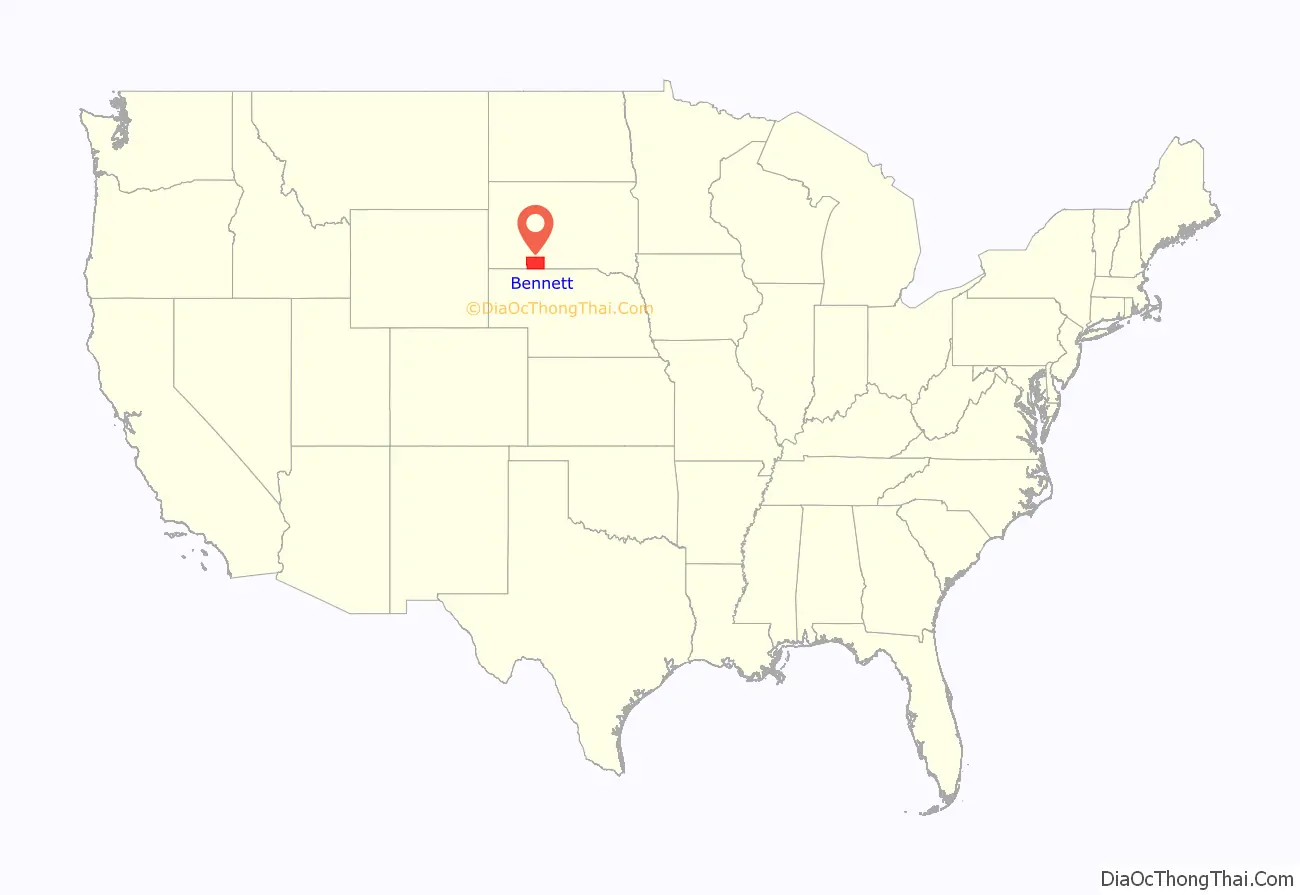
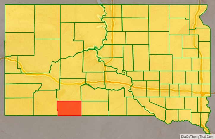
Bennett County is a county in the U.S. state of South Dakota. As of the 2020 census, the population was 3,381. Its county seat is Martin. The county lies completely within the exterior boundary of the Pine Ridge Indian Reservation. To the east is the Rosebud Indian Reservation, occupied by Sicangu Oyate, also known the Upper Brulé Sioux Nation and the Rosebud Sioux Tribe (RST), a branch of the Lakota people.
The North American continental pole of inaccessibility is in Bennett County, located 1650 km (1024 mi) from the nearest coastline, between Allen and Kyle (Oglala Lakota County) at 43°22′N 101°58′W / 43.36°N 101.97°W / 43.36; -101.97 (Pole of Inaccessibility North America).
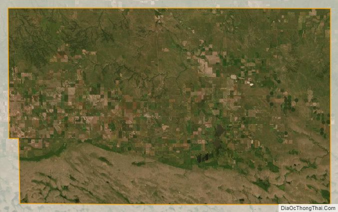
Historically, ranching and dry land farming have been the chief agricultural pursuits possible given climate and soil conditions.
| Name: | Bennett County |
|---|---|
| FIPS code: | 46-007 |
| State: | South Dakota |
| Founded: | 1909 |
| Named for: | John E. Bennett or Granville G. Bennett |
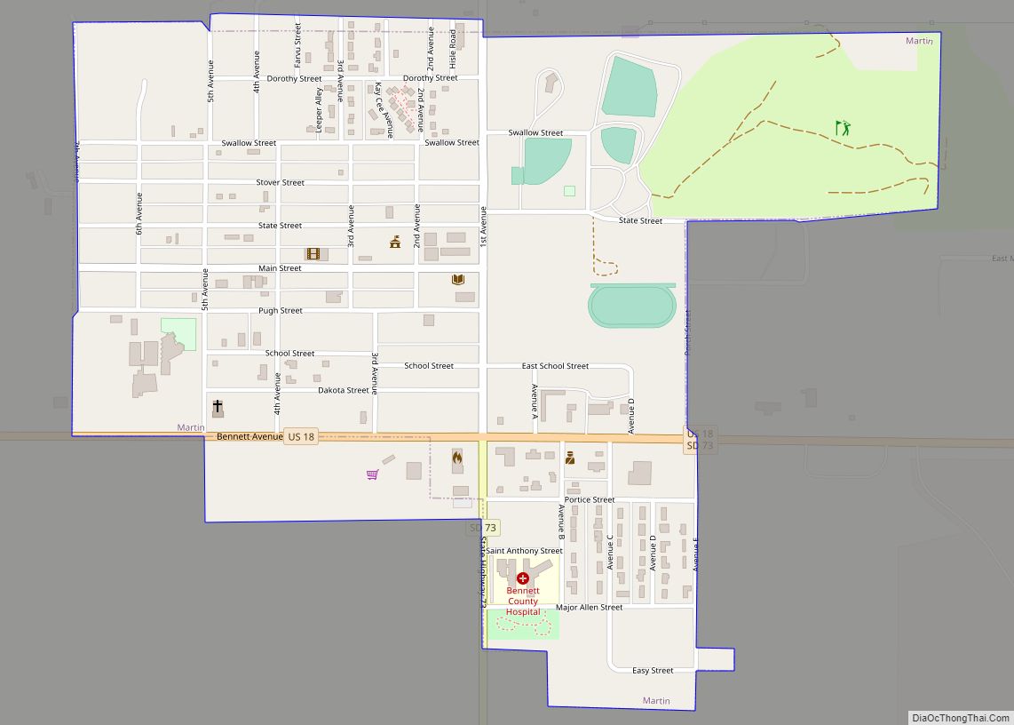
| Seat: | Martin |
| Largest city: | Martin |
| Total Area: | 1,191 sq mi (3,080 km²) |
| Land Area: | 1,185 sq mi (3,070 km²) |
| Total Population: | 3,381 |
| Population Density: | 2.8/sq mi (1.1/km²) |
| Time zone: | UTC−7 (Mountain) |
| Summer Time Zone (DST): | UTC−6 (MDT) |
Bennett County location map. Where is Bennett County?
History
This land has for centuries been the traditional territory of the Oglala Lakota, also known as the Sioux; it has been part of their legally defined territory since the treaty of 1851 and has remained within its legal boundaries through various other Treaties and Acts that reduced their land base to the current boundaries of the Pine Ridge Indian Reservation when the reservation was created by the Act of March 2, 1889 (25 Stat. 888). Despite its reservation status, most of the county was opened for settlement by the Act of May 27, 1910, where the US Congress “authorized and directed the Secretary of Interior to sell and dispose of all that portion of the Pine Ridge Indian Reservation, in the State of South Dakota, lying and being in Bennett County”. Open settlement was ended by a Secretarial Order of June 10, 1936, which restored “to tribal ownership of all lands which are now, or may hereafter be, classified as undisposed-of surplus opened lands of the Pine Ridge Reservation….” The allotment process left the county’s landownership a “checkerboard” mixture of Indian trust lands and state and private lands.
The county was created in 1909, with land partitioned from Fall River County. On April 27, 1912, the county’s first board of commissioners was elected. In November 1912, residents chose the town of Martin as the county seat.
Bennett County Road Map
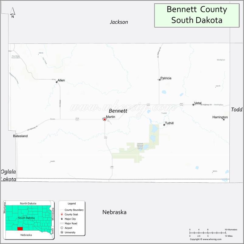
Geography
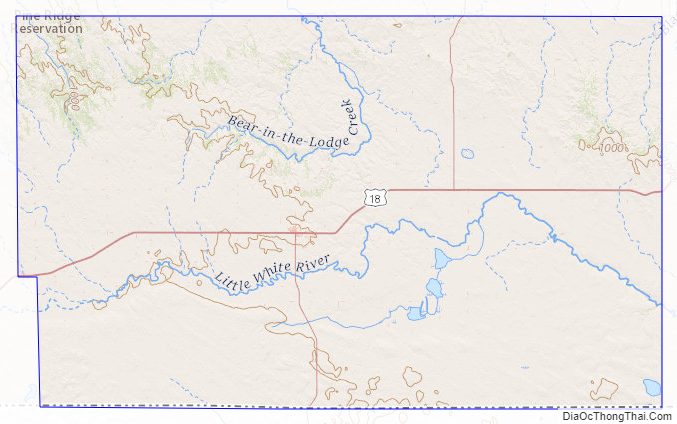
Bennett County lies on the south line of South Dakota. Its south boundary line abuts the north boundary line of the state of Nebraska. The Little White River flows eastward through the lower central part of the county. The highest point on the county’s terrain is the SW corner, at 3,497′ (1066m) ASL. Its lowest point is along the north boundary line, at 2,703′ (824m) ASL. The terrain consists of rolling hills cut with drainage gullies, sloping to the east-northeast.
The county has a total area of 1,191 square miles (3,080 km), of which 1,185 square miles (3,070 km) is land and 5.8 square miles (15 km) (0.5%) is water.
The eastern portion of South Dakota’s counties (48 of 66) observe Central Time; the western counties (18 of 66) observe Mountain Time. Bennett County is the easternmost of the SD counties to observe Mountain Time.
Major highways
- U.S. Highway 18
- South Dakota Highway 73
Adjacent counties
- Jackson County – north
- Mellette County – northeast (boundary of Central Time)
- Todd County – east (boundary of Central Time)
- Cherry County, Nebraska – south (eastern part of county observes Central Time)
- Sheridan County, Nebraska – southwest
- Oglala Lakota County – west
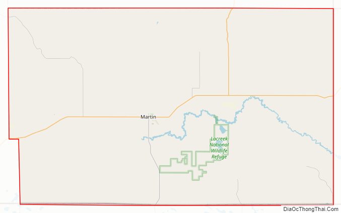
Protected areas
- Lacreek National Wildlife Refuge
- Little White River Recreation Area
- Little White River State Game Production Area
- Todd State Game Production Area
Bennett County Topographic Map
Bennett County Satellite Map
Bennett County Outline Map