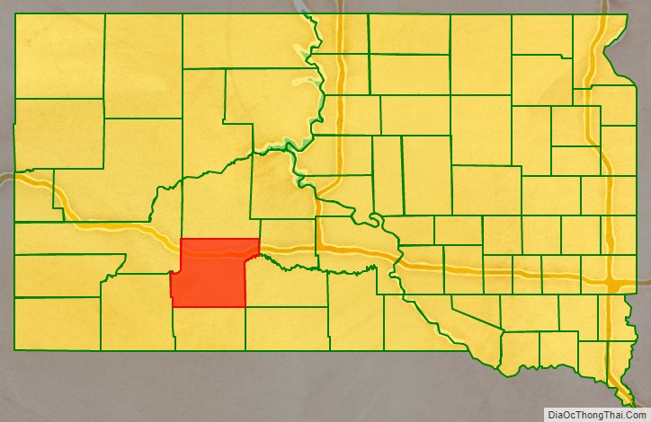
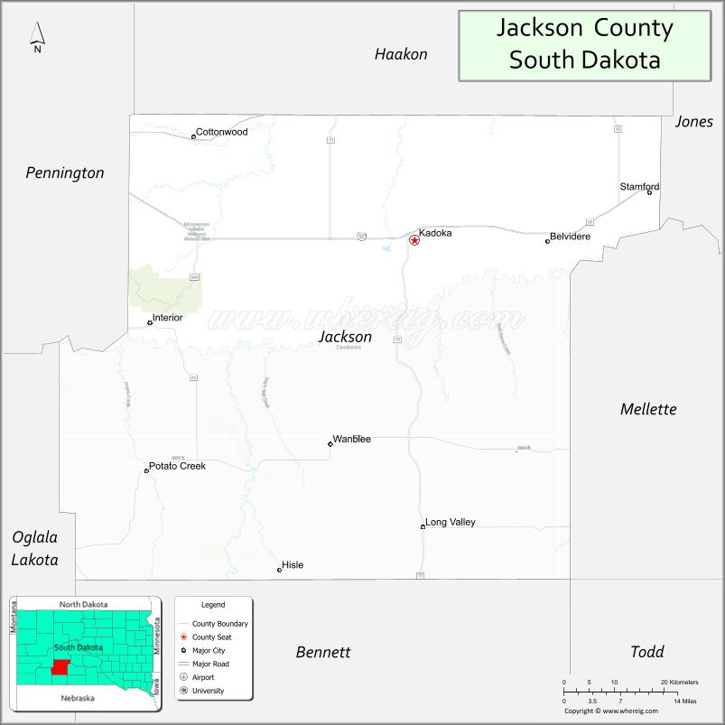
| Name: | Jackson County |
|---|---|
| FIPS code: | 46-071 |
| State: | South Dakota |
| Founded: | 1914 |
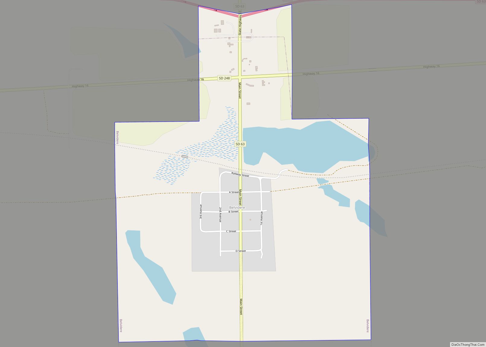
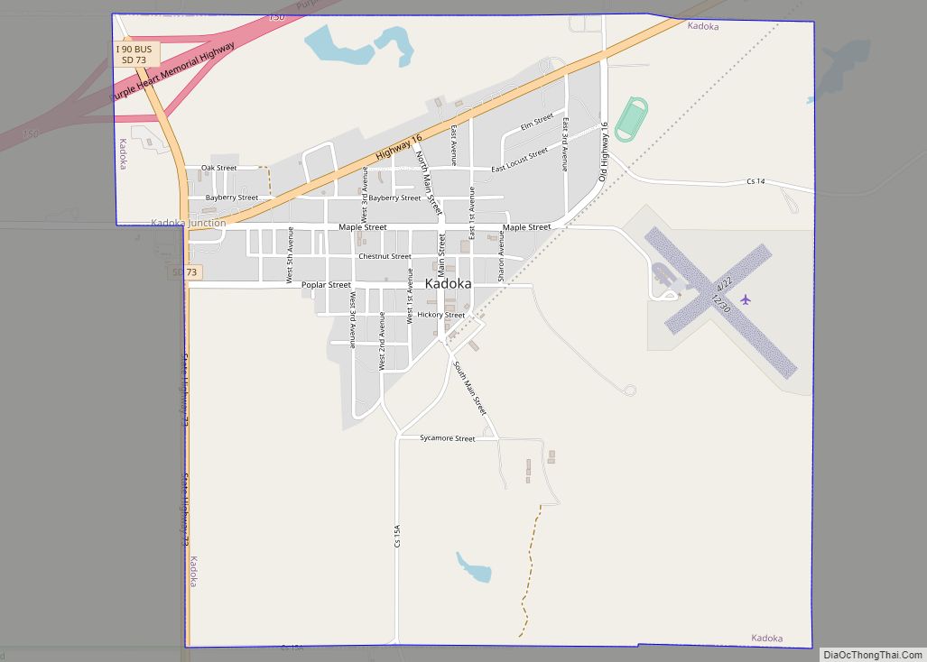
| Seat: | Kadoka |
| Total Area: | 1,871 sq mi (4,850 km²) |
| Land Area: | 1,864 sq mi (4,830 km²) |
| Total Population: | 2,806 |
| Population Density: | 1.5/sq mi (0.58/km²) |
| Time zone: | UTC−7 (Mountain) |
| Summer Time Zone (DST): | UTC−6 (MDT) |
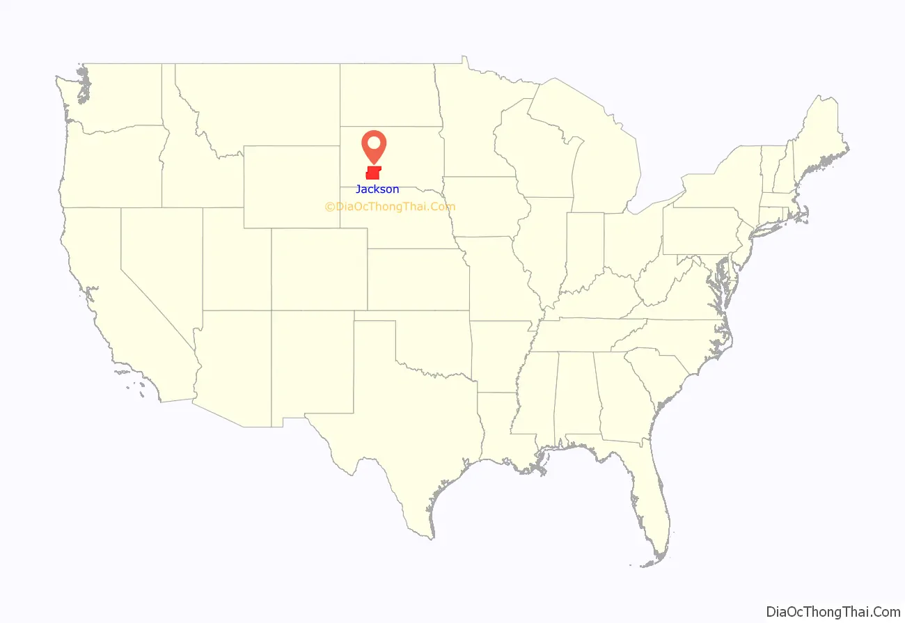
Jackson County location map. Where is Jackson County?
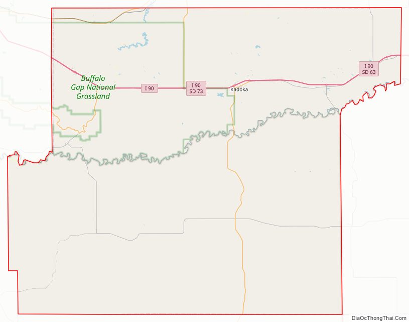
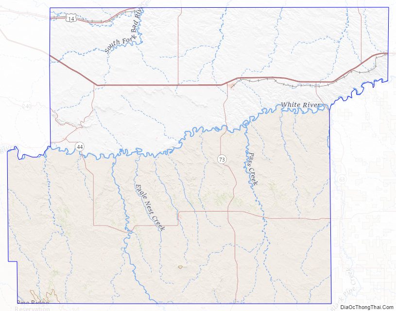
Jackson County Road Map
Geography
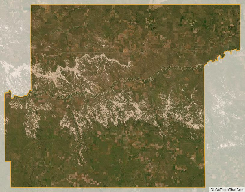
The terrain of Jackson County consists of mountains rising from rolling hills. The ground is arid and carved with drainages. The White River flows eastward, cutting a meandering channel through the central part. The terrain generally slopes to the NE; its highest point is a ridge near the SW corner, at 3,274′ (998m) ASL.
Jackson County has a total area of 1,871 square miles (4,850 km), of which 1,864 square miles (4,830 km) is land and 7.4 square miles (19 km) (0.4%) is water. About 57 percent of its land, the portion south of White River, is on the Pine Ridge Indian Reservation. The county includes the easternmost portion of Badlands National Park.
South Dakota’s eastern counties (48 of 66) observe Central Time; the western counties (18 of 66) observe Mountain Time. Jackson County is the easternmost of the state’s counties to observe Mountain Time.
Major highways
- Interstate 90
- U.S. Highway 14
- South Dakota Highway 44
- South Dakota Highway 63
- South Dakota Highway 73
- South Dakota Highway 377
Adjacent counties
- Haakon County – north
- Jones County – northeast (observes Central Time)
- Mellette County – east (observes Central Time)
- Todd County – southeast (observes Central Time)
- Bennett County – south
- Oglala Lakota County – southwest
- Pennington County – northwest
Lakes
- Kadoka Lake
- Wanblee Lake
National protected areas
- Badlands National Park (part)
- Buffalo Gap National Grassland (part)
- Minuteman Missile National Historic Site (part)
Jackson County Topographic Map
Jackson County Satellite Map
Jackson County Outline Map