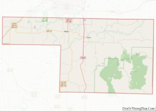
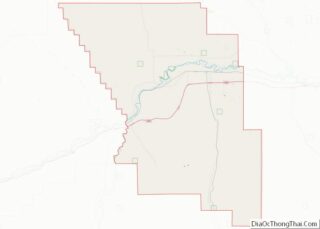
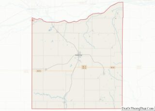
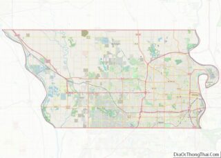
Map of Screven County, Georgia
Screven County is a county located in the southeastern part of the U.S. state of Georgia. As of the 2020 census, the population was 14,067. The county seat is Sylvania. Screven County overview: Name: Screven County FIPS code: 13-251 State: Georgia Founded: 1793 Named for: James Screven Seat: Sylvania Largest city: Sylvania Total Area: 656 sq mi ... Read more
Map of Screven County, Georgia
Map of Treutlen County, Georgia
Treutlen County is a county located in the east central portion of the U.S. state of Georgia. As of the 2020 census, the population was 6,406. The county seat is Soperton. It is host to the Million Pines Arts and Crafts Festival which occurs during the first weekend in November. Treutlen County overview: Name: Treutlen ... Read more
Map of Treutlen County, Georgia
Map of Wilcox County, Georgia
Wilcox County is a county located in the central portion of the U.S. state of Georgia. As of the 2020 census, the population was 8,766. The county seat is Abbeville. Wilcox County overview: Name: Wilcox County FIPS code: 13-315 State: Georgia Founded: 1857 Named for: Mark Wilcox Seat: Abbeville Largest city: Abbeville Total Area: 382 sq mi ... Read more
Map of Wilcox County, Georgia
Map of Boise County, Idaho
Boise County is a rural mountain county in the U.S. state of Idaho. As of the 2020 United States Census, the population was 7,610. The county seat is historic Idaho City, which is connected through a series of paved and unpaved roads to Lowman, Centerville, Placerville, Pioneerville, Star Ranch, Crouch, Garden Valley, and Horseshoe Bend. ... Read more
Map of Boise County, Idaho
Map of Gooding County, Idaho
Gooding County is a county located in the U.S. state of Idaho. As of the 2010 census, the population was 15,464. Its county seat is Gooding. The county was created by the Idaho Legislature on January 28, 1913, by a partition of Lincoln County. It is named for Frank R. Gooding, the 7th governor and ... Read more
Map of Gooding County, Idaho
Map of Shoshone County, Idaho
Shoshone County is a county in the U.S. state of Idaho. As of the 2020 census, the population was 13,169. The largest city is Kellogg. The county was established in 1864, named for the Native American Shoshone tribe. Shoshone County is commonly referred to as the Silver Valley, due to its century-old mining history. The ... Read more
Map of Shoshone County, Idaho
Map of Clark County, Illinois
Clark County is a county located in the southeastern part of U.S. state of Illinois, along the Indiana state line. As of the 2010 census, the population was 16,335. Its county seat is Marshall. The county was named for George Rogers Clark, an officer who served in the American Revolution. Clark County overview: Name: Clark ... Read more
Map of Clark County, Illinois
Map of Franklin County, Illinois
Franklin County is a county in Southern Illinois. At the 2020 census, it had a population of 37,804. The largest city is West Frankfort and the county seat is Benton. This area of Southern Illinois is known locally as “Little Egypt”. Franklin County overview: Name: Franklin County FIPS code: 17-055 State: Illinois Founded: January 2, ... Read more
Map of Franklin County, Illinois
Map of Johnson County, Illinois
Johnson County is a county in the U.S. state of Illinois. According to the 2010 census, it has a population of 12,582. Its county seat is Vienna. It is located in the southern portion of Illinois known locally as “Little Egypt”. Johnson County overview: Name: Johnson County FIPS code: 17-087 State: Illinois Founded: 1812 Named ... Read more
Map of Johnson County, Illinois
Map of Marshall County, Illinois
Marshall County is a county located in the U.S. state of Illinois. According to the 2010 census, it had a population of 12,640. Its county seat is Lacon. Marshall County is part of the Peoria, IL Metropolitan Statistical Area. Marshall County overview: Name: Marshall County FIPS code: 17-123 State: Illinois Founded: January 19, 1839 Named ... Read more
Map of Marshall County, Illinois
Map of Pike County, Illinois
Pike County is a county in the U.S. state of Illinois. It is located between the Mississippi River and the Illinois River in western Illinois. According to the 2010 United States Census, it had a population of 16,430. Its county seat is Pittsfield. Pike County overview: Name: Pike County FIPS code: 17-149 State: Illinois Founded: ... Read more
Map of Pike County, Illinois
Map of Union County, Illinois
Union County is a county located in the U.S. state of Illinois. According to the 2020 United States Census, it had a population of 17,244. Its county seat is Jonesboro. It is located in the southern portion of Illinois known locally as “Little Egypt”. Union County overview: Name: Union County FIPS code: 17-181 State: Illinois ... Read more
Map of Union County, Illinois