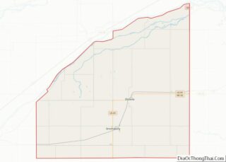
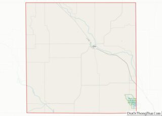
Map of Union County

Map of Union County, New Jersey

Union County overview: Name: Union County FIPS code: 34-039 State: New Jersey Founded: 1857 Named for: Union threatened by slavery dispute Seat: Elizabeth Largest city: Elizabeth (population and area) Total Area: 105.40 sq mi (273.0 km²) Land Area: 102.86 sq mi (266.4 km²) Total Population: 575,345 Population Density: 5,593.5/sq mi (2,159.7/km²) Website: www.ucnj.org Union County location map. Where is Union County? History … Read more

Map of Lincoln County

Map of Lincoln County, New Mexico

Lincoln County is a county in the U.S. state of New Mexico. As of the 2010 census, the population was 20,497. Its county seat is Carrizozo, while its largest community is Ruidoso. Lincoln County overview: Name: Lincoln County FIPS code: 35-027 State: New Mexico Founded: 1869 Named for: Abraham Lincoln Seat: Carrizozo Total Area: 4,831 sq mi … Read more

Map of Torrance County

Map of Torrance County, New Mexico

Torrance County is a county located in the center of the U.S. state of New Mexico. As of the 2010 census, the population was 16,383. The county seat is Estancia. The geographic center of New Mexico is located in Torrance County, southwest of the Village of Willard, and in 2010, the center of population of … Read more

Map of Dutchess County

Map of Dutchess County, New York

Dutchess County is a county in the U.S. state of New York. As of the 2020 census, the population was 295,911. The county seat is the city of Poughkeepsie. The county was created in 1683, one of New York’s first twelve counties, and later organized in 1713. It is located in the Mid-Hudson Region of … Read more

Map of Montgomery County

Map of Montgomery County, New York

Montgomery County is a county in the U.S. state of New York. As of the 2020 census, the population was 49,532. The county seat is Fonda. The county was named in honor of Richard Montgomery, an American Revolutionary War general killed in 1775 at the Battle of Quebec. Historically occupied by the Mohawk people, one … Read more

Map of Saint Lawrence County

Map of St. Lawrence County, New York

St. Lawrence County is a county in the U.S. state of New York. As of the 2020 census, the population was 108,505. The county seat is Canton. The county is named for the Saint Lawrence River, which in turn was named for the Christian saint Lawrence of Rome, on whose feast day the river was … Read more

Map of Wyoming County

Map of Wyoming County, New York

Wyoming County is a county in the U.S. state of New York in the state’s western area. As of the 2020 census, the population was 40,531. The county seat is Warsaw. The name is modified from a Lenape (Delaware) Native American word meaning “broad bottom lands”. Wyoming County was formed from Genesee County in 1841. … Read more

Map of Camden County

Map of Camden County, North Carolina

Camden County is a consolidated city-county located in the U.S. State of North Carolina. As of the 2020 census, the population was 10,335, making it the fourth-least populous county in North Carolina. Its county seat is Camden. Camden County is part of the Elizabeth City, NC Micropolitan Statistical Area, which is also included in the … Read more

Map of Duplin County

Map of Duplin County, North Carolina

Duplin County (/ˈduːplɪn/) is a county located in the U.S. state of North Carolina. As of the 2020 census, the population was 48,715. Its county seat is Kenansville. Duplin County overview: Name: Duplin County FIPS code: 37-061 State: North Carolina Founded: 1750 Named for: Thomas Hay, Viscount Dupplin Seat: Kenansville Largest town: Wallace Total Area: … Read more

Map of Hoke County

Map of Hoke County, North Carolina

Hoke County is a county in the U.S. state of North Carolina. As of the 2020 census, its population was 52,082. Its county seat is Raeford. Hoke County is part of the Fayetteville metropolitan statistical area. The county is home to part of the Fort Bragg military reservation. Hoke County overview: Name: Hoke County FIPS … Read more

Map of Moore County

Map of Moore County, North Carolina

Moore County is a county located in the U.S. state of North Carolina. As of the 2020 census, its population was 99,727. Its county seat is Carthage and its largest municipality is the Village of Pinehurst. It is a border county between the Piedmont and the Atlantic Coastal Plain. In the early years, the economy … Read more

Map of Rockingham County

Map of Rockingham County, North Carolina

Rockingham County is a county located in the U.S. state of North Carolina. As of the 2020 census, the population was 91,096. Its county seat is Wentworth. The county is known as “North Carolina’s North Star.” Rockingham County overview: Name: Rockingham County FIPS code: 37-157 State: North Carolina Founded: 1785 Named for: Charles Watson-Wentworth, 2nd … Read more