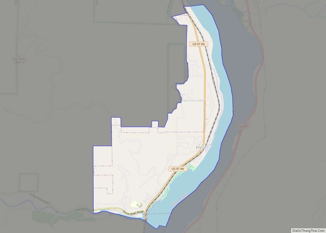
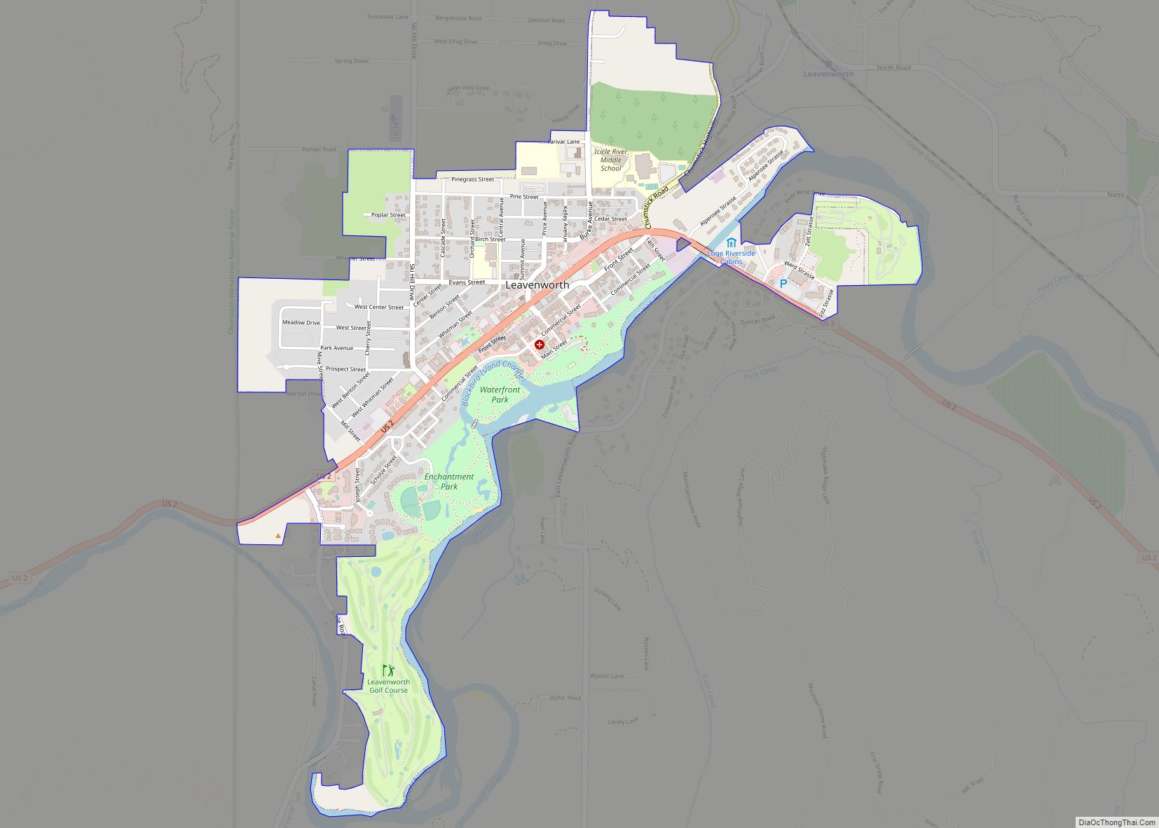
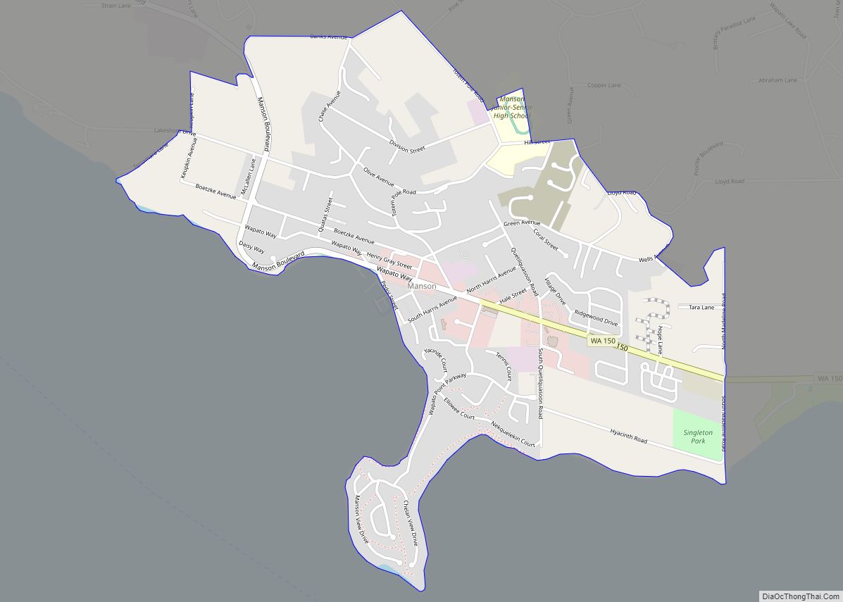
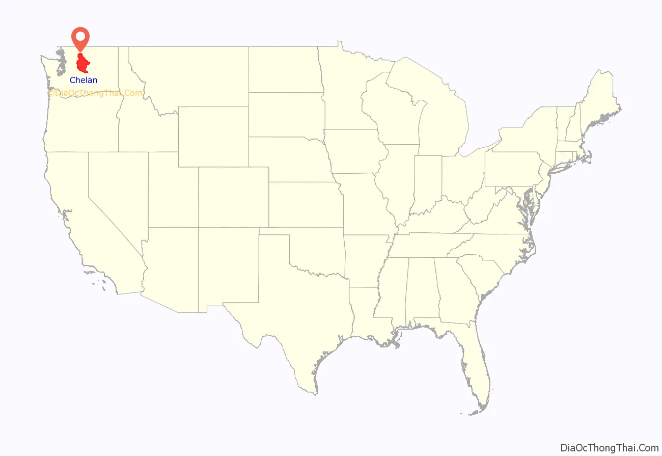
Chelan County (/ʃəˈlæn/, shə-LAN) is a county in the U.S. state of Washington. As of the 2020 census, its population was 79,074. The county seat and largest city is Wenatchee. The county was created out of Okanogan and Kittitas Counties on March 13, 1899. It derives its name from a Chelan Indian word meaning “deep water,” likely a reference to 55-mile (89 km)-long Lake Chelan, which reaches a maximum depth of 1,486 feet (453 m).
Chelan County is part of the Wenatchee, Washington, Metropolitan Statistical Area.
| Name: | Chelan County |
|---|---|
| FIPS code: | 53-007 |
| State: | Washington |
| Founded: | March 13, 1899 |
| Seat: | Wenatchee |
| Largest city: | Wenatchee |
| Total Area: | 2,994 sq mi (7,750 km²) |
| Land Area: | 2,921 sq mi (7,570 km²) |
| Total Population: | 79,074 |
| Population Density: | 26/sq mi (10/km²) |
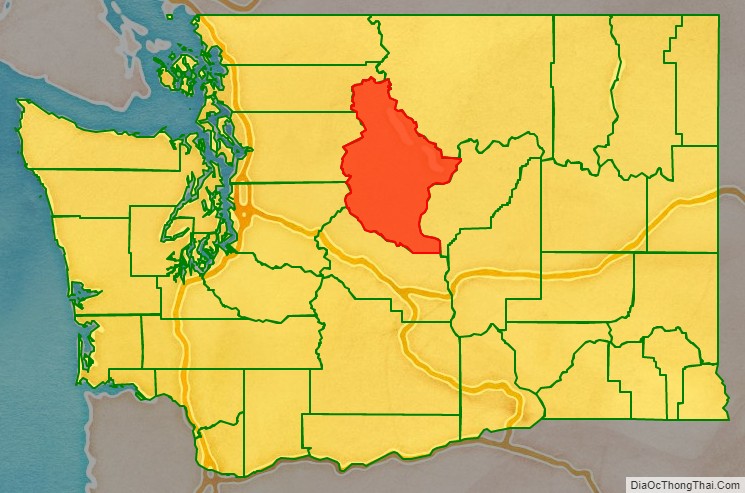
Chelan County location map. Where is Chelan County?
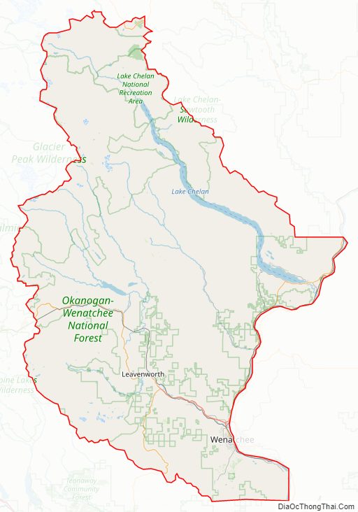
Chelan County Road Map
Geography
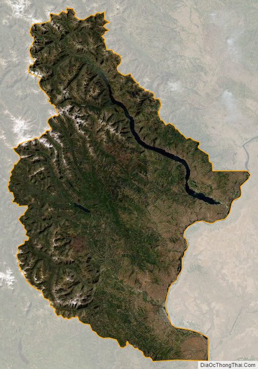
According to the United States Census Bureau, the county has a total area of 2,994 square miles (7,750 km), of which 2,921 square miles (7,570 km) is land and 73 square miles (190 km) (2.5%) is water. It is the third-largest county in Washington by area.
Geographic features
- Bonanza Peak, highest point in Chelan County
- Cascade Mountains
- Chelan Mountains
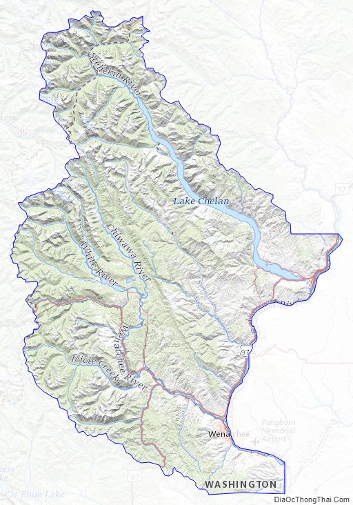
- Chelan River
- Chiwaukum Mountains
- Columbia River
- Entiat Mountains
- Entiat River
- Lake Chelan
- Lake Wenatchee
- Stuart Range
- The Enchantments
- Wenatchee Mountains
- Wenatchee River
- Columbia River Basalt
Major highways
- U.S. Route 2
- U.S. Route 97
Adjacent counties
- Okanogan County – northeast
- Douglas County – east
- Kittitas County – south
- King County – southwest
- Snohomish County – west
- Skagit County – northwest
National protected areas
- Lake Chelan National Recreation Area
- North Cascades National Park (part)
- Wenatchee National Forest (part)
- Alpine Lakes Wilderness
Chelan County Topographic Map
Chelan County Satellite Map
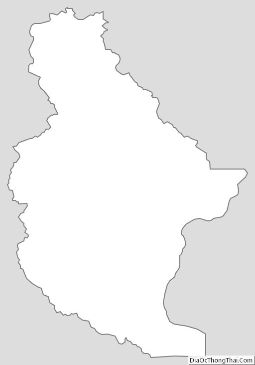
Chelan County Outline Map