Currituck County (/ˈkʊrɪtʌk/) is the northeastern most county in the U.S. state of North Carolina. As of the 2020 census, the population was 28,100. Its county seat is Currituck. The county was formed in 1668 as a precinct of Albemarle County and later gained county status in 1739. The name is “traditionally said to be an indigenous word for wild geese; Coratank.” Currituck County is included in the Virginia Beach–Norfolk–Newport News, VA-NC Metropolitan Area. It is in the northeastern section of the state and is bounded by the Atlantic Ocean, Currituck Sound, Camden County, Dare County and the Commonwealth of Virginia. Currituck Court House, mentioned as early as 1755, was the name of the county seat. Today the words “Court House” have been dropped and only Currituck is used as the town name.
| Name: | Currituck County |
|---|---|
| FIPS code: | 37-053 |
| State: | North Carolina |
| Founded: | 1668 |
| Named for: | Algonquin term meaning “The Land of the Wild Goose” |
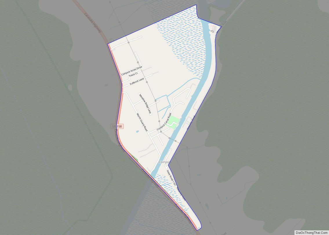
| Seat: | Currituck |
| Total Area: | 527 sq mi (1,360 km²) |
| Land Area: | 262 sq mi (680 km²) |
| Total Population: | 28,100 |
| Population Density: | 53/sq mi (21/km²) |
| Time zone: | UTC−5 (Eastern) |
| Summer Time Zone (DST): | UTC−4 (EDT) |
| Website: | www.co.currituck.nc.us |
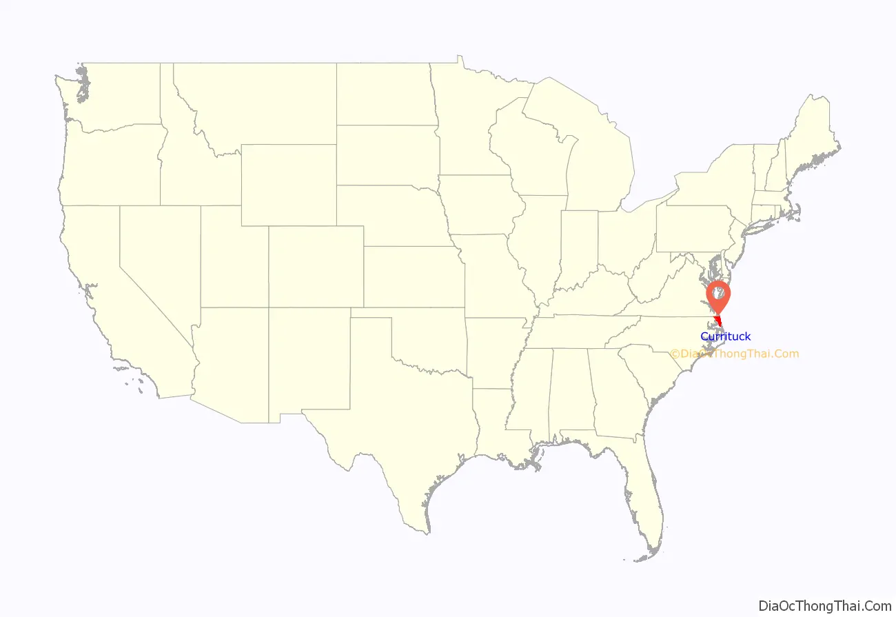
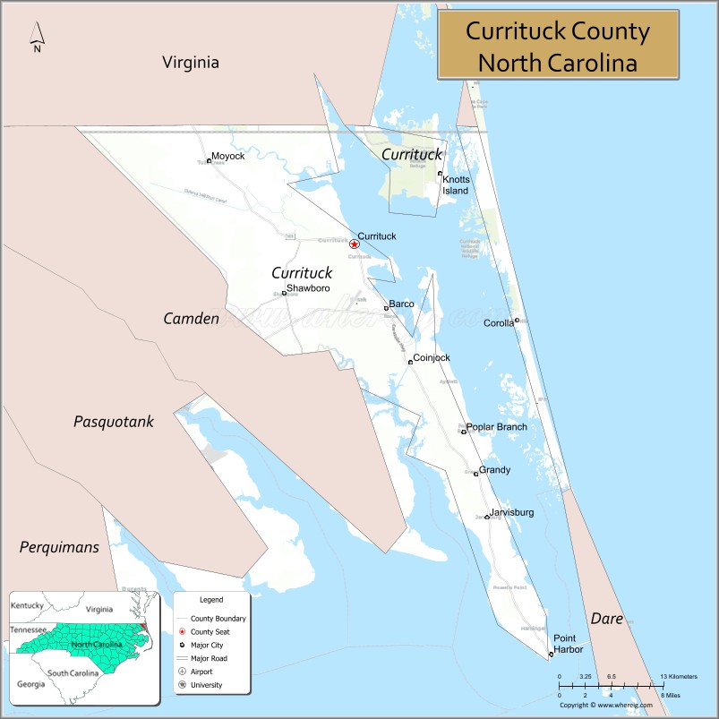
Currituck County location map. Where is Currituck County?
History
Currituck County was created in 1668 from Albemarle County.
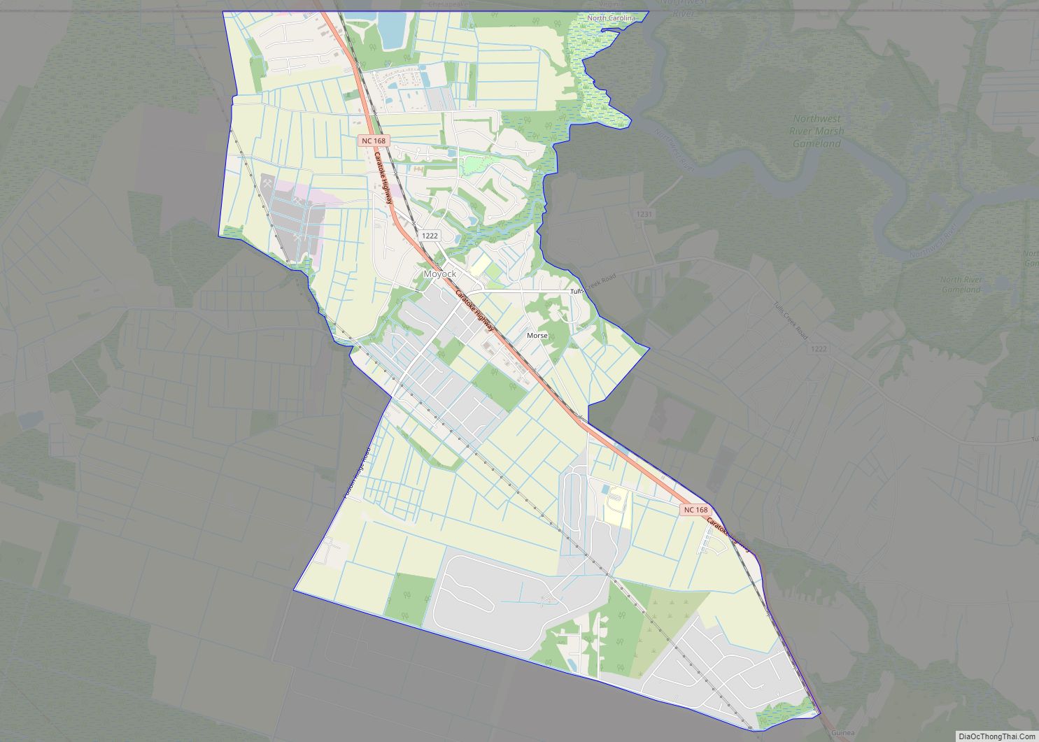
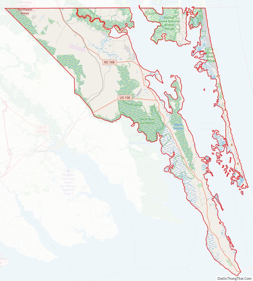
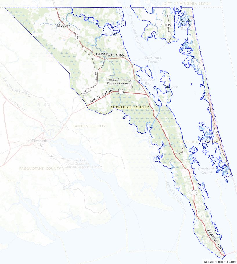
Currituck County Road Map
Geography
According to the U.S. Census Bureau, the county has a total area of 527 square miles (1,360 km), of which 262 square miles (680 km) is land and 265 square miles (690 km) (50%) is water.
Currituck County includes the northern communities of North Carolina’s Outer Banks, separated from mainland Currituck County by the Currituck Sound.
National protected areas
- Currituck National Wildlife Refuge
- Mackay Island National Wildlife Refuge (part)
State and local protected areas/sites
- Currituck Banks Estuarine Reserve Dedicated Nature Preserve
- Currituck Banks Game Land
- Currituck Banks Reserve
- Currituck Beach Lighthouse
- Currituck Outer Banks Preserve Dedicated Nature Preserve
- Mackay Island National Wildlife Refuge (part)
- Monkey Island
- North River Game Land Dedicated Nature Preserve (part)
- Northwest River Marsh Game Land
- Northwest River Marsh Game Land Dedicated Nature Preserve
- Northwest River Natural Area Preserve (part)
- Princess Anne Wildlife Management Area Pocahontas Marsh Tract (part)
Major water bodies
- Albemarle Sound
- Atlantic Ocean
- Currituck Sound
- Intracoastal Waterway
- North River
- Northwest River
Adjacent counties
- City of Chesapeake, Virginia – north
- City of Virginia Beach, Virginia – north
- Camden County – southwest
- Dare County – south
- Tyrrell County – southwest
Major highways
- US 158
- NC 12
- NC 34
- NC 168
- NC 615
Major infrastructure
- Currituck – Knotts Island Ferry
- Currituck County Regional Airport
Currituck County Topographic Map
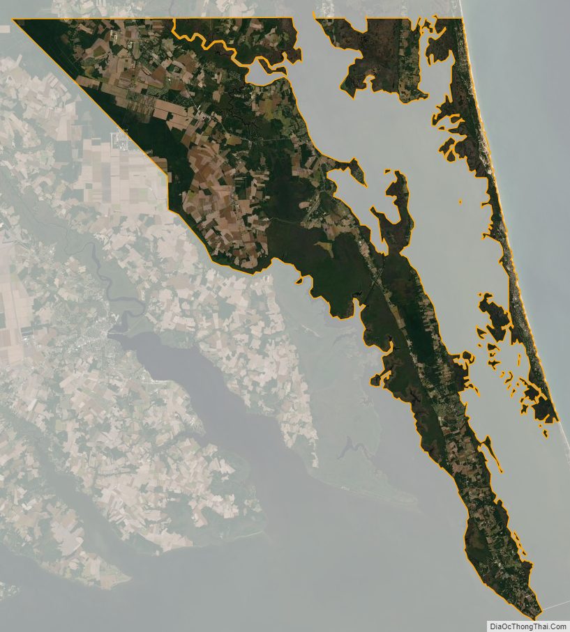
Currituck County Satellite Map
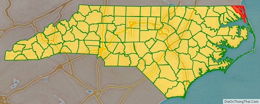
Currituck County Outline Map