Norfolk (/ˈnɔːrfʊk/ (listen) NOR-fuk) is an independent city in the Commonwealth of Virginia in the United States. Incorporated in 1705, it had a population of 238,005 at the 2020 census, making it the third-most populous city in Virginia after neighboring Virginia Beach and Chesapeake, and the 94th-largest city in the nation.
Norfolk holds a strategic position as the historical, urban, financial, and cultural center of the Hampton Roads region, which has more than 1.8 million inhabitants and is the thirty-third largest Metropolitan Statistical area in the United States. Officially known as Virginia Beach-Norfolk-Newport News, VA-NC MSA, the Hampton Roads region is sometimes called “Tidewater” and “Coastal Virginia”/”COVA,” although these are broader terms that also include Virginia’s Eastern Shore and entire coastal plain. Named for the eponymous natural harbor at the mouth of the Chesapeake Bay, Hampton Roads has ten cities, including Norfolk; seven counties in Virginia; and two counties in North Carolina.
Bordered to the west by the Elizabeth River and to the north by the Chesapeake Bay, the city shares land borders with the independent cities of Chesapeake to its south and Virginia Beach to its east. With coastline along multiple bodies of water, Norfolk has many miles of riverfront and bayfront property, including beaches on the Chesapeake Bay.
The coastal zones are important for the economy. The largest naval base in the world, Naval Station Norfolk, is located in Norfolk along with one of NATO’s two Strategic Command headquarters. Additionally Norfolk is an important contributor to the Port of Virginia. It is home to Maersk Line, Limited, which manages the world’s largest fleet of US-flag vessels. This low-lying coastal infrastructure is very vulnerable to sea level rise, with water levels expected to rise by more than 5.5 feet by the end of the 21st century.
The city has a long history as a strategic military and transportation point, where many railroad lines started. It is linked to its neighbors by an extensive network of interstate highways, bridges, tunnels, and three bridge-tunnel complexes.
| Name: | Norfolk City |
|---|---|
| FIPS code: | 51-710 |
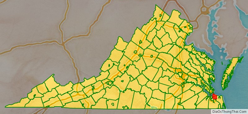
| State: | Virginia |
| Founded: | 1682 |
| Land Area: | 53.27 sq mi (137.98 km²) |
| Population Density: | 4,468/sq mi (1,725/km²) |
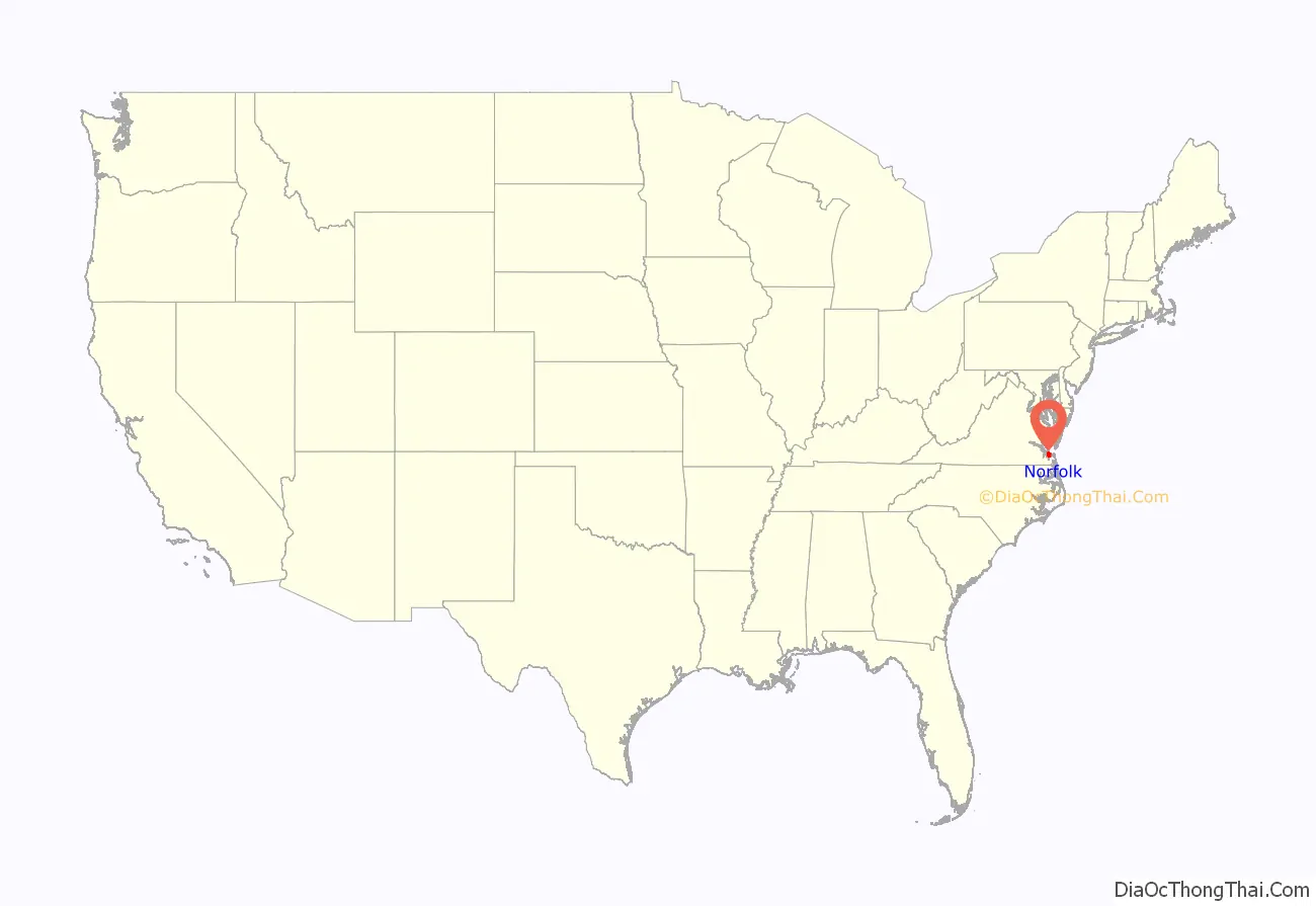
Norfolk City location map. Where is Norfolk City?
History
Before 1607
In the late sixteenth century, the area on which Norfolk now sits was inhabited by the Chesepian people. William Strachey recorded that their settlements were destroyed by the Powhatan shortly before the establishment of Jamestown in 1607.
Colonial Era
Norfolk’s lands were some of the first to draw settlers from the Virginia Colony, although Norfolk would not be incorporated as a town until the 1700s. When the establishment of the House of Burgesses introduced representative government to the colony in 1619, governor Sir George Yeardley divided the developed portion the colony into four incorporated jurisdictions, termed citties. The land on which Norfolk now sits fell under Elizabeth Cittie incorporation.
In 1634 King Charles I reorganized the colony into a system of shires, and Elizabeth Cittie became Elizabeth City Shire. After persuading 105 people to settle in the colony, Adam Thoroughgood (who had immigrated to Virginia in 1622 from King’s Lynn, Norfolk, England) was granted a large land holding, through the head rights system, along the Lynnhaven River in 1636.
When the South Hampton Roads portion of the shire was separated, Thoroughgood suggested the name of his birthplace for the newly formed New Norfolk County. One year later, it was divided into two counties, Upper Norfolk and Lower Norfolk (the latter now incorporated into the City of Norfolk), chiefly on Thoroughgood’s recommendation. This area of Virginia became known as the place of entrepreneurs, including men of the Virginia Company of London.
Norfolk developed in the late-seventeenth century as a “Half Moone” fort was constructed and 50 acres (200,000 m) were acquired from local natives of the Powhatan Confederacy in exchange for 10,000 pounds of tobacco. The House of Burgesses established the “Towne of Lower Norfolk County” in 1680. In 1691, a final county subdivision took place when Lower Norfolk County split to form Norfolk County (included in present-day cities of Norfolk, Chesapeake, and parts of Portsmouth) and Princess Anne County (present-day Virginia Beach).
Norfolk was incorporated in 1705. In 1730, a tobacco inspection site was located here. According to the Tobacco Inspection Act, the inspection was “At Norfolk Town, upon the fort land, in the County of Norfolk; and Kemp’s Landing, in Princess Anne, under one inspection.” In 1736 George II granted it a royal charter as a borough. By 1775, Norfolk developed into what contemporary observers argued was the most prosperous city in Virginia. It was an important port for exporting goods to the British Isles and beyond.
Mercantile ties with the British Empire bolstered Norfolk’s base of Loyalist support during the early part of the American Revolution but were insufficient to allow the Royal Governor of Virginia John Murray, 4th Earl of Dunmore to make Norfolk his new capital after fleeing Williamsburg in 1775. On New Year’s Day, 1776, Lord Dunmore’s fleet of three ships shelled the city of Norfolk for more than eight hours. The gunfire, combined with fires started by the British and spread by the Patriots, destroyed more than 800 buildings, constituting nearly two-thirds of the city. Patriot forces destroyed the remaining buildings for strategic reasons the following month. Ultimately, Colonel Woodford drove Dunmore into exile, ending more than 168 years of British rule in Virginia. Only the walls of Saint Paul’s Episcopal Church survived the bombardment and subsequent fires. A cannonball from the bombardment (fired by the Liverpool) remains within the wall of Saint Paul’s.
Nineteenth century
Following recovery from the Revolutionary War’s burning, Norfolk and its citizens struggled to rebuild. In 1804, another serious fire along the city’s waterfront destroyed some 300 buildings and the city suffered a serious economic setback. In the War of 1812 between America and Great Britain, Norfolk saw action between American militia led by Richard Lawson and the British navy. On July 13, 1813. A British landing party of 8 marines and 16 sailors landed at the beaches of Norfolk to construct a well and gather water. Richard Lawson concealed his company of militia behind a benign looking sandhill. Richard Lawson and his militia sprang their ambush by opening fire from their concealment behind the Sandhills. The British landing party who suffered 3 marines killed surrendered. Richard Lawson who suffered none killed had his militia destroy the British boat, take all provisions, and take the brass cannon. The American militia under Lawson returned to town with their prisoners. During the 1820s, agrarian communities across the American South suffered a prolonged recession, which caused many families to migrate to other areas. Many moved west into the Piedmont, or further into Kentucky and Tennessee. This migration also followed the exhaustion of soil due to tobacco cultivation in the Tidewater, where it had been the primary commodity crop for generations.
Virginia made some attempts to phase out slavery and manumissions increased in the two decades following the war. Thomas Jefferson Randolph gained passage of an 1832 resolution for gradual abolition in the state. However, by that time the increased demand from the settlement of the lower South states had created a large internal market for slavery. The invention of the cotton gin in the late-eighteenth century had made profitable the cultivation of short-staple cotton in the uplands, which was widely practiced.
The American Colonization Society proposed to “repatriate” free blacks and freed slaves to Africa by establishing the new colony of Liberia and paying for transportation. But most African-Americans wanted to stay in their birthplace of the United States and achieve freedom and rights there. For a period, many emigrants to Liberia from Virginia and North Carolina embarked from the port of Norfolk. Joseph Jenkins Roberts, a free person of color native to Norfolk, emigrated via the American Colonization Society and later was elected as the first president of Liberia, establishing a powerful family.
On June 7, 1855, the 183-foot vessel Benjamin Franklin put into Hampton Roads for repairs. The ship had just sailed from the West Indies, where there had been an outbreak of yellow fever. The port health officer ordered the ship quarantined. After eleven days, a second inspection found no issues, so it was allowed to dock. A few days later, the first cases of yellow fever were discovered in Norfolk, and a machinist died from the disease on July 8. By August, several people were dying per day, and a third of the city’s population had fled in the hopes of escaping the epidemic. No one understood how the disease was transmitted. With both Norfolk and Portsmouth being infected, New York banned all traffic from those sites. Neighboring cities also banned residents from Norfolk. The epidemic spread through the city via mosquitoes and poor sanitation, affecting every family and causing widespread panic. The number of infected reached 5,000 in September, and by the second week, 1,500 had died in Norfolk and Portsmouth. As the weather cooled, the outbreak began to wane, leaving a final tally of about 3,200 dead. It took the city some time to recover.
In early 1861, Norfolk voters instructed their delegate to vote for secession. Virginia voted to secede from the Union. In the spring of 1862, the Battle of Hampton Roads took place off the northwest shore of the city’s Sewell’s Point Peninsula, marking the first fight between two ironclads, the USS Monitor and the CSS Virginia. The battle ended in a stalemate, but changed the course of naval warfare; from then on, warships were fortified with metal.
In May 1862, Norfolk Mayor William Lamb surrendered the city to Union General John E. Wool and his forces. They held the city under martial law for the duration of the Civil War. Thousands of slaves from the region escaped to Union lines to gain freedom; they quickly set up schools in Norfolk to start learning how to read and write, years before the end of the war.
20th century to present
1907 brought both the Virginian Railway and the Jamestown Exposition to Sewell’s Point. The large Naval Review at the Exposition demonstrated the peninsula’s favorable location and laid the groundwork for the world’s largest naval base. Southern Democrats in Congress gained its location here. Commemorating the tricentennial anniversary of the founding of Jamestown, the exposition featured many prominent officials, including President Theodore Roosevelt, members of Congress, and diplomats from twenty-one countries. By 1917, as the US prepared to enter World War I, the Naval Air Station Hampton Roads had been constructed on the former exposition grounds.
In the first half of the twentieth century, the city of Norfolk expanded its borders through annexation. In 1906, the city annexed the incorporated town of Berkley, making the city cross the Elizabeth River. In 1923, the city expanded to include Sewell’s Point, Willoughby Spit, the town of Campostella, and the Ocean View area. The city included the Navy Base and miles of beach property fronting on Hampton Roads and the Chesapeake Bay. After a smaller annexation in 1959, and a 1988 land swap with Virginia Beach, the city assumed its current boundaries.
The establishment of the Interstate Highway System following World War II brought new highways to the region. A series of bridges and tunnels, constructed during fifteen years, linked Norfolk with the Peninsula, Portsmouth, and Virginia Beach. In 1952, the Downtown Tunnel opened to connect Norfolk with the city of Portsmouth. The highways also stimulated the development of new housing suburbs, leading to the population spreading out. Additional bridges and tunnels included the Hampton Roads Bridge-Tunnel in 1957, the Midtown Tunnel in 1962, and the Virginia Beach-Norfolk Expressway (Interstate 264 and State Route 44) in 1967. In 1991, the new Downtown Tunnel/Berkley Bridge complex opened a new system of multiple lanes of highway and interchanges connecting Downtown Norfolk and Interstate 464 with the Downtown Tunnel tubes.
In 1954 the Supreme Court ruled in Brown v. Board of Education that segregated public schools were unconstitutional, as the public system was supported by all taxpayers. It ordered integration, but Virginia pursued a policy of “massive resistance”. (At this time, most black citizens were still disfranchised under the state’s turn-of-the-century constitution and discriminatory practices related to voter registration and elections.) The Virginia General Assembly prohibited state funding for integrated public schools.
In 1958, United States district courts in Virginia ordered schools to open for the first time on a racially integrated basis. In response, Governor J. Lindsay Almond ordered the schools closed. The Virginia Supreme Court of Appeals declared the state law to be in conflict with the state constitution and ordered all public schools to be funded, whether integrated or not. About ten days later, Almond capitulated and asked the General Assembly to rescind several “massive resistance” laws. In September 1959, seventeen black children entered six previously segregated Norfolk public schools. Virginian-Pilot editor Lenoir Chambers editorialized against massive resistance and earned the Pulitzer Prize for Editorial Writing.
With new suburban developments beckoning, many white middle-class residents moved out of the city along new highway routes, and Norfolk’s population declined, a pattern repeated in numerous cities during the postwar era independently of segregation issues. In the late-1960s and early-1970s, the advent of newer suburban shopping destinations along with freeways spelled demise for the fortunes of downtown’s Granby Street commercial corridor, located just a few blocks inland from the waterfront. The opening of malls and large shopping centers drew off retail business from Granby Street.
People for the Ethical Treatment of Animals (PETA) has been based in Norfolk since 1996.
Norfolk’s city leaders began a long push to revive its urban core. While Granby Street underwent decline, Norfolk city leaders focused on the waterfront and its collection of decaying piers and warehouses. Many obsolete shipping and warehousing facilities were demolished. In their place, planners created a new boulevard, Waterside Drive, along which many of the high-rise buildings in Norfolk’s skyline have been erected. In 1983, the city and The Rouse Company developed the Waterside festival marketplace to attract people back to the waterfront and catalyze further downtown redevelopment. Waterside was redeveloped in 2017. Additionally the waterfront area hosts the Nauticus maritime museum and the USS Wisconsin. Other facilities opened in the ensuing years, including the Harbor Park baseball stadium, home of the Norfolk Tides Triple-A minor league baseball team. In 1995, the park was named the finest facility in minor league baseball by Baseball America. Norfolk’s efforts to revitalize its downtown have attracted acclaim from economic development and urban planning circles throughout the country. Downtown’s rising fortunes helped to expand the city’s revenues and allowed the city to direct attention to other neighborhoods.
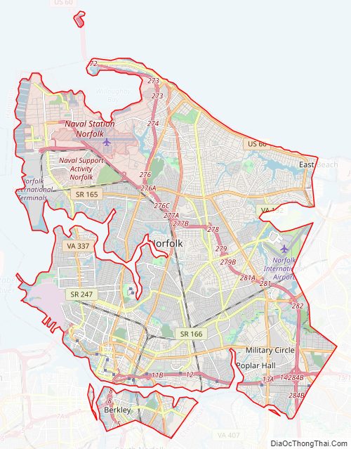
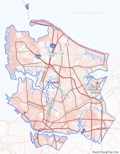
Norfolk City Road Map
Geography
The city is located at the southeastern corner of Virginia at the junction of the Elizabeth River and the Chesapeake Bay. The Hampton Roads Metropolitan Statistical Area (officially known as the Virginia Beach-Norfolk-Newport News, VA-NC MSA) is the 37th largest in the United States, with an estimated population of 1,716,624 in 2014. The area includes the Virginia cities of Norfolk, Virginia Beach, Chesapeake, Hampton, Newport News, Poquoson, Portsmouth, Suffolk, Williamsburg, and the counties of Gloucester, Isle of Wight, James City, Mathews, and York, as well as the North Carolina counties of Currituck and Gates. The city of Norfolk is recognized as the central business district, while the Virginia Beach oceanside resort district and Williamsburg are primarily centers of tourism. Virginia Beach is the most populated city within the MSA though it functions more as a suburb. Additionally, Norfolk is part of the Virginia Beach-Norfolk, VA-NC Combined Statistical Area, which includes the Virginia Beach-Norfolk-Newport News, VA-NC MSA, the Elizabeth City, North Carolina Micropolitan Statistical Area, and the Kill Devil Hills, NC Micropolitan Statistical Area. The CSA is the 32nd largest in the nation with an estimated population in 2013 of 1,810,266.
In addition to extensive riverfront property, Norfolk has miles of bayfront resort property and beaches in the Willoughby Spit and Ocean View communities.
Sea level rise and subsidence
Being low-lying and largely surrounded by water, Norfolk is particularly vulnerable to rising sea levels caused by climate change. In addition, the land on which it is built is slowly subsiding. Some areas already flood regularly at high tide, and the city commissioned a study in 2012 to investigate how to address the issue in the future: it reported the cost of dealing with a sea-level rise of one foot would be around $1,000,000,000. Since then, scientists at the Virginia Institute of Marine Science in 2013 have estimated that if current trends hold, the sea in Norfolk will rise by 5 and 1/2 feet or more by the end of this century.
Cityscape
When Norfolk was first settled, homes were made of wood and frame construction, similar to most medieval English-style homes. These homes had wide chimneys and thatch roofs. Some decades after the town was first laid out in 1682, the Georgian architectural style, which was popular in the South at the time, was used. Brick was considered more substantial construction; patterns were made by brick laid and Flemish bond. This style evolved to include projecting center pavilions, Palladian windows, balustraded roof decks, and two-story porticoes. By 1740, homes, warehouses, stores, workshops, and taverns began to dot Norfolk’s streets.
Norfolk was burned down during the Revolutionary War. After the Revolution, Norfolk was rebuilt in the Federal style, based on Roman ideals. Federal-style homes kept Georgian symmetry, though they had more refined decorations to look like New World homes. Federal homes had features such as narrow sidelights with an embracing fanlight around the doorway, giant porticoes, gable or flat roofs, and projecting bays on exterior walls. Rooms were oval, elliptical or octagonal. Few of these federal rowhouses remain standing today. A majority of buildings were made of wood and had a simple construction.
In the early nineteenth century, Neoclassical architectural elements began to appear in the federal style row homes, such as ionic columns in the porticoes and classic motifs over doorways and windows. Many Federal-style row houses were modernized by placing a Greek-style porch at the front. Greek and Roman elements were integrated into public buildings such as the old City Hall, the old Norfolk Academy, and the Customs House.
Greek-style homes gave way to Gothic Revival in the 1830s, which emphasized pointed arches, steep gable roofs, towers and tracer-lead windows. The Freemason Baptist Church and St. Mary’s Catholic Church are examples of Gothic Revival. Italianate elements emerged in the 1840s including cupolas, verandas, ornamental brickwork, or corner quoins. Norfolk still had simple wooden structures among its more ornate buildings.
High-rise buildings were first built in the late nineteenth century when structures such as the current Commodore Maury Hotel and the Royster Building were constructed to form the initial Norfolk skyline. Past styles were revived during the early years of the twentieth century. Bungalows and apartment buildings became popular for those living in the city.
As the Great Depression wore on, Art Deco emerged as a popular building style, as evidenced by the Post Office building downtown. Art Deco consisted of streamlined concrete faced appearance with smooth stone or metal, with terracotta, and trimming consisting of glass and colored tiles.
Neighborhoods
Norfolk has a variety of historic neighborhoods, notably Freemason and West Freemason. Some neighborhoods, such as Berkley, were formerly cities and towns. Others, including Willoughby Spit and Ocean View, have a long history tied to the Chesapeake Bay. The city’s revitalization in recent decades has transformed neighborhoods such as Downtown, Ghent and Fairmount Park. Popular residential neighborhoods include Ghent, Colonial Place, Larchmont, North Shore, Edgewater, and Lafayette Shores.
Climate
Narrative below is based on climate data from the 1991-2020 period. Norfolk has a humid subtropical climate and its USDA Hardiness Zone is 8a. Spring arrives in March with mild days and cool nights, and by late May, the temperature has warmed up considerably to herald warm summer days. Summers are consistently warm and humid, but the nearby Atlantic Ocean often exercises a slight cooling effect on daytime high temperatures, but a slight warming effect on nighttime low temperatures (compared to areas farther inland). As such, temperatures reach 90 °F (32 °C) or higher on an average 35 days annually, and 100 °F (37.8 °C) are uncommon, occurring in fewer than one-third of all years. On average, July is the warmest month, with a normal mean temperature of 81.1 °F (27.3 °C). On average, July and August are the wettest months, due to frequent summer thunderstorm activity. In August and September, rainfall remains high, due to rising frequency of tropical activity (hurricanes and tropical storms), which can bring high winds and heavy rains. These usually brush Norfolk and only occasionally make landfalls in the area; the highest-risk period is mid-August to the end of September. Fall is marked by mild to warm days and cooler nights. Winter is usually mild in Norfolk, with average winter days featuring lows near or slightly above freezing and highs in the upper-40s to mid-50s (8 to 13 °C). On average, the coldest month of the year is January, with a normal mean temperature of 42.2 °F (5.7 °C), Snow occurs sporadically, with an average winter accumulation of 6.2 in (15.7 cm). Norfolk’s record high was 105 °F (41 °C) on August 7, 1918, and July 24 and 25, 2010, and the record low was −3 °F (−19 °C) recorded on January 21, 1985.
Norfolk City Topographic Map
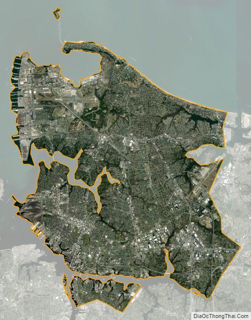
Norfolk City Satellite Map
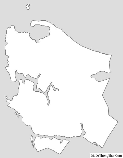
Norfolk City Outline Map