Edgefield County is a county located on the western border of the U.S. state of South Carolina. As of the 2020 census, its population was 25,657. Its county seat and largest municipality is Edgefield. The county was established on March 12, 1785.
The Savannah River makes up part of the western border of Edgefield County; across the river lies the city of Augusta, Georgia. Edgefield is part of the Augusta-Richmond County, GA-SC Metropolitan Statistical Area.
| Name: | Edgefield County |
|---|---|
| FIPS code: | 45-037 |
| State: | South Carolina |
| Founded: | 1785 |
| Named for: | County’s location at the Edge of the State |
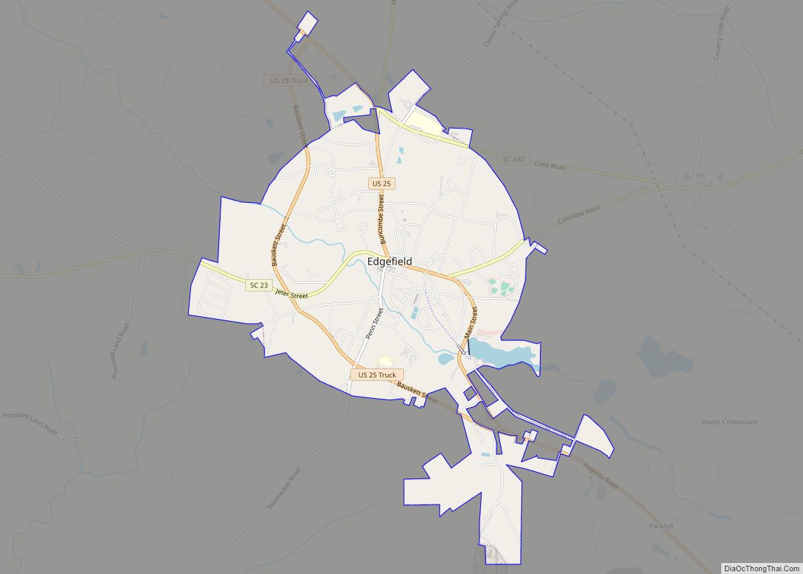
| Seat: | Edgefield |
| Largest town: | Edgefield |
| Total Area: | 507 sq mi (1,310 km²) |
| Land Area: | 500 sq mi (1,000 km²) |
| Total Population: | 25,657 |
| Population Density: | 51/sq mi (20/km²) |
| Time zone: | UTC−5 (Eastern) |
| Summer Time Zone (DST): | UTC−4 (EDT) |
| Website: | edgefieldcounty.sc.gov |
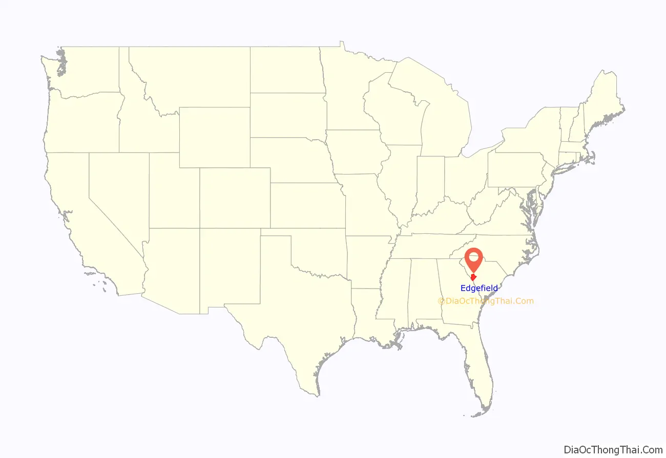
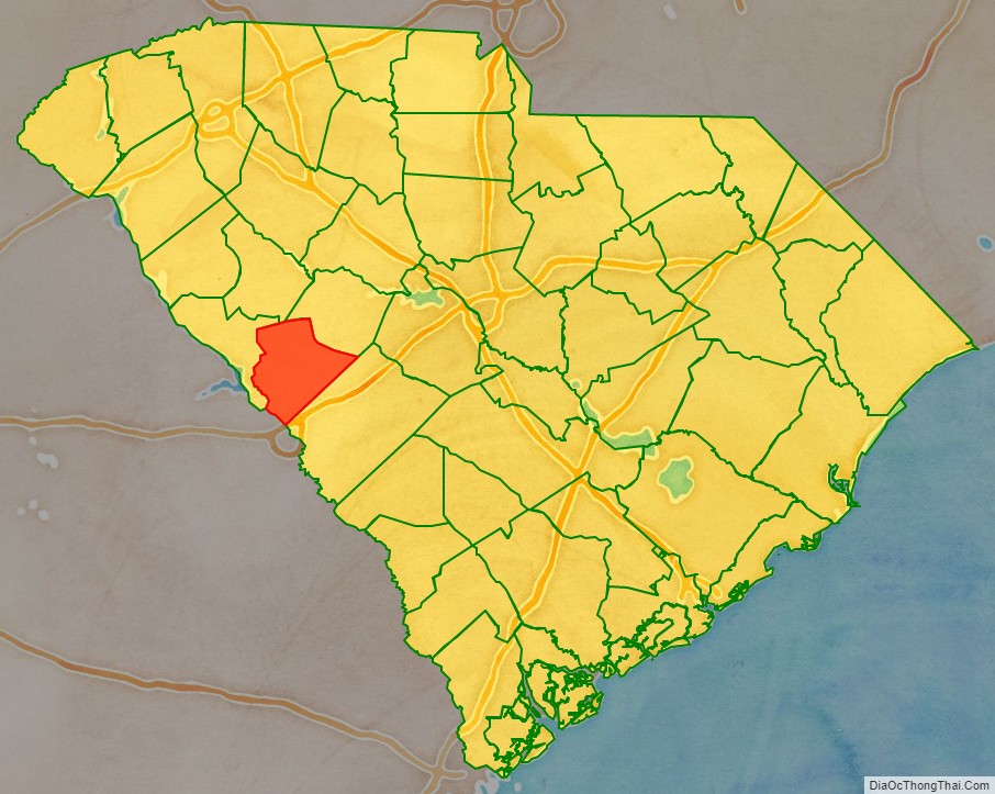
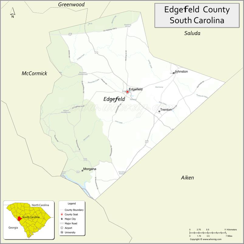
Edgefield County location map. Where is Edgefield County?
History
The origin of the name Edgefield is unclear; the South Carolina State Library’s information on the county’s history suggests that the name “is usually described as ‘fanciful.'” There is a village named Edgefield in Norfolk, England.
Edgefield District was created in 1785, and it is bordered on the west by the Savannah River. It was formed from the southern section of the former Ninety-Six District when it was divided into smaller districts or counties by an act of the state legislature. Parts of the district were later used in the formation of other neighboring counties, specifically:
In his study of Edgefield County, South Carolina, Orville Vernon Burton classified white society as comprising the poor, the yeoman middle class, and the elite planters. A clear line demarcated the elite, but according to Burton, the line between poor and yeoman was never very distinct. Stephanie McCurry argues that yeomen were clearly distinguished from poor whites by their ownership of land (real property). Edgefield’s yeomen farmers were “self-working farmers,” distinct from the elite because they worked their land themselves alongside any slaves they owned. By owning large numbers of slaves, planters took on a managerial function and did not work in the fields.
During Reconstruction, Edgefield County had a slight black majority. It became a center of political tensions following the postwar amendments that gave freedmen civil rights under the US constitution. Whites conducted an insurgency to maintain white supremacy, particularly through paramilitary groups known as the Red Shirts. They used violence and intimidation during election seasons from 1872 on to disrupt and suppress black Republican voting.
In May 1876, six black suspects were lynched by a white mob for the alleged murders of a white couple. In the Hamburg Massacre of July 8, 1876, several black militia were killed by whites, part of a large group of more than 100 armed men who attended a court hearing of a complaint of whites against the militia. Some of the white men came from Augusta. Due to fraud, more Democratic votes were recorded in Edgefield County than there were total residents; similar fraud occurred elsewhere, as did suppression of black voting. Eventually the election was decided in Hampton’s favor, and the Democrats also took control of the state legislature. As a result of a national compromise, Federal troops were withdrawn in 1877 from South Carolina and other southern states, ending Reconstruction.
The long decline in population from 1910 to 1980 reflects the decline in agriculture, mechanization reducing labor needs, and the effect of many African Americans leaving for Northern and Midwestern cities in the Great Migration out of the rural South.
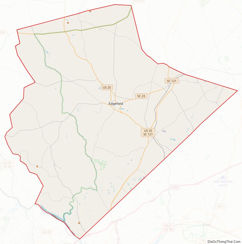
Edgefield County Road Map
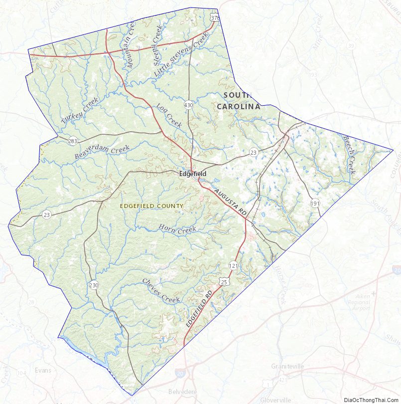
Geography
According to the U.S. Census Bureau, the county has a total area of 507 square miles (1,310 km), of which 500 square miles (1,300 km) is land and 6.3 square miles (16 km) (1.2%) is water.
National protected area
- Sumter National Forest (part)
State and local protected area
- Steven’s Creek Heritage Preserve (part)
Major water bodies
- Savannah River
- Steven Creek
Adjacent counties
- Saluda County – northeast
- Aiken County – east
- Richmond County, Georgia – southwest
- Columbia County, Georgia – southwest
- McCormick County – west
- Greenwood County – northwest
Major highways
- US 25
- US 25 Truck
- US 378
- SC 19
- SC 19 Conn.
- SC 23
- SC 23 Truck
- SC 121
- SC 191
- SC 230
- SC 430
- SC 430 Conn.
Major infrastructure
- Edgefield County Airport (6J6)
Edgefield County Topographic Map
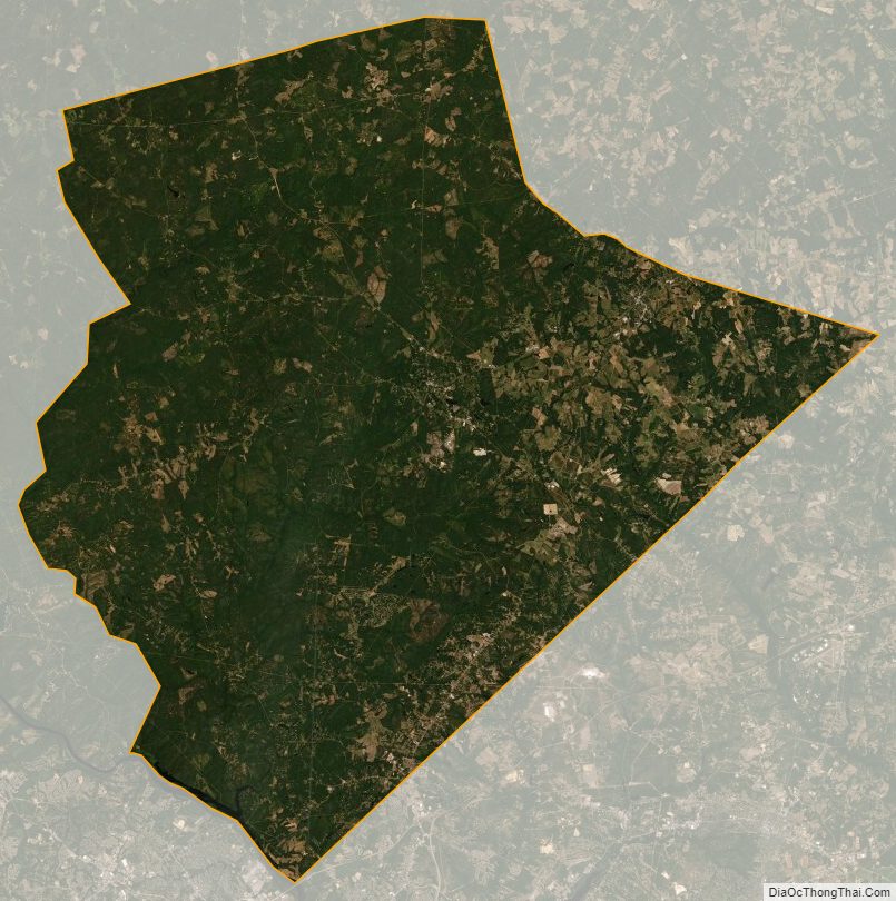
Edgefield County Satellite Map
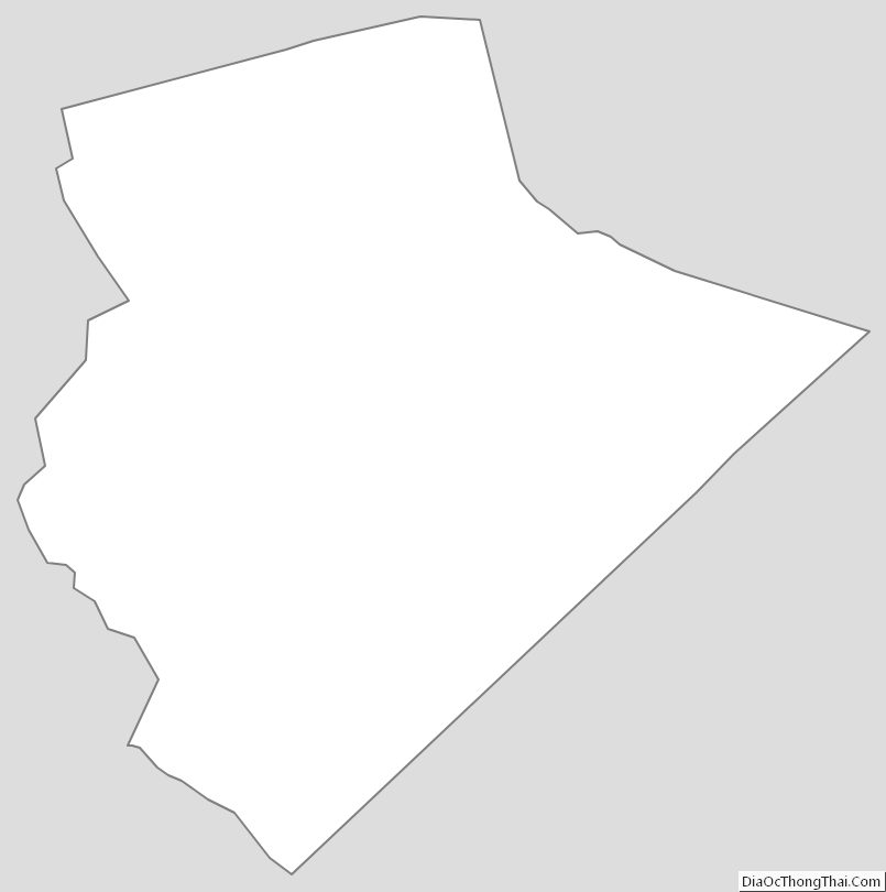
Edgefield County Outline Map