Johnston is a town in Edgefield County, South Carolina, United States. The population was 2,362 at the 2010 census. It is part of the Augusta, Georgia, metropolitan area. The town’s official welcome sign states that it is “Peach Capital of the World”.
| Name: | Johnston town |
|---|---|
| LSAD Code: | 43 |
| LSAD Description: | town (suffix) |
| State: | South Carolina |
| County: | Edgefield County |
| Elevation: | 663 ft (202 m) |
| Total Area: | 2.73 sq mi (7.08 km²) |
| Land Area: | 2.65 sq mi (6.86 km²) |
| Water Area: | 0.09 sq mi (0.22 km²) |
| Total Population: | 1,997 |
| Population Density: | 754.15/sq mi (291.21/km²) |
| ZIP code: | 29832 |
| Area code: | 803, 839 |
| FIPS code: | 4537150 |
| GNISfeature ID: | 1246191 |
| Website: | www.facebook.com/townofjohnston/ |
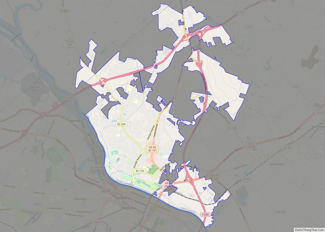
Online Interactive Map
Click on ![]() to view map in "full screen" mode.
to view map in "full screen" mode.
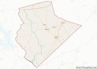
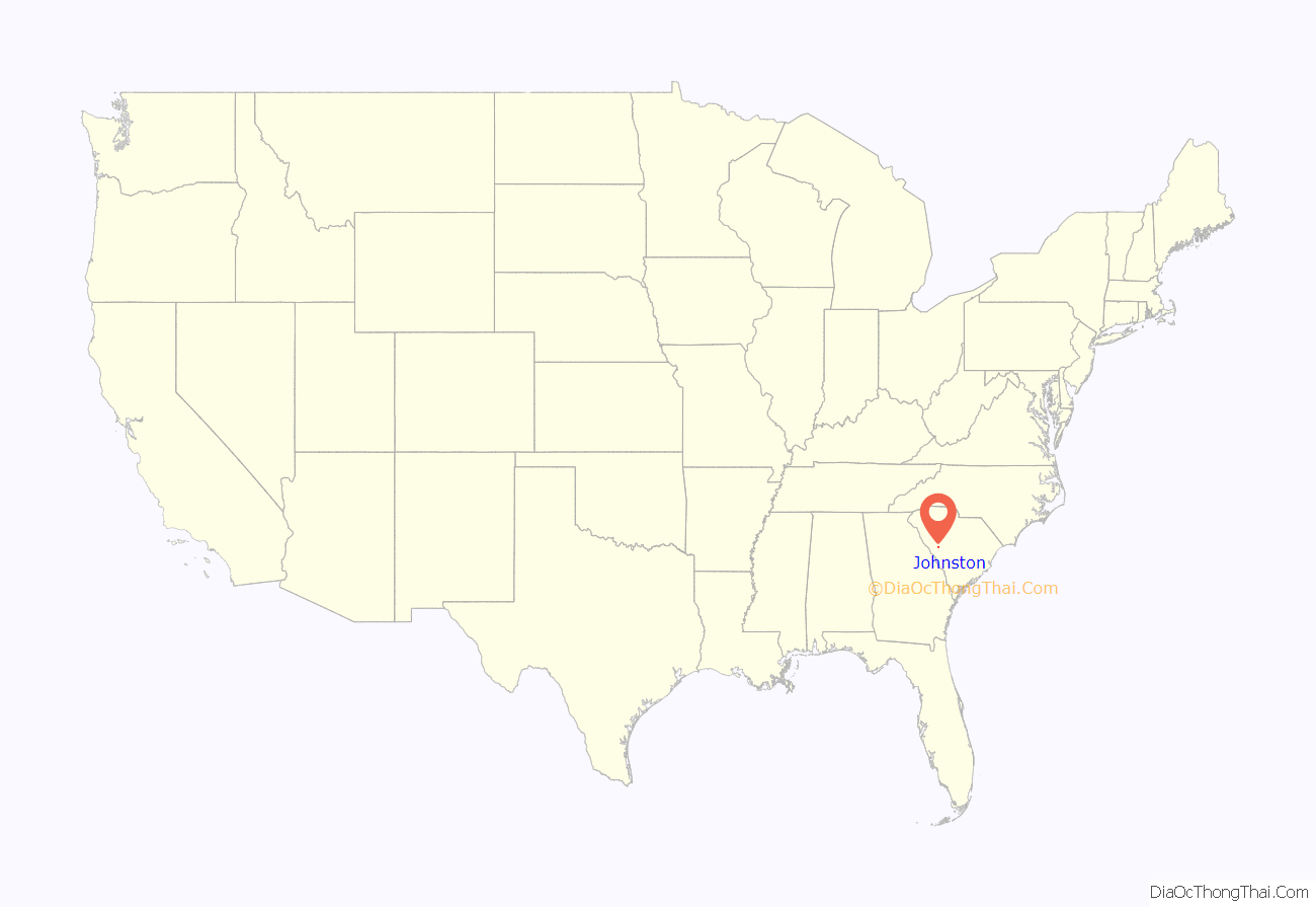
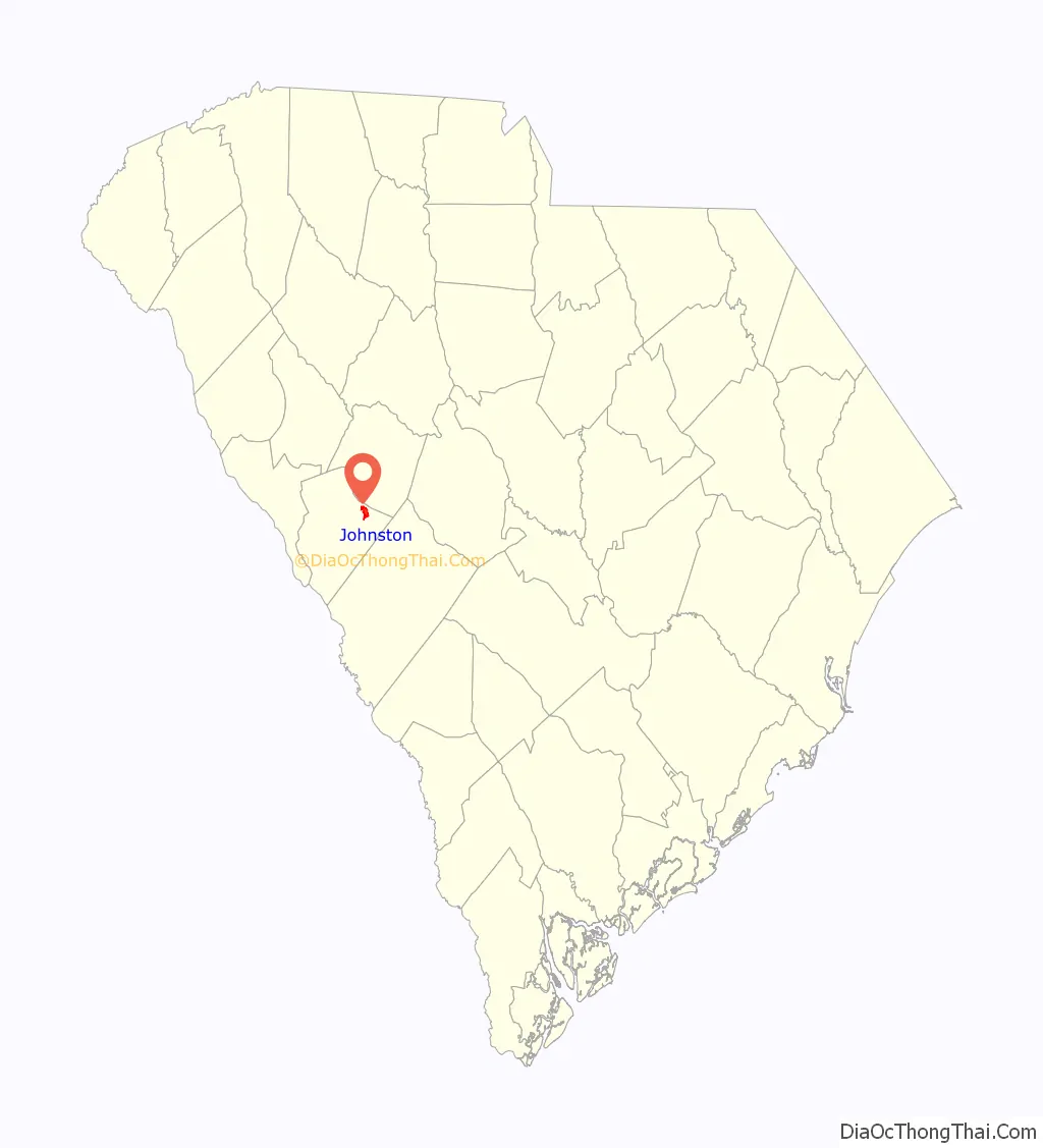
Johnston location map. Where is Johnston town?
History
Johnston is called The Hub of the Ridge because it is located at the meeting place of the three river systems which flow away from the Ridge, a fertile plateau about 30 miles (48 km) long between clay hills to the north and sand hills to the south. The area has been settled since the mid-1700s. In 1791 as George Washington traveled through the area on his triumphal tour through the country, he stopped at the Lott family plantation, just east of Johnston.
In the late 1860s, the Charlotte, Columbia and Augusta Railroad expanded westward from Columbia to Augusta. Edward Jones Mims, M.D., persuaded William Johnston, president of the railroad, to run the railroad through the 1,200-acre (490 ha) Mims plantation. In return, Dr. Mims agreed to name the new town for Mr. Johnston.
In the early 1900s, the peach industry became successful in this area. Today, the Ridge produces about 60 percent of South Carolina’s peaches. Johnston is proclaimed to be the “Peach Capitol of the World.”
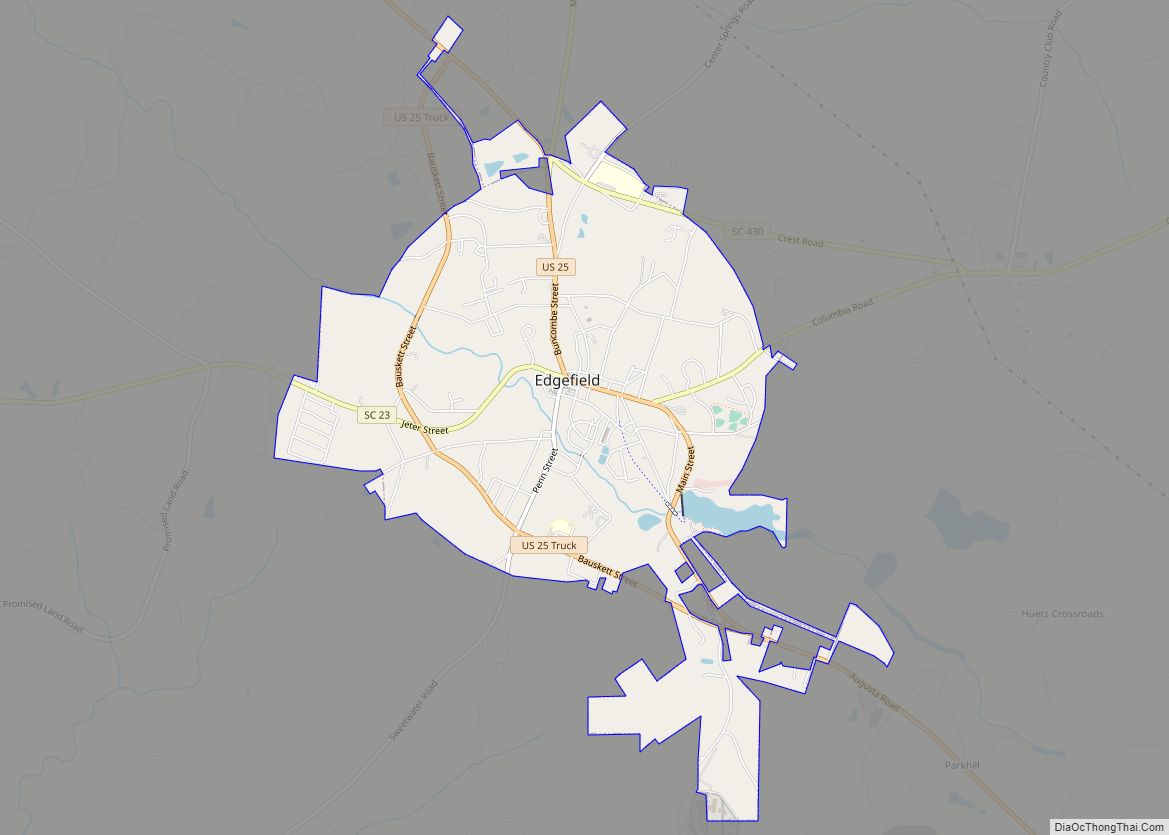
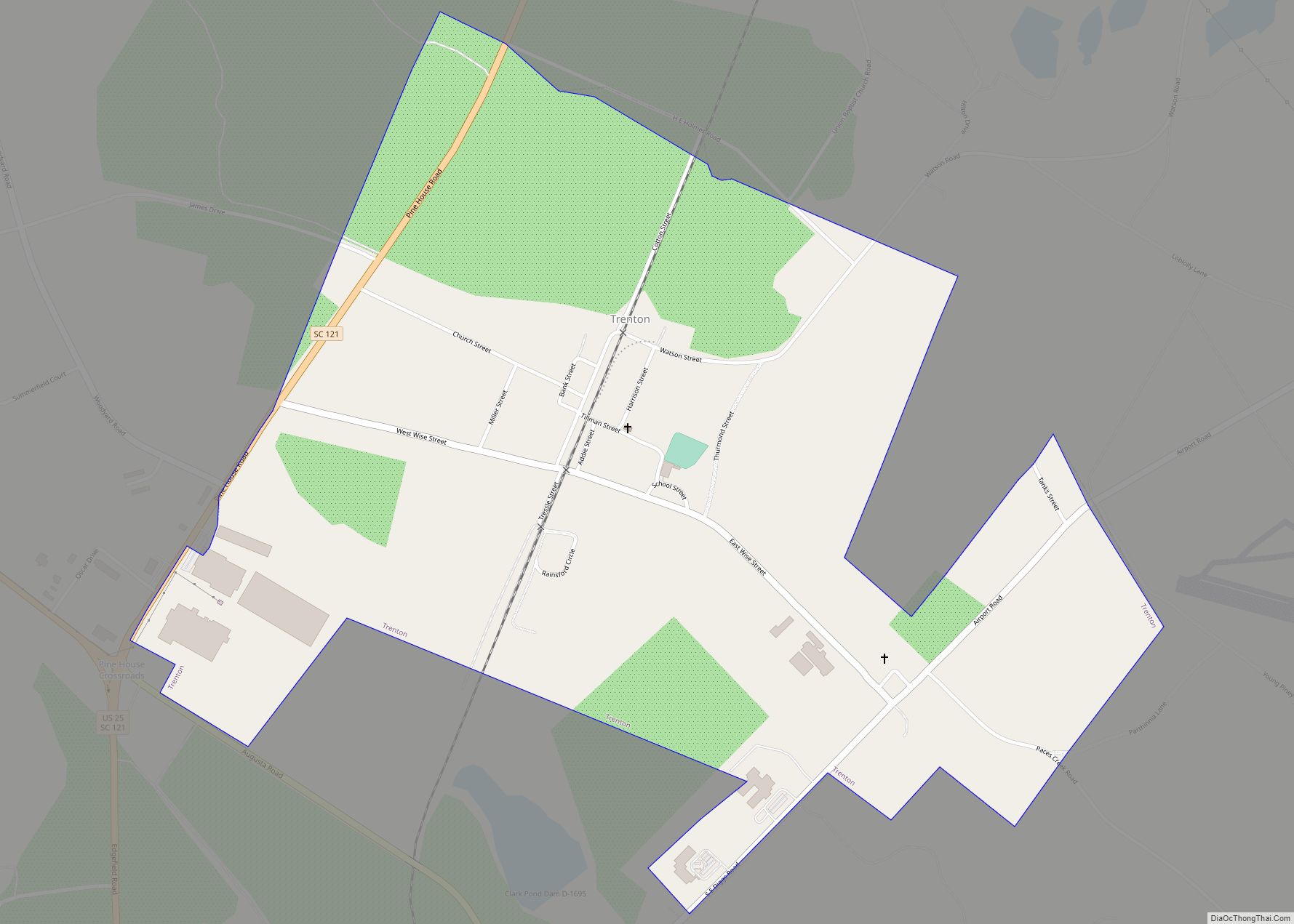
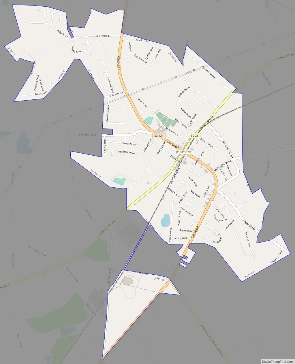
Johnston Road Map
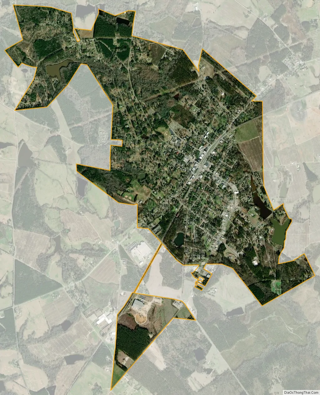
Johnston city Satellite Map
Geography
Johnston is located in eastern Edgefield County at 33°49′55″N 81°48′8″W / 33.83194°N 81.80222°W / 33.83194; -81.80222 (33.831927, -81.802304). South Carolina Highway 23 passes through the center of town as Calhoun Street, leading southwest 8 miles (13 km) to Edgefield, the county seat, and northeast 4.5 miles (7.2 km) to Ward. South Carolina Highway 121 (Lee Street) crosses SC 23 at the town center, leading north 12 miles (19 km) to Saluda and south 7 miles (11 km) to Trenton.
According to the United States Census Bureau, the town has a total area of 2.7 square miles (7.1 km), of which 2.7 square miles (6.9 km) is land and 0.1 square miles (0.2 km), or 3.15%, is water.
See also
Map of South Carolina State and its subdivision:- Abbeville
- Aiken
- Allendale
- Anderson
- Bamberg
- Barnwell
- Beaufort
- Berkeley
- Calhoun
- Charleston
- Cherokee
- Chester
- Chesterfield
- Clarendon
- Colleton
- Darlington
- Dillon
- Dorchester
- Edgefield
- Fairfield
- Florence
- Georgetown
- Greenville
- Greenwood
- Hampton
- Horry
- Jasper
- Kershaw
- Lancaster
- Laurens
- Lee
- Lexington
- Marion
- Marlboro
- McCormick
- Newberry
- Oconee
- Orangeburg
- Pickens
- Richland
- Saluda
- Spartanburg
- Sumter
- Union
- Williamsburg
- York
- Alabama
- Alaska
- Arizona
- Arkansas
- California
- Colorado
- Connecticut
- Delaware
- District of Columbia
- Florida
- Georgia
- Hawaii
- Idaho
- Illinois
- Indiana
- Iowa
- Kansas
- Kentucky
- Louisiana
- Maine
- Maryland
- Massachusetts
- Michigan
- Minnesota
- Mississippi
- Missouri
- Montana
- Nebraska
- Nevada
- New Hampshire
- New Jersey
- New Mexico
- New York
- North Carolina
- North Dakota
- Ohio
- Oklahoma
- Oregon
- Pennsylvania
- Rhode Island
- South Carolina
- South Dakota
- Tennessee
- Texas
- Utah
- Vermont
- Virginia
- Washington
- West Virginia
- Wisconsin
- Wyoming