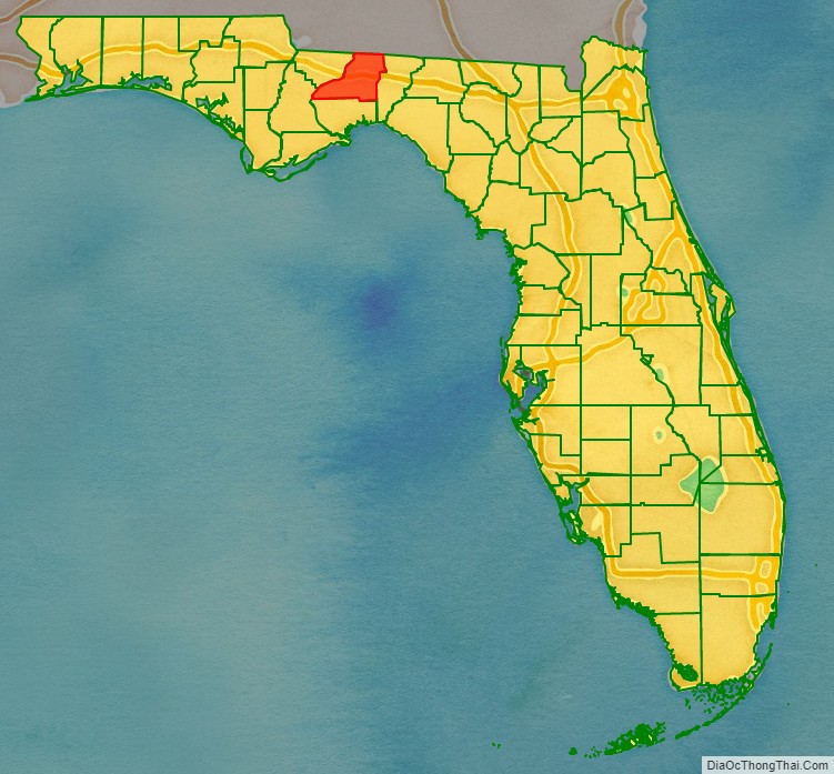
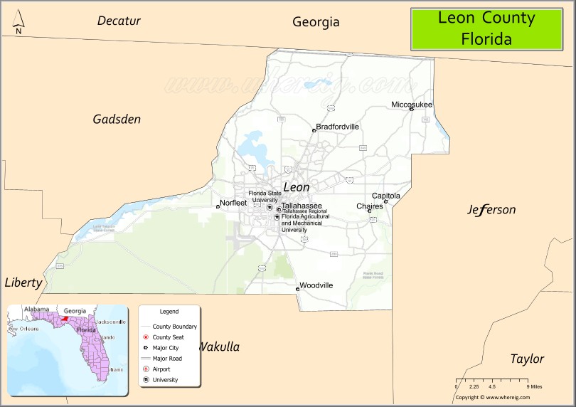
Leon County (Spanish: Condado de León) is a county in the Panhandle of the U.S. state of Florida. It was named after the Spanish explorer Juan Ponce de León. As of the 2020 census, the population was 292,198.
The county seat is Tallahassee, which is also the state capital and home to many politicians, lobbyists, jurists, and attorneys.
Leon County is included in the Tallahassee metropolitan area. Tallahassee is home to two of Florida’s major public universities, Florida State University and Florida A&M University, as well as Tallahassee Community College. Together these institutions have a combined enrollment of more than 70,000 students annually, creating both economic and social effects.
| Name: | Leon County |
|---|---|
| FIPS code: | 12-073 |
| State: | Florida |
| Founded: | December 29, 1824 |
| Named for: | Juan Ponce de León |
| Seat: | Tallahassee |
| Largest city: | Tallahassee |
| Total Area: | 702 sq mi (1,820 km²) |
| Land Area: | 667 sq mi (1,730 km²) |
| Total Population: | 292,198 |
| Population Density: | 420/sq mi (160/km²) |
| Time zone: | UTC−5 (Eastern) |
| Summer Time Zone (DST): | UTC−4 (EDT) |
| Website: | www.leoncountyfl.gov |
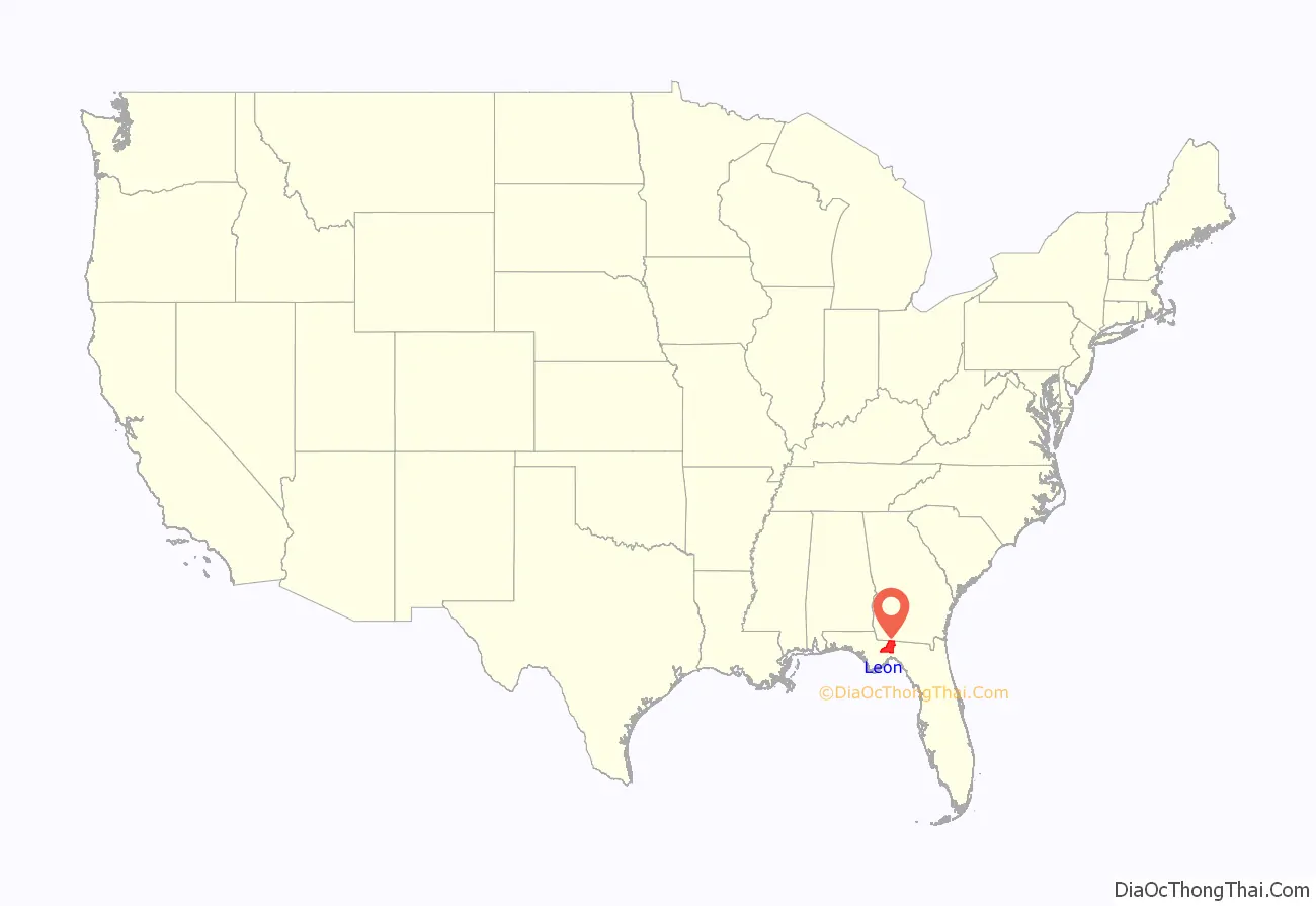
Leon County location map. Where is Leon County?
History
Originally part of Escambia and later Gadsden County, Leon County was created in 1824. It was named after Juan Ponce de León, the Spanish explorer who was the first European to reach Florida.
The United States finally acquired this territory in the 19th century. In the 1830s, it attempted to conduct Indian Removal of the Seminole and Creek peoples, who had migrated south to escape European-American encroachment in Georgia and Alabama. After many Seminole were forcibly removed from the area or moved south to the Everglades during the Seminole Wars, planters developed cotton plantations based on enslaved labor.
By the 1850s and 1860s, Leon County had become part of the Deep South’s “cotton kingdom”. It ranked fifth of all Florida and Georgia counties in cotton production from the 20 major plantations. Uniquely among Confederate capitals east of the Mississippi River, in the American Civil War Tallahassee was never captured by Union forces. No Union soldiers set foot in Leon County until the Reconstruction Era.
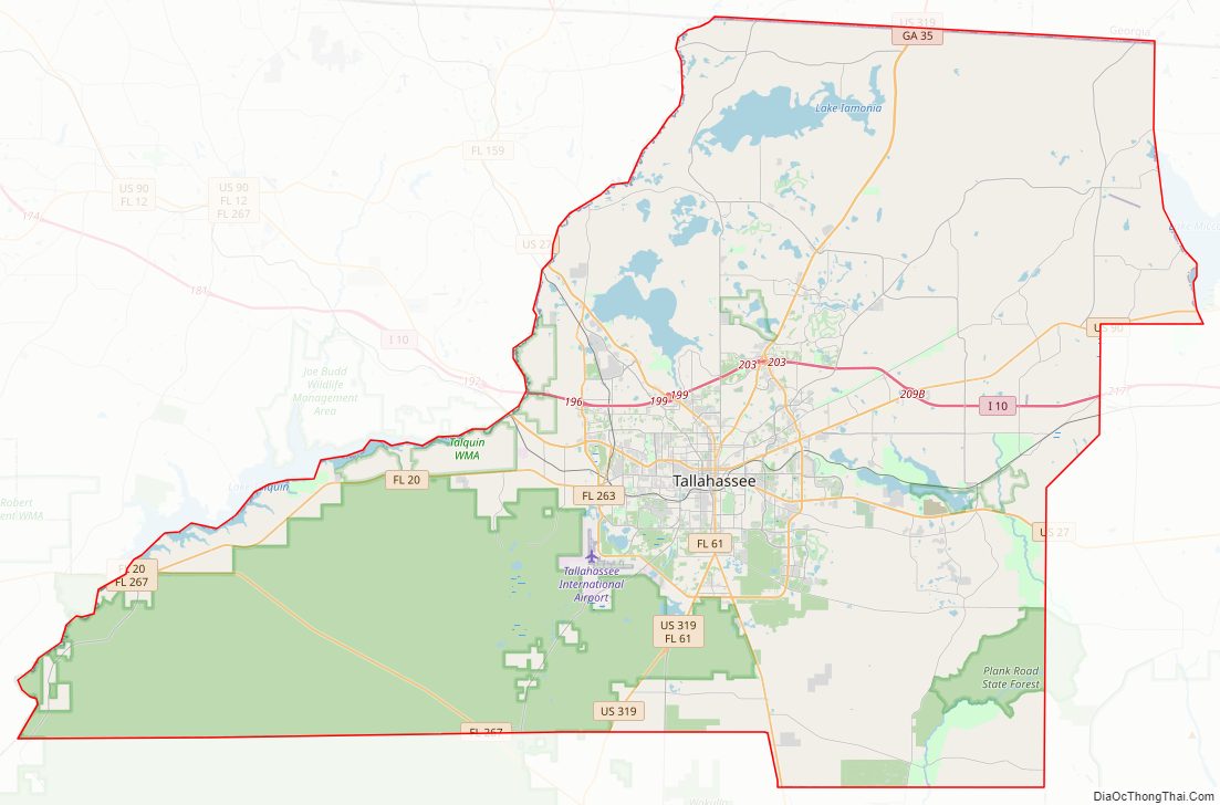
Leon County Road Map
Geography
According to the U.S. Census Bureau, the county has an area of 702 square miles (1,820 km), of which 667 square miles (1,730 km) are land and 35 square miles (91 km) (5.0%) are water. Unlike much of Florida, most of Leon County has rolling hills, as part of Florida’s Red Hills Region. The highest point is 280 feet (85 m), in the northern part of the county.
Geology
Leon County encompasses basement rock composed of basalts of the Triassic and Jurassic from ~251 to 145 million years ago interlayered with Mesozoic sedimentary rocks. The layers above the basement are carbonate rock created from dying foraminifera, bryozoa, mollusks, and corals from as early as the Paleocene, a period of ~66—55.8 Ma.
During the Eocene (~55.8—33.9 Ma) and Oligocene (~33.9—23 Ma), the Appalachian Mountains began to uplift and the erosion rate increased enough to fill the Gulf Trough with quartz sands, silts, and clays via rivers and streams. The first sedimentation layer in Leon County is the Oligocene Suwannee Limestone in the southeastern part of the county as stated by the United States Geological Survey and Florida Geological Survey.
The Early Miocene (~23.03—15.7 Ma) sedimentation in Leon County is Hawthorn Group, Torreya Formation and St. Marks Formation and found in the northern two-thirds of the county.
The Pliocene (~5.332—2.588 Ma) is represented by the Miccosukee Formation scattered within the Torreya Formation.
Sediments were laid down from the Pleistocene epoch (~2.588 million—12 000 years ago) through Holocene epoch (~12,000—present) and are designated Beach ridge and trail and undifferentiated sediments.
During the Pleistocene, what would be Leon County emerged and submerged with each glacial and interglacial period. Interglacials created the county’s topography.
Also See Leon County Pleistocene coastal terraces
Also see: Florida Platform and Lithostratigraphy
- Red Hills Region (North)
- Cody Scarp (central)
- Woodville Karst Plain (South)
Three sites in Leon County have yielded fossil remnants of the Miocene epoch.
National protected area
- Apalachicola National Forest (part)
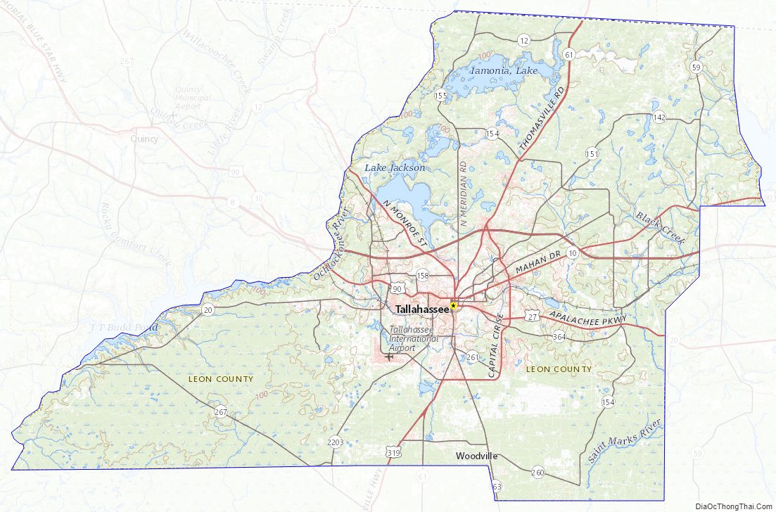
Bodies of water
- Lake Miccosukee
- Black Creek
- Lake Bradford
- Lake Ella
- Lake Hall
- Lake Iamonia
- Lake Jackson
- Lake Lafayette
- Lake Talquin
- Ochlockonee River
- Lake Munson
Adjacent counties
- Grady County, Georgia – north
- Thomas County, Georgia – northeast
- Jefferson County – east
- Wakulla County – south
- Gadsden County – west
- Liberty County – west
Leon County Topographic Map
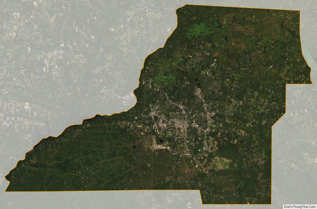
Leon County Satellite Map
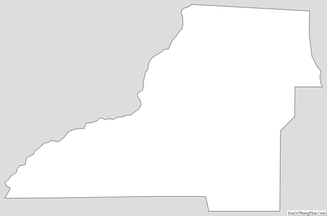
Leon County Outline Map