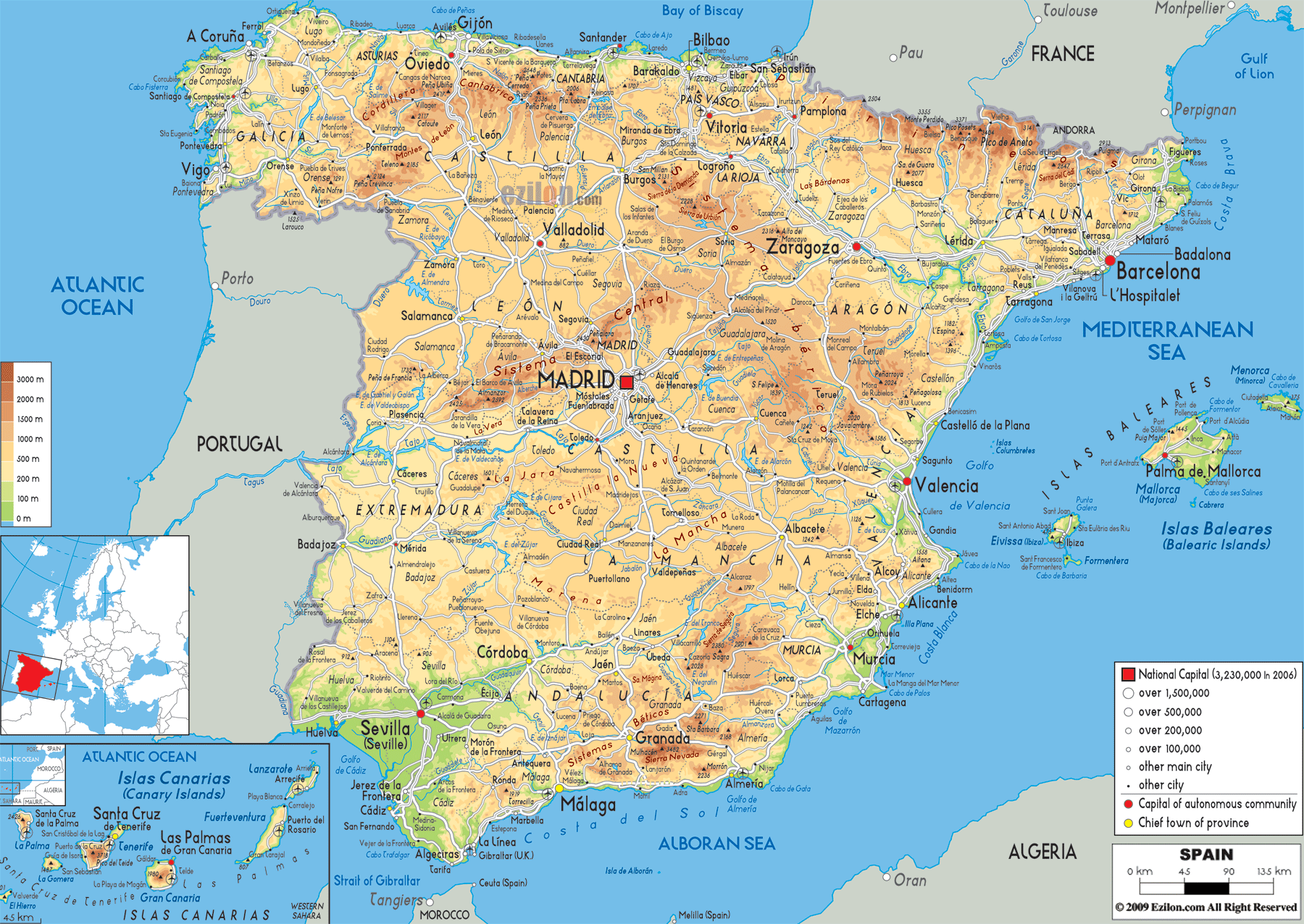
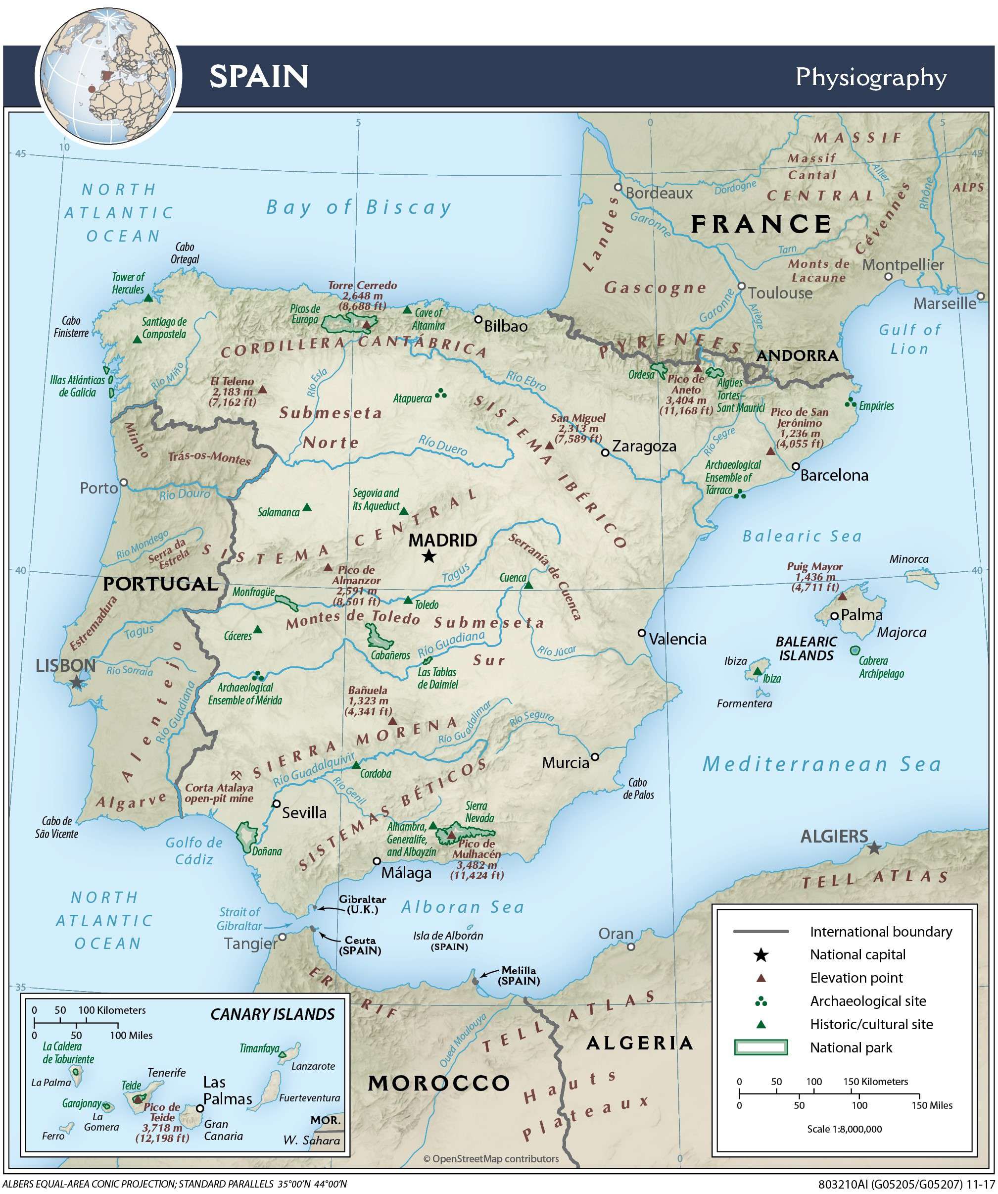
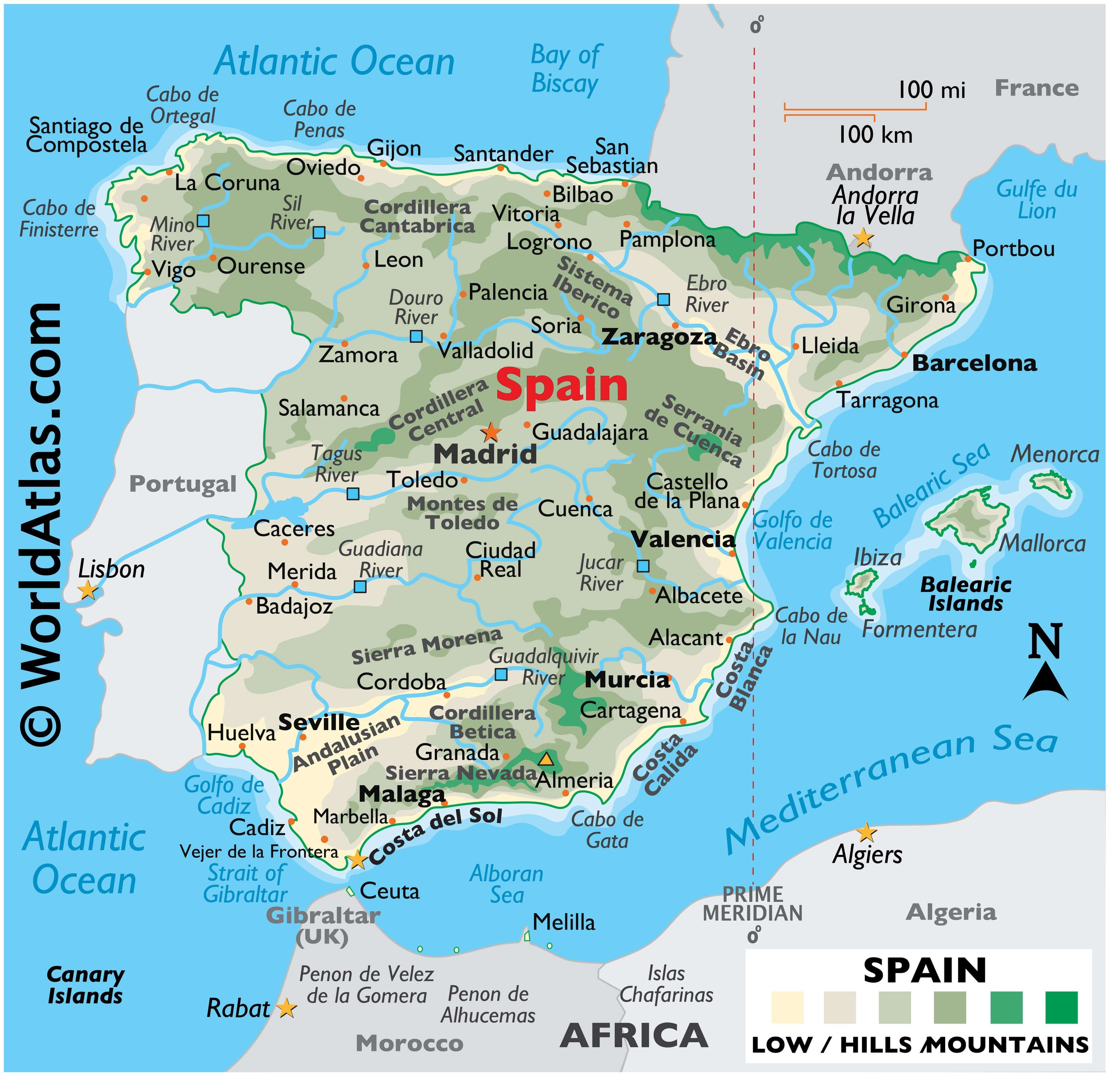
Occupying most of the Iberian Peninsula’s land area (approximately 85%), Spain is the third-largest country in Europe and 45% is covered by the Meseta Plateau.
As observed on the physical map of Spain, the terrain of the land is highly undulating. That plateau is rarely flat, and is in reality a mostly hilly highland area divided by the Cordillera Central (mountains), and then ringed by additional mountain ranges, north, east and south. In the west the Meseta slopes gently down into neighboring Portugal.
Significant mountains in Spain include the limestone Cordillera Cantabrica and rugged Sistema Iberico (north); massive Pyrenees (northeast) where many peaks exceed 3,000 meters; the deeply eroded and rocky Sierra de Cuenca(east), and the lower Montes de Toledo and Serrania de Cuenca (south-central).
In the far south the mountains of the Cordillera Betica and Sierra Nevada dominate the landscape. Mainland Spain’s highest point (Mulhacen at 3,481 meters) stands in the Sierra Nevada. It has been marked on the map by a yellow triangle.
Significant lowlands include the fertile Andalusian Plain in the southwest, and the Ebro River Basin in the northeast. In addition, much of Spain is fronted by a low and narrow coastal plain, one that separates the mountains from the sea.
Those deeply indented coastal areas include countless bays and coves, and most have sandy beaches. In the far northwest, along the Bay of Biscay, rugged cliffs front the coastline.
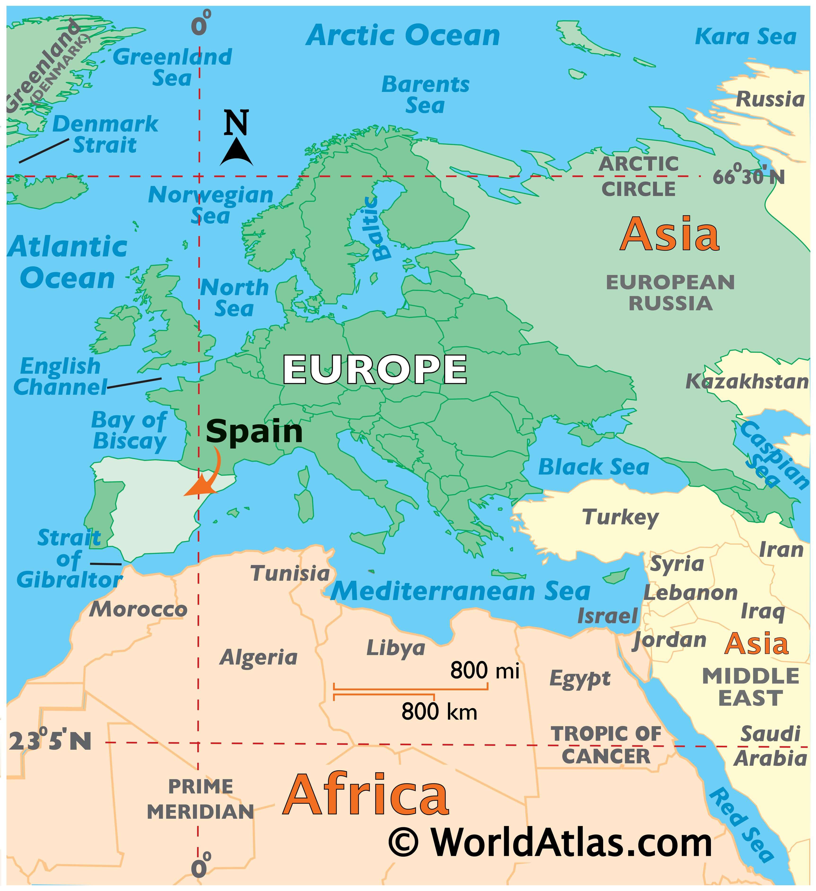
In the far south, the Strait of Gibraltar separates Spain and Europe from Morocco (Africa), and here, the two continents are only 13 km (8 miles) apart.
The country is drained by an estimated 1,500 rivers (mostly small). The longest and most significant rivers include the Douro (Duero), Ebro, Jucar, Tagus (Tejo), Guadiana and Guadalquivir.
| Flag: |  |
|---|---|
| Legal Name: | Kingdom of Spain |
| Capital Value: | Madrid |
| Demonym(s): |
|
| Government: | Unitary parliamentary constitutional monarchy |
| Legislature: | Cortes Generales |
| Total Area: | 505,370 km² |
| Land Area: | 498,980 km² |
| Water Area: | 6,390 km² |
| Population: | 47,076,781 |
| Density: | 94/km (243.5/sq mi) (120th) |
| GDP: | $1.39 Trillion |
| GDP Per Capita: | $29,613.67 |
| Currency Value: | Euros (EUR) |
| Driving side: | right |
| Calling code: | +34 |
| Internet TLD: | .es |
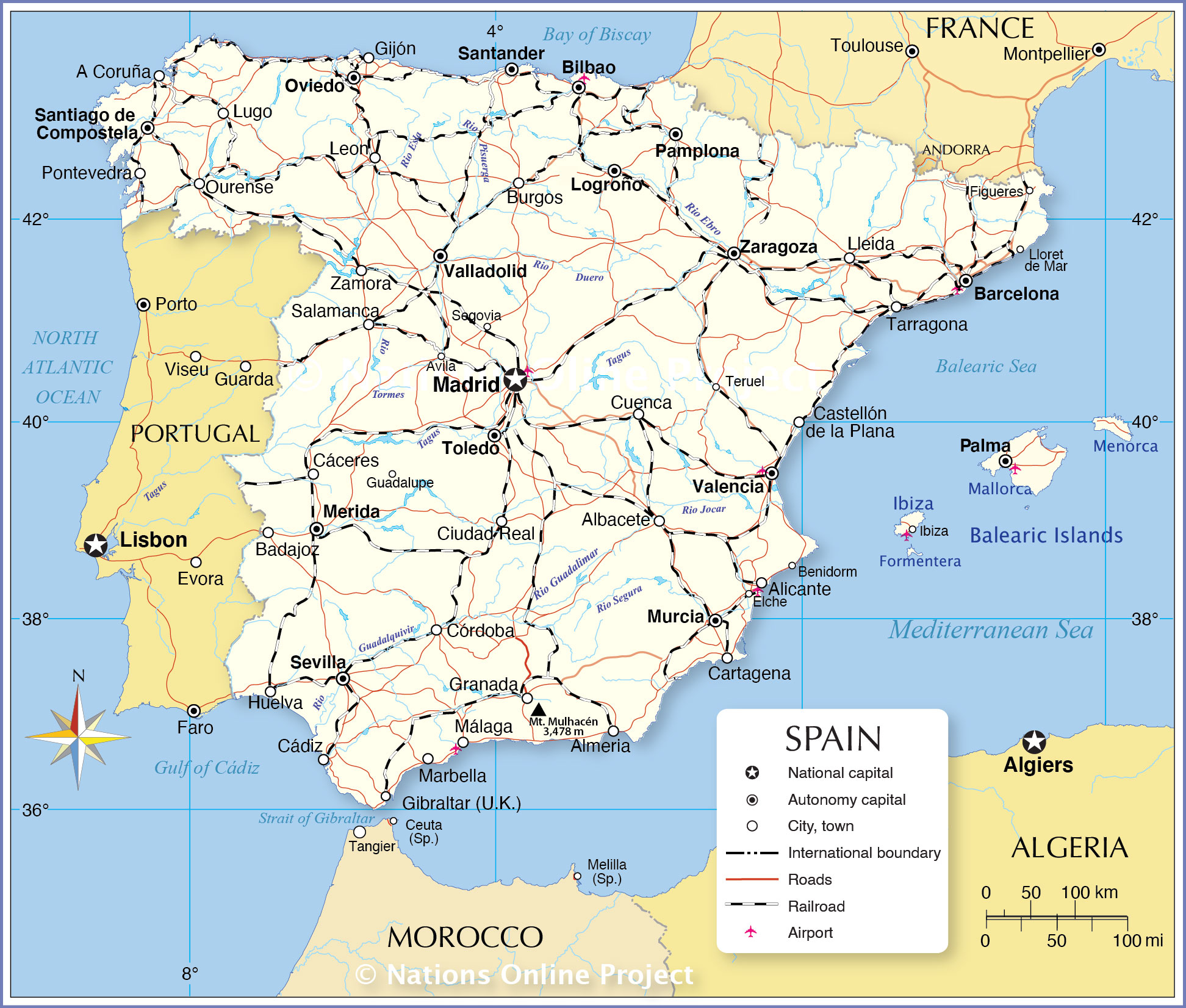
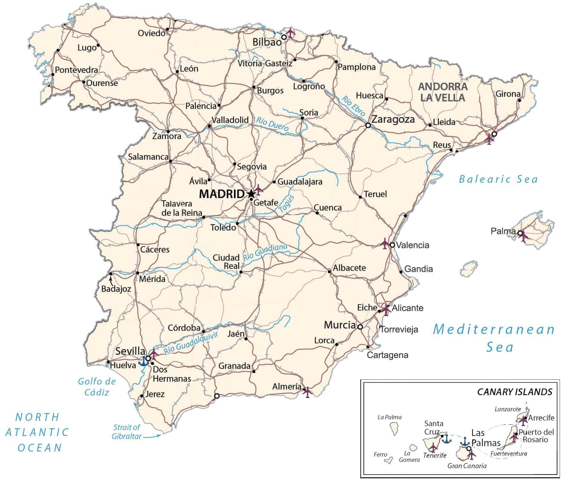
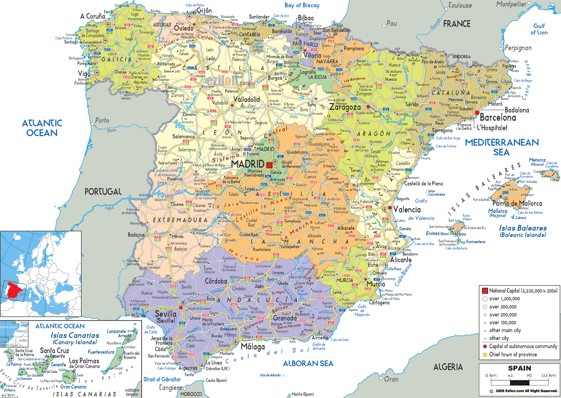
Discover the beauty of Spain with this detailed map of the country. From the bustling cities of Madrid and Barcelona, to the stunning beaches of the Costa Brava, you can find it all on this map. See the major roads, rivers, lakes, and islands that make up this incredible country. With a reference map, satellite imagery, a physical map, and an administrative map of Spain, you can explore every corner of the country.
Online Interactive Political Map
Click on ![]() to view map in "full screen" mode.
to view map in "full screen" mode.
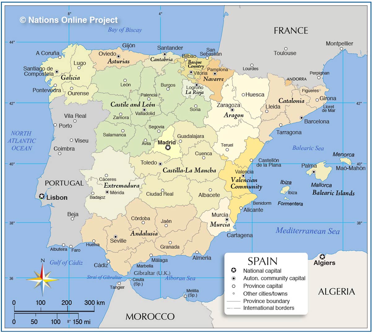
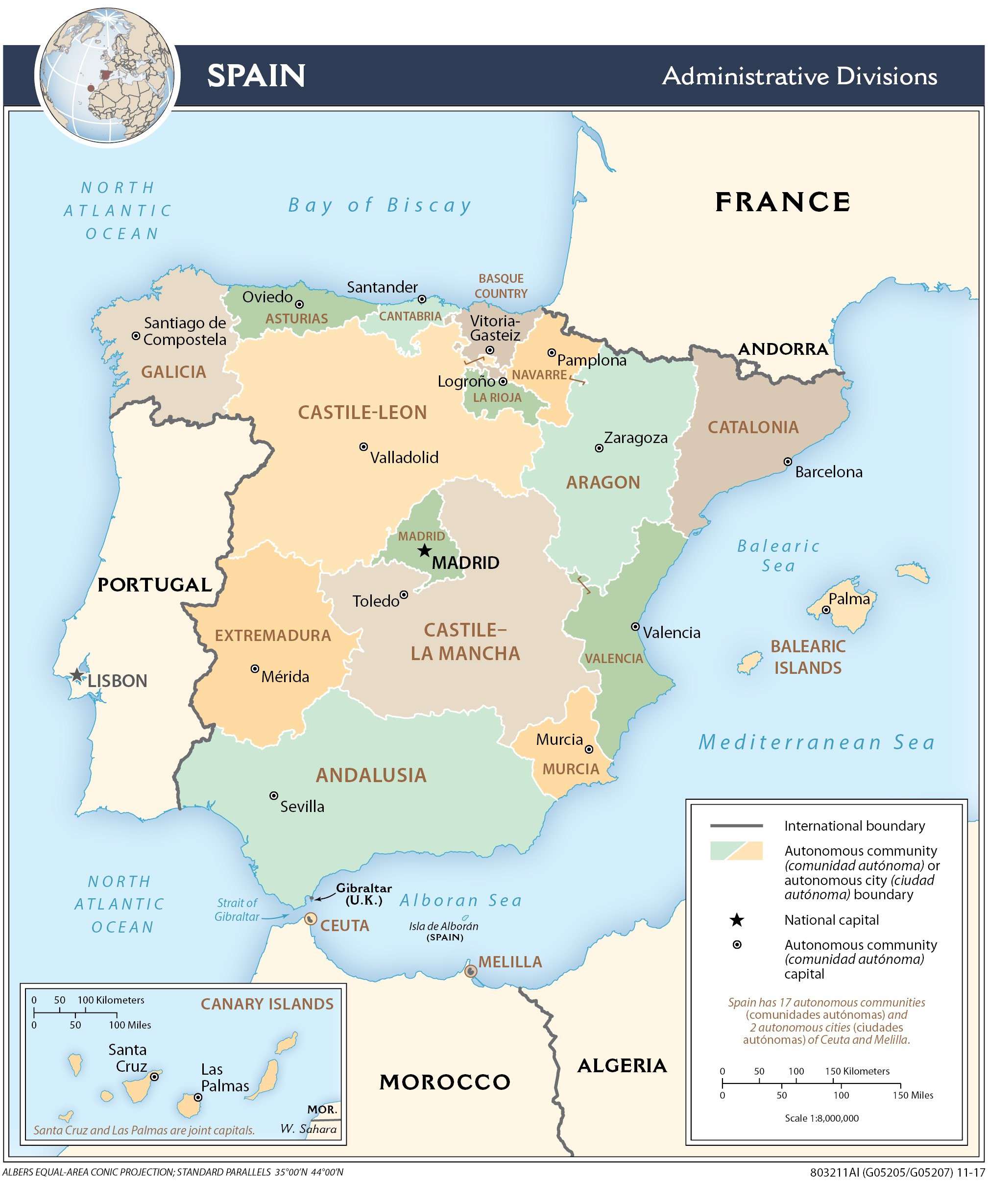
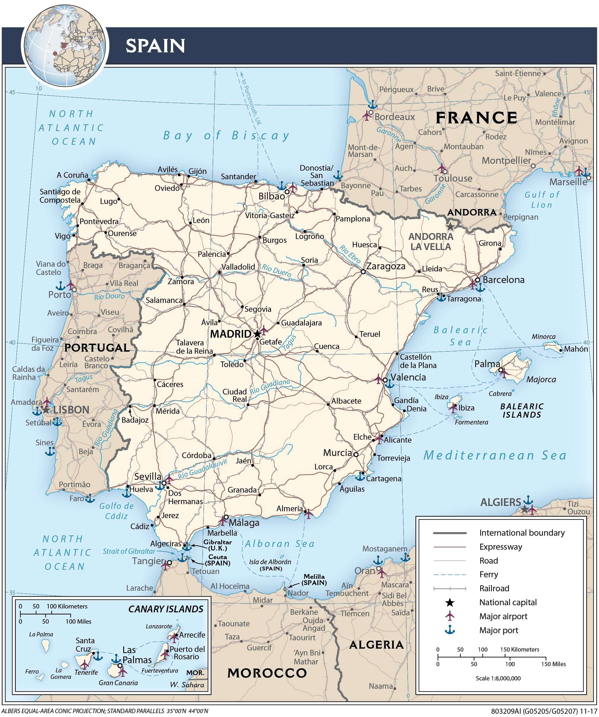
Spain (officially, the Kingdom of Spain) is divided into 17 autonomous communities (comunidades autonomas, sing. comunidad autonoma) and 2 autonomous cities (ciudades autonomas, sing. ciudad autonoma). The autonomous communities are: Andalusia, Catalonia (Catalan), Madrid, Comunitat Valenciana [Valencian Community], Galicia, Castilla-Leon, Euskadi (Basque) [Basque Country], Castilla-La Mancha, Canarias (Canary Islands), Murcia, Aragon, Extremadura, Illes Baleares (Balearic Islands), Asturias, Navarre (Castilian), Cantabria, and La Rioja. The 2 autonomous cities are: Ceuta and Melilla. The autonomous communities are further subdivided into provinces and smaller subdivisions.
With an area of 505,990 sq. km, Spain is the largest country in Southern Europe and the 4th largest country in the continent of Europe. It is also the 2nd largest country in Western Europe and EU. Spain has a population of over 47 million, making it the 6th most populous country in Europe and the 4th most populous country in EU. Located in the central part of the country is, Madrid – the capital, the largest and the most populous city of Spain. Madrid is also the cultural, administrative and economic center of Spain. Madrid functions as an important financial hub of Southern Europe.
Location Maps
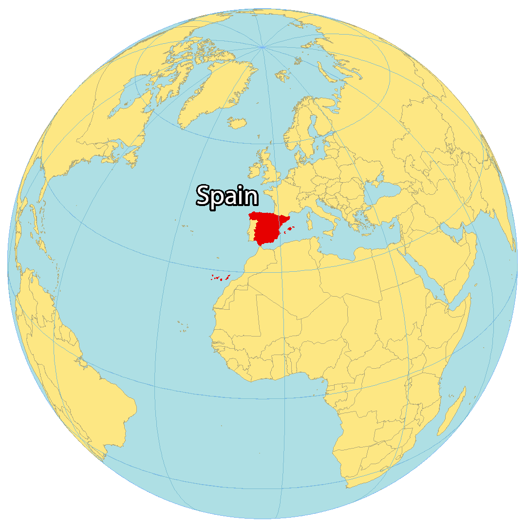
Where is Spain?
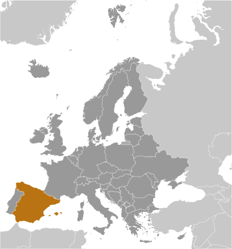
Spain is a country in Southwestern Europe. It has borders with France and Andorra to the northeast and Portugal to the west. It is also a transcontinental country with territory in both Europe and Africa and shares a border with Morocco and a small 1.2 km (0.75 mi) border with Gibraltar. Additionally, it is situated along the Bay of Biscay to the north, the Balearic Sea to the east, and the Alboran Sea to the south. Spain is the fourth largest in size and fifth-most populous in Europe.
The country is renowned for its rich culture and heritage, with the third-highest number of UNESCO World Heritage Sites, and its festivals like La Tomatina and the Running of the Bulls. Madrid is the capital and largest city of Spain, while other major cities are Barcelona, Valencia, and Seville. Spain also has several large islands, such as the Balearic Islands and the Canary Islands.
High Definition Political Map of Spain
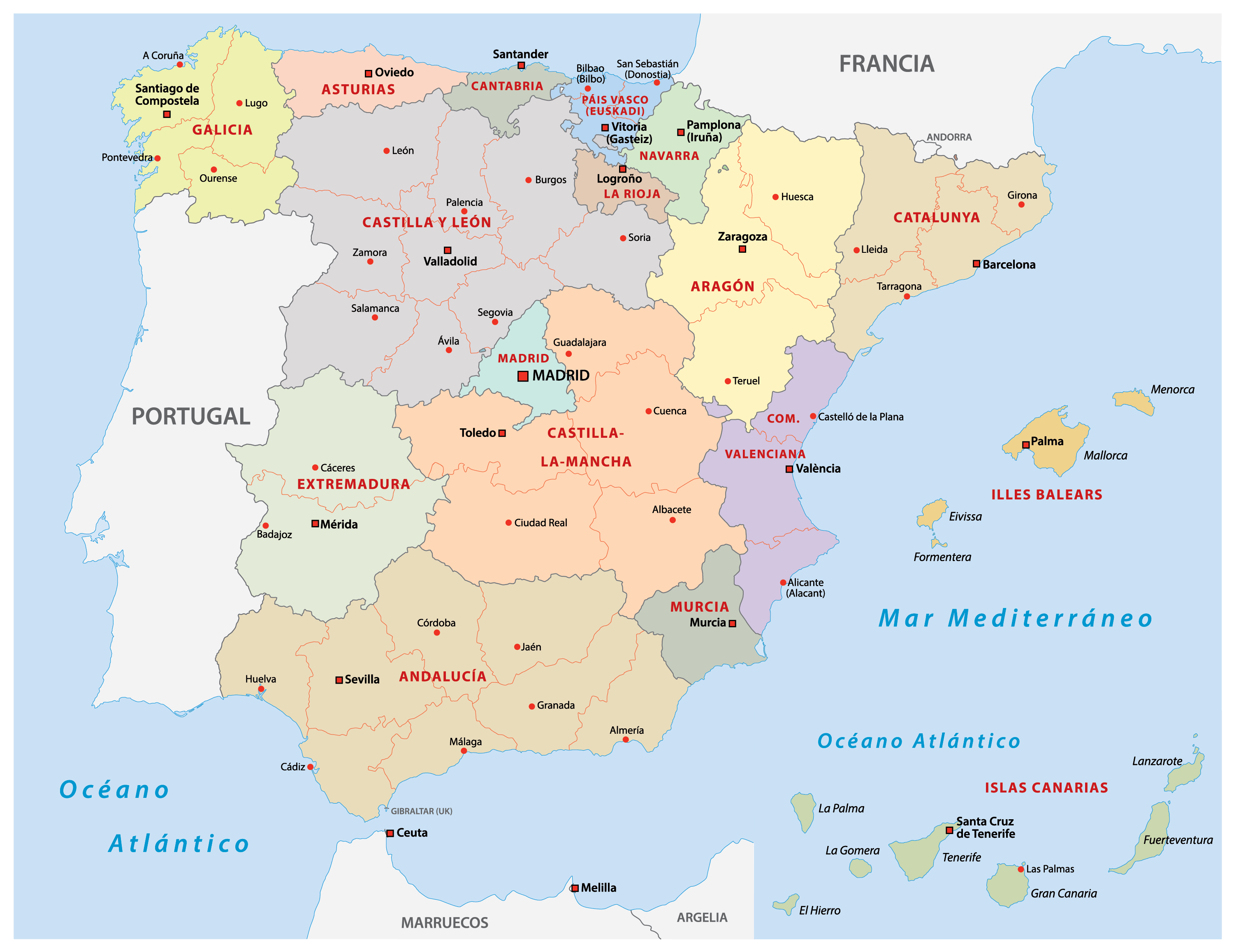
Spain Administrative Map
Physical Map of Spain
Transportation Map of Spain
Other Maps