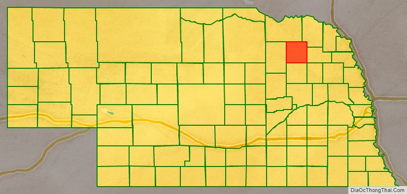
Pierce County is a county in the U.S. state of Nebraska. As of the 2010 United States Census, the population was 7,266. Its county seat is Pierce. The county was formed in 1859, and was named for US President Franklin Pierce.
Pierce County is part of the Norfolk, NE Micropolitan Statistical Area.
In the Nebraska license plate system, Pierce County is represented by the prefix 40 (it had the 40th-largest number of vehicles registered in the county when the license plate system was established in 1922).
| Name: | Pierce County |
|---|---|
| FIPS code: | 31-139 |
| State: | Nebraska |
| Founded: | 1859 |
| Named for: | Franklin Pierce |
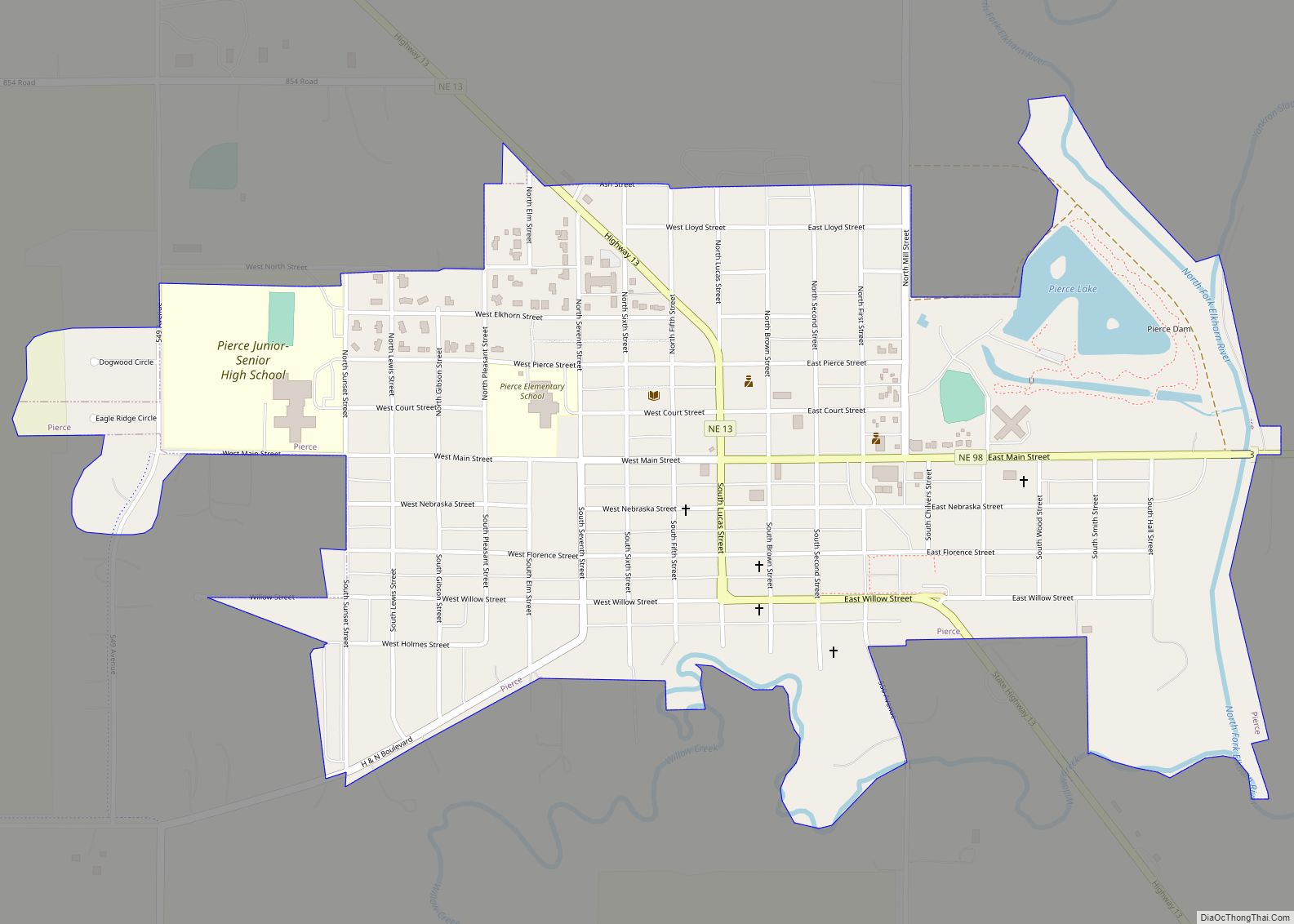
| Seat: | Pierce |
| Largest city: | Pierce |
| Total Area: | 575 sq mi (1,490 km²) |
| Land Area: | 573 sq mi (1,480 km²) |
| Total Population: | 7,313 |
| Population Density: | 12.5/sq mi (4.8/km²) |
| Time zone: | UTC−6 (Central) |
| Summer Time Zone (DST): | UTC−5 (CDT) |
| Website: | www.co.pierce.ne.us |
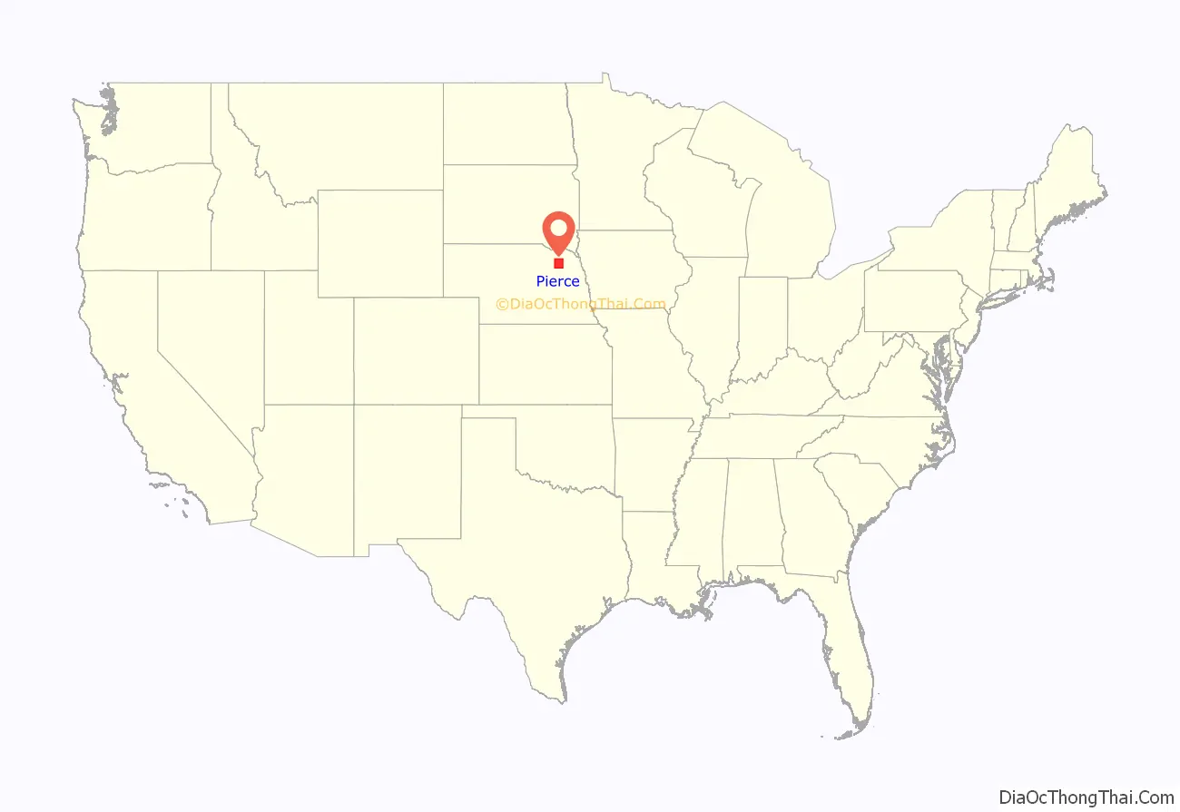
Pierce County location map. Where is Pierce County?
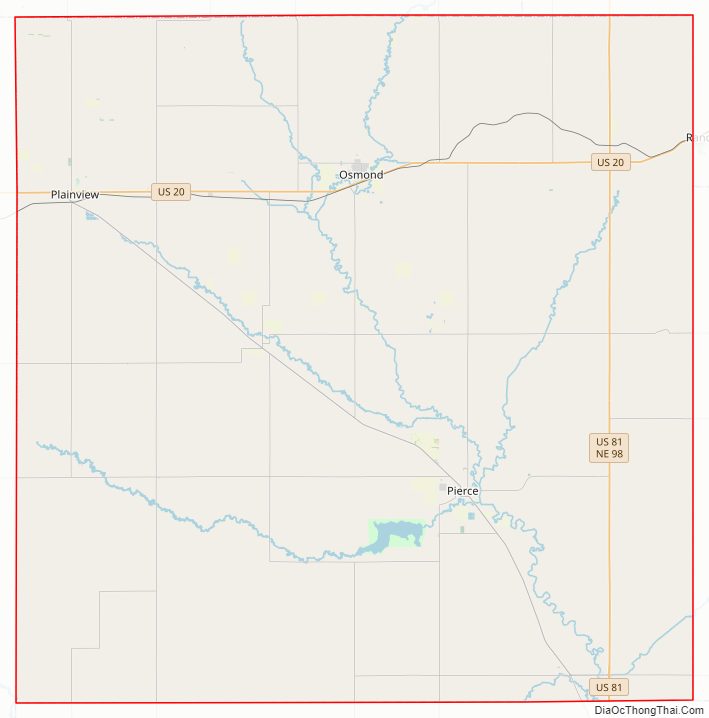
Pierce County Road Map
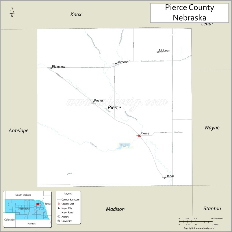
Geography
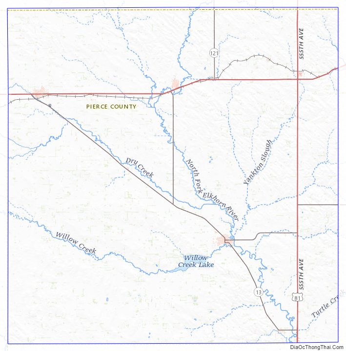
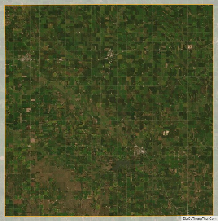
The Pierce County terrain consists of low rolling hills, sloping to the east and southeast. The north fork of the Elkhorn River flows southeastward through the central part of the county, while Dry Fork drains the lower western part, then discharges into the north fork of the Elkhorn. Most of the county’s area is devoted to agriculture, often under central pivot irrigation.
The county has a total area of 575 square miles (1,490 km), of which 573 square miles (1,480 km) is land and 1.3 square miles (3.4 km) (0.2%) is water.
Major highways
- U.S. Highway 20
- U.S. Highway 81
- Nebraska Highway 13
- Nebraska Highway 98
- Nebraska Highway 121
Adjacent counties
- Cedar County – northeast
- Wayne County – east
- Stanton County – southeast
- Madison County – south
- Antelope County – west
- Knox County – north
Protected areas
- Willow Creek Recreation Area
Pierce County Topographic Map
Pierce County Satellite Map
Pierce County Outline Map