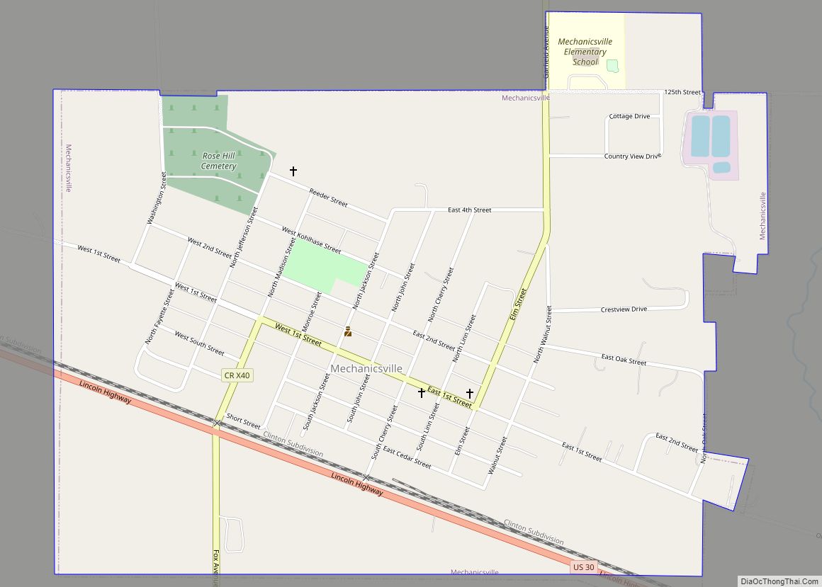
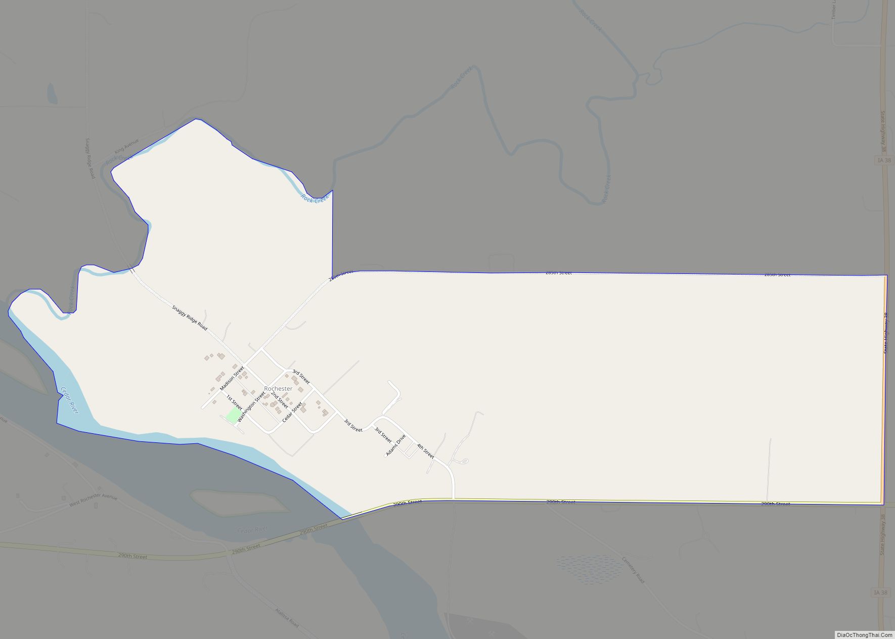
Cedar County is a county located in the U.S. state of Iowa. As of the 2020 census, the population was 18,505. Its county seat is Tipton. The county is named for the Cedar River, which runs through the county.
Cedar County is located between the Cedar Rapids, Quad Cities and Iowa City metropolitan areas, areas also known as the “Tri-Metro” county. It is the only Iowa county which shares the name of a tree. Cedar County was the focus of the Iowa Cow War of 1931.
| Name: | Cedar County |
|---|---|
| FIPS code: | 19-031 |
| State: | Iowa |
| Founded: | 1837 |
| Named for: | Cedar River |
| Seat: | Tipton |
| Largest city: | Tipton |
| Total Area: | 582 sq mi (1,510 km²) |
| Land Area: | 579 sq mi (1,500 km²) |
| Total Population: | 18,505 |
| Population Density: | 32/sq mi (12/km²) |
| Time zone: | UTC−6 (Central) |
| Summer Time Zone (DST): | UTC−5 (CDT) |
| Website: | cedarcounty.iowa.gov |
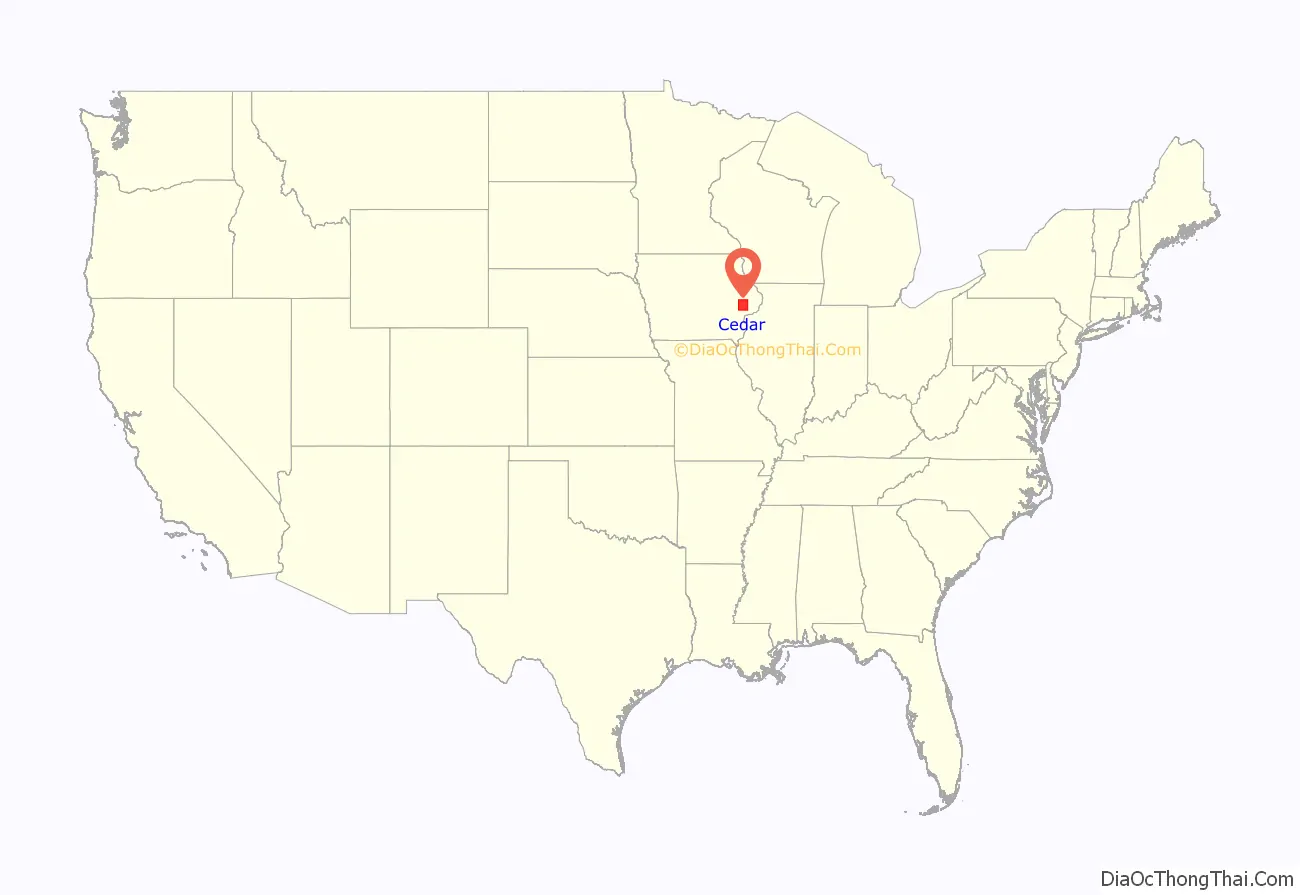
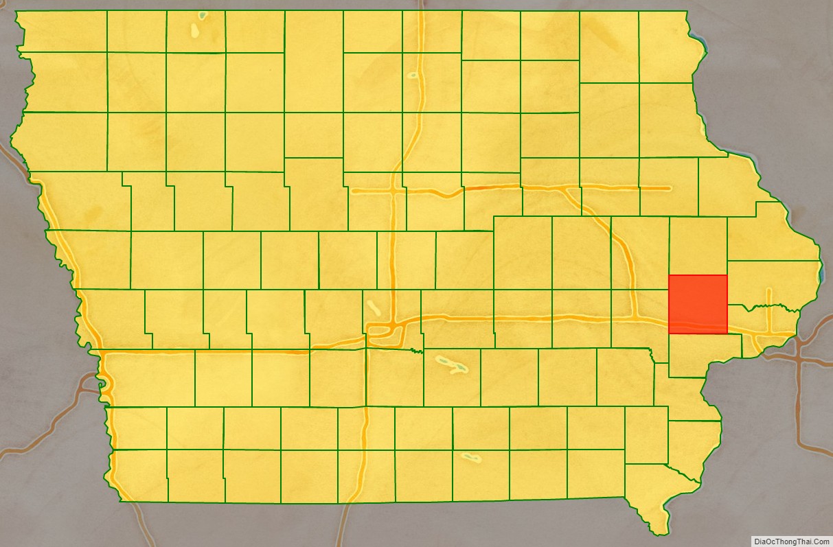
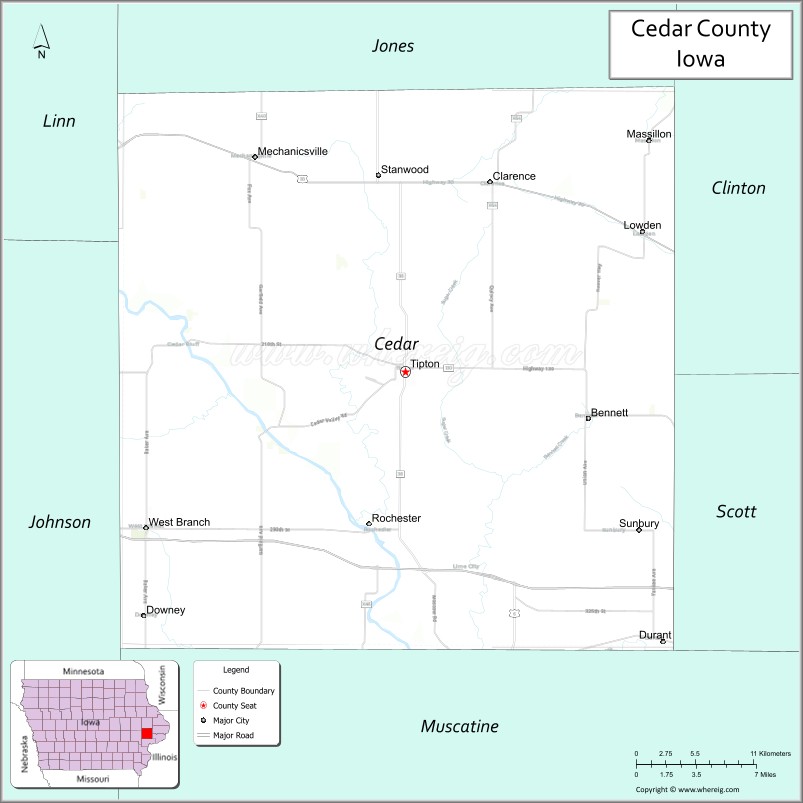
Cedar County location map. Where is Cedar County?
History
Cedar County was formed on December 21, 1837, from sections of Dubuque County. It was named for the Cedar River.
In 1840, the City of Tipton, the current county seat, was established.
Before the Civil War, the area around West Branch was an active focal point of the Underground Railroad, a network for the freeing of slaves from the southern states.
The former US President Herbert Hoover (1874-1964) was born in West Branch in Cedar County.
The Cedar County Sheriff’s House and Jail is believed to be the last jail and residence combination still in use when it closed in 2001. It was listed on the National Register of Historic Places in 2003.
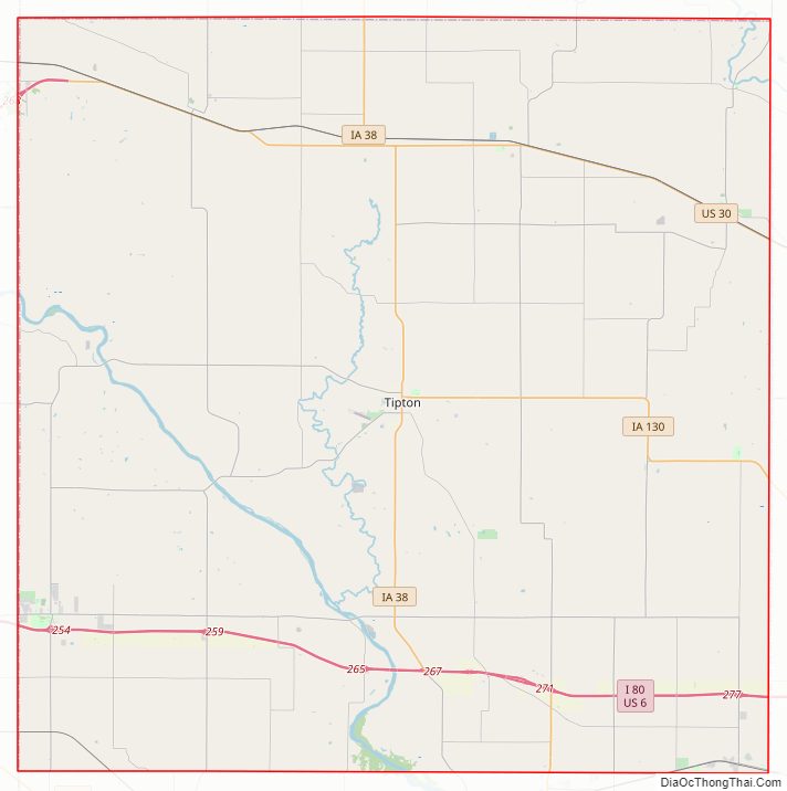
Cedar County Road Map
Geography
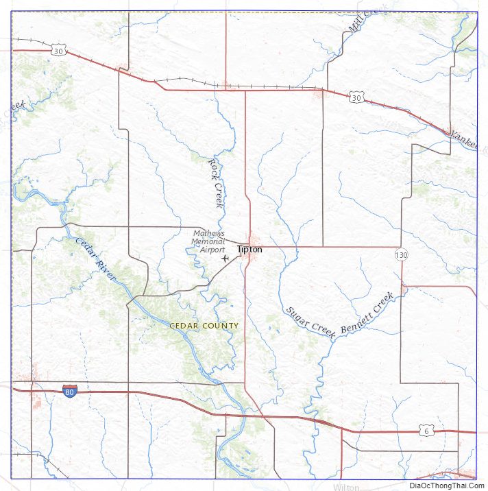
According to the U.S. Census Bureau, the county has a total area of 582 square miles (1,510 km), of which 579 square miles (1,500 km) is land and 2.5 square miles (6.5 km) (0.4%) is water. Rock Creek flows through Cedar County.
Major highways
- Interstate 80
- U.S. Highway 6
- U.S. Highway 30
- Iowa Highway 38
- Iowa Highway 130
Adjacent counties
- Jones County (north)
- Clinton County (northeast)
- Scott County (southeast)
- Muscatine County (south)
- Johnson County (west)
- Linn County (northwest)
National protected area
- Herbert Hoover National Historic Site
Cedar County Topographic Map
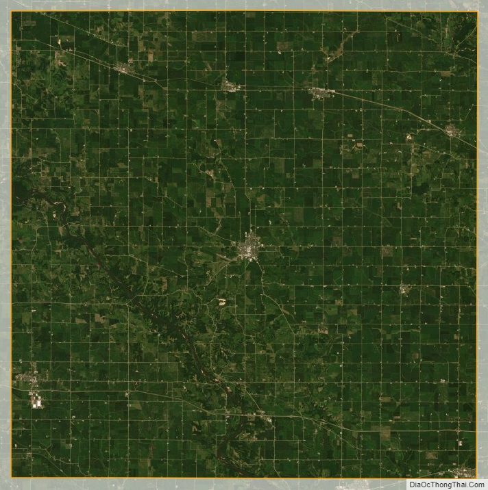
Cedar County Satellite Map
Cedar County Outline Map