Ferry County is a county located on the northern border of the U.S. state of Washington. As of the 2020 census, the population was 7,178, making it the fourth-least populous county in Washington. The county seat and largest city is Republic. The county was created out of Stevens County in February 1899 and is named for Elisha P. Ferry, the state’s first governor.
| Name: | Ferry County |
|---|---|
| FIPS code: | 53-019 |
| State: | Washington |
| Founded: | February 21, 1899 |
| Named for: | Elisha P. Ferry |
| Seat: | Republic |
| Largest city: | Republic |
| Total Area: | 2,257 sq mi (5,850 km²) |
| Land Area: | 2,203 sq mi (5,710 km²) |
| Total Population: | 7,178 |
| Population Density: | 3.5/sq mi (1.4/km²) |
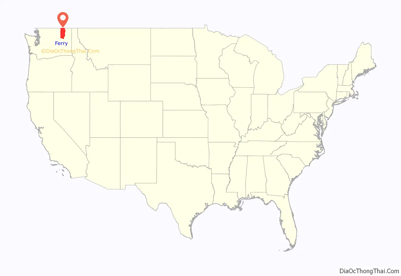
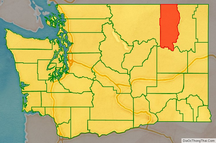
Ferry County location map. Where is Ferry County?
History
During the time of Washington Territory, the Territorial Legislature created Stevens County in 1863, containing all the land from the Columbia River to the Cascades north of the Wenatchee River from Walla Walla County. On January 20, 1864, the original Spokane County was dissolved and merged with the unorganized Stevens County. The western section of Stevens County was separated on February 18, 1899, and named Ferry County, in recognition of the Territory’s last governor and the State’s first governor, Elisha P. Ferry.
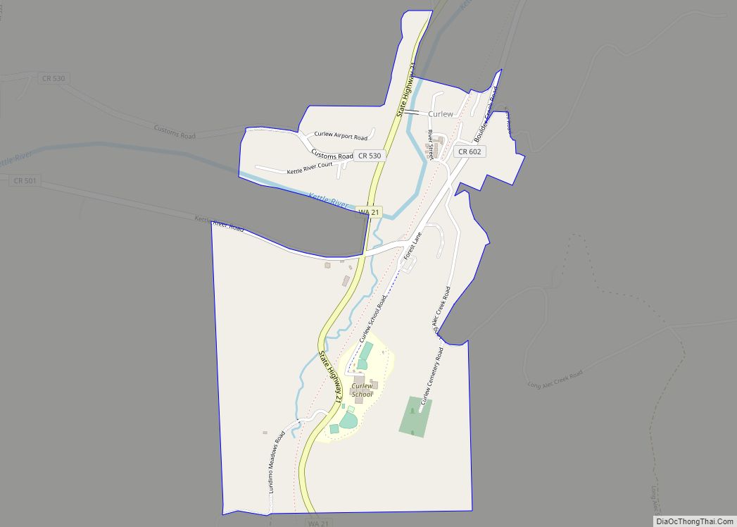
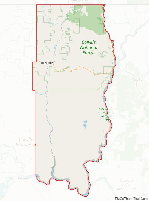
The town of Republic is the county’s seat of government, as well as the largest town. It was founded at the end of the nineteenth century by gold prospectors and was incorporated in 1900. The original election precinct of Republic was created on April 6, 1898. Following the 1922 primary elections, a group of citizens called for an investigation into possible election irregularities. The group claimed that two of that years voting precincts had been formed unlawfully in conjunction with misconduct in six precincts by election officers and the canvassing board. As a result of the actions, the validity of two candidates were called in question. Demands were made that Thomas F. Barker, seeking re-election as sheriff, and John W. McCool, seeking the County Treasurer seat, be barred from the ballot. Barker was notably facing charges at the federal level at that time from allegations of conspiring and abetting bootleggers.
The original county courthouse, made of wood, burned in 1934. Its replacement, made of concrete and stucco, is presently being considered for historical preservation.
Ferry County Road Map
Geography
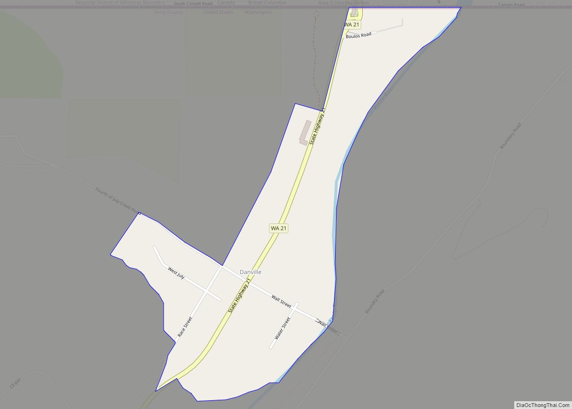
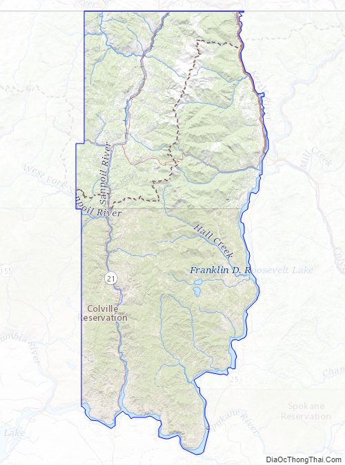
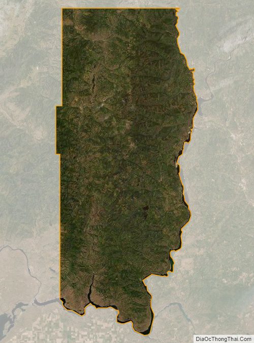
According to the United States Census Bureau, the county has a total area of 2,257 square miles (5,850 km), of which 2,203 square miles (5,710 km) is land and 54 square miles (140 km) (2.4%) is water. Most of the county is covered by the rugged Kettle River Range, which extends from the Canada–US border to its southernmost perimeter bounded by the Columbia River and Lake Roosevelt. Only a narrow north–south strip running the length of the county on the west between the San Poil River and the Okanogan County line is covered by the Okanogan Highland. Except for the town of Republic, the county is sparsely populated.
Geographic features
Major rivers and lakes
- Columbia River
- Kettle River
- Sanpoil River
- Franklin D. Roosevelt Lake, called Lake Roosevelt
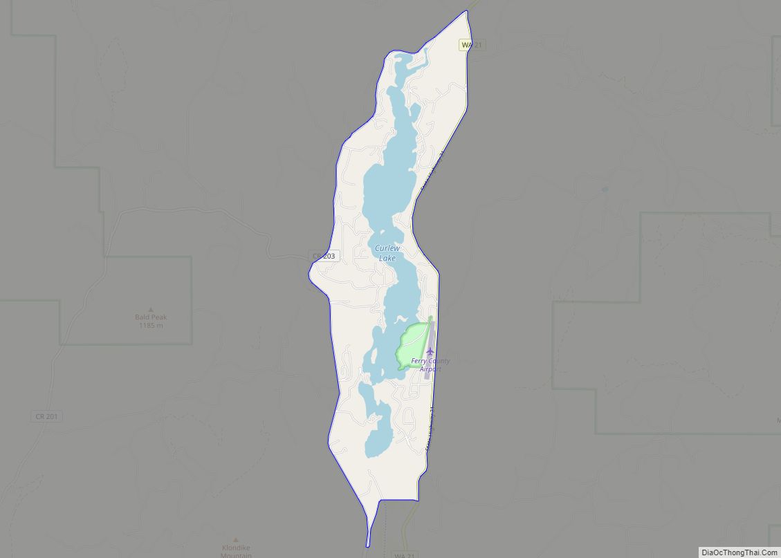
- Curlew Lake
- Swan Lake
- Ferry Lake
- Fish Lake
- Long Lake
Adjacent counties
- Kootenay Boundary Regional District, British Columbia, north
- Stevens County, east
- Lincoln County, southwest
- Okanogan County, west
National protected areas
- Pacific Northwest National Scenic Trail (part)
- Colville National Forest (part)
- Lake Roosevelt National Recreation Area (part)
Ferry County Topographic Map
Ferry County Satellite Map
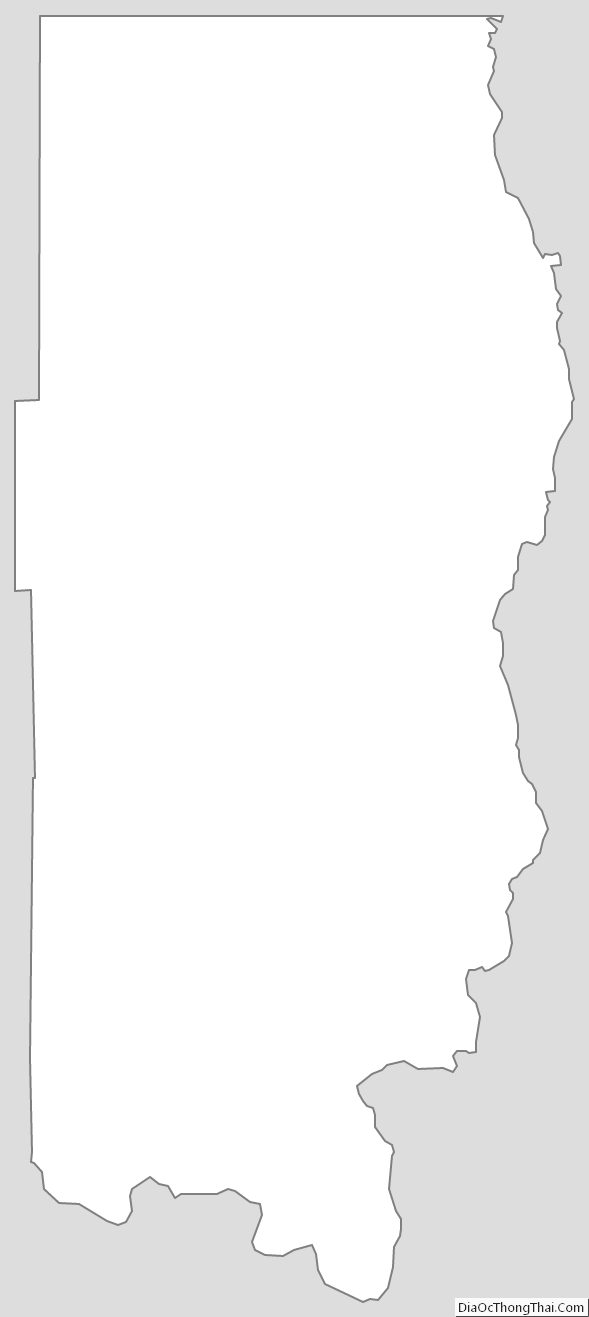
Ferry County Outline Map