| Name: | Garrett County |
|---|---|
| FIPS code: | 24-023 |
| State: | Maryland |
| Founded: | November 4, 1872 |
| Named for: | John Work Garrett |
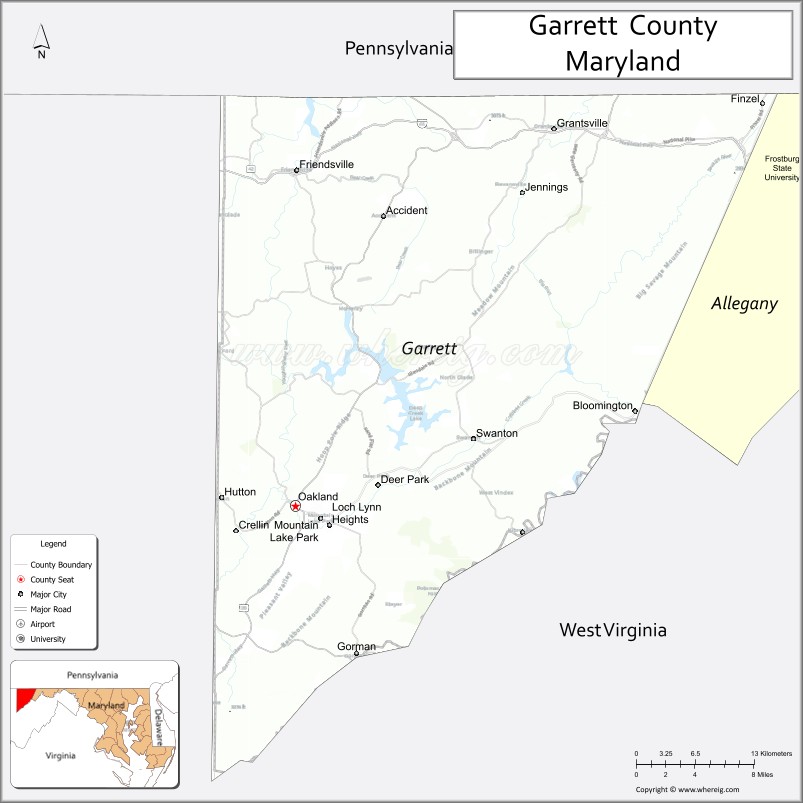
| Seat: | Oakland |
| Largest town: | Mountain Lake Park |
| Total Area: | 656 sq mi (1,700 km²) |
| Land Area: | 647 sq mi (1,680 km²) |
| Total Population: | 28,806 |
| Population Density: | 44/sq mi (17/km²) |
| Time zone: | UTC−5 (Eastern) |
| Summer Time Zone (DST): | UTC−4 (EDT) |
| Website: | www.garrettcounty.org |
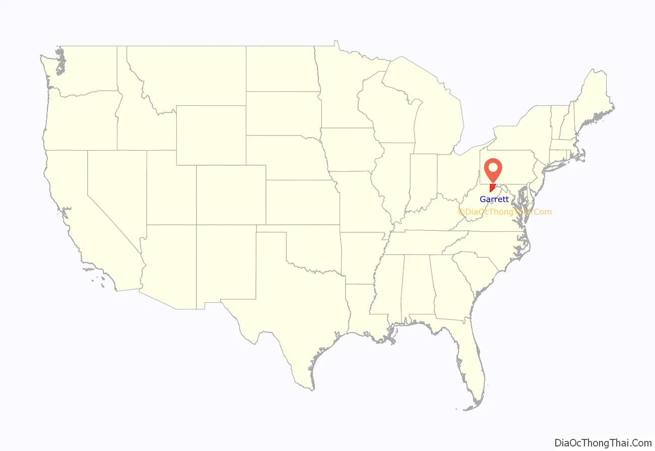
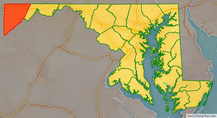
Garrett County location map. Where is Garrett County?
History
In the early 20th century, the railroad and tourism started to decline. Coal mining and timber production continued at a much slower pace. Today, tourism has made a dramatic rebound in the county with logging and farming making up the greatest part of the economic base. Due to a cool climate and lack of any large city, Garrett County has remained a sparsely populated rural area.
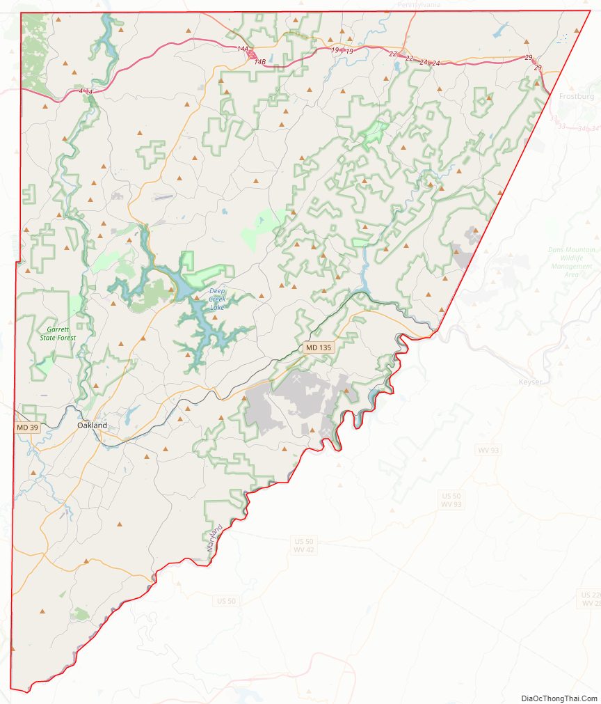
Garrett County Road Map
Geography
According to the U.S. Census Bureau, the county has a total area of 656 square miles (1,700 km), of which 647 square miles (1,680 km) is land and 8.6 square miles (22 km) (1.3%) is water. It is the second-largest county in Maryland by land area.
Garrett County is Maryland’s westernmost, bordering Pennsylvania to the north via the Mason–Dixon line, West Virginia to the south and west (with the Potomac River forming its southern boundary), and Allegany County, Maryland to the east. The county’s northwesternmost point is approximately 60 miles (97 km) southeast of Pittsburgh, Pennsylvania, and its southeasternmost point is approximately 160 miles (260 km) northwest of Baltimore, Maryland.
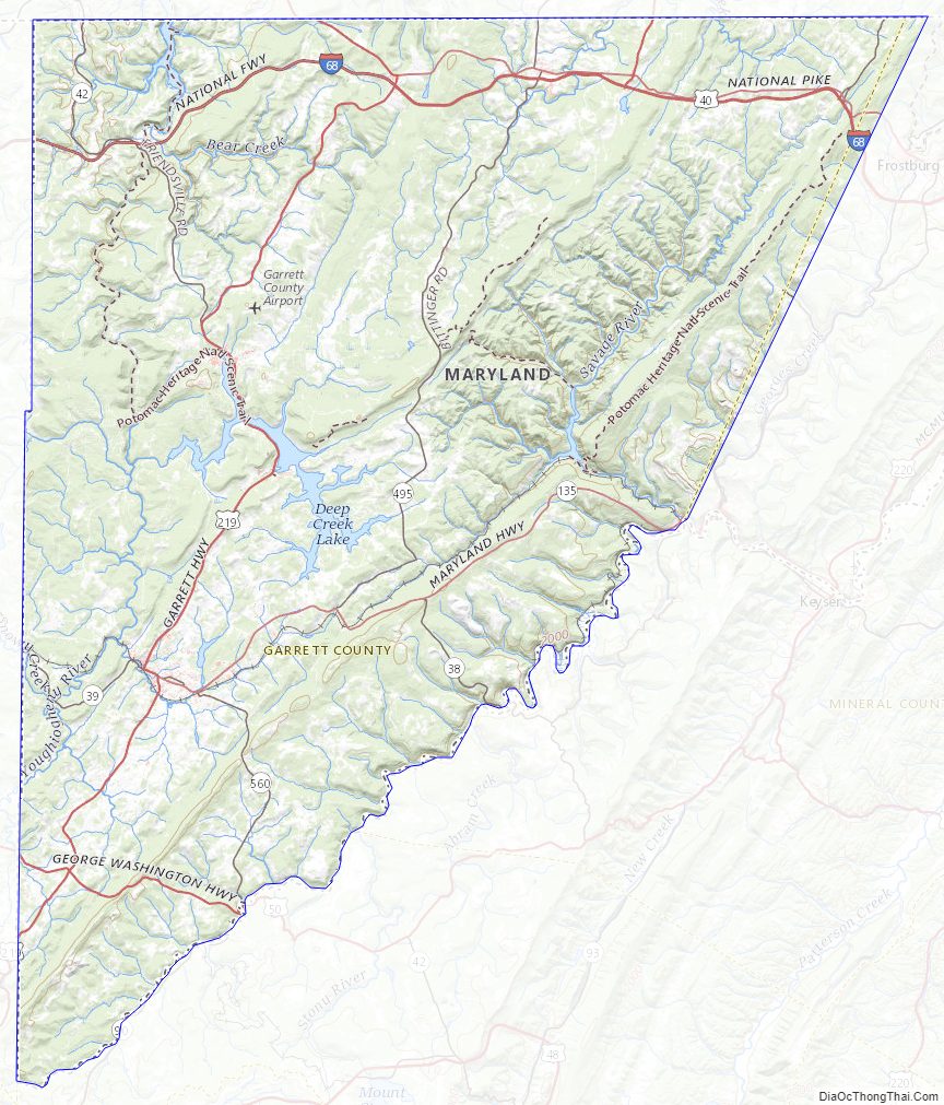
Garrett County is located entirely within the highland zone of the Appalachian Mountains known variously as the Allegheny Mountains, the Allegheny Plateau, and the Appalachian Plateau. The county’s highest elevations are located along four flat-topped ridges and range to a height of 3,360 feet (1,020 m) at Hoye-Crest along Backbone Mountain, the highest point in the state of Maryland. As is typical in the Allegheny region, broad flats generally lie below the ridge crests at elevations of approximately 500 feet (150 m). River valleys are generally narrow and deep, with ravines typically 1,000 to 1,800 feet (550 m) below surrounding peaks.
The county contains over 76,000 acres (310 km) of parks, lakes, and publicly accessible forestland. It is drained by two river systems, the Potomac and the Youghiogheny. The Savage River, a tributary of the Potomac, drains about a third of the county. The Casselman River, a tributary of the Youghiogheny, flows north from the county’s central section into Pennsylvania. The Youghiogheny itself drains the westernmost area of the county and flows north into Pennsylvania, where it empties into the Monongahela River at McKeesport, just south of Pittsburgh.
Geologic points of interest
The Glades’ 601 acres (2.43 km) is of great scientific interest because it is an ombrotrophic system (fed solely by rainwater) with peat layers up to 9 feet (2.7 m) thick, and is one of the oldest examples of mountain peatland in the Appalachians.
On the western edge of the Savage River State Forest along Maryland Route 495 lies Bittinger, Maryland, which is named after Henry Bittinger, who first settled in the area and who was joined by other German settlers moving in and taking up the fertile farmland. On the eastern edge of Bittinger is one of the largest glades area of Garrett County. Geographically, this is an area that seems to have been affected by the last great ice sheet of North America. Two miles southeast of Bittinger, there is a large deposit of peat moss.
In the Casselman River valley, 1-mile (1.6 km) south of Grantsville, Maryland and beside Maryland Route 495, one can see remains of geological evidence about the last great ice sheet over North America. A series of low mounds can be seen in the fields on the west side of Maryland Route 495 that are “loess” (wind-blown) material. Apparently, these are the only ones still visible in the northern part of Garrett County.
The mounds were formed when a glacier lake existed in the Casselman valley, and the ice around the edges of the frozen lake melted. Wind blew fine grains of earth into the water around the edges where it sank to the bottom, and the mounds were the result of the deposit of this wind-blown material.
Forests, rivers, caves
See these articles for information on the forests, rivers, and caves of Garrett County:
- List of Maryland state forests
- List of rivers of Maryland
- Caves of Maryland (Crabtree – largest cave in Maryland)
Parks and recreation
Garrett County contains over 76,000 acres (310 km) of parks, lakes, and publicly accessible forestland. Popular activities in the county include camping, hiking, backpacking, rock climbing, alpine and cross-country skiing, snowmobiling, hunting, ice fishing, fly fishing, whitewater canoeing, kayaking, rafting, boating, swimming, sailing, horseback riding, and water skiing.
There are seven state parks in Garrett County. All offer picnic and fishing areas; all but Casselman River State Park have hiking paths. Mountain bike paths, swimming areas, and boat launches and rentals are available at Deep Creek, Herrington Manor, and New Germany state parks. Rental cabins are available at Herrington Manor and New Germany state parks. Big Run, Deep Creek, Herrington Manor, and New Germany state parks all offer canoeing, while campsites may be found at Big Run, Deep Creek, New Germany, and Swallow Falls state parks.
- Big Run State Park
- Casselman River Bridge State Park (Grantsville)
- Deep Creek Lake State Park (Swanton)
- Herrington Manor State Park (Oakland)
- New Germany State Park (Grantsville)
- Sang Run State Park
- Swallow Falls State Park
Garrett County owns four park sites and fifteen recreation facilities. The parks are maintained in cooperation with local associations and civic groups. The recreation areas are attached to public schools and colleges and maintained by the Garrett County Board of Education.
The municipal parks of Garrett County provide sport facilities, hiking, bike and walk paths, playgrounds, picnic areas, boat ramps, and fishing.
- Kitzmiller Parks & Recreation Dept.
- Oakland Broadford Park includes swimming, picnic tables, fishing, boat ramp, playgrounds, sports fields.
Garrett County Topographic Map
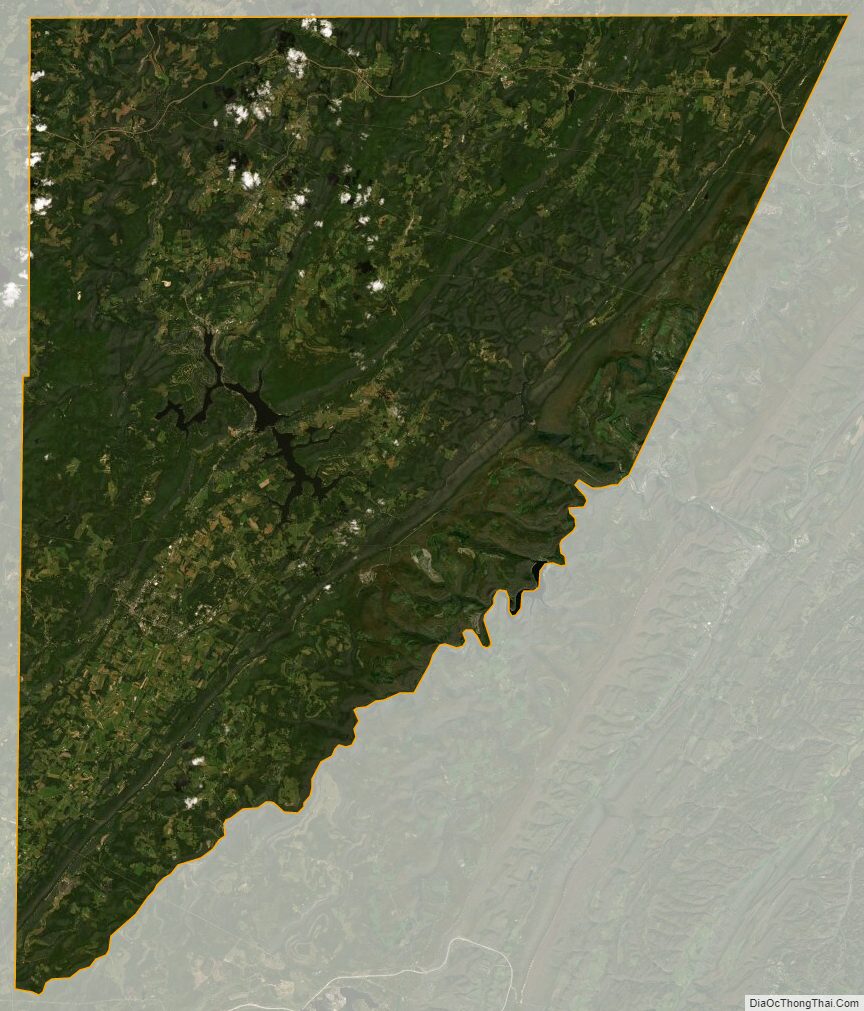
Garrett County Satellite Map
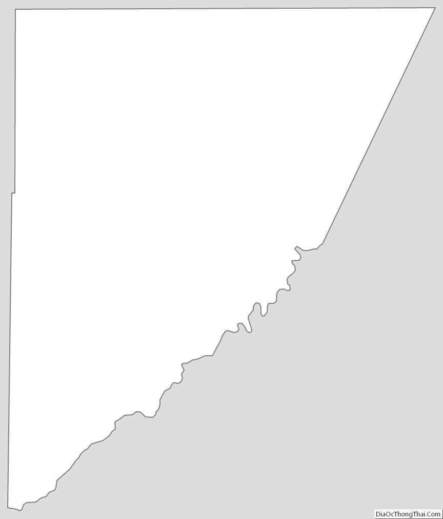
Garrett County Outline Map