Carroll County is located in the U.S. state of Maryland. As of the 2020 census, the population was 172,891. Its county seat is Westminster.
Carroll County is included in the Baltimore-Columbia-Towson, MD Metropolitan Statistical Area, which is also included in the Washington-Baltimore-Arlington, DC-MD-VA-WV-PA Combined Statistical Area. While predominantly rural, the county has become increasingly suburban in recent years.
| Name: | Carroll County |
|---|---|
| FIPS code: | 24-013 |
| State: | Maryland |
| Founded: | January 19, 1837 |
| Named for: | Charles Carroll of Carrollton |
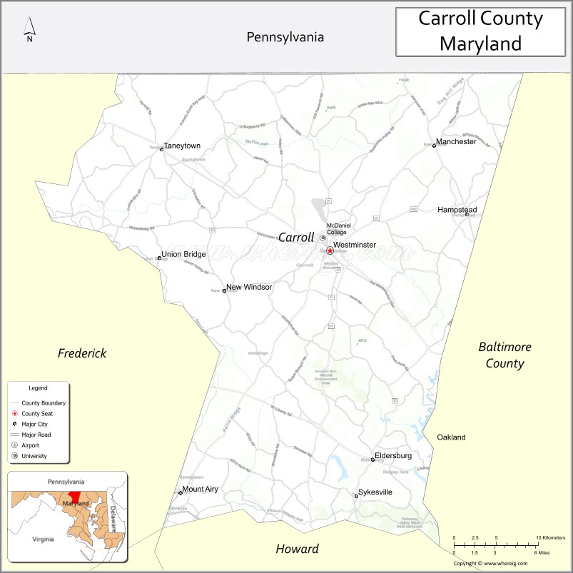
| Seat: | Westminster |
| Total Area: | 453 sq mi (1,170 km²) |
| Land Area: | 448 sq mi (1,160 km²) |
| Total Population: | 172,891 |
| Population Density: | 380/sq mi (150/km²) |
| Time zone: | UTC−5 (Eastern) |
| Summer Time Zone (DST): | UTC−4 (EDT) |
| Website: | carrollcountymd.gov |
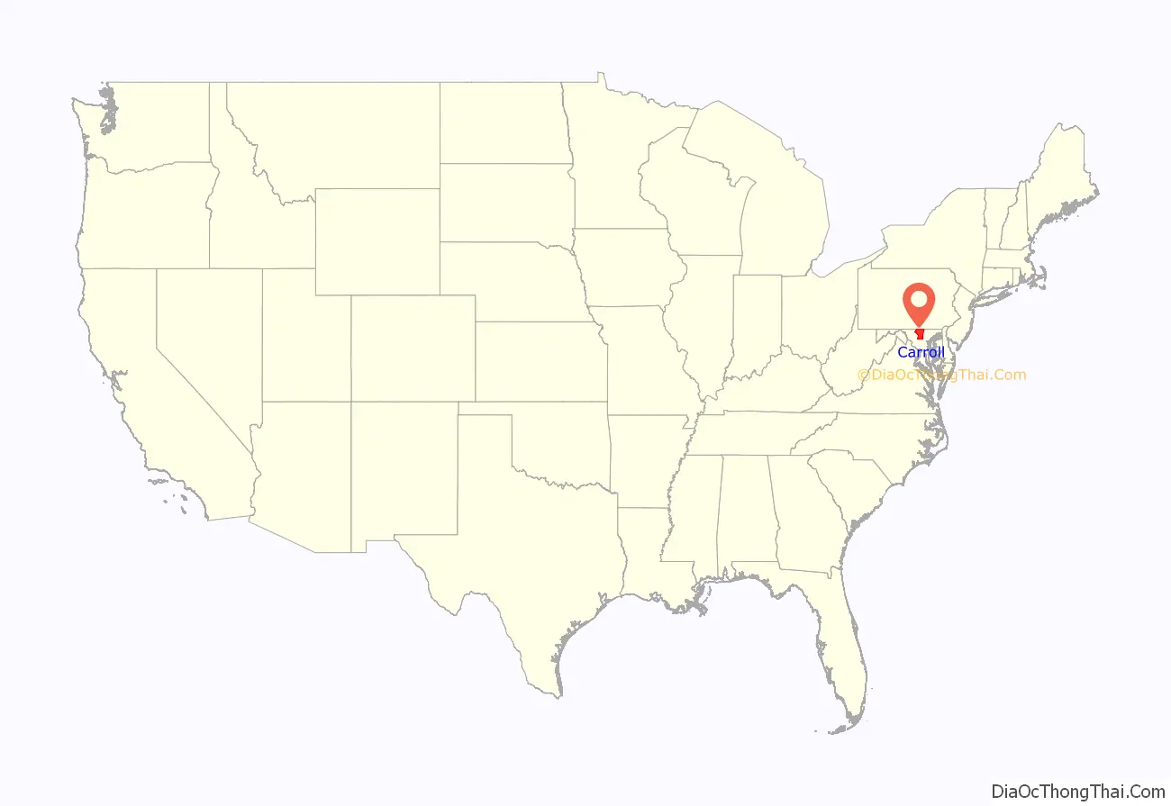
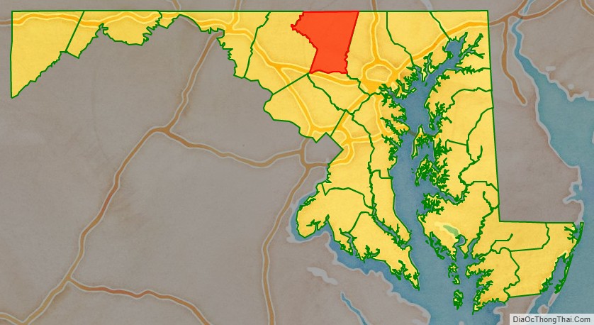
Carroll County location map. Where is Carroll County?
History
Prior to European colonization, the land that now makes up Carroll County was inhabited by Native Americans for thousands of years. Numerous Native American archaeological sites and archeological artifacts have been located across the county. Native Americans used the land for permanent settlements, seasonal visits and journeys, and as hunting grounds. At the time of European colonization, the Susquehannock and the Lenape were the predominant indigenous nations in the area. What is now the city of Manchester was inhabited by the Susquehannock nation until around 1750 and was the location of the intersection of two important Native American trails. An ancient trail that was used by Algonquian and Iroquois nations, named the “Patapsco-Conewago (Hanover) Road” by colonists, stretched from the Susquehanna River to the Potomac River. Main Street in Westminster was built over a portion of the trail between the two rivers. By the end of the 1700s, most roads in Carroll County were trails established by Native Americans. Maryland Route 26 (Liberty Road) was built over top what was originally a Native American trail. This trail passed through the Freedom area of southern Carroll County and was used by Native Americans to travel from the Blue Ridge Mountains to the Chesapeake Bay. The trail was transformed into a road and renamed “Liberty” by an act of the Maryland General Assembly in the early 1800s. The land of what is now Sykesville was used by the Susquehannock and the Lenape as hunting grounds. Taneytown was inhabited by the Tuscarora people during the early to mid-1700s. The Tuscarora hunted deer, wolves, wildcats, and otters in the woodlands of what is now Taneytown. Due to the Six Nations land cessions, the Tuscarora were expelled westward across the South Mountain of the Cumberland Valley.
Carroll County was created in 1837 from parts of Baltimore and Frederick Counties, see Hundred (division). It was named for Charles Carroll of Carrollton (1737–1832), signer of the American Declaration of Independence.
The earliest European settlers in Carroll County were predominantly Pennsylvania Dutch from southeast Pennsylvania and English from the Tidewater region of Maryland. German was the predominant language of Carroll County until the Civil War. German was most heavily spoken in the northern and western parts of the county. The towns of Hampstead, Manchester, and Taneytown had German majorities. English-speakers were a minority and were concentrated in southern Carroll.
During the American Civil War, the population of Carroll County was sharply divided between supporters of the Union and the Confederacy. In 1863, there were significant troop movements through the county as part of the Gettysburg campaign. On June 29, 1863, the cavalry skirmish known as Corbit’s Charge was fought in the streets of Westminster, when two companies of Delaware cavalry attacked a much larger Confederate force under General J.E.B. Stuart.
During the 1970s, Carroll County was a stronghold of the Ku Klux Klan and the Klan regularly held rallies and cross-burnings. The KKK held rallies and handed out leaflets on Main Street in Westminster and in Manchester until the late 1980s. In 2012, two minors were charged for a cross-burning in Westminster. In 2018, the KKK distributed fliers in southern Carroll County.
In 2013 the Carroll County Board of Commissioners voted to make English the official language of the county. In 2018, the Carroll County Public Schools announced that Confederate flags and Nazi swastikas would be banned from Carroll County schools, along with Ku Klux Klan and Aryan Nation symbolism and other messages that promote hatred or intolerance.
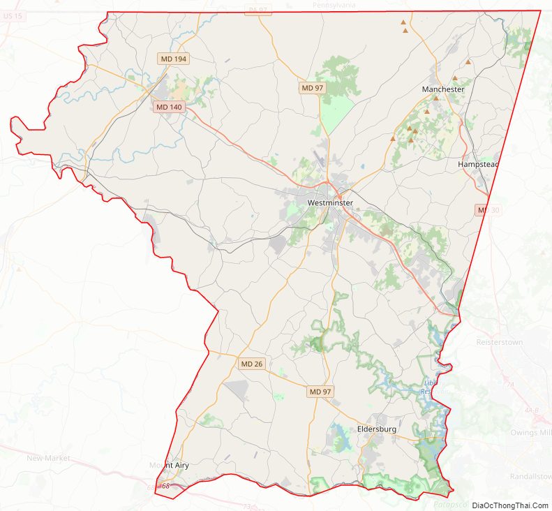
Carroll County Road Map
Geography
According to the U.S. Census Bureau, the county has a total area of 453 square miles (1,170 km), of which 448 square miles (1,160 km) is land and 5.1 square miles (13 km) (1.1%) is water.
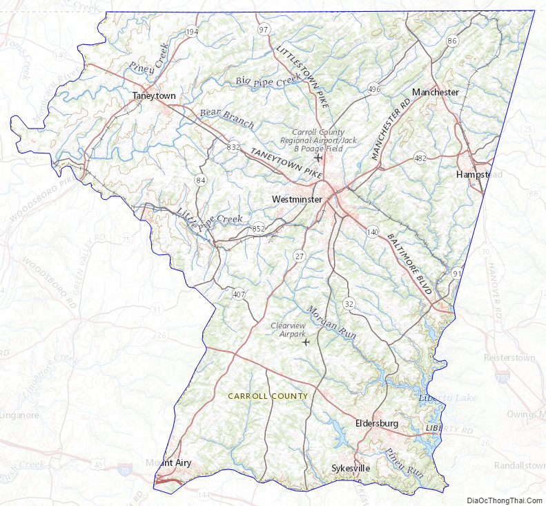
Topographically, Carroll County is located within the Piedmont Plateau region, with characteristic upland terrain of rolling hills and deciduous forest. The most prominent relief is Parr’s Ridge, which bisects the county from southwest to northeast. The highest point is an unnamed 1,120-foot (340 m) hilltop a half-mile south of the Pennsylvania state line in the northeastern part of the county off Harvey Yingling Road.
Carroll County is bordered on the north by the Mason–Dixon line with Pennsylvania, and on the south by Howard County across the South Branch of the Patapsco River. About half of the eastern border, with Baltimore County, is formed by the North Branch of the Patapsco River and by Liberty Reservoir, though the northern half near Manchester and Hampstead is a land border. Carroll County is bordered on the west by Frederick County, across the Monocacy River and Sam’s Creek. Other major streams in the county include Big Pipe Creek, Little Pipe Creek, and Double Pipe Creek, Bear Branch, and the headwaters of the Gunpowder Falls. The Piney Run Reservoir is in the southern part of the county.
Three railroad lines cross Carroll County. The old Baltimore and Ohio (B&O) Old Main Line crosses the southern part of the county from east to west, with former stations in Sykesville and Mount Airy. The original Western Maryland Railway (WM) main line track runs southeast to northwest through Carrollton, Westminster, New Windsor, and Union Bridge. The old Baltimore and Hanover Railroad (later acquired by WM) runs further to the east through Hampstead, Millers, and Lineboro. Two of these railroad lines are now operated by CSX Transportation; the former WM main line is now operated by Maryland Midland Railway.
Carroll County has two water reservoirs at present, Liberty and Piney Run; the county has also proposed a Union Mills Reservoir and Gillis Falls Reservoir.
Climate
The county is divided by the January freezing isotherm into a humid subtropical climate (Cfa) and a hot-summer humid continental climate (Dfa.) The hardiness zones are 6b and 7a.
Adjacent counties
- York County, Pennsylvania (northeast)
- Baltimore County (east)
- Howard County (south)
- Frederick County (west)
- Adams County, Pennsylvania (northwest)
- Montgomery County (southwest)
Carroll County Topographic Map
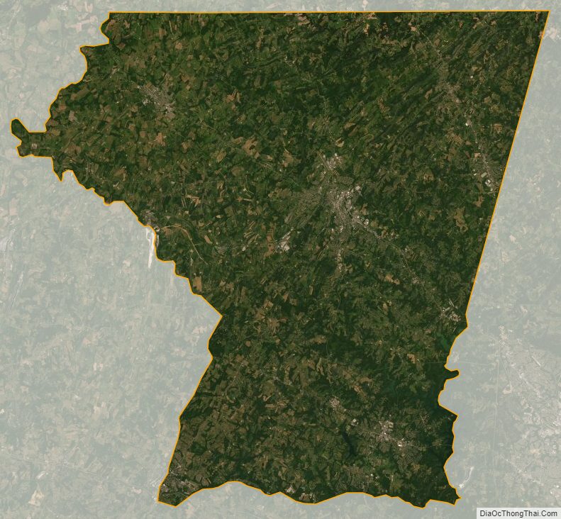
Carroll County Satellite Map
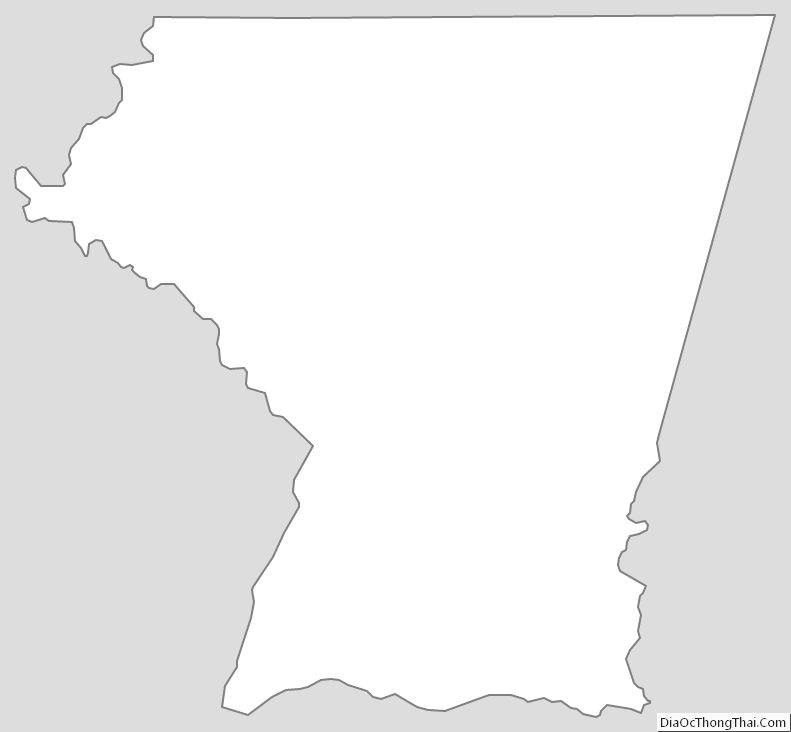
Carroll County Outline Map