Grantsville is a town in the northern part of Garrett County, Maryland, United States, near the Pennsylvania border. The population was 968 as of the 2020 census.
| Name: | Grantsville town |
|---|---|
| LSAD Code: | 43 |
| LSAD Description: | town (suffix) |
| State: | Maryland |
| County: | Garrett County |
| Incorporated: | 1864 |
| Elevation: | 2,303 ft (702 m) |
| Total Area: | 1.04 sq mi (2.69 km²) |
| Land Area: | 1.04 sq mi (2.69 km²) |
| Water Area: | 0.00 sq mi (0.00 km²) |
| Total Population: | 968 |
| Population Density: | 933.46/sq mi (360.43/km²) |
| ZIP code: | 21536 |
| Area code: | 301, 240 |
| FIPS code: | 2434525 |
| GNISfeature ID: | 0584690 |
| Website: | www.visitgrantsville.com |
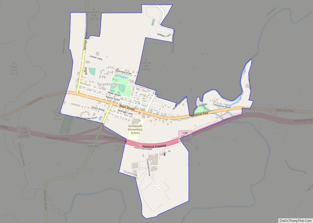
Online Interactive Map
Click on ![]() to view map in "full screen" mode.
to view map in "full screen" mode.
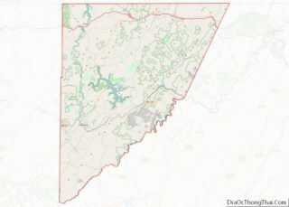
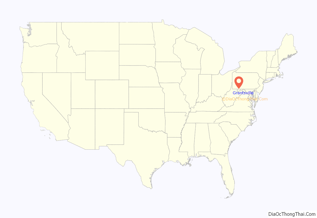
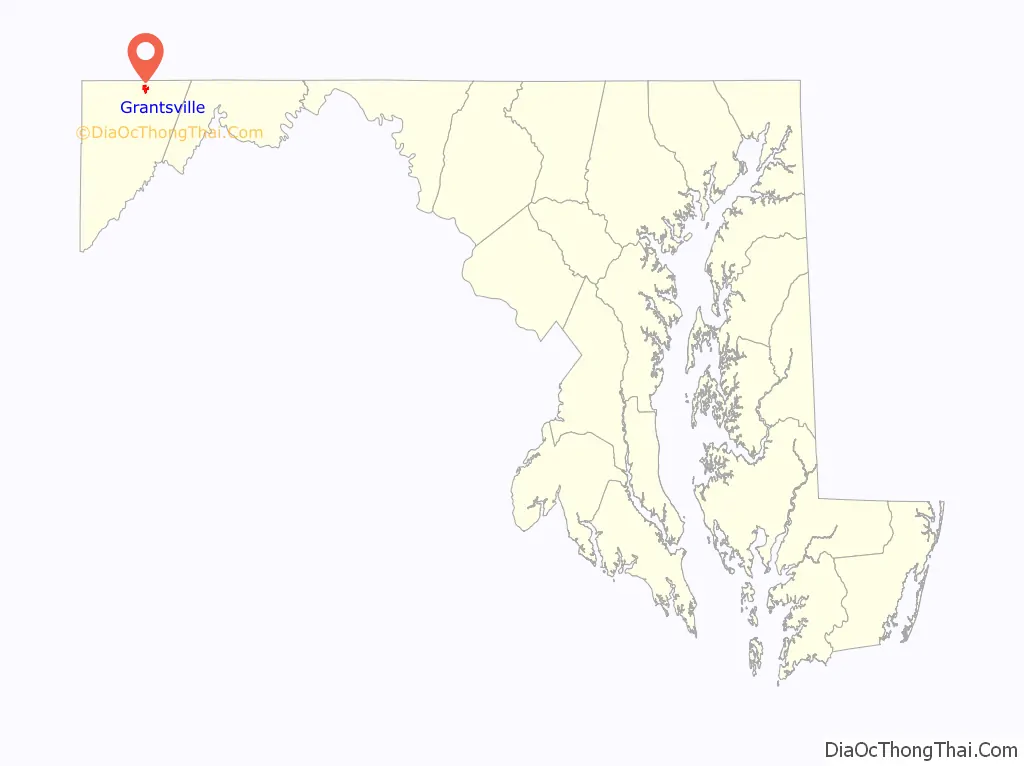
Grantsville location map. Where is Grantsville town?
History
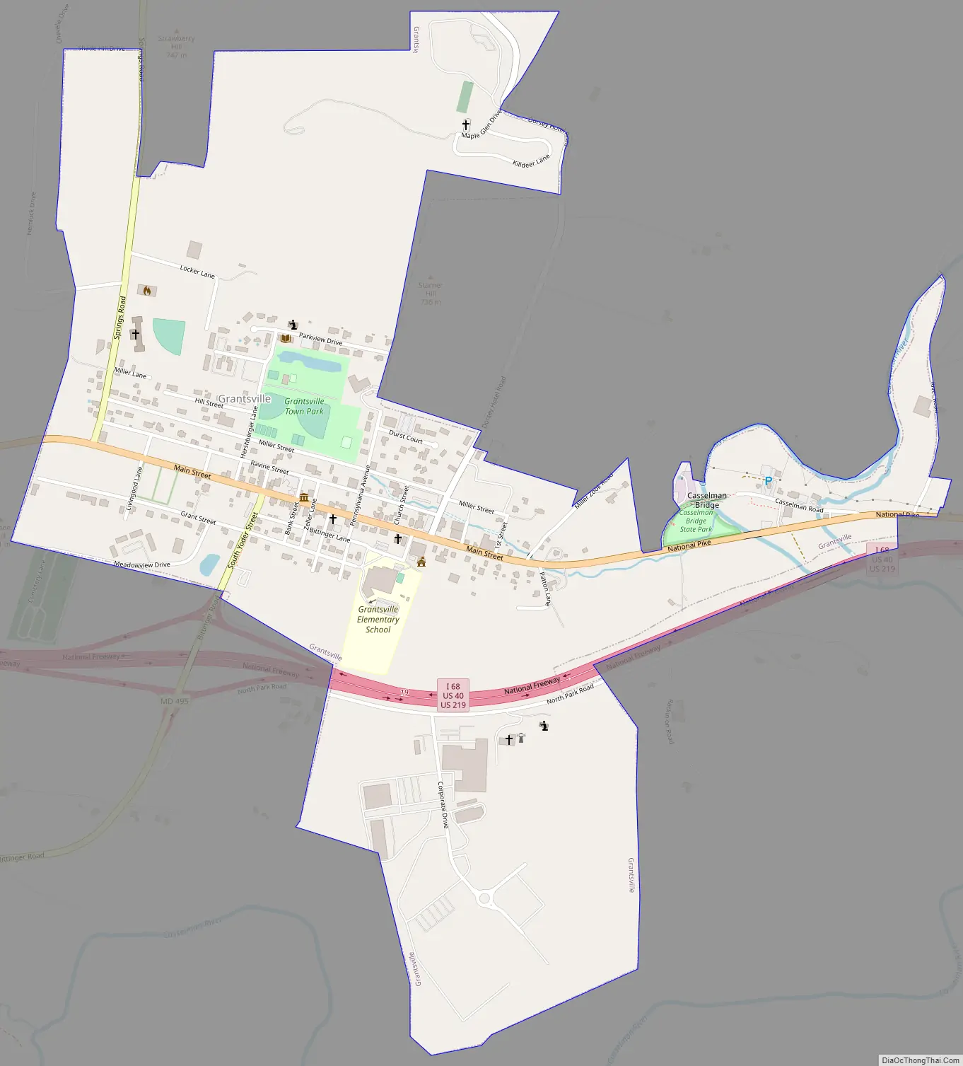
Grantsville, half a mile west of the Casselman River, began as a small Amish and Mennonite settlement, called Tomlinson’s or Little Crossing, along Braddock Road, which wound westward from Cumberland over Negro Mountain. Later a new village flourished as a stop along the nearby National Road, U.S. Route 40. From 1818, the national road carried hundreds of thousands of pioneers and settlers in stagecoaches and covered wagons. In the 1800s, an area just outside Grantsville (once known as Little Crossing but now marked by the intersection of Route 40 and River Road) was a major stop on the old National Pike. There is a “dip” in the road that travelers will not miss when they pass through Little Crossing on Route 40.
Signs mark the location of the post office and the blacksmith shop that stayed open all night to fix broken horseshoes. An 1879 article in Harper’s Monthly described the wagons as “so numerous that the leaders of one team had their noses in the trough at the end of the next wagon ahead.”
The Casselman Inn sits in the center of town, where it has provided food and lodging to travelers since 1824. A sign outside displays a replica 1842 stagecoach advertisement.
Near the Casselman Bridge, a historic stone arch bridge, are Penn Alps Restaurant and The Spruce Forest Artisan Village, which was founded in 1957 by Alta Schrock. Penn Alps Restaurant is housed in the last log hospitality house on the National Pike. It is situated between a 1797 gristmill and the Casselman Bridge, the longest single span of stone in America when built in 1813.
Spruce Forest Artisan Village, a part of the extended Penn Alps campus, has grown from a few cabins to some 12 log and frame structures of early vintage, two of which date to the Revolutionary War Period. Most of these provide studio space for artisans. Artisans work in various media, including bird carving, stained glass, basket making, hand-loom weaving, and hand-thrown pottery.
Grantsville Road Map
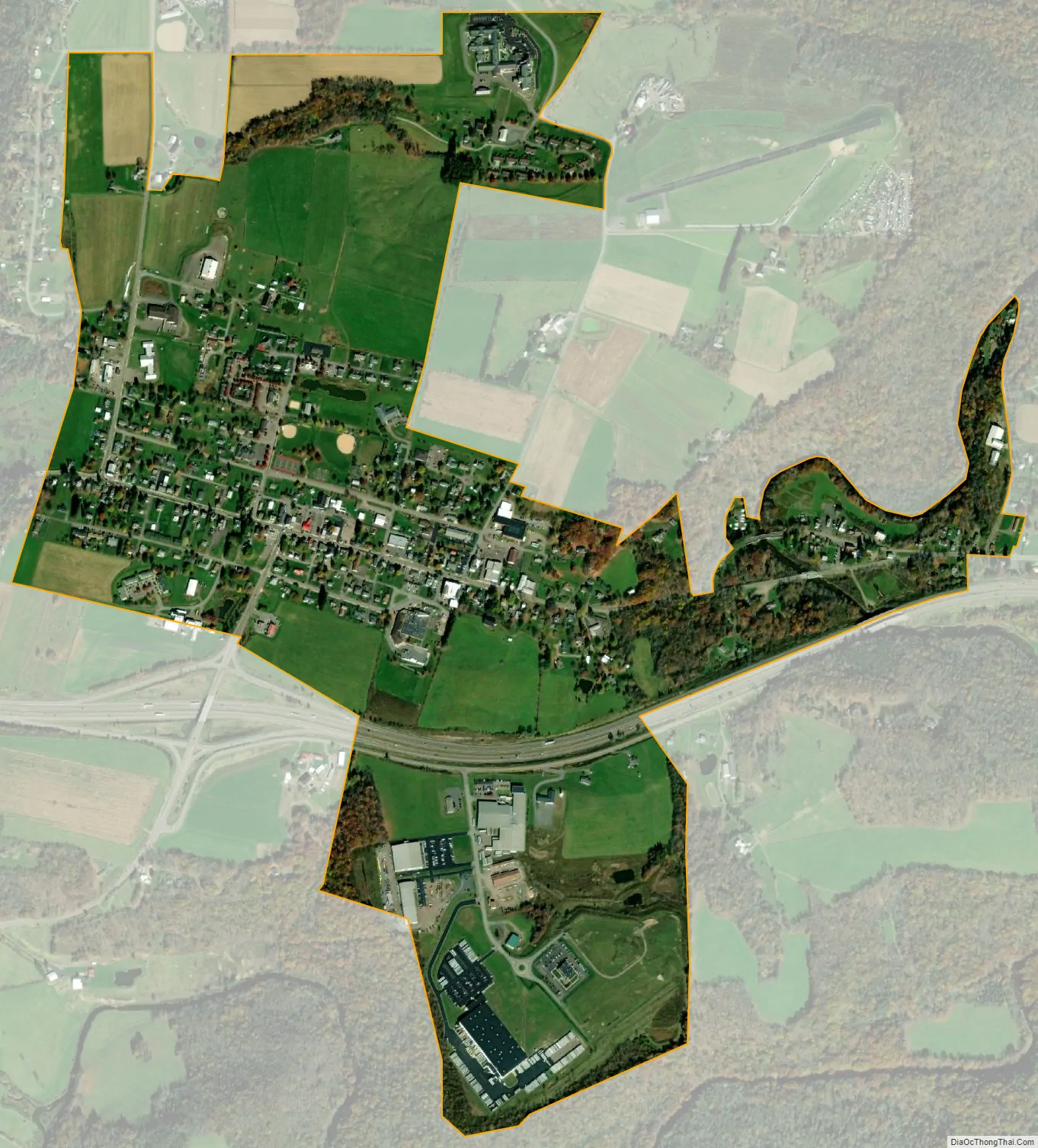
Grantsville city Satellite Map
Geography
Grantsville is located at 39°41′49″N 79°9′21″W / 39.69694°N 79.15583°W / 39.69694; -79.15583 (39.6970, -79.1559).
According to the United States Census Bureau, the town has a total area of 0.98 square miles (2.54 km), all land.
See also
Map of Maryland State and its subdivision: Map of other states:- Alabama
- Alaska
- Arizona
- Arkansas
- California
- Colorado
- Connecticut
- Delaware
- District of Columbia
- Florida
- Georgia
- Hawaii
- Idaho
- Illinois
- Indiana
- Iowa
- Kansas
- Kentucky
- Louisiana
- Maine
- Maryland
- Massachusetts
- Michigan
- Minnesota
- Mississippi
- Missouri
- Montana
- Nebraska
- Nevada
- New Hampshire
- New Jersey
- New Mexico
- New York
- North Carolina
- North Dakota
- Ohio
- Oklahoma
- Oregon
- Pennsylvania
- Rhode Island
- South Carolina
- South Dakota
- Tennessee
- Texas
- Utah
- Vermont
- Virginia
- Washington
- West Virginia
- Wisconsin
- Wyoming