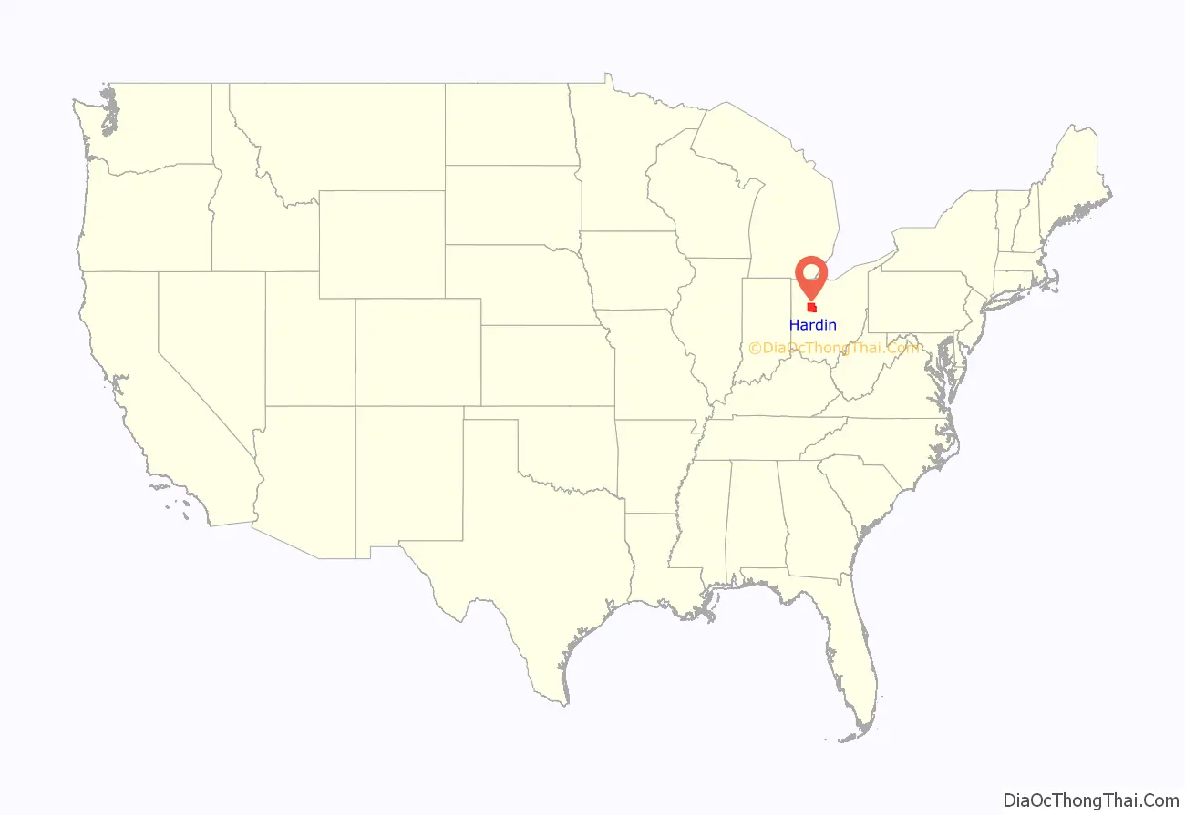
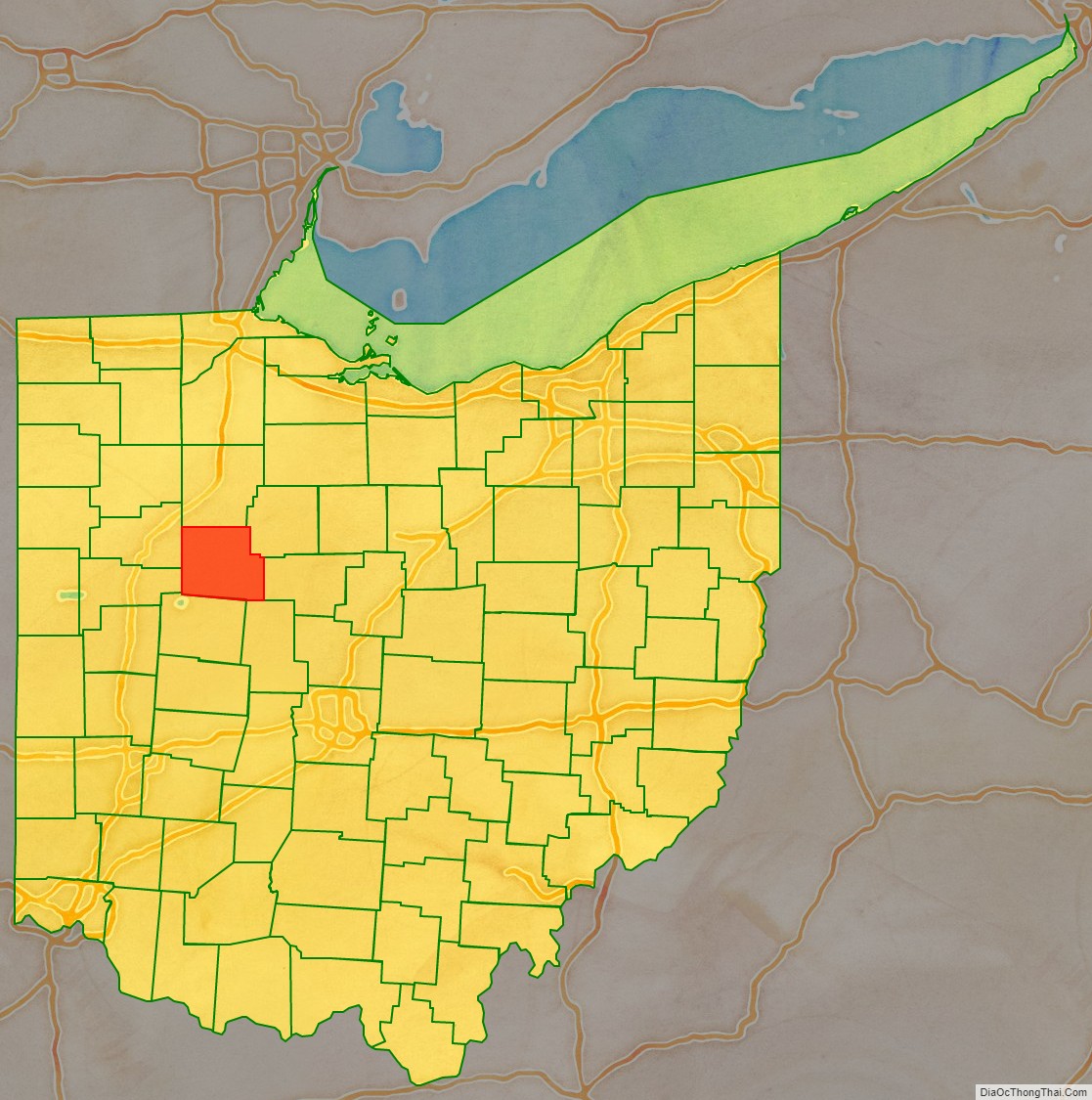
Hardin County is a county located in the west central portion of the U.S. state of Ohio. As of the 2020 census, the population was 30,696. Its county seat and largest city is Kenton. The county was created in 1820 and later organized in 1833. It is named for John Hardin, an officer in the American Revolution.
| Name: | Hardin County |
|---|---|
| FIPS code: | 39-065 |
| State: | Ohio |
| Founded: | March 1, 1833 |
| Named for: | John Hardin |
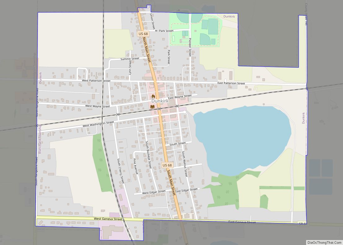
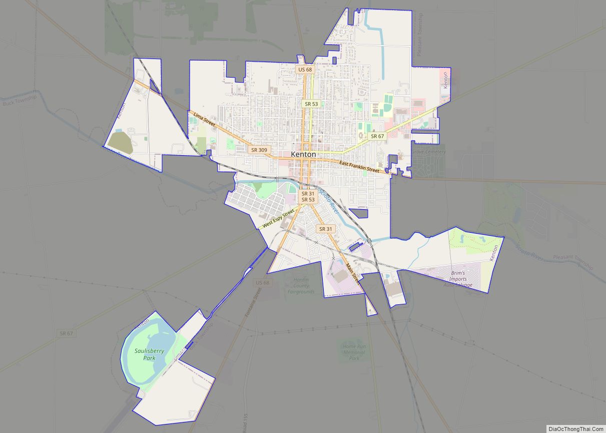
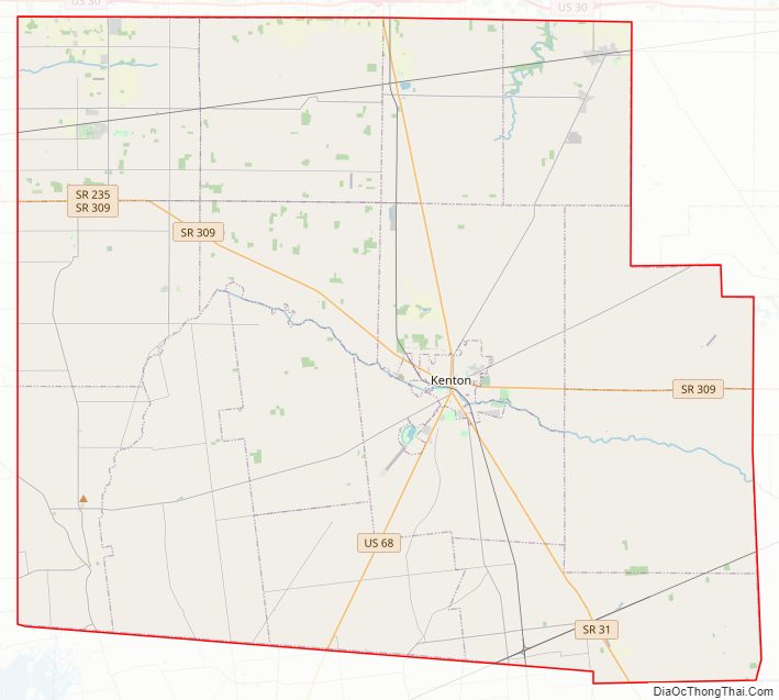
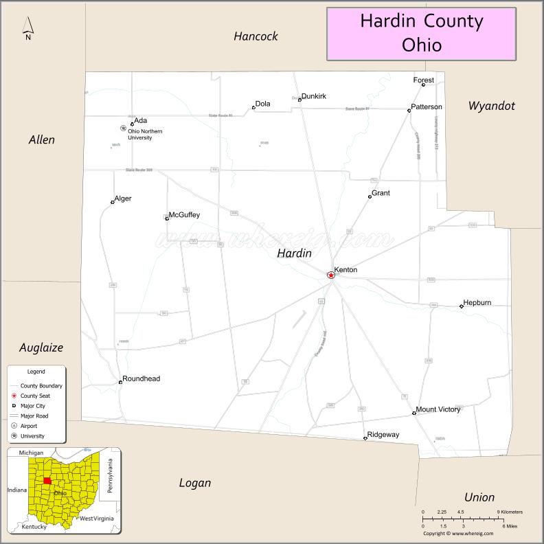
| Seat: | Kenton |
| Largest city: | Kenton |
| Total Area: | 471 sq mi (1,220 km²) |
| Land Area: | 470 sq mi (1,200 km²) |
| Total Population: | 30,696 |
| Population Density: | 65/sq mi (25/km²) |
| Time zone: | UTC−5 (Eastern) |
| Summer Time Zone (DST): | UTC−4 (EDT) |
| Website: | www.co.hardin.oh.us |
Hardin County location map. Where is Hardin County?
Hardin County Road Map
Geography
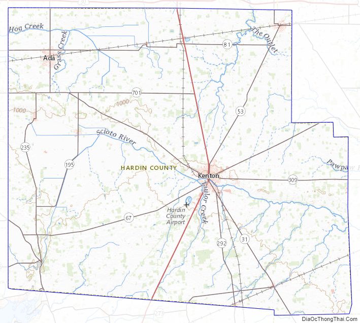
According to the U.S. Census Bureau, the county has a total area of 471 square miles (1,220 km), of which 470 square miles (1,200 km) is land and 0.2 square miles (0.52 km) (0.1%) is water.
Adjacent counties
- Hancock County (north)
- Wyandot County (northeast)
- Marion County (east)
- Union County (southeast)
- Logan County (south)
- Auglaize County (southwest)
- Allen County (northwest)
Hardin County Topographic Map
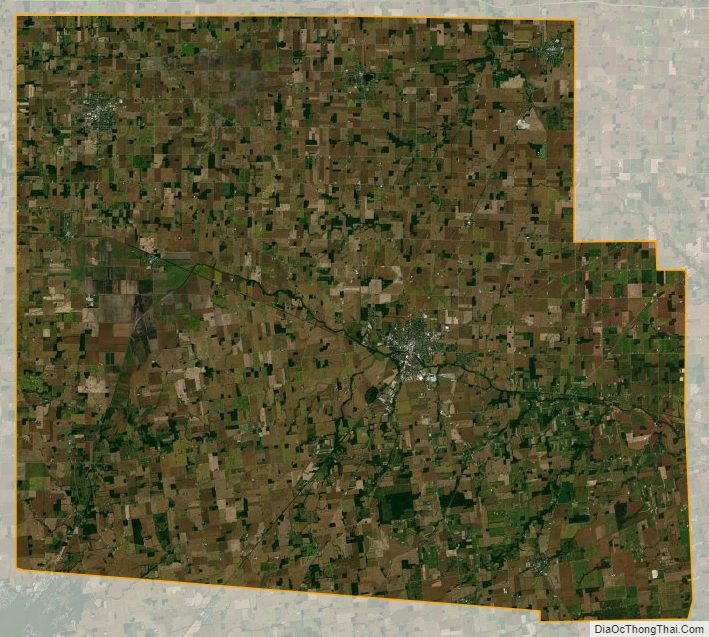
Hardin County Satellite Map
Hardin County Outline Map