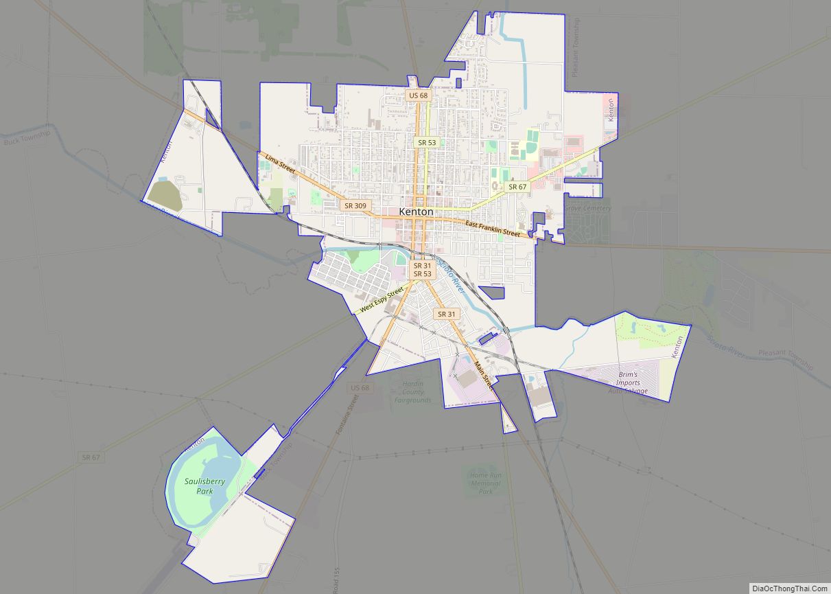
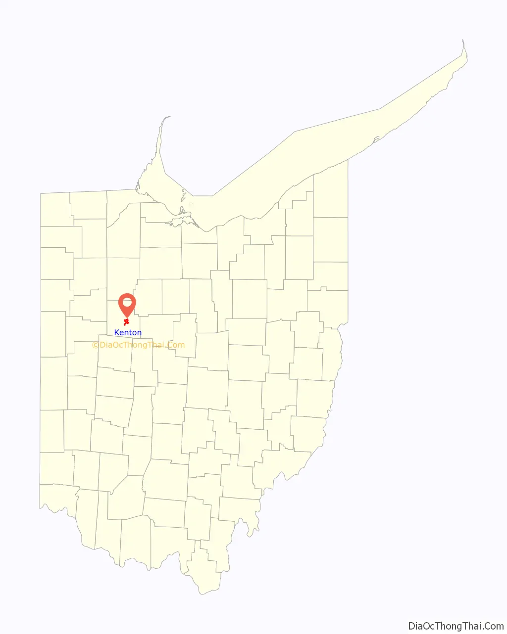
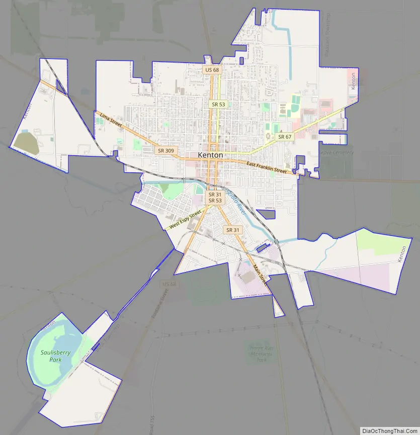
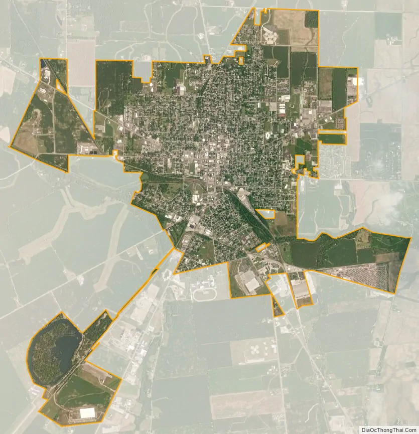
Kenton is a city in and the county seat of Hardin County, Ohio, United States, located in the west-central part of Ohio about 57 mi (92 km) northwest of Columbus and 70 mi (113 km) south of Toledo. Its population was 7,947 at the 2020 census. The city was named for frontiersman Simon Kenton of Kentucky and Ohio.
| Name: | Kenton city |
|---|---|
| LSAD Code: | 25 |
| LSAD Description: | city (suffix) |
| State: | Ohio |
| County: | Hardin County |
| Elevation: | 991 ft (302 m) |
| Total Area: | 5.09 sq mi (13.19 km²) |
| Land Area: | 5.00 sq mi (12.95 km²) |
| Water Area: | 0.09 sq mi (0.24 km²) |
| Total Population: | 7,947 |
| Population Density: | 1,589.40/sq mi (613.70/km²) |
| ZIP code: | 43326 |
| Area code: | 419 567 |
| FIPS code: | 3939886 |
| GNISfeature ID: | 1064929 |
Online Interactive Map
Click on ![]() to view map in "full screen" mode.
to view map in "full screen" mode.
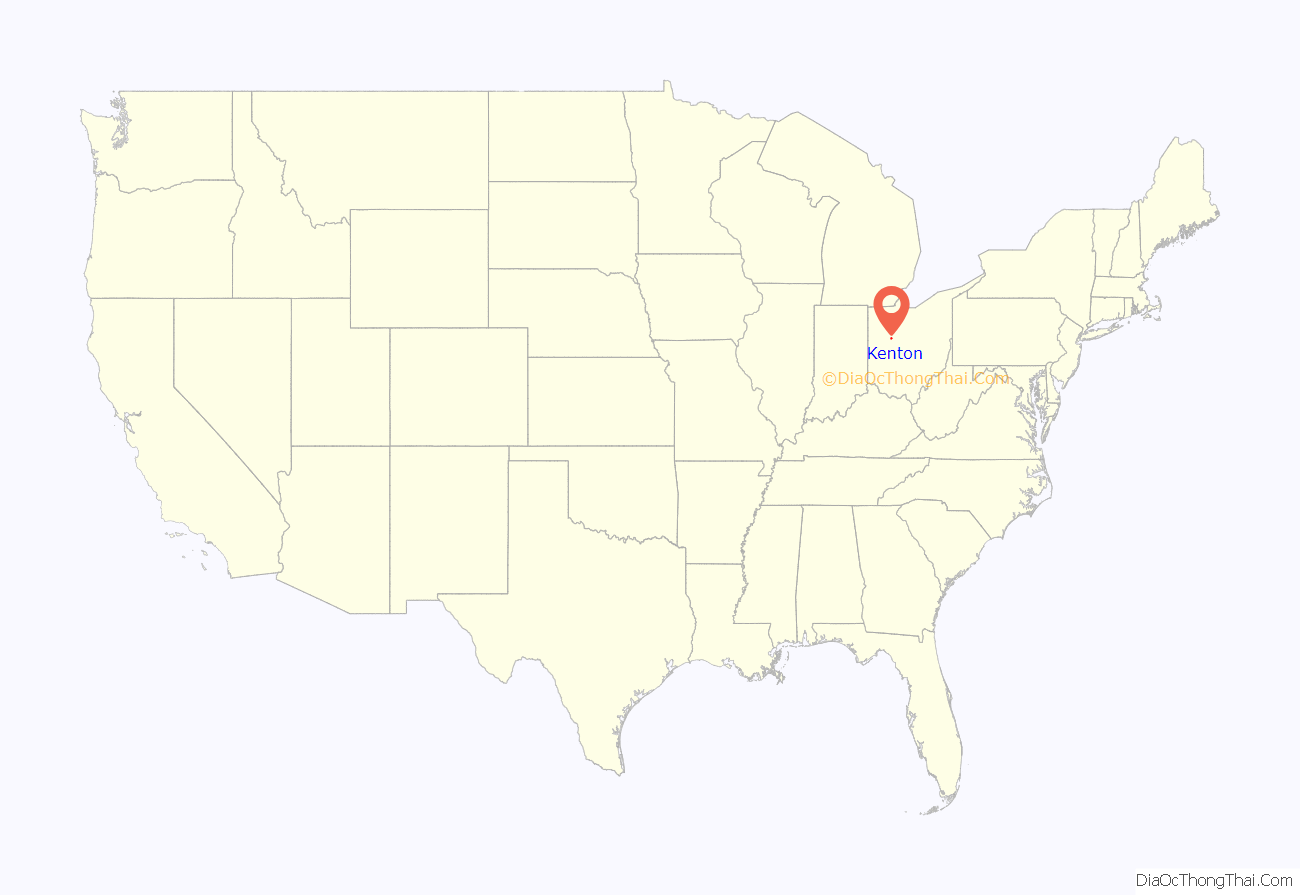
Kenton location map. Where is Kenton city?
History
Kenton was originally the site of Fort McArthur, erected in 1812 by Colonel Duncan McArthur as one of the forts along the line of General William Hull’s march against the British headquarters at Fort Detroit during the War of 1812.
In 1845, Kenton was incorporated as a village; it became a city in 1886. The city was named after frontiersman Simon Kenton.
The city began as a center for agricultural trade, then in the late 19th century, developed industry common to America of the time. From 1890 to 1952, Kenton was home to the Kenton Hardware Company, manufacturers of locks, cast-iron toys, and the very popular Gene Autry toy cap guns.
International Car Company, a manufacturer of rail cabooses, operated in Kenton for many years. In 1975, it was purchased by Paccar, a manufacturer of medium- and heavy-duty trucks. In 1983, Paccar closed down the business, noting a decrease in demand for rail equipment.
The 2001 CSX 8888 incident involving an unmanned freight train ended in Kenton.
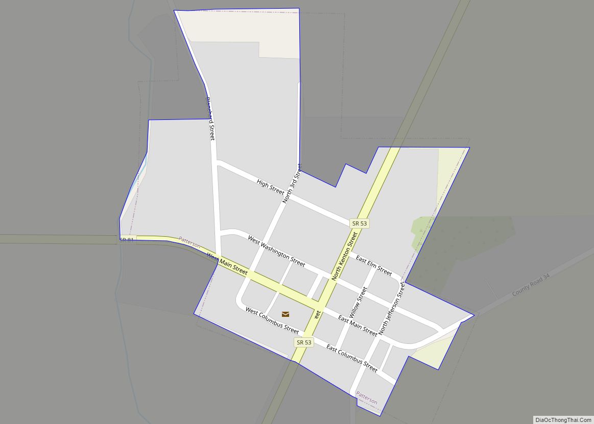
Kenton Road Map
Kenton city Satellite Map
Geography
According to the United States Census Bureau, the city has a total area of 5.13 square miles (13.29 km), of which 0.09 square miles (0.23 km) is covered by water.
Climate
See also
Map of Ohio State and its subdivision:- Adams
- Allen
- Ashland
- Ashtabula
- Athens
- Auglaize
- Belmont
- Brown
- Butler
- Carroll
- Champaign
- Clark
- Clermont
- Clinton
- Columbiana
- Coshocton
- Crawford
- Cuyahoga
- Darke
- Defiance
- Delaware
- Erie
- Fairfield
- Fayette
- Franklin
- Fulton
- Gallia
- Geauga
- Greene
- Guernsey
- Hamilton
- Hancock
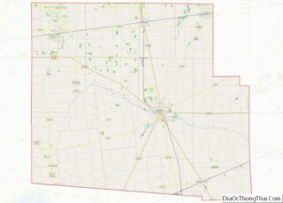
- Hardin
- Harrison
- Henry
- Highland
- Hocking
- Holmes
- Huron
- Jackson
- Jefferson
- Knox
- Lake
- Lake Erie
- Lawrence
- Licking
- Logan
- Lorain
- Lucas
- Madison
- Mahoning
- Marion
- Medina
- Meigs
- Mercer
- Miami
- Monroe
- Montgomery
- Morgan
- Morrow
- Muskingum
- Noble
- Ottawa
- Paulding
- Perry
- Pickaway
- Pike
- Portage
- Preble
- Putnam
- Richland
- Ross
- Sandusky
- Scioto
- Seneca
- Shelby
- Stark
- Summit
- Trumbull
- Tuscarawas
- Union
- Van Wert
- Vinton
- Warren
- Washington
- Wayne
- Williams
- Wood
- Wyandot
- Alabama
- Alaska
- Arizona
- Arkansas
- California
- Colorado
- Connecticut
- Delaware
- District of Columbia
- Florida
- Georgia
- Hawaii
- Idaho
- Illinois
- Indiana
- Iowa
- Kansas
- Kentucky
- Louisiana
- Maine
- Maryland
- Massachusetts
- Michigan
- Minnesota
- Mississippi
- Missouri
- Montana
- Nebraska
- Nevada
- New Hampshire
- New Jersey
- New Mexico
- New York
- North Carolina
- North Dakota
- Ohio
- Oklahoma
- Oregon
- Pennsylvania
- Rhode Island
- South Carolina
- South Dakota
- Tennessee
- Texas
- Utah
- Vermont
- Virginia
- Washington
- West Virginia
- Wisconsin
- Wyoming