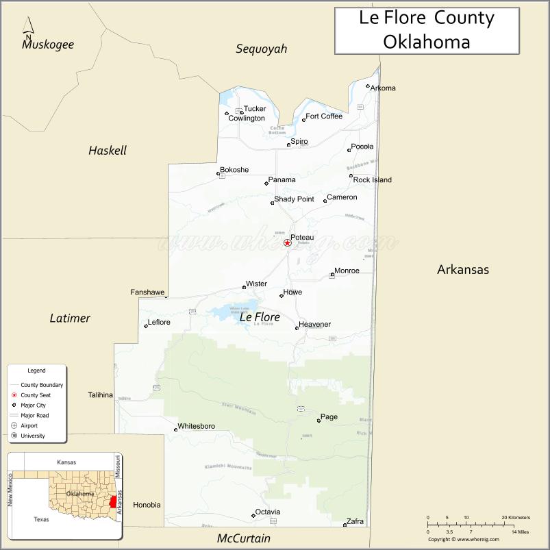
LeFlore County is a county along the eastern border of the U.S state of Oklahoma. As of the 2010 census, the population was 50,384. Its county seat is Poteau. The county is part of the Fort Smith metropolitan area and the name honors a Choctaw family named LeFlore. The United States District Court for the Eastern District of Oklahoma is the federal district court with jurisdiction in LeFlore County.
| Name: | Le Flore County |
|---|---|
| FIPS code: | 40-079 |
| State: | Oklahoma |
| Founded: | 1907 |
| Named for: | An influential Choctaw Indian family |
| Seat: | Poteau |
| Largest city: | Poteau |
| Total Area: | 1,609 sq mi (4,170 km²) |
| Land Area: | 1,589 sq mi (4,120 km²) |
| Total Population: | 50,384 |
| Population Density: | 32/sq mi (12/km²) |
| Time zone: | UTC−6 (Central) |
| Summer Time Zone (DST): | UTC−5 (CDT) |
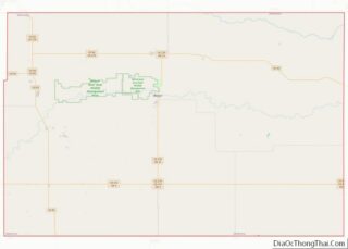
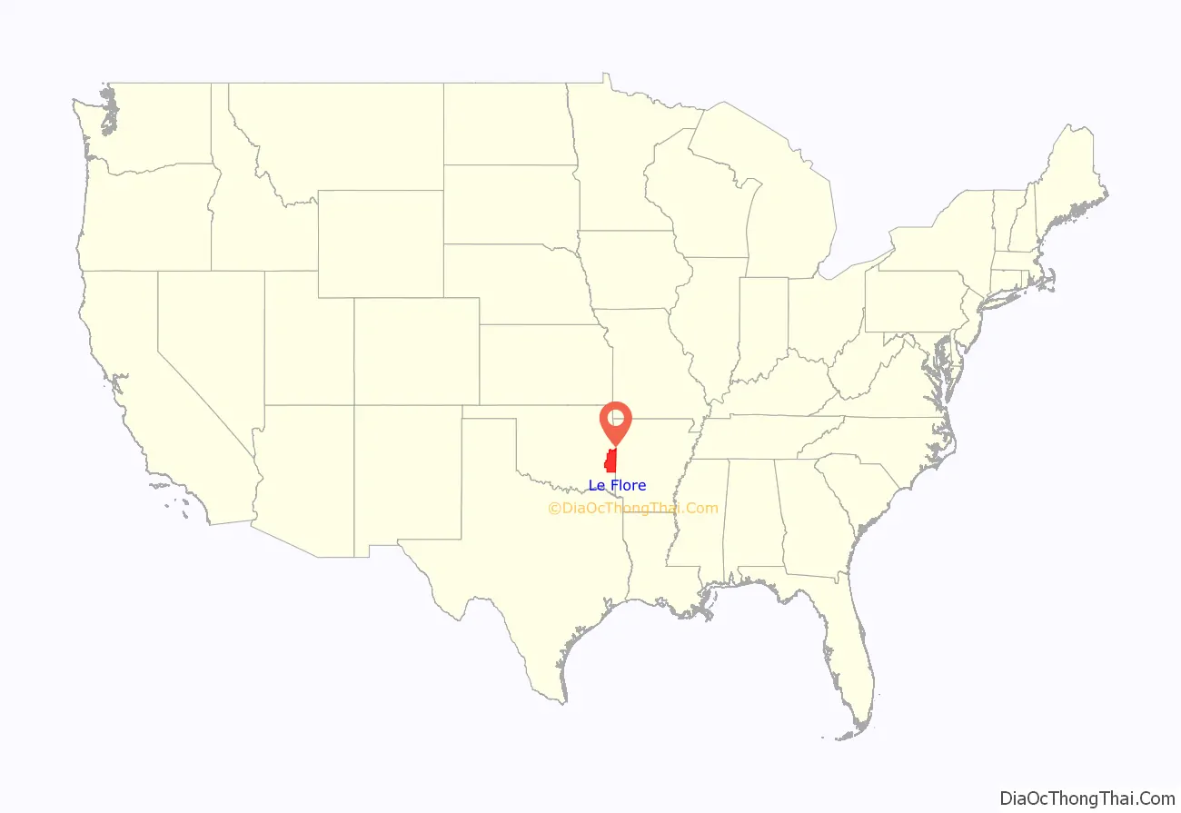
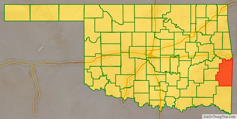
Le Flore County location map. Where is Le Flore County?
History
The Choctaw Nation signed the Treaty of Doak’s Stand in 1820, ceding part of their ancestral home in the Southeastern U. S. and receiving a large tract in Indian Territory. They signed the Treaty of Dancing Rabbit Creek in 1830, which ceded the remainder of their original homeland. Most of the remainder of the Choctaw were removed to Indian Territory, escorted by federal military troops, in several waves.
In 1832, the Federal Government constructed the Choctaw Agency in Indian Territory about 15 miles (24 km) west of Fort Smith, Arkansas. The town of Skullyville developed around the agency. It was designated as county seat of Skullyville County, the capital of the Moshulatubbee District of which Skullyville County was a part, and the national capital of the Choctaw Nation.
The US Indian agents lived in the town. In the late 1850s, it was designated as a stage stop (Walker’s Station) for the Butterfield Overland Mail route.
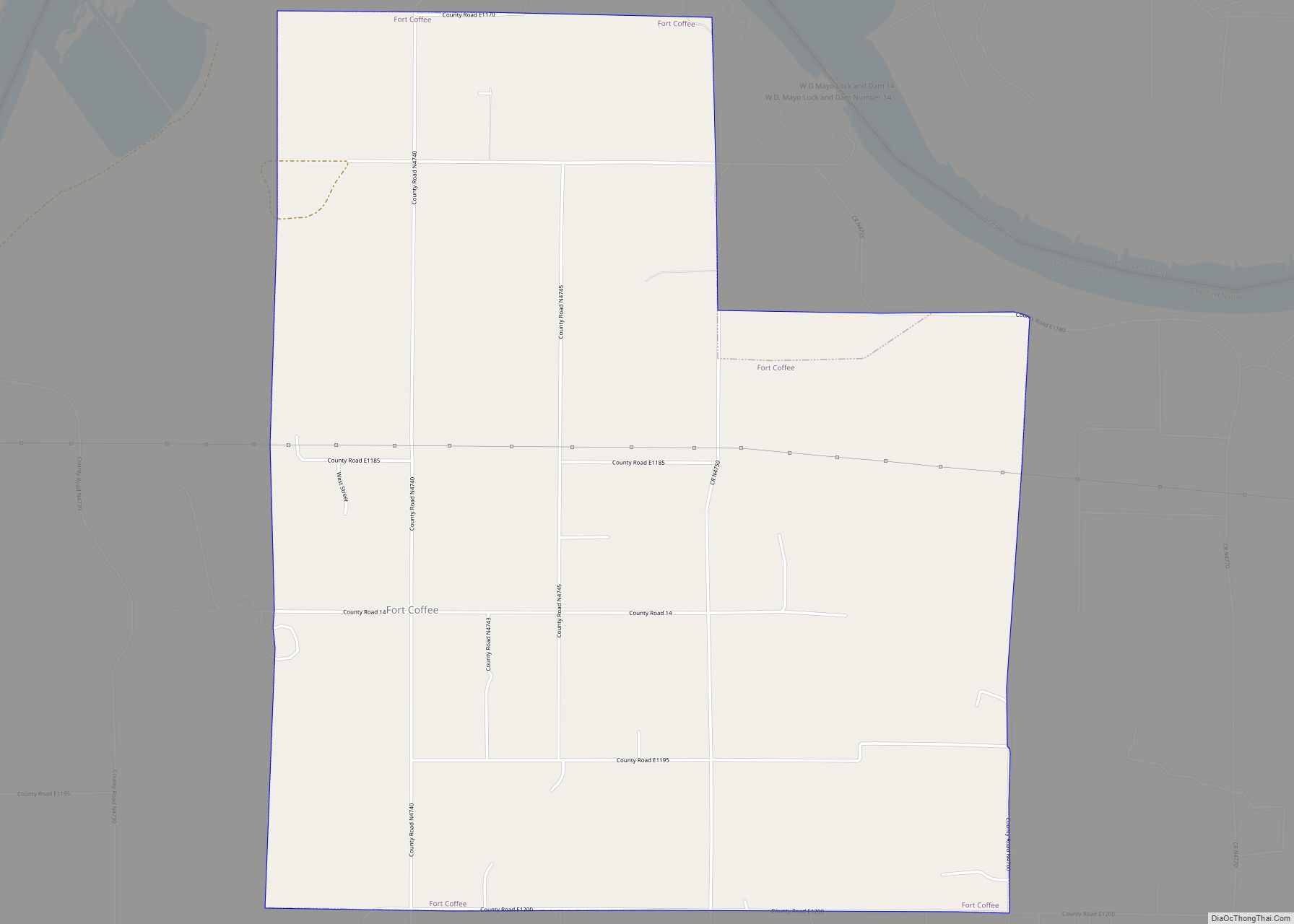
In 1834, the U. S. Army built Fort Coffee a few miles north of Skullyville, but reassigned the garrison after four years. The Methodist Church took over the facility, converting it for use as the Fort Coffee Academy for Boys, a missionary school. That church also established the New Hope Seminary for Girls in 1845, just east of town. In 1847, the Choctaw Agency burned and its functions were transferred to Fort Washita.
During the Civil War, the Choctaw allied with the Confederacy and many of their men served in its army. The Battle of Devil’s Backbone was fought near the present town of Pocola on September 1, 1863. Union Major General James G. Blunt defeated Confederate Brigadier General William Cabell. Union troops burned the Fort Coffee Academy in 1863, because it was being used to house Confederate troops.
In 1866, the Choctaw government reopened New Hope Seminary, but never rebuilt a boys academy. New Hope Seminary operated until it burned in 1896. The first school for Choctaw freedmen opened at Boggy Depot. In 1892, the Tushkalusa (black warriors) Freedmen Boarding school opened three miles southeast of Talihina.
From 1886, development of coal mining and timber production attracted considerable railroad construction: the Choctaw, Oklahoma and Gulf Railroad built tracks from Wister west to McAlester. In 1898, the company extended the line east from Wister to Howe, continuing the line to Arkansas in 1899. (This line was leased to the Chicago, Rock Island and Pacific Railway in 1904).
In 1896 the Kansas City, Pittsburg and Gulf Railroad (acquired by the Kansas City Southern Railway in 1900) built tracks through the region from north to south, exiting into Arkansas near the Page community in southern LeFlore County. In 1900-01 the Poteau Valley Railroad built a line from Shady Point to Sutter (later known as Calhoun, which they abandoned in 1926. Also in 1900-01 the Arkansas Western Railroad constructed tracks from Heavener east to Arkansas. In 1901 the Fort Smith and Western Railroad connected Coal Creek west to McCurtain in Haskell County. In 1903-04 the Midland Valley Railroad laid tracks from Arkansas west through Bokoshe to Muskogee. The Oklahoma and Rich Mountain Railroad, owned by the Dierks Lumber and Coal Company, constructed the county’s last railroad, from Page to the lumber town of Pine Valley in 1925–26.
Prior to statehood, the area that became LeFlore County was part of Moshulatubbee and the Apukshunnubbee districts. Its present-day territory fell primarily within Nashoba, Skullyville, Sugar Loaf, and Wade counties, with small portions falling within Cedar and San Bois counties, in the Choctaw Nation.
Robert S. Kerr, former Governor of Oklahoma and U.S. Senator, established a ranch outside Poteau in the 1950s. In 1978 the family donated this residence to the state. It was adapted and opened for use as the Kerr Conference Center and Museum. The Kerr Center for Sustainable Agriculture and the Overstreet-Kerr Historical Farm are also in the county.
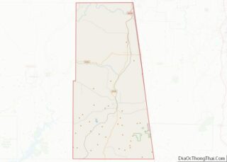
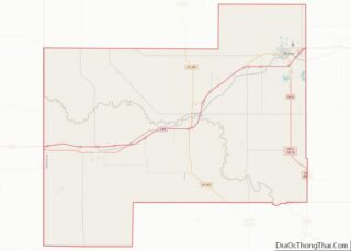
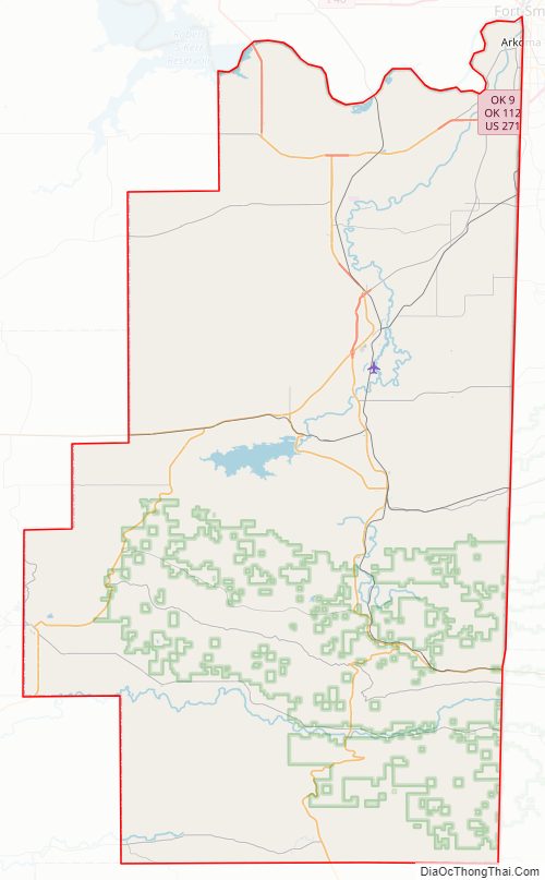
Le Flore County Road Map
Geography
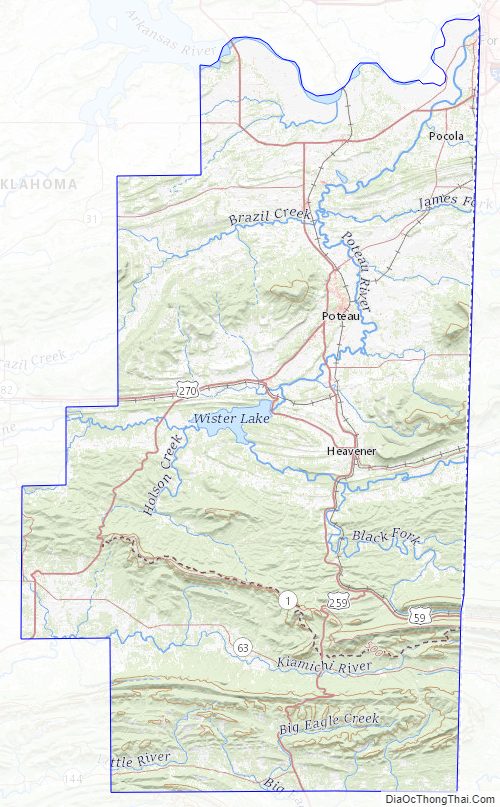
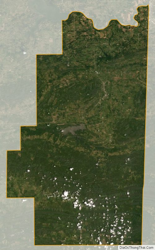
According to the United States Census Bureau, the county has a total area of 1,609 square miles (4,170 km), of which 1,589 square miles (4,120 km) is land and 19 square miles (49 km) (1.2%) is water.
The Arkansas River forms the northern boundary of the county, while its tributaries, the Poteau and James Fork rivers drain much of the county into the Arkansas. The Kiamichi, Little and Mountain Fork rivers drain the rest of the county into the Red River of the South. The Ouachita Mountains extend into the southern part of the county, along with associated ranges: the Winding Stair Mountains and the Kiamichi Mountains. Cavanal Hill is partly in the northern part of the county.
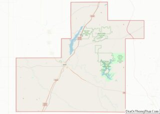
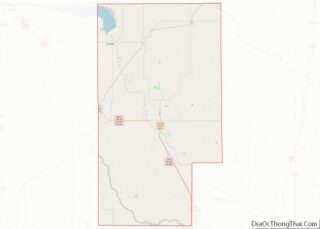
Le Flore County Topographic Map
Le Flore County Satellite Map
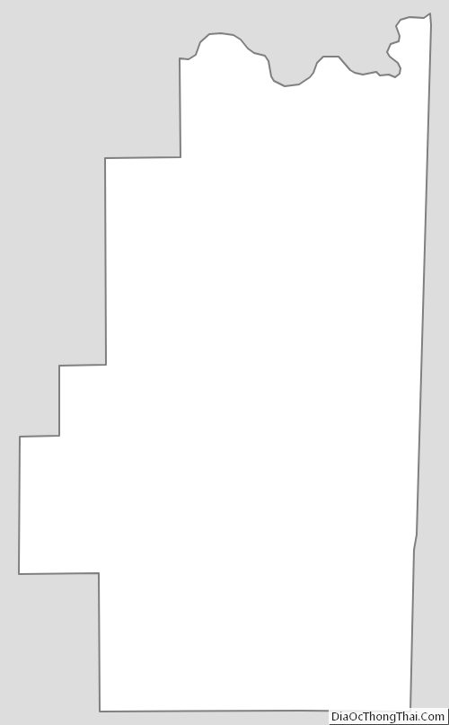
Le Flore County Outline Map