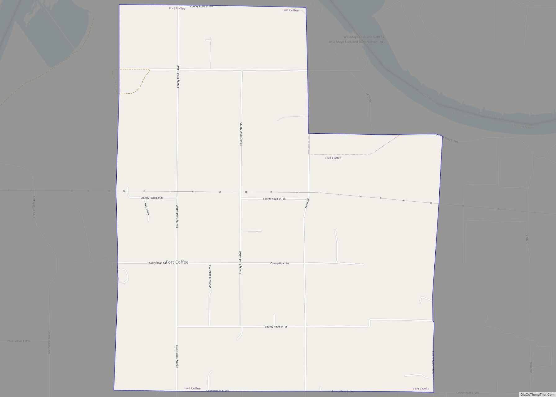
Fort Coffee is a town in Le Flore County, Oklahoma, United States. Originally constructed as a U. S. Army fort in 1834, it was named for U. S. General John Coffee, a veteran of the Seminole Wars. It is part of the Fort Smith, Arkansas-Oklahoma Metropolitan Statistical Area. The population was 424 at the 2010 census, a gain of 2.9 percent over the figure of 412 in 2000.
| Name: | Fort Coffee town |
|---|---|
| LSAD Code: | 43 |
| LSAD Description: | town (suffix) |
| State: | Oklahoma |
| County: | Le Flore County |
| Elevation: | 463 ft (141 m) |
| Total Area: | 6.53 sq mi (16.91 km²) |
| Land Area: | 6.53 sq mi (16.91 km²) |
| Water Area: | 0.00 sq mi (0.01 km²) |
| Total Population: | 335 |
| Population Density: | 51.33/sq mi (19.82/km²) |
| FIPS code: | 4027150 |
| GNISfeature ID: | 1092956 |
Online Interactive Map
Click on ![]() to view map in "full screen" mode.
to view map in "full screen" mode.
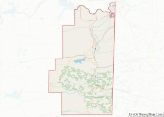
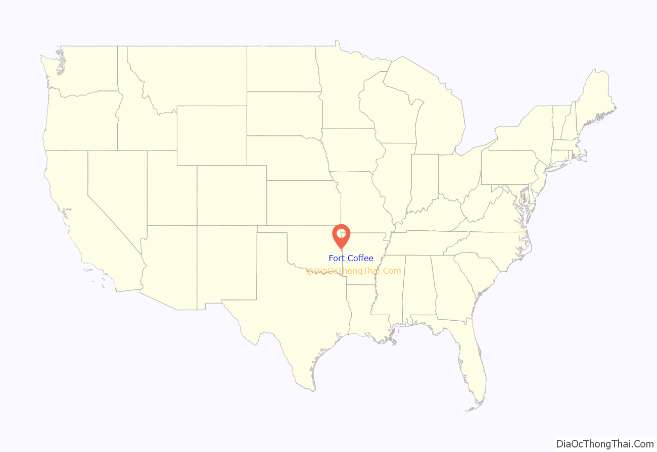
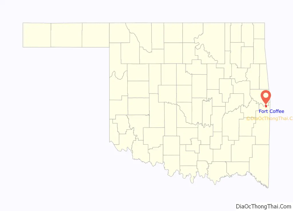
Fort Coffee location map. Where is Fort Coffee town?
History
The town of Fort Coffee traces its beginnings to 1832, when the Choctaw Indian tribe was removed from the southeastern United States and transported to land in the eastern part of Indian Territory (now in the state of Oklahoma). Most of the travel was by water, and the site of Fort Coffee became a port on the Arkansas River.
In 1834, the Choctaw Nation petitioned the U.S. War Department to construct a fort that would stop the flow of alcohol and other illegal items from flowing into their territory along the Arkansas River. The garrison succeeded in its mission and also built roads connecting Fort Smith, Arkansas, Fort Gibson, and Fort Towson. The army abandoned Fort Coffee in 1838 when Fort Smith was reestablished. The site of Fort Coffee was located in Skullyville County, a part of the Moshulatubbee District of the Choctaw Nation.
In 1843, the Choctaw nation allowed the Methodist Episcopal church to establish the Fort Coffee Choctaw Boys Academy in the buildings. This school continued until the outbreak of the Civil War, when Confederate forces commanded by General Stand Watie occupied the site. The Union Army recaptured the fort in 1863. Most of the buildings were burned during this time. Several small houses were built using the foundation stones.
The Choctaw were required to release their slaves by the Reconstruction Treaty of 1866. Many of the freed men remained in the Choctaw Nation lands. Many of these were legally adopted into the Choctaw Nation in 1885, thus qualifying for land allotments by the Dawes Commission.
The local economy has largely been based on agriculture. Major crops included cotton, livestock and soybeans. There was a cotton gin in Fort Coffee to handle locally grown crops. The Fort Smith and Western Railroad and the Kansas City, Pittsburg and Gulf Railway (bought by the Kansas City Southern Railway in 1900) transported the products to outside markets.
The town of Fort Coffee did not incorporate until 1998.
Fort Coffee Road Map
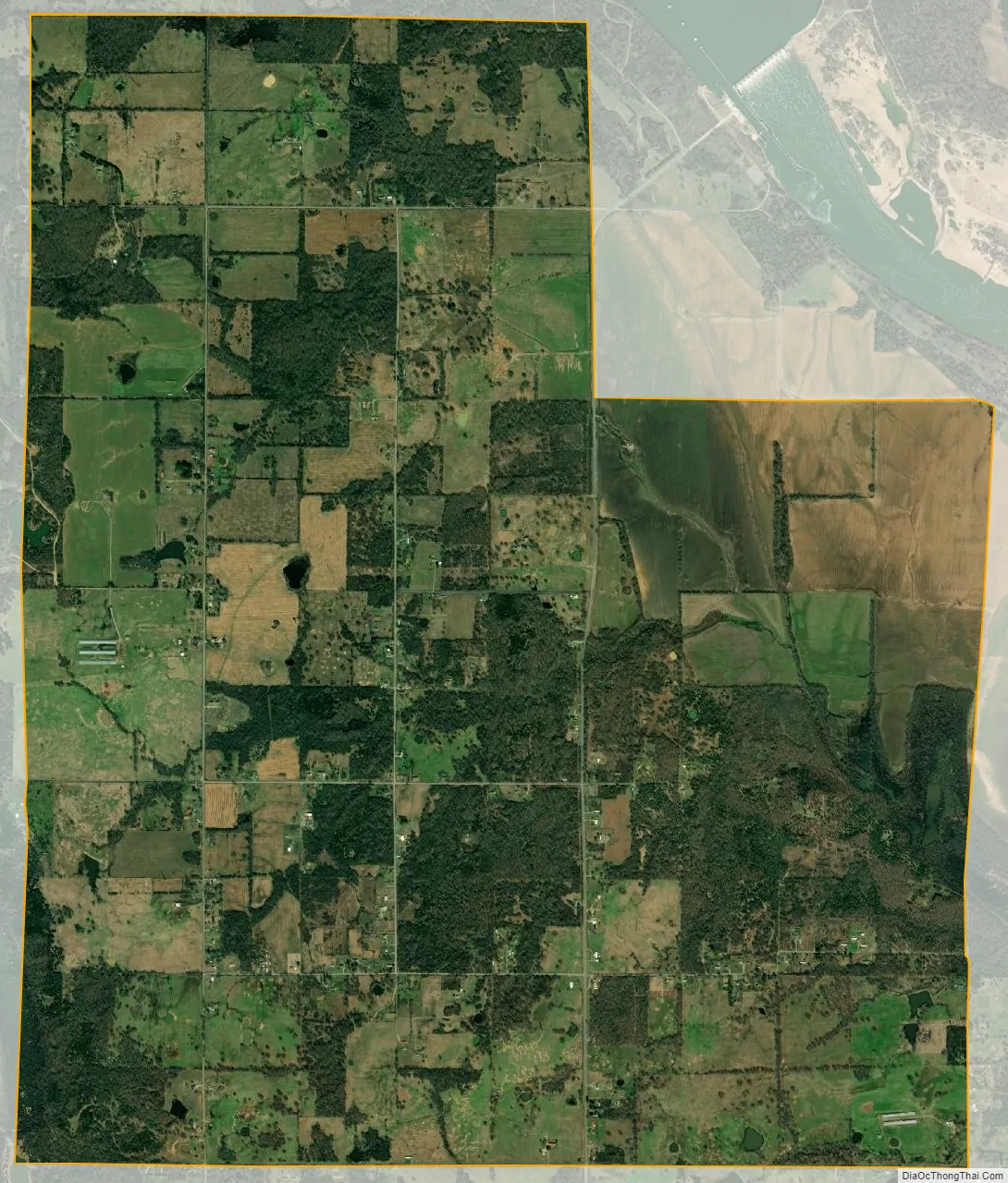
Fort Coffee city Satellite Map
Geography
Fort Coffee is located at 35°17′57″N 94°34′48″W / 35.299124°N 94.580011°W / 35.299124; -94.580011. It is 6 miles (9.7 km) northeast of Spiro.
According to the United States Census Bureau, the town has a total area of 6.4 square miles (17 km), of which 6.4 square miles (17 km) is land and 0.16% is water.
The town is just south of a bend of the Arkansas River, downstream from the Robert S. Kerr Reservoir, and north of U.S. Route 271, about 11 miles from the Arkansas border.
See also
Map of Oklahoma State and its subdivision:- Adair
- Alfalfa
- Atoka
- Beaver
- Beckham
- Blaine
- Bryan
- Caddo
- Canadian
- Carter
- Cherokee
- Choctaw
- Cimarron
- Cleveland
- Coal
- Comanche
- Cotton
- Craig
- Creek
- Custer
- Delaware
- Dewey
- Ellis
- Garfield
- Garvin
- Grady
- Grant
- Greer
- Harmon
- Harper
- Haskell
- Hughes
- Jackson
- Jefferson
- Johnston
- Kay
- Kingfisher
- Kiowa
- Latimer
- Le Flore
- Lincoln
- Logan
- Love
- Major
- Marshall
- Mayes
- McClain
- McCurtain
- McIntosh
- Murray
- Muskogee
- Noble
- Nowata
- Okfuskee
- Oklahoma
- Okmulgee
- Osage
- Ottawa
- Pawnee
- Payne
- Pittsburg
- Pontotoc
- Pottawatomie
- Pushmataha
- Roger Mills
- Rogers
- Seminole
- Sequoyah
- Stephens
- Texas
- Tillman
- Tulsa
- Wagoner
- Washington
- Washita
- Woods
- Woodward
- Alabama
- Alaska
- Arizona
- Arkansas
- California
- Colorado
- Connecticut
- Delaware
- District of Columbia
- Florida
- Georgia
- Hawaii
- Idaho
- Illinois
- Indiana
- Iowa
- Kansas
- Kentucky
- Louisiana
- Maine
- Maryland
- Massachusetts
- Michigan
- Minnesota
- Mississippi
- Missouri
- Montana
- Nebraska
- Nevada
- New Hampshire
- New Jersey
- New Mexico
- New York
- North Carolina
- North Dakota
- Ohio
- Oklahoma
- Oregon
- Pennsylvania
- Rhode Island
- South Carolina
- South Dakota
- Tennessee
- Texas
- Utah
- Vermont
- Virginia
- Washington
- West Virginia
- Wisconsin
- Wyoming