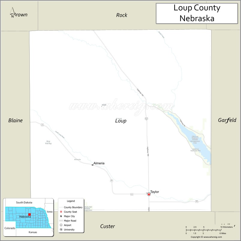
Loup County is a county in the U.S. state of Nebraska. As of the 2010 United States Census, the population was 632, making it Nebraska’s fifth-least populous county and the tenth-least populous county in the United States. Its county seat is Taylor. The county was named after the Pawnee Loup Indians.
In the Nebraska license plate system, Loup County is represented by the prefix 88 (it had the eighty-eighth-largest number of vehicles registered in the county when the license plate system was established in 1922).
| Name: | Loup County |
|---|---|
| FIPS code: | 31-115 |
| State: | Nebraska |
| Founded: | 1883 |
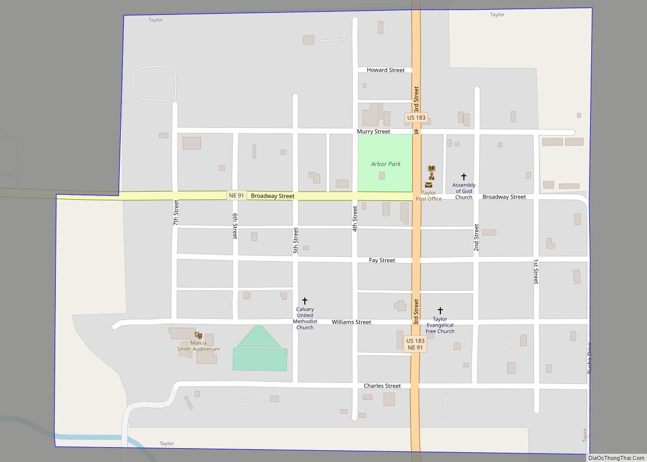
| Seat: | Taylor |
| Total Area: | 571 sq mi (1,480 km²) |
| Land Area: | 568 sq mi (1,470 km²) |
| Total Population: | 604 |
| Population Density: | 1.07/sq mi (0.41/km²) |
| Time zone: | UTC−6 (Central) |
| Summer Time Zone (DST): | UTC−5 (CDT) |
| Website: | www.co.loup.ne.us |
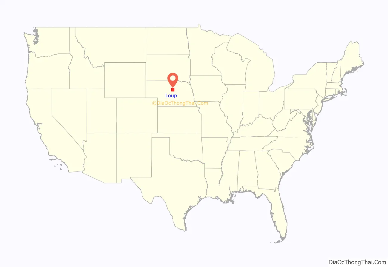
Loup County location map. Where is Loup County?
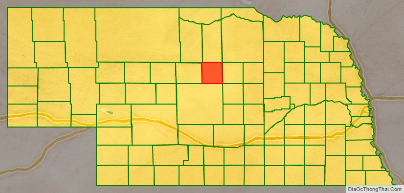
Loup County Road Map
Geography
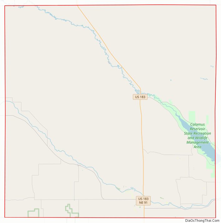
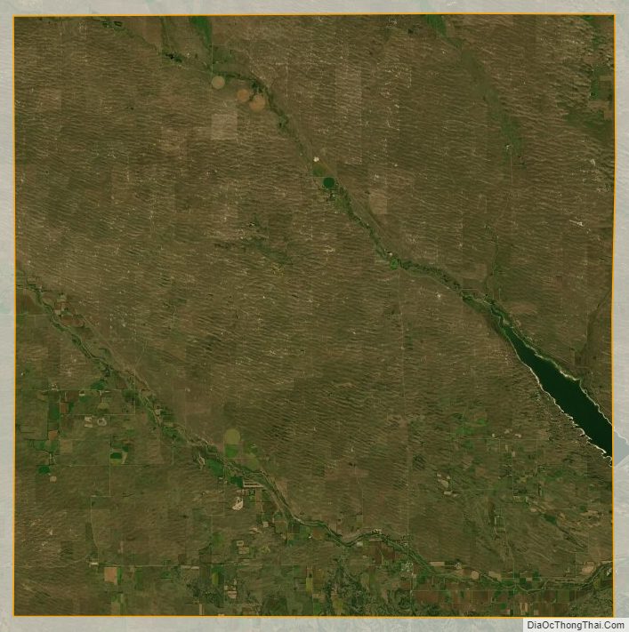
The terrain of Loup County consists of low corrugated flatland, sparsely used for agricultural purposes at present. The ground slopes to the southeast. The Calamus River runs southeastward through the upper center of the county, feeding into the Calamus Reservoir which lies on the county’s east border. The North Loup River also runs southeastward through the lower center of the county, exiting eastward near the SE corner to run to its junction with the Calamus River at a point east of Loup County. The county has an area of 571 square miles (1,480 km), of which 568 square miles (1,470 km) is land and 2.8 square miles (7.3 km) (0.5%) is water.
Major highways
- U.S. Highway 183
- Nebraska Highway 91
- Nebraska Highway 96
Adjacent counties
- Holt County – northeast
- Garfield County – east
- Custer County – south
- Blaine County – west
- Brown County – northwest
- Rock County – north
Protected area
- Calamus River State Recreation Area
Loup County Topographic Map
Loup County Satellite Map
Loup County Outline Map