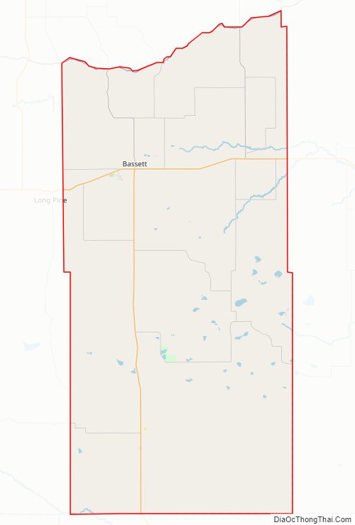
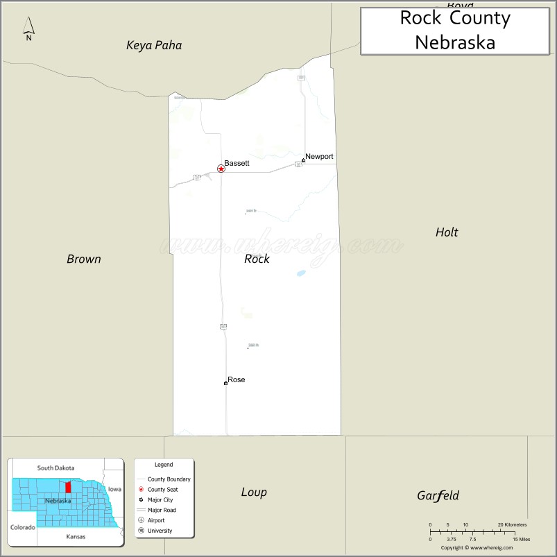
Rock County is a county in the U.S. state of Nebraska. As of the 2010 United States Census, the population was 1,526. Its county seat is Bassett.
In the Nebraska license plate system, Rock County is represented by the prefix 81 (it had the 81st-largest number of vehicles registered in the county when the license plate system was established in 1922).
| Name: | Rock County |
|---|---|
| FIPS code: | 31-149 |
| State: | Nebraska |
| Founded: | 1888 |
| Named for: | Rock Creek, or its rocky soil |
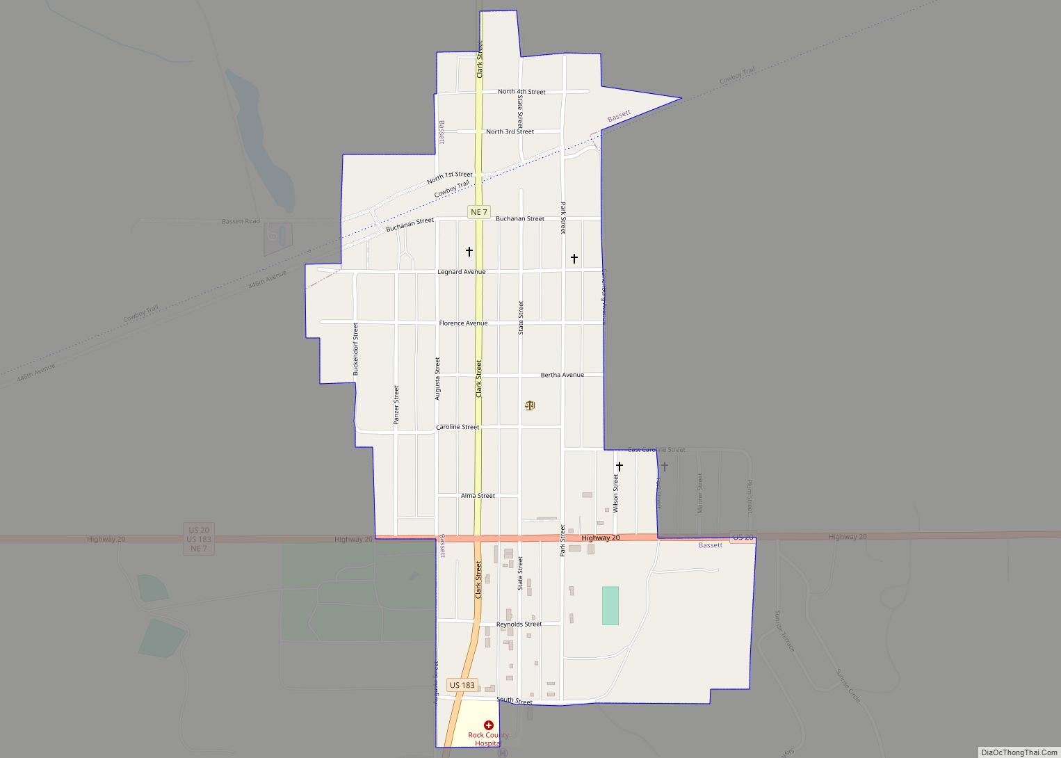
| Seat: | Bassett |
| Largest city: | Bassett |
| Total Area: | 1,012 sq mi (2,620 km²) |
| Land Area: | 1,008 sq mi (2,610 km²) |
| Total Population: | 1,264 |
| Population Density: | 1.4/sq mi (0.5/km²) |
| Time zone: | UTC−6 (Central) |
| Summer Time Zone (DST): | UTC−5 (CDT) |
| Website: | www.rockcountynebraska.org |
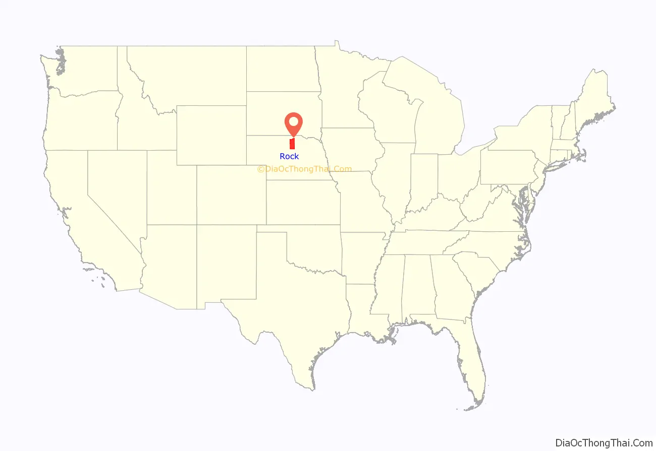
Rock County location map. Where is Rock County?
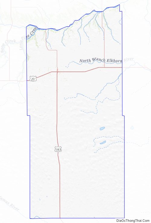
Rock County Road Map
Geography
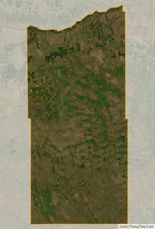
The Niobrara River flows eastward along the northern boundary line of Rock County. The terrain is composed of rolling hills oriented east–west. The county’s central portion is dotted with small lakes. The land sees comparatively little agricultural use. The ground slopes to the northeast.
The county has a total area of 1,012 square miles (2,620 km), of which 1,008 square miles (2,610 km) is land and 3.4 square miles (8.8 km) (0.3%) is water.
Rock County is located in Nebraska’s Outback region.
Major highways
- U.S. Highway 20
- U.S. Highway 183
- Nebraska Highway 7
- Nebraska Highway 137
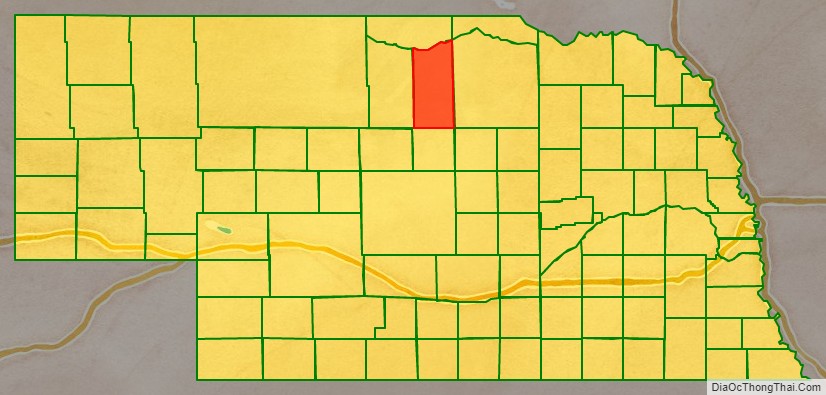
Adjacent counties
- Keya Paha County – north
- Boyd County – northeast
- Holt County – east
- Loup County – south
- Brown County – west
National protected areas
- John and Louise Seier National Wildlife Refuge
- Niobrara National Scenic River (part)
- Twin Lakes Rock County Wildlife Management Area
Rock County Topographic Map
Rock County Satellite Map
Rock County Outline Map