| Name: | Madison Parish |
|---|---|
| FIPS code: | 22-065 |
| State: | Louisiana |
| Founded: | 1838 |
| Named for: | James Madison |
| Seat: | Tallulah |
| Largest city: | Tallulah |
| Total Area: | 651 sq mi (1,690 km²) |
| Land Area: | 624 sq mi (1,620 km²) |
| Total Population: | 10,017 |
| Population Density: | 15/sq mi (5.9/km²) |
| Time zone: | UTC−6 (Central) |
| Summer Time Zone (DST): | UTC−5 (CDT) |
| Website: | madisonparish.org |
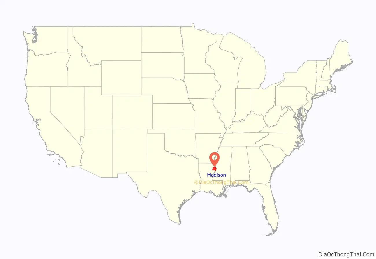
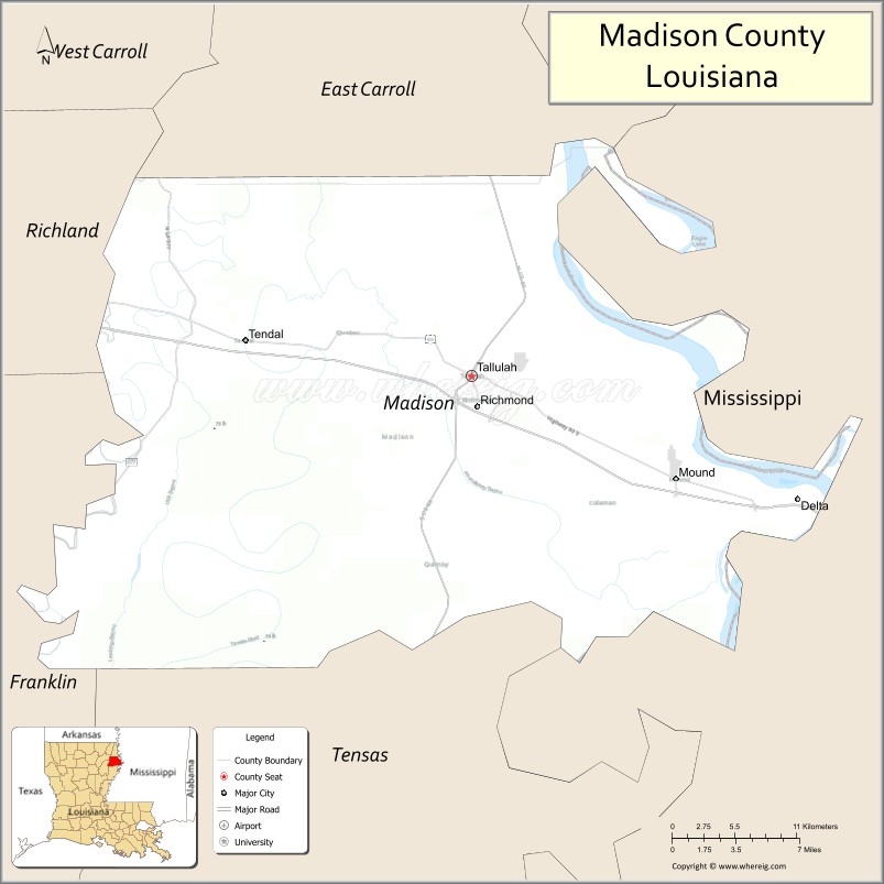
Madison Parish location map. Where is Madison Parish?
History
Prehistory
Madison Parish was the home to many succeeding Native American groups in the thousands of years before European settlement. Peoples of the Marksville culture, Troyville culture, Coles Creek culture and Plaquemine culture built villages and earthwork mound complexes throughout the area. Notable examples include the Fitzhugh Mounds and the Raffman site.
Historic tribes which were encountered by European colonists include the Taensa and Natchez peoples, who both spoke the Natchez language.
European settlement to present
The parish is named for former U.S. President James Madison. As was typical of northern areas of Louisiana, and especially along the Mississippi River, it was developed for cotton agriculture on large plantations worked by large groups of enslaved African Americans.
Following the Reconstruction era and during the Jim Crow era, white Democrats across the state violently suppressed black voting, which was for Republican candidates, and civil rights. Twelve blacks were lynched in Madison Parish from 1877 to 1950, most near the turn of the 20th century when social and economic tensions were the highest. In addition, in July 1899 five immigrant Sicilian grocers were lynched by whites in Tallulah, the parish seat, for failing to observe Jim Crow customs of serving whites before blacks and because they were competing with locals with their stores.
Civil rights legislation in 1965 enabled more African Americans to exercise their constitutional rights to register and vote in Madison Parish, and they began to elect candidates of their choice to local offices. In 1969 Zelma Wyche was elected as Police Chief of Tallulah. In 1974 Adell Williams was elected as mayor, the first African American to fill this position.
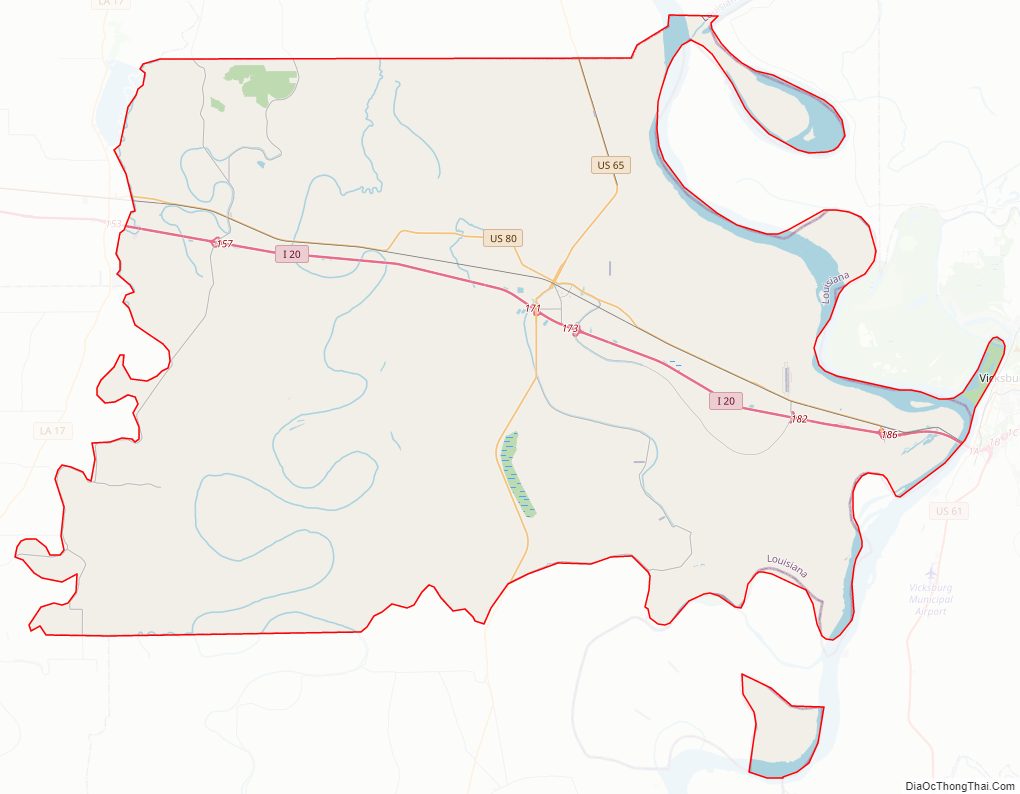
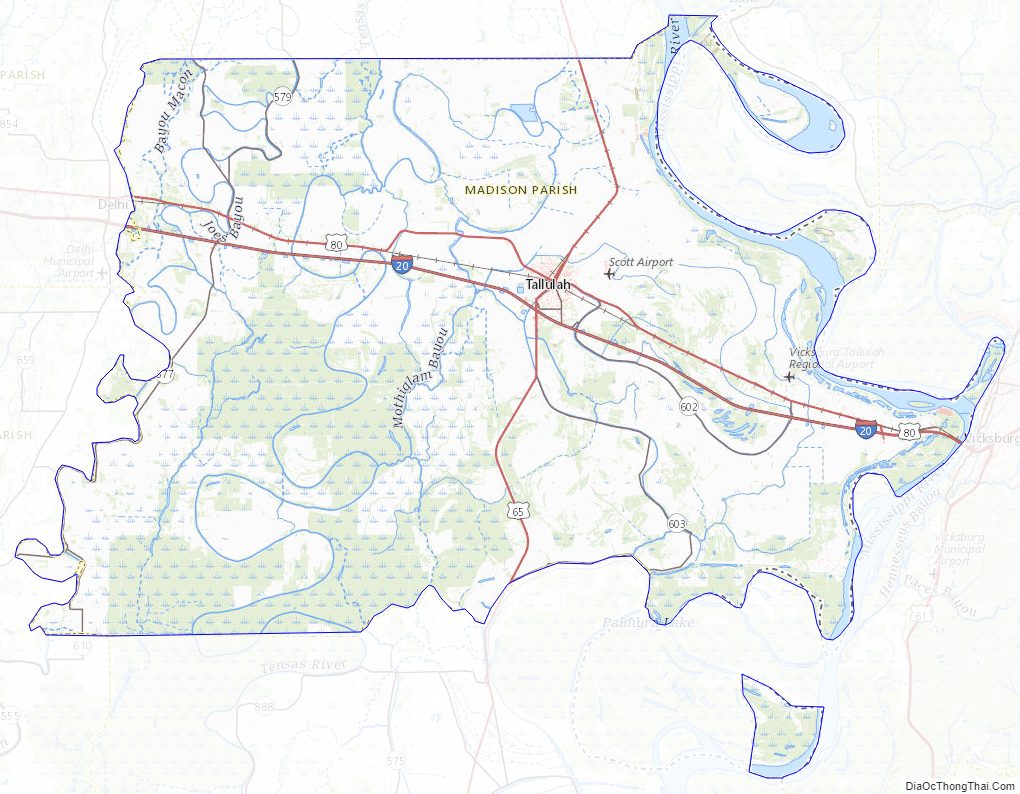
Madison Parish Road Map
Geography
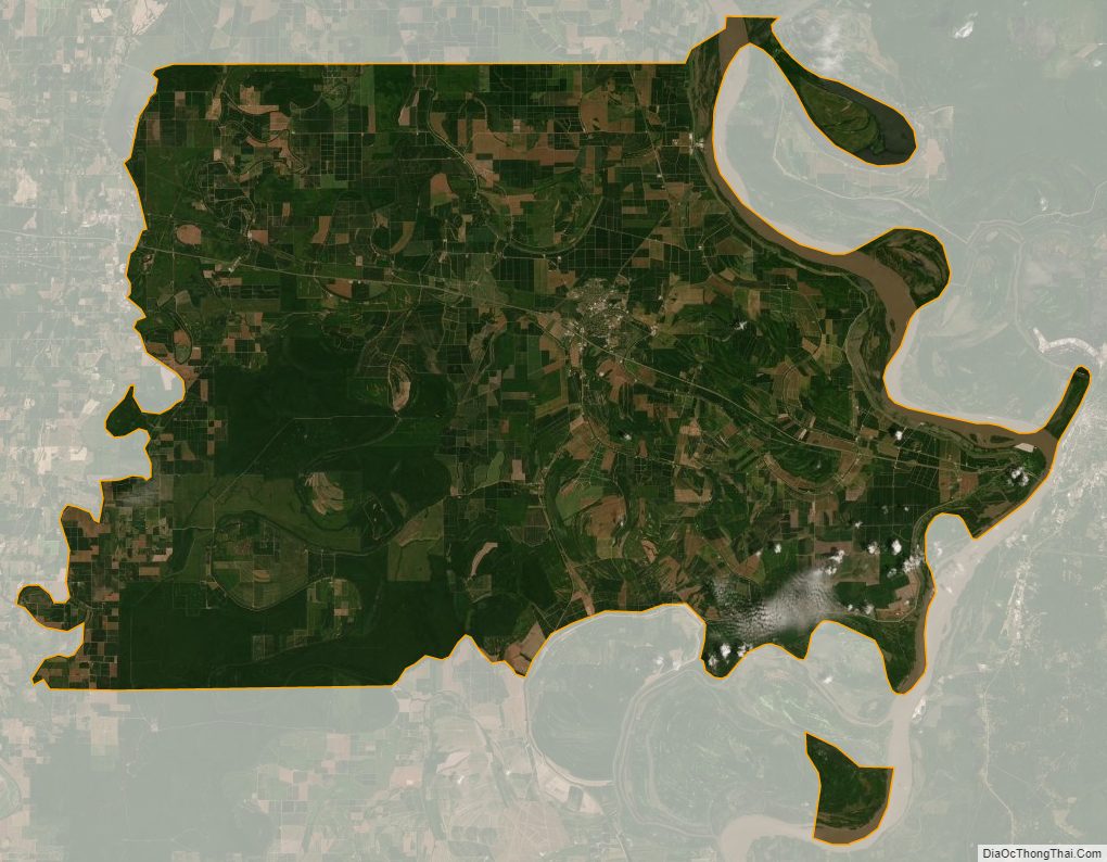
According to the U.S. Census Bureau, the parish has a total area of 651 square miles (1,690 km), of which 624 square miles (1,620 km) is land and 26 square miles (67 km) (4.1%) is water.
Major highways
- Interstate 20
- U.S. Highway 65
- U.S. Highway 80
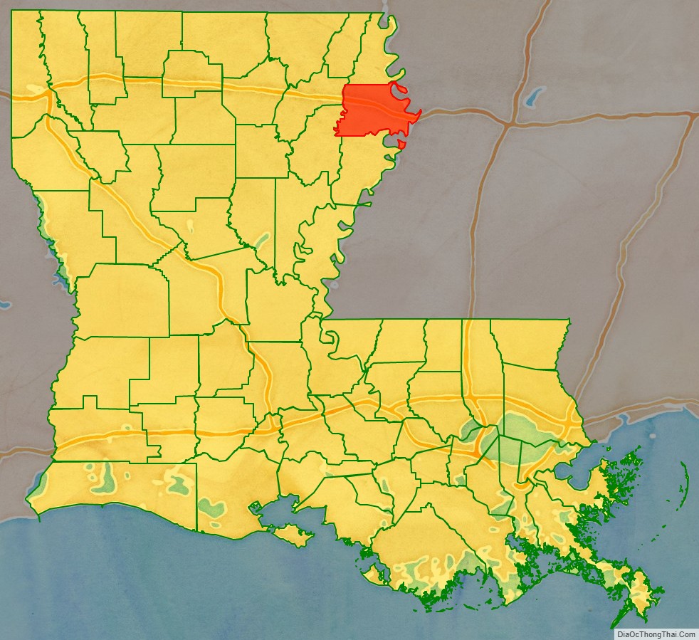
Adjacent counties and parishes
- East Carroll Parish (north)
- Warren County, Mississippi (east)
- Tensas Parish (south)
- Franklin Parish (southwest)
- Richland Parish (northwest)
National protected areas
- Tensas River National Wildlife Refuge (part)
- Vicksburg National Military Park (part)
Madison Parish Topographic Map
Madison Parish Satellite Map
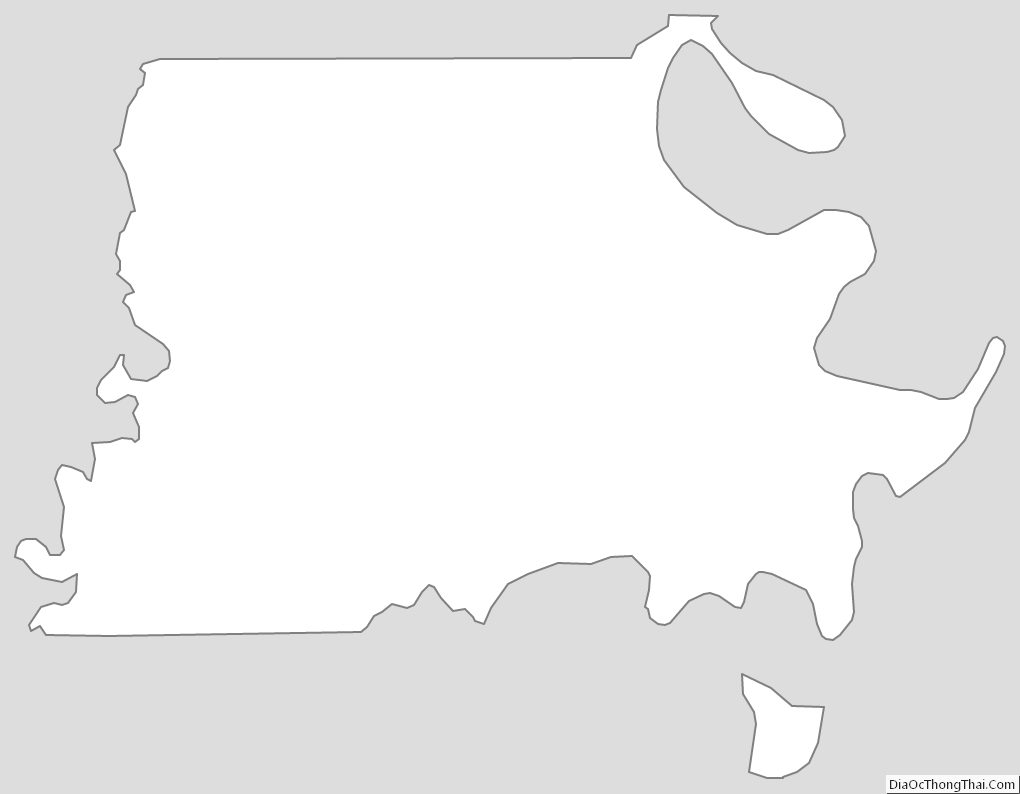
Madison Parish Outline Map