Ascension Parish (French: Paroisse de l’Ascension, Spanish: Parroquia de Ascensión) is a parish located in the U.S. state of Louisiana. As of the 2020 census, the population was 126,500. Its parish seat is Donaldsonville. The parish was created in 1807. Ascension Parish is part of the Baton Rouge metropolitan statistical area.
Ascension Parish is one of the 22 parishes that make up Acadiana, the heartland of the Cajun people and their culture. This is exhibited by the prevalence of the French or Cajun French language heard throughout the parish, as well as the many festivals celebrated by its residents, including the Boucherie Festival, Lagniappe Music and Seafood Festival, Crawfish Festival, and the Jambalaya Festival. The largest incorporated city in Ascension Parish, Gonzales, is celebrated as the “Jambalaya Capital of the World”.
| Name: | Ascension Parish |
|---|---|
| FIPS code: | 22-005 |
| State: | Louisiana |
| Founded: | 1807 |
| Named for: | Ascension of Jesus Christ |
| Seat: | Donaldsonville |
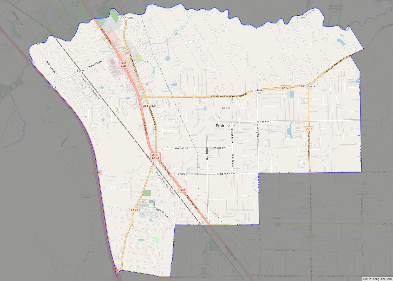
| Largest city: | Prairieville |
| Total Area: | 303 sq mi (780 km²) |
| Land Area: | 290 sq mi (800 km²) |
| Total Population: | 126,500 |
| Population Density: | 420/sq mi (160/km²) |
| Time zone: | UTC−6 (Central) |
| Summer Time Zone (DST): | UTC−5 (CDT) |
| Website: | www.ascensionparish.net |
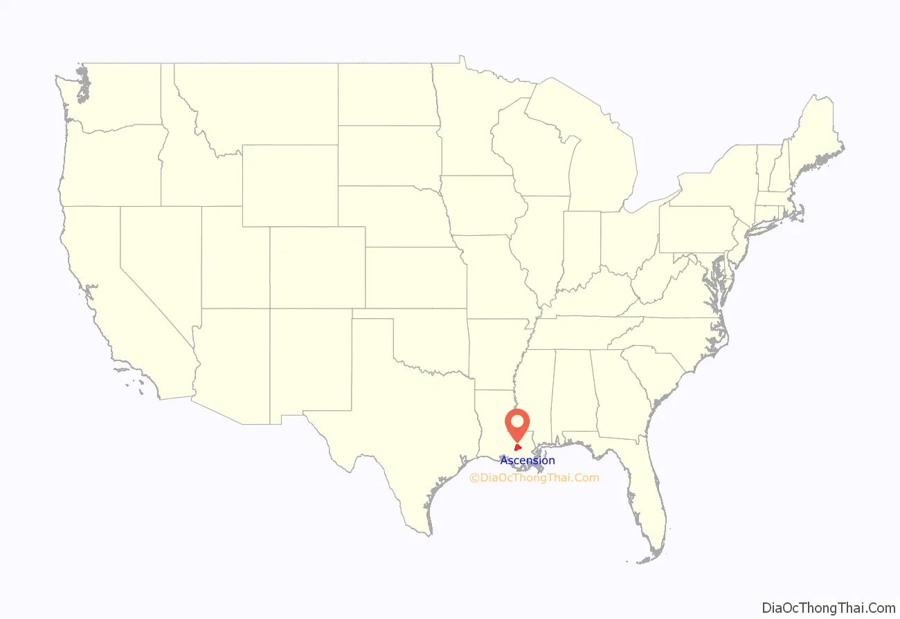
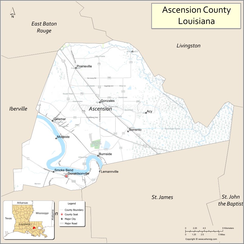
Ascension Parish location map. Where is Ascension Parish?
History
Early European settlers of the area that was developed as Ascension and Gonzales were, for the most part, of French and Spanish ancestry. They settled among the Houma Indians who lived in the area.
Among the projects and plans carried out by Luis de Unzaga ‘le Conciliateur’ while he was governor of Louisiana between 1769 and 1777 was the promotion of new settlements by Europeans, among them were French Acadians and Malaga in the fertile Mississippi region and more specifically in the Unzaga Post or ‘Puesto de Unzaga’ that he created in 1771 in Pointe Coupee, the parish of Saint Gabriel in 1773 and Fort Manchac in 1776; the Ascension people occupied land at the confluence of the aforementioned European settlements.
During the American Civil War, desertions had been of major concern to the Confederate States Army. Henry Watkins Allen, before he was governor, reported more than eight thousand deserters and draft-dodgers about Bayou Teche. There were some 1,200 deserters in Livingston, St. Tammany, and Ascension parishes.
Planters in Ascension Parish later complained of raids by guerrillas. In 1864, planter W.R. Hodges requested soldiers to protect the planted fields from such attacks. Union soldiers were accused of “wandering about at will, and helping themselves . . . to whatever could be found,” explains the historian John D. Winters in his The Civil War in Louisiana (1963).
During the historic 2016 Louisiana Floods, around one-third of all homes in Ascension Parish were flooded; 15,000 homes and businesses took on water, mostly in the Galvez-St. Amant area, prompting a visit to St. Amant by then-presidential candidate, Donald J. Trump.
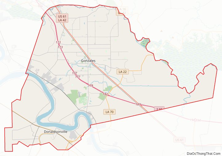
Ascension Parish Road Map
Geography
According to the U.S. Census Bureau, the parish has a total area of 303 square miles (780 km), of which 290 square miles (750 km) is land and 13 square miles (34 km) (4.2%) is water. It is the fourth-smallest parish in Louisiana by total area.
Waterways
- Alligator Bayou
- Amite River
- Amite River Diversion Canal
- Anderson Canal
- Babin Canal
- Bayou Antoine
- Bayou Manchac
- Bayou Narcisse
- Bayou Pierre
- Bayou Reponds Pas
- Bayou Conway
- Bayou Francois
- Bayou Lafourche
- Bayou Napoleon
- Bayou Verret
- Bayou Vicknair
- Black Bayou
- Blind River
- Boudreau Bayou
- Boyle Bayou
- Braud Bayou
- Cocodrie Bayou
- Cotton Bayou
- Crowley Ditch
- Duckroost Bayou
- Flat Lake
- Grand Goudine Bayou
- Hackett Canal
- Heath Bayou
- Henderson Bayou
- Jim Bayou
- Johnson Bayou
- Lake Millet
- Lake Villars
- Laurel Ridge Canal
- McCall Bayou
- Mississippi River
- Muddy Creek
- New River
- New River Canal
- Old New River
- Panama Canal
- Pipeline Canal
- Rocky Canal
- Roddy Bayou
- Saveiro Canal
- Sides Bayou
- Smith Bayou
- Spanish Lake
- Welsh Gully
Major highways
- Louisiana Highway 1
- Interstate 10
- Louisiana Highway 16
- Louisiana Highway 18
- Louisiana Highway 22
- Louisiana Highway 30
- Louisiana Highway 42
- Louisiana Highway 44
- U.S. Highway 61
- Louisiana Highway 70
- Louisiana Highway 73
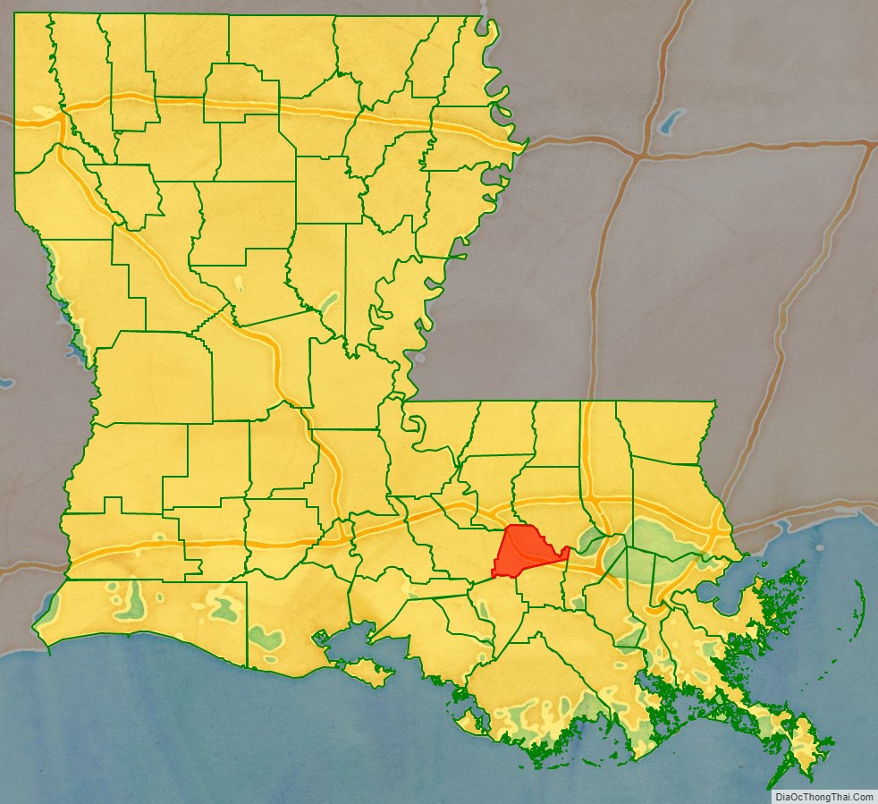
Adjacent parishes
- East Baton Rouge Parish (north)
- Livingston Parish (northeast)
- St. John the Baptist Parish (east)
- St. James Parish (southeast)
- Assumption Parish (southwest)
- Iberville Parish (west)
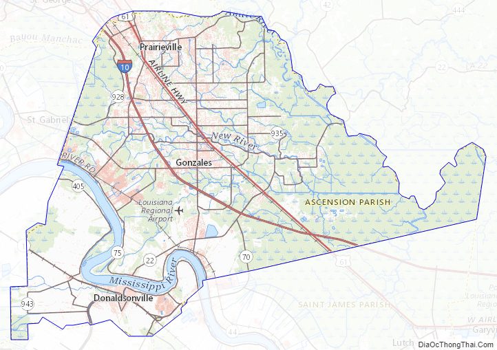
Ascension Parish Topographic Map
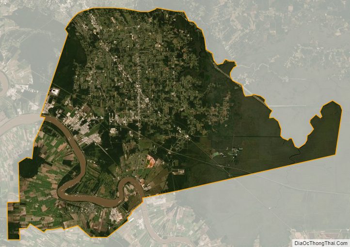
Ascension Parish Satellite Map
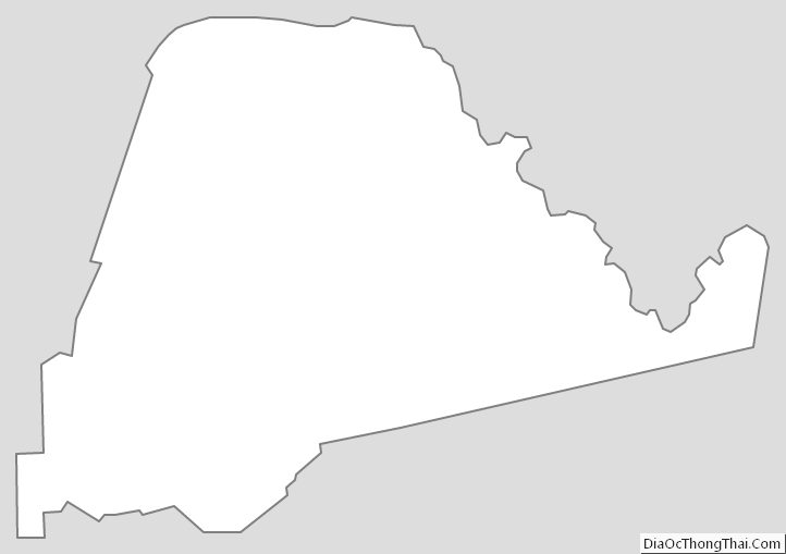
Ascension Parish Outline Map