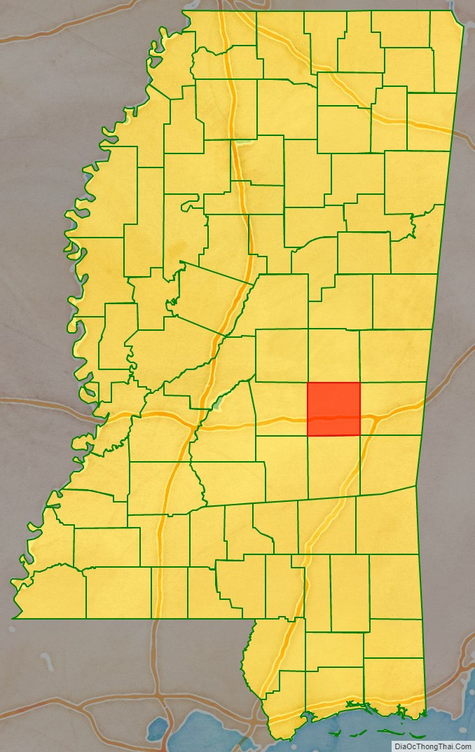
Newton County is a county located in the U.S. state of Mississippi. As of the 2020 census, the population was 21,291. Its county seat is Decatur.
| Name: | Newton County |
|---|---|
| FIPS code: | 28-101 |
| State: | Mississippi |
| Founded: | 1836 |
| Seat: | Decatur |
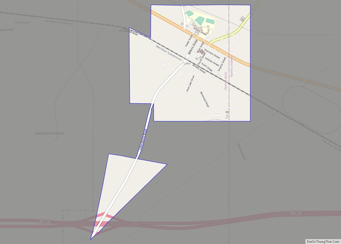
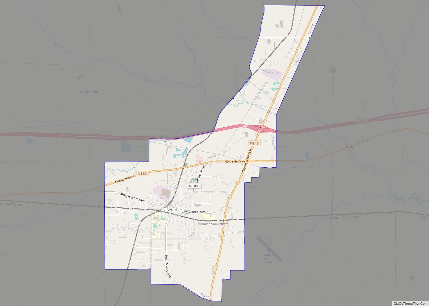
| Largest city: | Newton |
| Total Area: | 580 sq mi (1,500 km²) |
| Land Area: | 578 sq mi (1,500 km²) |
| Total Population: | 21,291 |
| Population Density: | 37/sq mi (14/km²) |
| Time zone: | UTC−6 (Central) |
| Summer Time Zone (DST): | UTC−5 (CDT) |
| Website: | www.newtoncountyms.net |
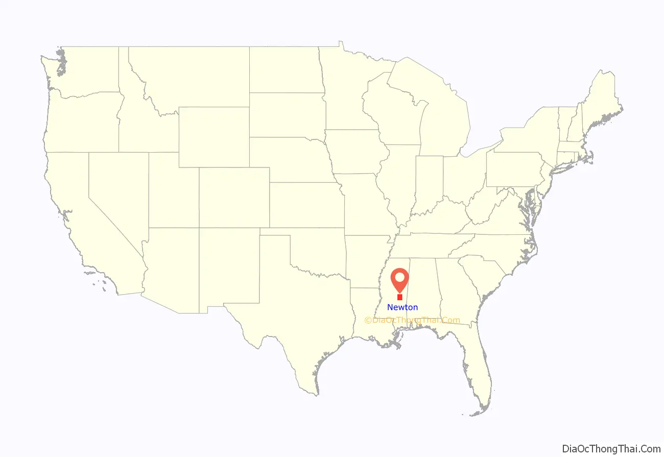
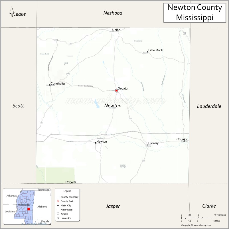
Newton County location map. Where is Newton County?
History
Newton County was formed in 1836 and named after scientist Isaac Newton.
The Battle of Newton’s Station was fought in the county on April 24, 1863, during Grierson’s Raid of the American Civil War.
In February 1864, General William Tecumseh Sherman crossed the county, burning the county seat at Decatur and was nearly captured during the Meridian Campaign. Sherman stopped during the return trip from Meridian and slept in the town of Union.
On October 8, 1908, a black sharecropper named Shep Jones had a disagreement with his white employer, leading to the employer’s death. While searching for Jones, a white mob destroyed property owned by black people, burned their church and meeting lodge, threatened black families, and hanged Jones’ father-in-law and two other black men. Many black people fled Newton County. No arrests or restitution occurred.
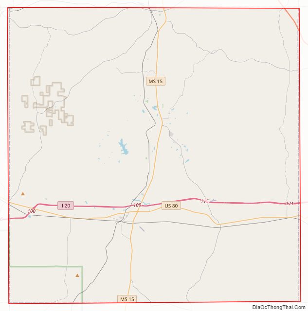
Newton County Road Map
Geography
According to the U.S. Census Bureau, the county has a total area of 580 square miles (1,500 km), of which 578 square miles (1,500 km) is land and 1.5 square miles (3.9 km) (0.3%) is water.
Major highways
- Interstate 20
- U.S. Highway 80
- Mississippi Highway 15
Adjacent counties
- Neshoba County (north)
- Lauderdale County (east)
- Jasper County (south)
- Scott County (west)
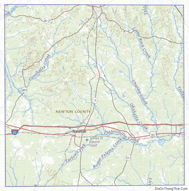
National protected area
- Bienville National Forest (part)
Newton County Topographic Map
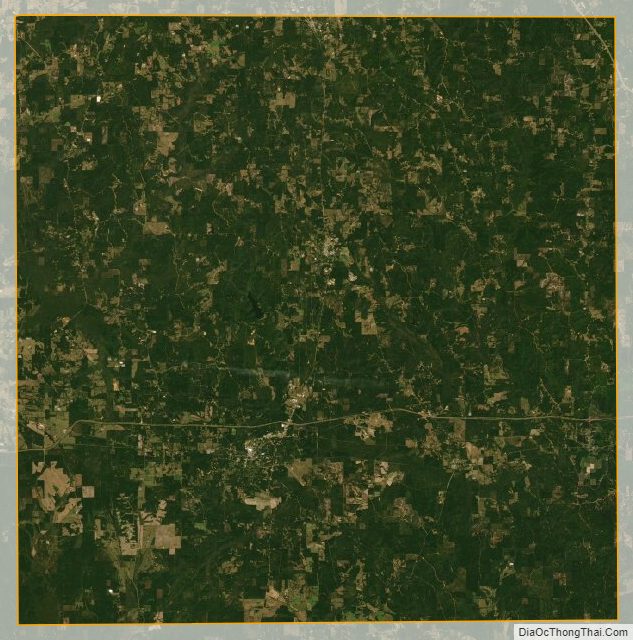
Newton County Satellite Map
Newton County Outline Map