Quitman County is a county located in the U.S. state of Mississippi. As of the 2020 census, the population was 6,176, making it the third-least populous county in Mississippi. Its county seat is Marks. The county is named after John A. Quitman, Governor of Mississippi from 1835 to 1836 and from 1850 to 1851.
Quitman County is located in the Mississippi Delta region of Mississippi.
| Name: | Quitman County |
|---|---|
| FIPS code: | 28-119 |
| State: | Mississippi |
| Founded: | 1877 |
| Named for: | John A. Quitman |
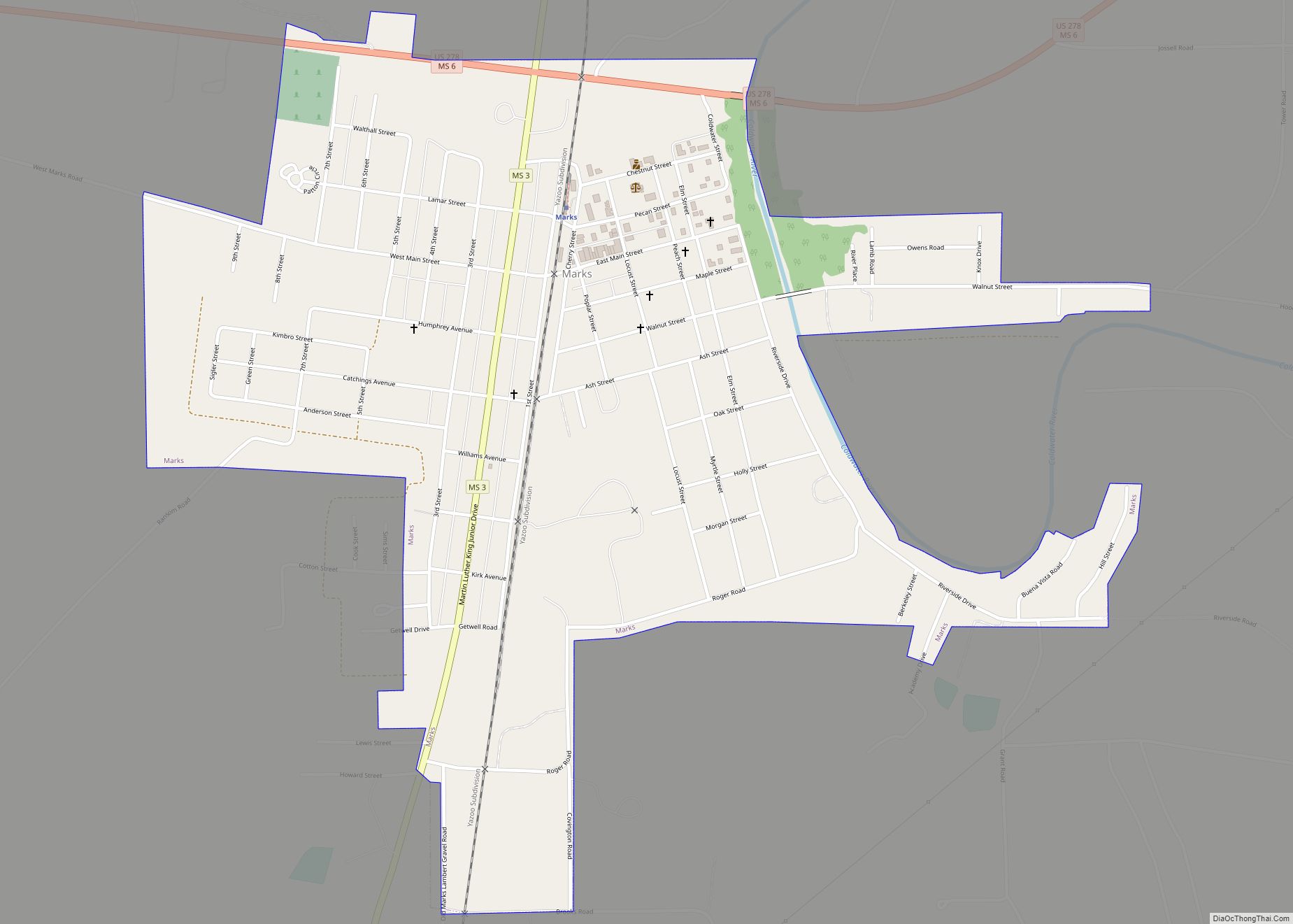
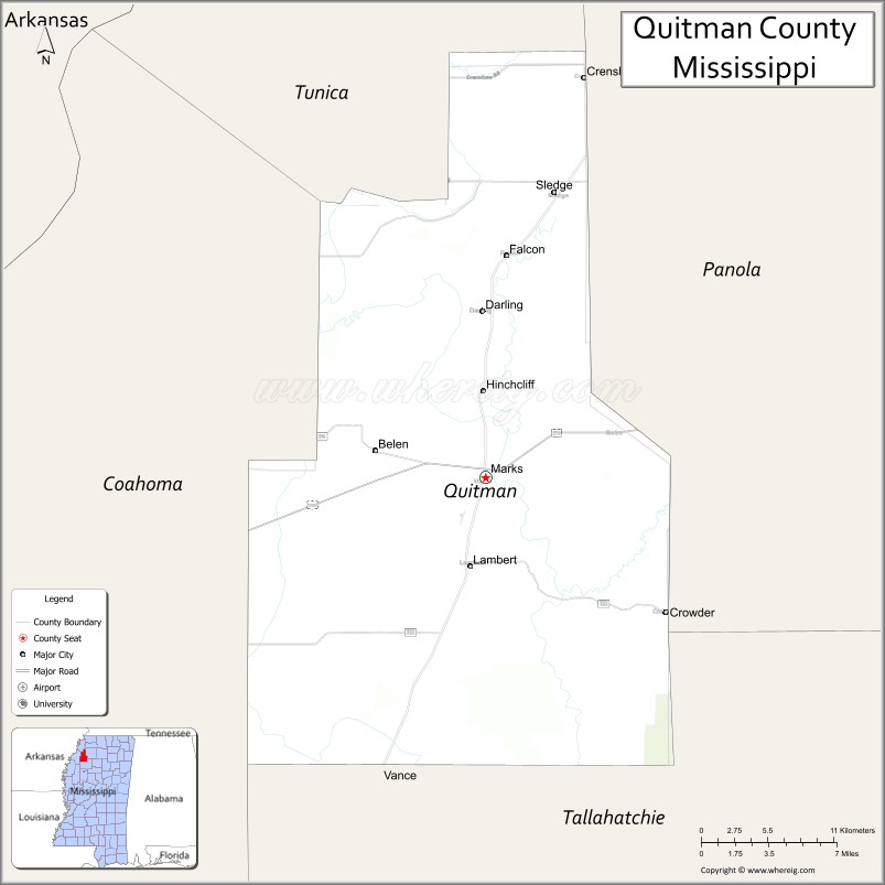
| Seat: | Marks |
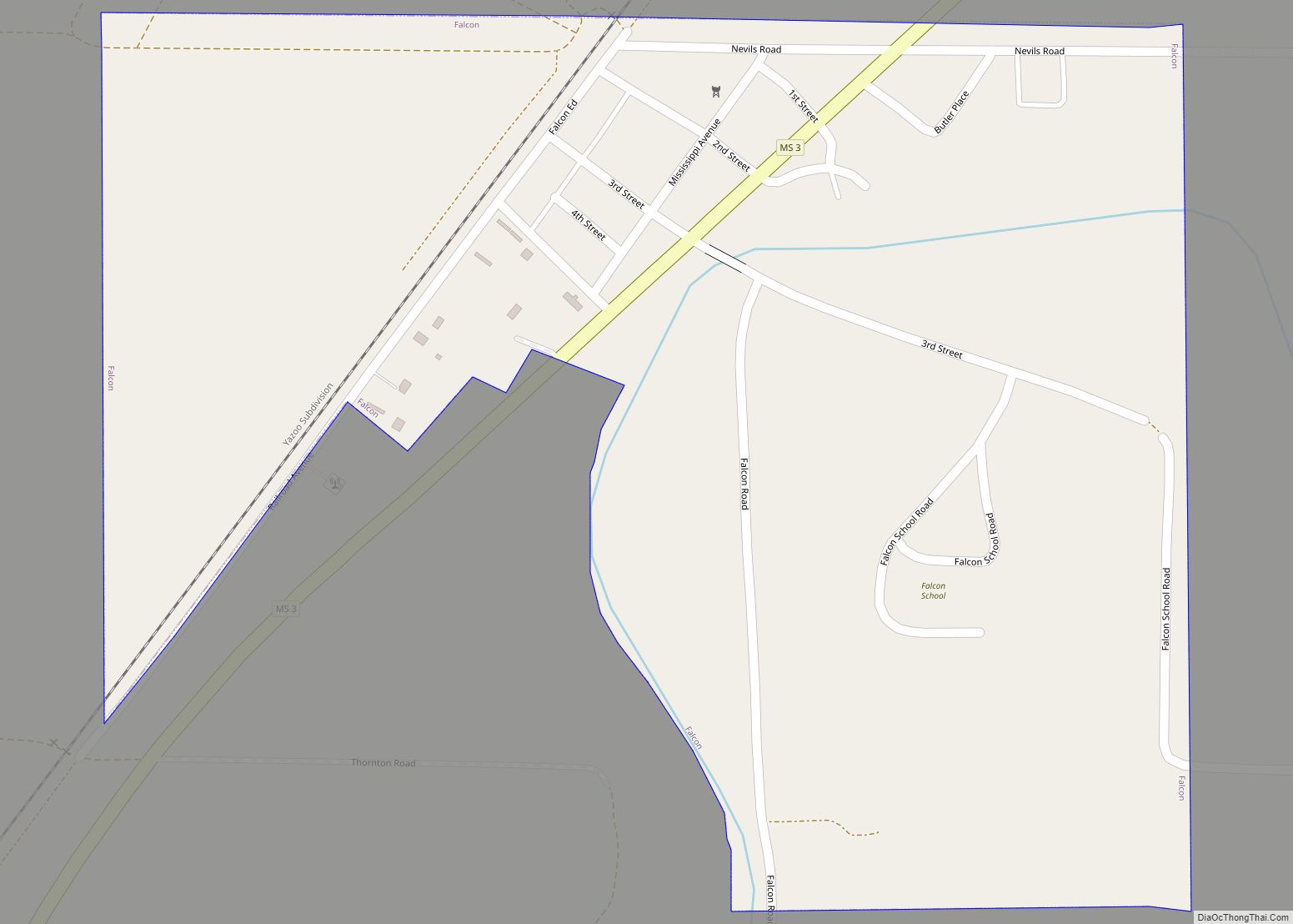
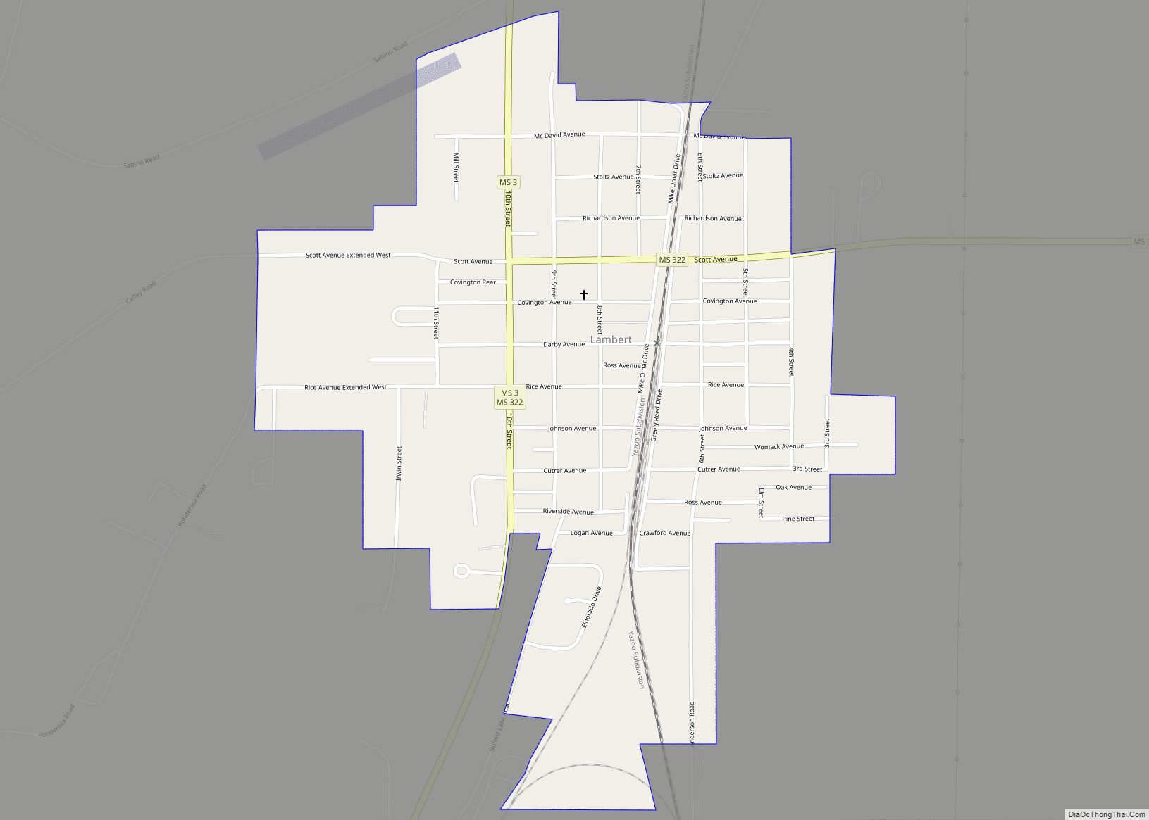
| Largest town: | Lambert |
| Total Area: | 406 sq mi (1,050 km²) |
| Land Area: | 405 sq mi (1,050 km²) |
| Total Population: | 6,176 |
| Population Density: | 15/sq mi (5.9/km²) |
| Time zone: | UTC−6 (Central) |
| Summer Time Zone (DST): | UTC−5 (CDT) |
| Website: | quitmancountyms.org |
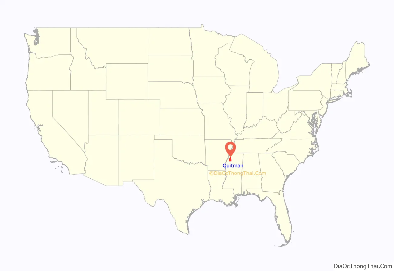
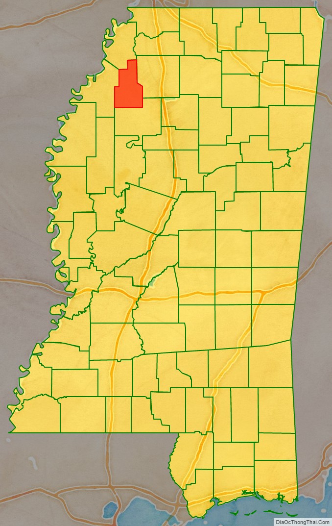
Quitman County location map. Where is Quitman County?
History
The county was developed for cotton cultivation. Much of the bottomlands behind the riverfront were not developed until the late 19th century, and population continued to increase as the frontier was cleared and cultivated. The county reached its peak population in 1940. Agricultural mechanization reduced the need for farm labor, and workers were recruited to northern and midwestern industrial cities. Thousands of African Americans left in the Great Migration, many going upriver to St. Louis and Chicago.
Poor People’s Campaign
Martin Luther King Jr. originally wanted the Poor People’s Campaign to start in Quitman County because of the intense and visible economic disparity there. On March 18, 1968, King visited the town of Marks, Mississippi. He watched a teacher feeding black schoolchildren their lunch, consisting only of a slice of apple and some crackers, and was moved to tears.
After King’s death, the Southern part of the Campaign began in Quitman County. Participants rode a train of mules to Washington, D.C. to protest about economic conditions. According to wagonmaster Willie Bolden, white citizens of Marks harassed the mule train on its way out of town. Bolden stated that they “would drive by blowing their horns, purposely trying to spook the mules and us.” More recently, Quitman County residents have made an effort to promote tourism based on the county’s role in the Poor People’s Campaign.
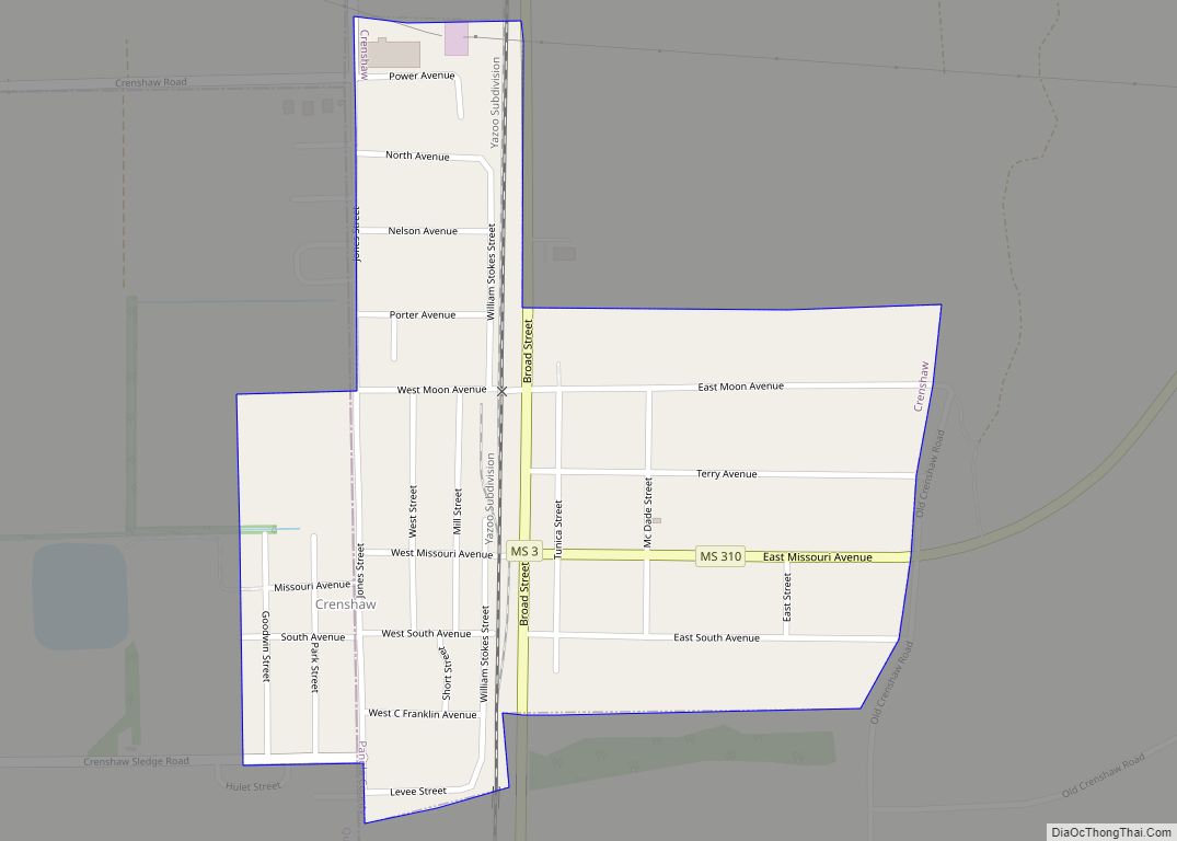
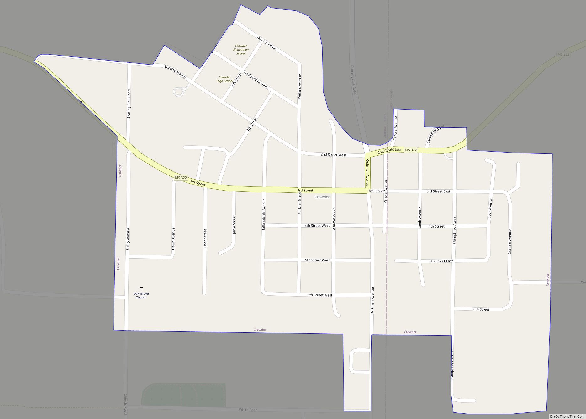
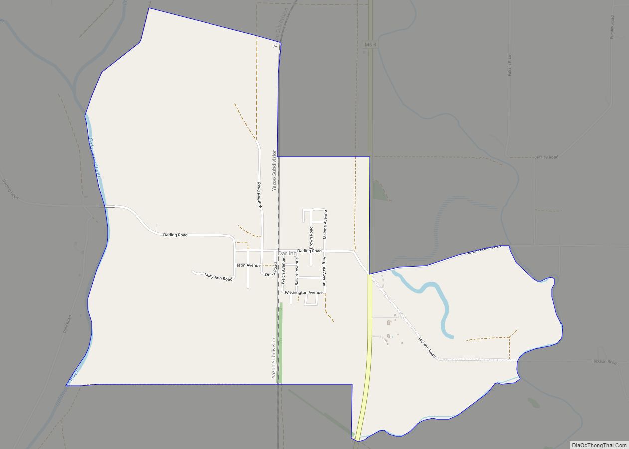
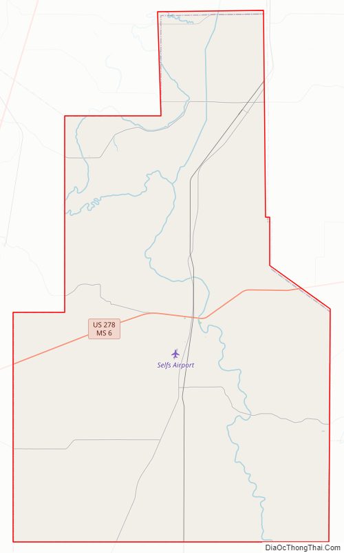
Quitman County Road Map
Geography
According to the U.S. Census Bureau, the county has a total area of 406 square miles (1,050 km), of which 405 square miles (1,050 km) is land and 1.4 square miles (3.6 km) (0.3%) is water. It is the fourth-smallest county in Mississippi by land area and third-smallest by total area.
Major highways
- Mississippi Highway 3
- Mississippi Highway 6
- U.S. Route 278
Adjacent counties
- Tunica County (north)
- Panola County (east)
- Tallahatchie County (south)
- Coahoma County (west)
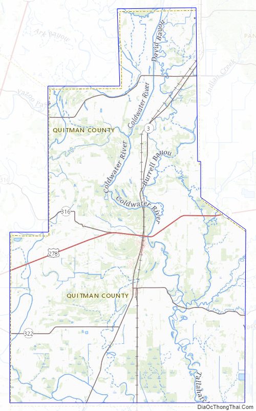
National protected area
- Coldwater River National Wildlife Refuge (part)
Quitman County Topographic Map
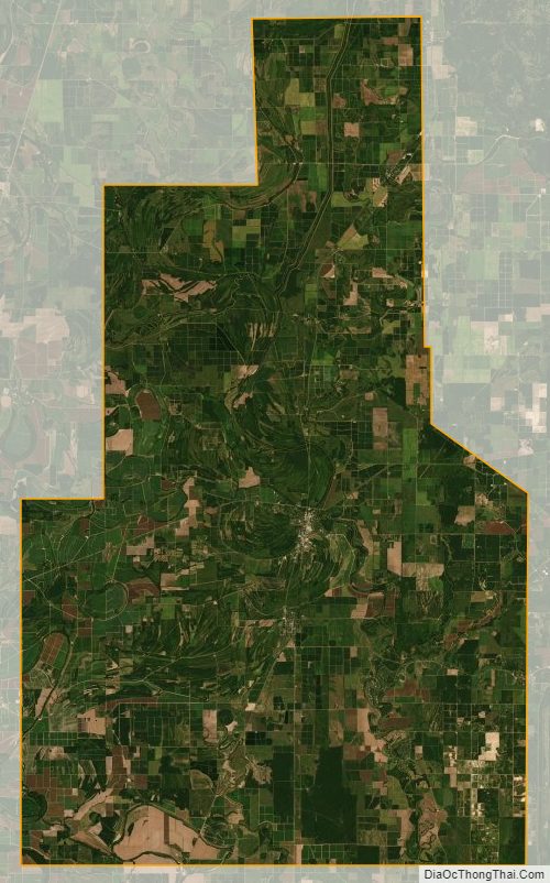
Quitman County Satellite Map
Quitman County Outline Map