Map of Macedonia CDP

Map of Macedonia CDP, Alabama

Macedonia is a census-designated place and former town in Pickens County, Alabama, United States. The population was 292 at the 2010 census, up from 291 in 2000. The town was incorporated in 1994, but disincorporated in 2001. It was reclassified as a census-designated place (CDP) for 2010. Macedonia CDP overview: Name: Macedonia CDP LSAD Code: … Read more

Map of Lynn town

Map of Lynn town, Alabama

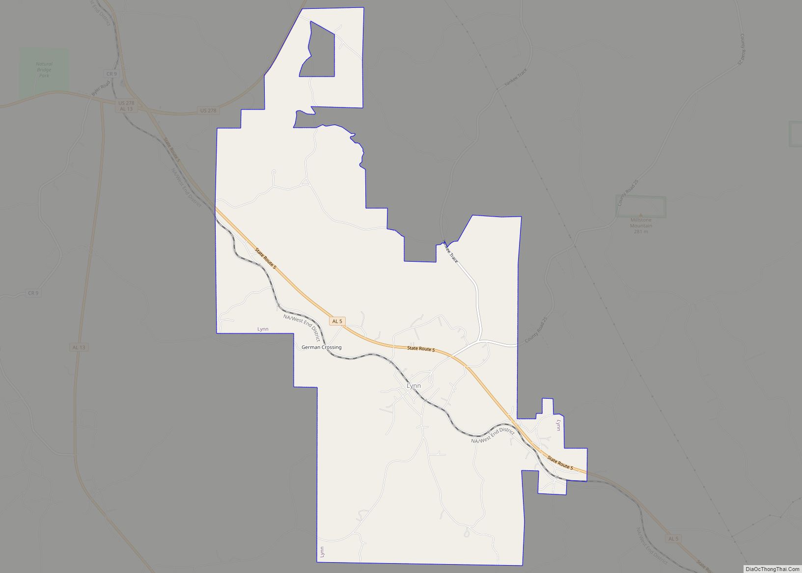
Lynn is a town in Winston County, Alabama, United States. It incorporated in April 1952. At the 2020 census the population was 832. Up from the 2010 census (659) up from 597 in 2000. Lynn town overview: Name: Lynn town LSAD Code: 43 LSAD Description: town (suffix) State: Alabama County: Winston County Elevation: 725 ft (221 m) … Read more

Map of Luverne city

Map of Luverne city, Alabama

Luverne is a city in and the county seat of Crenshaw County, Alabama, United States. The city describes itself as “The Friendliest City in the South”, a slogan that appears on its “welcome” signs. At the 2020 census, the population was 2,765. Luverne city overview: Name: Luverne city LSAD Code: 25 LSAD Description: city (suffix) … Read more

Map of Magnolia Springs town

Map of Magnolia Springs town

Magnolia Springs is a town in south Baldwin County, Alabama, United States, in the Daphne-Fairhope-Foley metropolitan area. The town voted to incorporate in 2006. As of the 2010 census it had a population of 723. Magnolia Springs town overview: Name: Magnolia Springs town LSAD Code: 43 LSAD Description: town (suffix) State: Alabama County: Baldwin County … Read more

Map of Madrid town

Map of Madrid town, Alabama

Madrid (/ˈmædrɪd/ MAD-rid) is a town in Houston County, Alabama, United States. It is part of the Dothan, Alabama Metropolitan Statistical Area. At the 2010 census the population was 350, up from 303 in 2000. Madrid town overview: Name: Madrid town LSAD Code: 43 LSAD Description: town (suffix) State: Alabama County: Houston County Elevation: 164 ft … Read more

Map of Madison city

Map of Madison city, Alabama

Madison is a city located primarily in Madison County, near the northern border of the U.S. state of Alabama. Madison extends west into neighboring Limestone County. The city is included in the Huntsville Metropolitan Area, the second-largest in the state, and is also included in the merged Huntsville-Decatur Combined Statistical Area. As of the 2020 … Read more

Map of Maplesville town

Map of Maplesville town

Maplesville is a town in Chilton County, Alabama, United States. At the 2020 census, the population was 637. It is located approximately halfway between Tuscaloosa and Montgomery on U.S. Route 82. The mayor of Maplesville is W. C. Hayes, Jr. Maplesville town overview: Name: Maplesville town LSAD Code: 43 LSAD Description: town (suffix) State: Alabama … Read more

Map of Malvern town

Map of Malvern town, Alabama

Malvern is a town in Geneva County, Alabama, United States. It is part of the Dothan, Alabama Metropolitan Statistical Area. At the 2010 census the population was 1,448, up from 1,215 in 2000. Malvern town overview: Name: Malvern town LSAD Code: 43 LSAD Description: town (suffix) State: Alabama County: Geneva County Elevation: 282 ft (86 m) Total … Read more

Map of Malcolm CDP

Map of Malcolm CDP, Alabama

Malcolm is a census-designated place and unincorporated community in Washington County, Alabama, United States. Its population was 187 as of the 2010 census. Malcolm CDP overview: Name: Malcolm CDP LSAD Code: 57 LSAD Description: CDP (suffix) State: Alabama County: Washington County Elevation: 43 ft (13 m) Total Area: 2.39 sq mi (6.19 km²) Land Area: 2.37 sq mi (6.13 km²) Water Area: 0.03 sq mi … Read more

Map of Marion city

Map of Marion city, Alabama

Marion is a city in, and the county seat of, Perry County, Alabama, United States. As of the 2010 census, the population of the city is 3,686, up 4.8% over 2000. First known as Muckle Ridge, the city was renamed for a hero of the American Revolution, Francis Marion. Two colleges, Judson College and Marion … Read more

Map of Margaret town

Map of Margaret town

Margaret is a city in St. Clair County, Alabama, United States. At the 2020 census, the population was 5,106. As of the 2010 census, the population is 4,428, an increase of 278.8%. Margaret incorporated in 1960 and became a city in October 2011. Margaret town overview: Name: Margaret town LSAD Code: 43 LSAD Description: town … Read more

Map of Marbury CDP

Map of Marbury CDP

Marbury is an unincorporated community and census-designated place in Autauga County, Alabama, United States. As of the 2010 census, its population was 1,418. Marbury CDP overview: Name: Marbury CDP LSAD Code: 57 LSAD Description: CDP (suffix) State: Alabama County: Autauga County Elevation: 522 ft (159 m) Total Area: 23.23 sq mi (60.17 km²) Land Area: 23.15 sq mi (59.97 km²) Water Area: 0.08 sq mi … Read more