Maplesville is a town in Chilton County, Alabama, United States. At the 2020 census, the population was 637. It is located approximately halfway between Tuscaloosa and Montgomery on U.S. Route 82.
The mayor of Maplesville is W. C. Hayes, Jr.
| Name: | Maplesville town |
|---|---|
| LSAD Code: | 43 |
| LSAD Description: | town (suffix) |
| State: | Alabama |
| County: | Chilton County |
| Elevation: | 351 ft (107 m) |
| Total Area: | 3.48 sq mi (9.00 km²) |
| Land Area: | 3.43 sq mi (8.89 km²) |
| Water Area: | 0.04 sq mi (0.11 km²) |
| Total Population: | 637 |
| Population Density: | 185.50/sq mi (71.63/km²) |
| ZIP code: | 36750 |
| Area code: | 334 |
| FIPS code: | 0146504 |
| GNISfeature ID: | 0160032 |
| Website: | www.townofmaplesville.com |
Online Interactive Map
Click on ![]() to view map in "full screen" mode.
to view map in "full screen" mode.
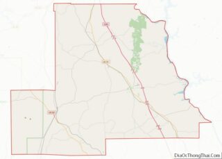
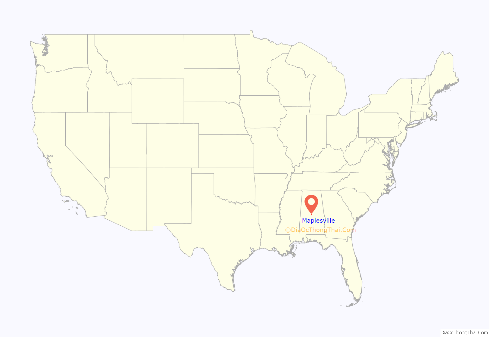
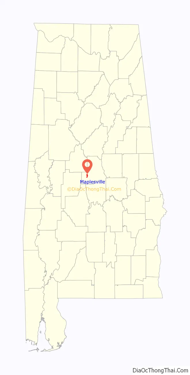
Maplesville location map. Where is Maplesville town?
History
The town of Maplesville first began to grow in a location 3 miles (5 km) east of its present location, near Mulberry Creek. European settlers migrated to the area from Georgia and the Carolinas following the Battle of Horseshoe Bend in 1814, after the Native Americans who had been living there were defeated. The town was named after Stephen W. Maples, a merchant and the town’s first postmaster.
The town was located at the crossroads of two important trading routes: the Elyton Road from Selma to Birmingham, and the Fort Jackson Road from Tuscaloosa to Montgomery. By 1850, the original town of Maplesville had a population of 809. The town had two horse-racing tracks, which brought visitors to the town, and had several inns and taverns to accommodate the stagecoach traffic.
The original town site began to decline in the early 1850s, after two railway lines were completed 3 miles west of the town. The Alabama & Tennessee River Railway was constructed through in 1853. That same year, a depot was constructed at that location. Residents and businesspeople from the original Maplesville began moving closer to the railroad, and when the Maplesville Post Office was relocated to the railroad town in 1856, the new town was renamed Maplesville. The original town site gradually became deserted, and all that remains today is the Old Maplesville Cemetery along Highway 191. The Old Maplesville Cemetery contains many of the town’s original inhabitants. This cemetery is also home to the oldest grave in Chilton County, dating back to 1833. However, the cemetery is just a fraction of its former size. Today, roughly 50 of the original tombstones remain. During the construction of Highway 191, several of the graves were destroyed during the process.
Because of Maplesville’s abundant rail access, it became a shipping point for cotton and other goods from the surrounding area. In 1865, the train depot was destroyed in a raid by Union general James H. Wilson, as Wilson’s Raiders marched on to Selma. It was replaced soon after the Civil War, but was destroyed by fire in 1911.
Maplesville continued to prosper after the Mobile and Ohio Railroad ran a line through the town in 1897, and many of the historic buildings in the town today were built during that period. In 1901, a lumber mill opened near the town, and the town’s population grew as people moved to Maplesville to work at the mill. Maplesville incorporated in 1914, but the incorporation soon lapsed because the town failed to hold elections after the initial round. It reincorporated in 1947, and by 1951 had established a telephone system, garbage pick-up, and water system.
A new town hall was completed in 1975.
There are four historic sites currently recognized in Maplesville. The Walker-Klinner Farm is listed on the National Register of Historic Places, and the following three locations are listed on the Alabama Register of Landmarks and Heritage:
- Maplesville Depot (circa 1912; listed November 23, 1976).
- Maplesville Methodist Episcopal Church (circa 1870–1890; listed December 4, 1992).
- Maplesville Railroad Historic District (19th–20th century; listed September 26, 2003).
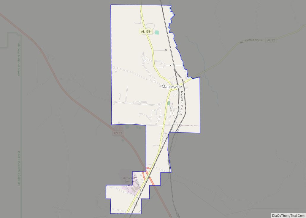
Maplesville Road Map
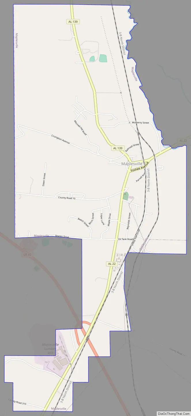
Maplesville city Satellite Map

Geography
Maplesville is located in southwestern Chilton County at 32°46’54.800″ North, 86°52’31.861″ West (32.781889, -86.875517). It is located along U.S. Route 82, which runs northwest to southeast on the south side of town. Tuscaloosa is 55 mi (89 km) to the northwest, and Montgomery is 49 mi (79 km) to the southeast, both via US-82. Alabama State Route 22 runs west to east through the center of town, leading east 15 mi (24 km) to Clanton, the Chilton County seat, and southwest 29 mi (47 km) to Selma.
According to the U.S. Census Bureau, the town has a total area of 3.3 square miles (8.6 km), of which 3.3 square miles (8.5 km) is land and 0.04 square miles (0.1 km), or 1.22%, is water.
See also
Map of Alabama State and its subdivision:- Autauga
- Baldwin
- Barbour
- Bibb
- Blount
- Bullock
- Butler
- Calhoun
- Chambers
- Cherokee
- Chilton
- Choctaw
- Clarke
- Clay
- Cleburne
- Coffee
- Colbert
- Conecuh
- Coosa
- Covington
- Crenshaw
- Cullman
- Dale
- Dallas
- De Kalb
- Elmore
- Escambia
- Etowah
- Fayette
- Franklin
- Geneva
- Greene
- Hale
- Henry
- Houston
- Jackson
- Jefferson
- Lamar
- Lauderdale
- Lawrence
- Lee
- Limestone
- Lowndes
- Macon
- Madison
- Marengo
- Marion
- Marshall
- Mobile
- Monroe
- Montgomery
- Morgan
- Perry
- Pickens
- Pike
- Randolph
- Russell
- Saint Clair
- Shelby
- Sumter
- Talladega
- Tallapoosa
- Tuscaloosa
- Walker
- Washington
- Wilcox
- Winston
- Alabama
- Alaska
- Arizona
- Arkansas
- California
- Colorado
- Connecticut
- Delaware
- District of Columbia
- Florida
- Georgia
- Hawaii
- Idaho
- Illinois
- Indiana
- Iowa
- Kansas
- Kentucky
- Louisiana
- Maine
- Maryland
- Massachusetts
- Michigan
- Minnesota
- Mississippi
- Missouri
- Montana
- Nebraska
- Nevada
- New Hampshire
- New Jersey
- New Mexico
- New York
- North Carolina
- North Dakota
- Ohio
- Oklahoma
- Oregon
- Pennsylvania
- Rhode Island
- South Carolina
- South Dakota
- Tennessee
- Texas
- Utah
- Vermont
- Virginia
- Washington
- West Virginia
- Wisconsin
- Wyoming