Map of Powell town

Map of Powell town, Alabama

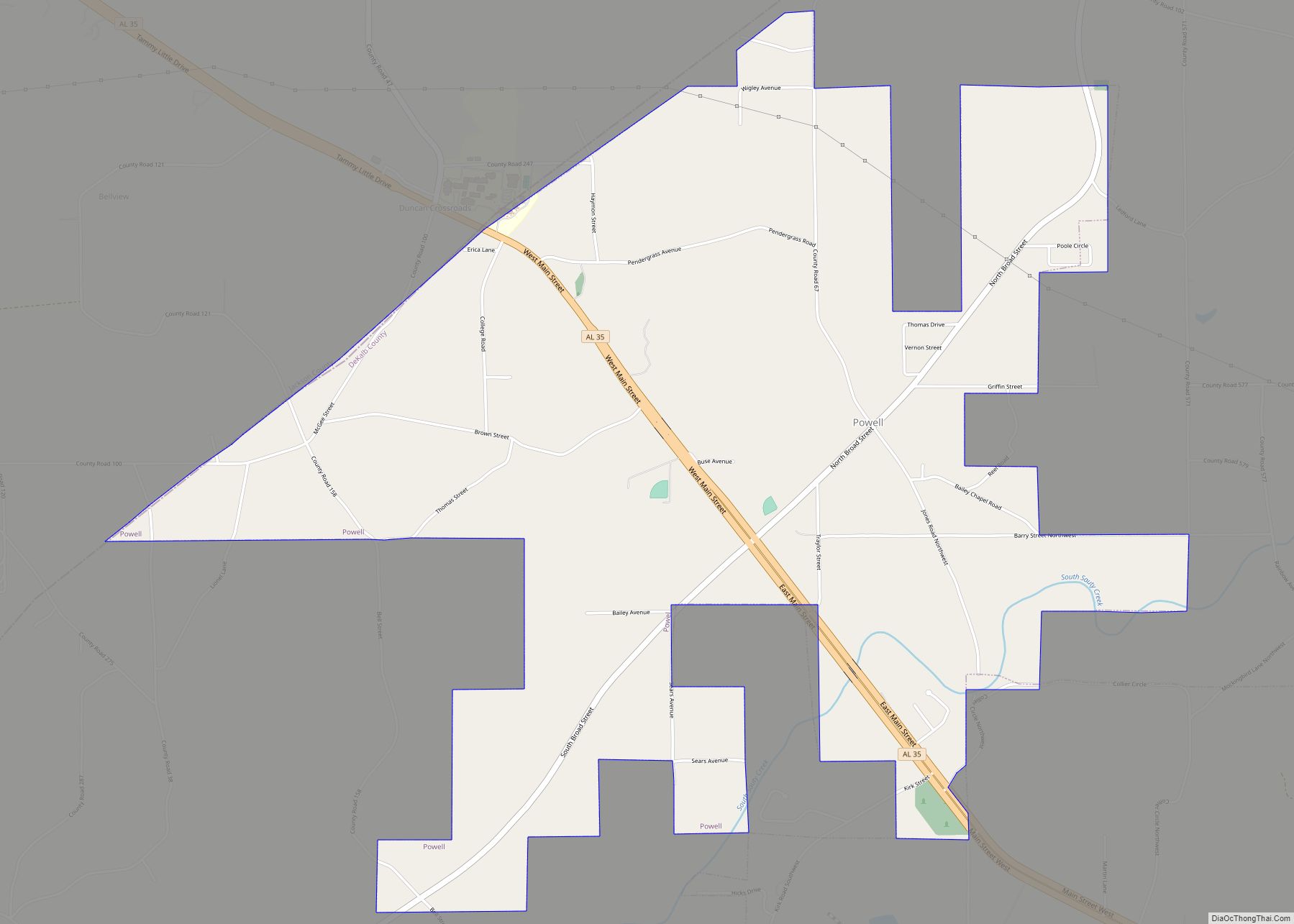
Powell is a town in DeKalb County, Alabama, United States. At the 2020 census, the population was 901. Powell is located atop Sand Mountain. Originally incorporated as Powell’s Crossroads in the 1960s, it had shortened its name to Powell by the 1990 U.S. Census. Northeast Alabama Community College is located on the northwest border of … Read more

Map of Pollard town

Map of Pollard town, Alabama

Pollard is a town in Escambia County, Alabama, United States. It was the first established county seat of Escambia County, from its creation in 1868 until 1883, when it lost that distinction to Brewton. At the 2020 census, the population was 128. Pollard town overview: Name: Pollard town LSAD Code: 43 LSAD Description: town (suffix) … Read more

Map of Point Clear CDP

Map of Point Clear CDP

Point Clear is an unincorporated census-designated place (CDP) in Baldwin County, Alabama, United States. As of the 2010 census, the population was 2,125. It is part of the Daphne-Fairhope-Foley metropolitan area. Point Clear CDP overview: Name: Point Clear CDP LSAD Code: 57 LSAD Description: CDP (suffix) State: Alabama County: Baldwin County Elevation: 10 ft (3 m) Total … Read more

Map of Prichard city

Map of Prichard city, Alabama

Prichard is a city in Mobile County, Alabama, United States. As of the 2020 census, the population of the city was 19,322, down from 22,659 at the 2010 census. It is a part of the Mobile metropolitan area. Prichard borders the north side of Mobile, as well as the Mobile suburbs of Chickasaw, Saraland, and … Read more

Map of Priceville town

Map of Priceville town

Priceville is the third largest municipality in Morgan County, Alabama, United States and is included in the Decatur Metropolitan Area, as well as the Huntsville-Decatur Combined Statistical Area. The 2020 census counted a population of 3,513, up from 2,658 in 2010. Priceville was incorporated in 1975. Priceville town overview: Name: Priceville town LSAD Code: 43 … Read more

Map of Prattville city

Map of Prattville city, Alabama

Prattville is a city located within both Autauga and Elmore counties in the State of Alabama but serves as the county seat of Autauga County. As of the 2020 census, the population of the city was 37,781. Nicknamed “The Fountain City” due to the many artesian wells in the area, Prattville is part of the … Read more

Map of Ragland town

Map of Ragland town

Ragland is a town in St. Clair County, Alabama, United States southeast of Ashville. It incorporated in 1899. At the 2010 census the population was 1,639, down from 1,918 in 2000. It is part of the Birmingham-Hoover-Cullman Combined Statistical Area. Ragland town overview: Name: Ragland town LSAD Code: 43 LSAD Description: town (suffix) State: Alabama … Read more

Map of Putnam CDP

Map of Putnam CDP, Alabama

Putnam is an unincorporated community and census-designated place (CDP) in Marengo County, Alabama, United States. As of the 2020 census, its population was 172. Putnam CDP overview: Name: Putnam CDP LSAD Code: 57 LSAD Description: CDP (suffix) State: Alabama County: Marengo County Elevation: 226 ft (69 m) Total Area: 9.48 sq mi (24.6 km²) Land Area: 9.48 sq mi (24.6 km²) Water Area: … Read more

Map of Providence city

Map of Providence town, Alabama

Providence is a town in Marengo County, Alabama, United States. As of the 2020 United States census, the population was 167, down from 223 at the 2010 census. It incorporated sometime in the 1970s. Providence town overview: Name: Providence town LSAD Code: 43 LSAD Description: town (suffix) State: Alabama County: Marengo County Elevation: 98 ft (30 m) … Read more

Map of Rainsville city

Map of Rainsville city

Rainsville is a city in DeKalb County, Alabama, United States. At the 2010 census the population was 4,948, up from 4,499 in 2000. Rainsville is located on top of Sand Mountain, a southern extension of the Cumberland Plateau. Rainsville city overview: Name: Rainsville city LSAD Code: 25 LSAD Description: city (suffix) State: Alabama County: DeKalb … Read more

Map of Rainbow City city

Map of Rainbow City, Alabama

Rainbow City is a city in Etowah County, Alabama, United States. It incorporated in 1950. The population was 9,602 at the 2010 census. It is part of the Gadsden Metropolitan Statistical Area. Rainbow City overview: Name: Rainbow City LSAD Code: 25 LSAD Description: city (suffix) State: Alabama County: Etowah County Elevation: 518 ft (158 m) Total Area: … Read more

Map of Ranburne town

Map of Ranburne town

Ranburne is a town in Cleburne County, Alabama, United States. At the 2020 census, the population was 422. Ranburne town overview: Name: Ranburne town LSAD Code: 43 LSAD Description: town (suffix) State: Alabama County: Cleburne County Elevation: 1,020 ft (311 m) Total Area: 1.59 sq mi (4.11 km²) Land Area: 1.59 sq mi (4.11 km²) Water Area: 0.00 sq mi (0.00 km²) Total Population: 422 Population … Read more