Prattville is a city located within both Autauga and Elmore counties in the State of Alabama but serves as the county seat of Autauga County. As of the 2020 census, the population of the city was 37,781. Nicknamed “The Fountain City” due to the many artesian wells in the area, Prattville is part of the Montgomery metropolitan statistical area.
| Name: | Prattville city |
|---|---|
| LSAD Code: | 25 |
| LSAD Description: | city (suffix) |
| State: | Alabama |
| County: | Autauga County, Elmore County |
| Founded: | 1839 |
| Elevation: | 328 ft (100 m) |
| Total Area: | 36.29 sq mi (94.00 km²) |
| Land Area: | 35.41 sq mi (91.71 km²) |
| Water Area: | 0.88 sq mi (2.29 km²) |
| Total Population: | 37,781 |
| Population Density: | 1,066.96/sq mi (411.96/km²) |
| ZIP code: | 36066-36068 |
| Area code: | 334 |
| FIPS code: | 0162328 |
| GNISfeature ID: | 0125246 |
| Website: | www.prattvilleal.gov |
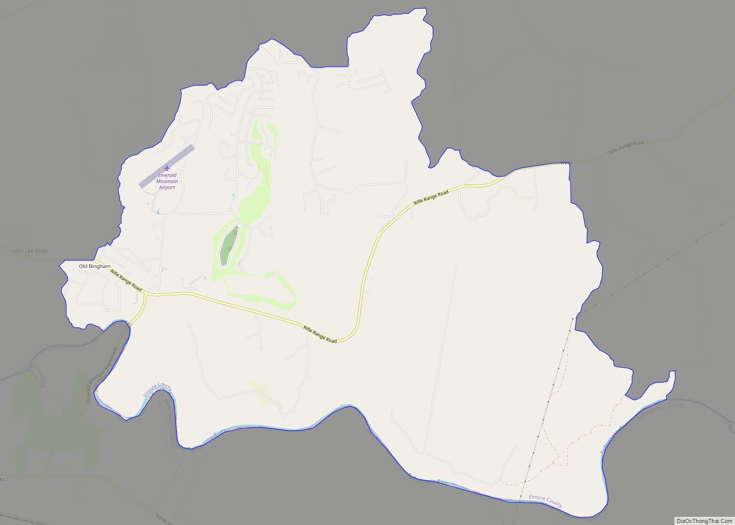
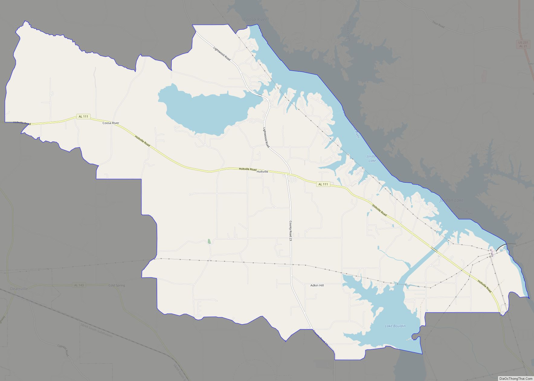
Online Interactive Map
Click on ![]() to view map in "full screen" mode.
to view map in "full screen" mode.
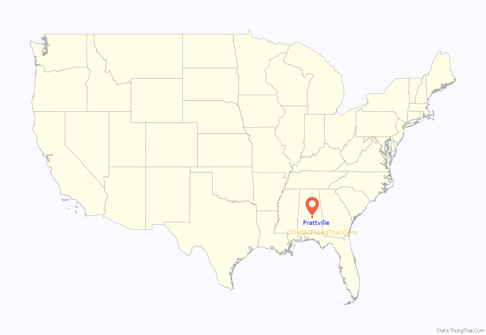
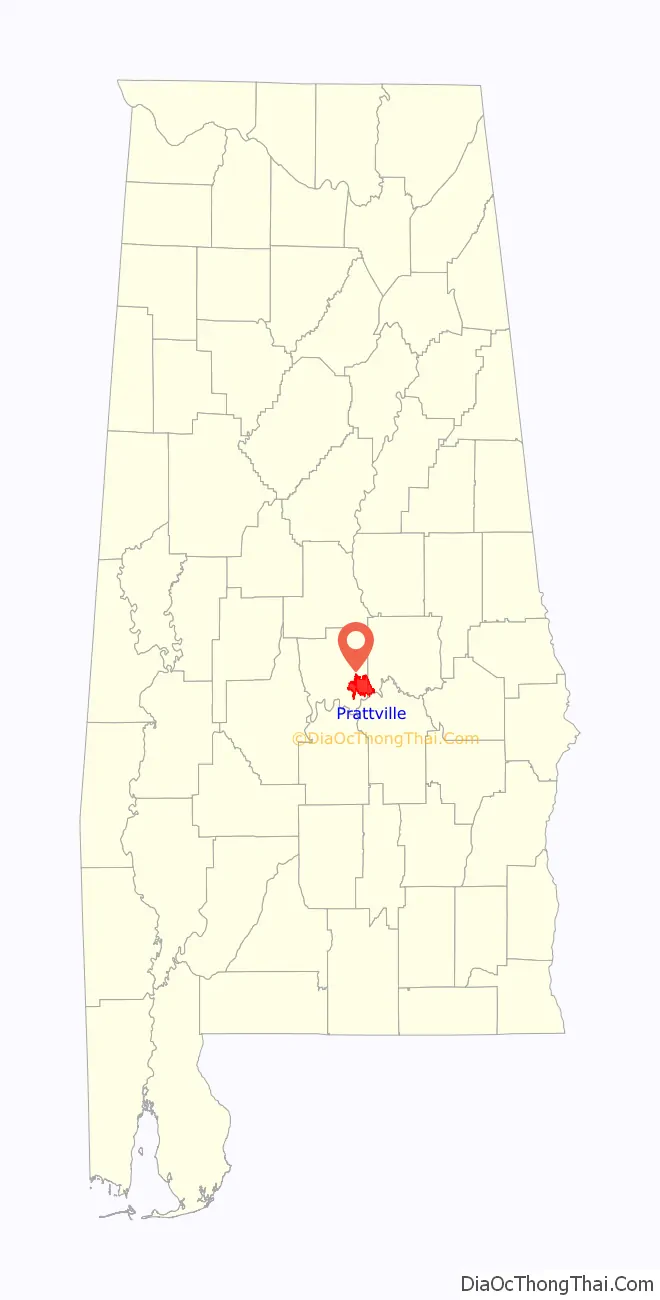
Prattville location map. Where is Prattville city?
History
Prattville was founded in 1839 by industrialist and architect Daniel Pratt. The area was largely inhabited by Native Americans and a few settlers when Pratt, a native of Temple, New Hampshire, first observed the Autauga Creek in the 1830s. He purchased approximately 1,000 acres (4.0 km) from Joseph May at $21.00 an acre, and set out to build his manufacturing facilities and the town along the banks of Autauga Creek. The location was chosen because the creek could supply power to the cotton gin manufacturing equipment. The town became an industrial center and rapidly grew. In 1868, it was named the county seat for Autauga County.
Prattville contains several sites on the National Register of Historic Places, including the Daniel Pratt Historic District, Bell House and Buena Vista.
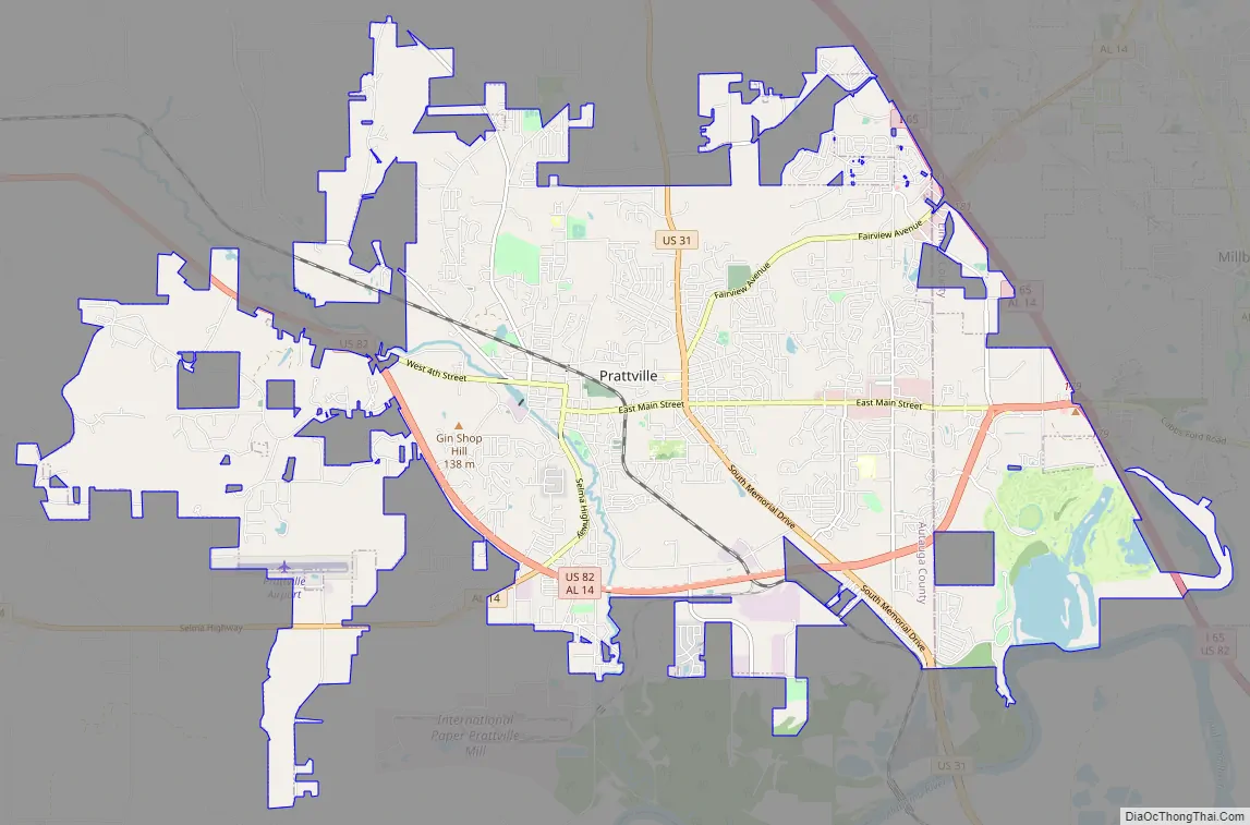
Prattville Road Map
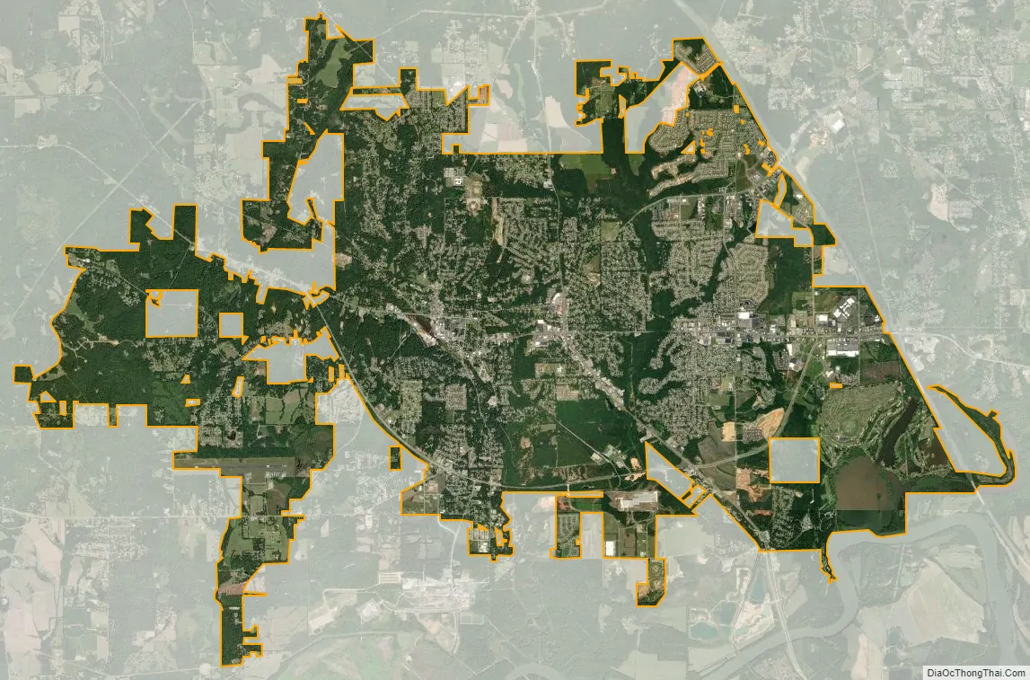
Prattville city Satellite Map
Geography
Prattville is located at Coordinates: 32°27′44″N 86°27′41″W / 32.462235°N 86.461264°W / 32.462235; -86.461264 (32.462235, -86.461264). According to the U.S. Census Bureau, the city has a total area of 33.8 square miles (88 km) of which 32.9 square miles (85 km) is land and 0.9 square miles (2.3 km) (3.09%) is water. The city is located northwest of Montgomery and along Interstate 65 and U.S. Route 82. I-65 runs north to south east of downtown, with access from exits 179 and 181, both in the Elmore County portion of the city. I-65 leads southeast 14 mi (23 km) to downtown Montgomery and north 82 mi (132 km) to Birmingham. US 82 runs south with I-65 to downtown Montgomery, and northwest 89 mi (143 km) to Tuscaloosa.
See also
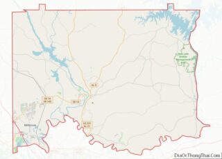
Map of Alabama State and its subdivision:- Autauga
- Baldwin
- Barbour
- Bibb
- Blount
- Bullock
- Butler
- Calhoun
- Chambers
- Cherokee
- Chilton
- Choctaw
- Clarke
- Clay
- Cleburne
- Coffee
- Colbert
- Conecuh
- Coosa
- Covington
- Crenshaw
- Cullman
- Dale
- Dallas
- De Kalb
- Elmore
- Escambia
- Etowah
- Fayette
- Franklin
- Geneva
- Greene
- Hale
- Henry
- Houston
- Jackson
- Jefferson
- Lamar
- Lauderdale
- Lawrence
- Lee
- Limestone
- Lowndes
- Macon
- Madison
- Marengo
- Marion
- Marshall
- Mobile
- Monroe
- Montgomery
- Morgan
- Perry
- Pickens
- Pike
- Randolph
- Russell
- Saint Clair
- Shelby
- Sumter
- Talladega
- Tallapoosa
- Tuscaloosa
- Walker
- Washington
- Wilcox
- Winston
- Alabama
- Alaska
- Arizona
- Arkansas
- California
- Colorado
- Connecticut
- Delaware
- District of Columbia
- Florida
- Georgia
- Hawaii
- Idaho
- Illinois
- Indiana
- Iowa
- Kansas
- Kentucky
- Louisiana
- Maine
- Maryland
- Massachusetts
- Michigan
- Minnesota
- Mississippi
- Missouri
- Montana
- Nebraska
- Nevada
- New Hampshire
- New Jersey
- New Mexico
- New York
- North Carolina
- North Dakota
- Ohio
- Oklahoma
- Oregon
- Pennsylvania
- Rhode Island
- South Carolina
- South Dakota
- Tennessee
- Texas
- Utah
- Vermont
- Virginia
- Washington
- West Virginia
- Wisconsin
- Wyoming