Priceville is the third largest municipality in Morgan County, Alabama, United States and is included in the Decatur Metropolitan Area, as well as the Huntsville-Decatur Combined Statistical Area. The 2020 census counted a population of 3,513, up from 2,658 in 2010.
Priceville was incorporated in 1975.
| Name: | Priceville town |
|---|---|
| LSAD Code: | 43 |
| LSAD Description: | town (suffix) |
| State: | Alabama |
| County: | Morgan County |
| Elevation: | 600 ft (200 m) |
| Total Area: | 5.91 sq mi (15.31 km²) |
| Land Area: | 5.88 sq mi (15.22 km²) |
| Water Area: | 0.03 sq mi (0.08 km²) |
| Total Population: | 3,513 |
| Population Density: | 597.48/sq mi (230.69/km²) |
| FIPS code: | 0162472 |
| GNISfeature ID: | 2407160 |
| Website: | townofpriceville.com |
Online Interactive Map
Click on ![]() to view map in "full screen" mode.
to view map in "full screen" mode.
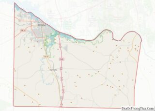
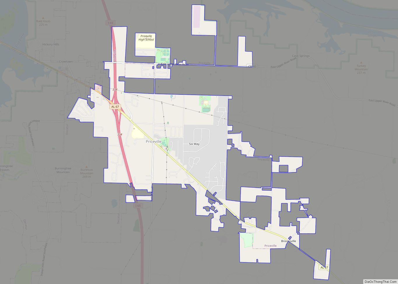
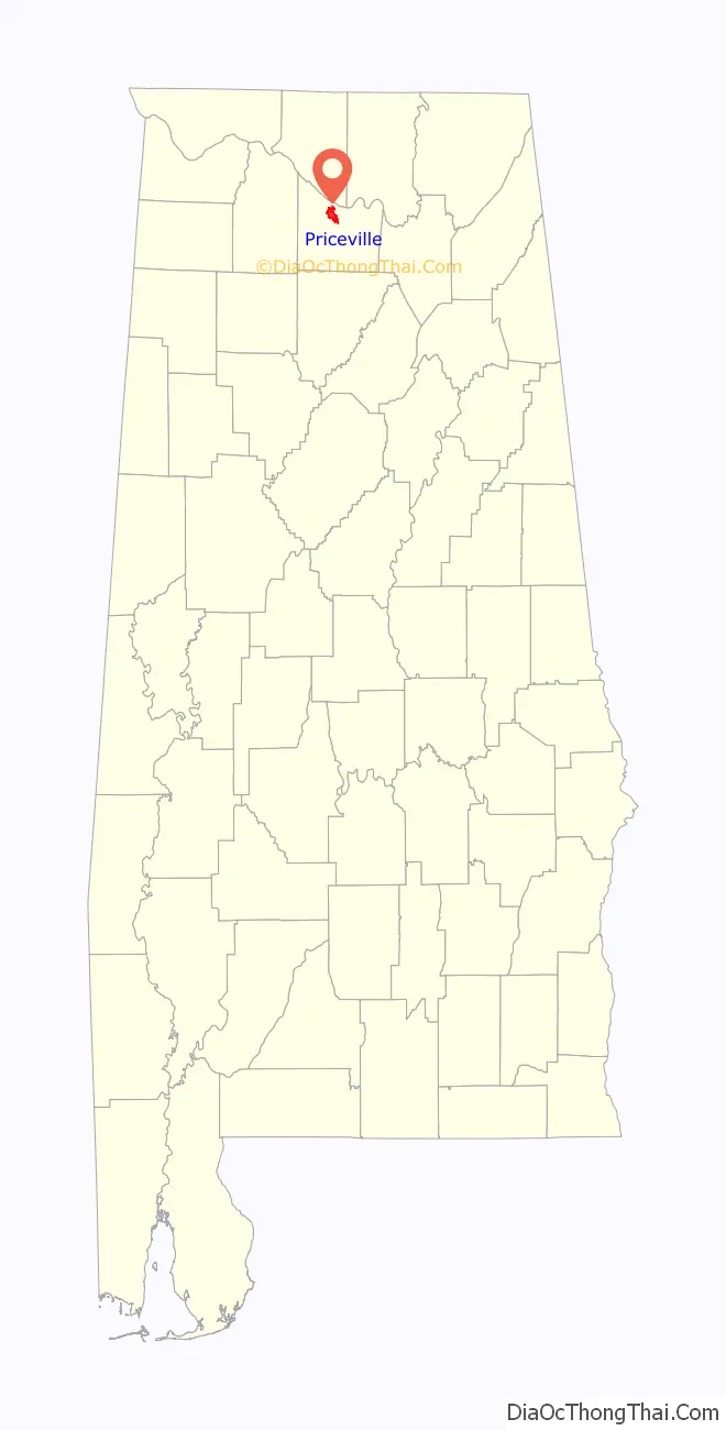
Priceville location map. Where is Priceville town?

History
Priceville was settled in the 1820s and is named for the Price family, who played prominent roles in its early history. The community remained sparsely populated until the 1950s, when the construction of Interstate 65 brought rapid economic expansion.
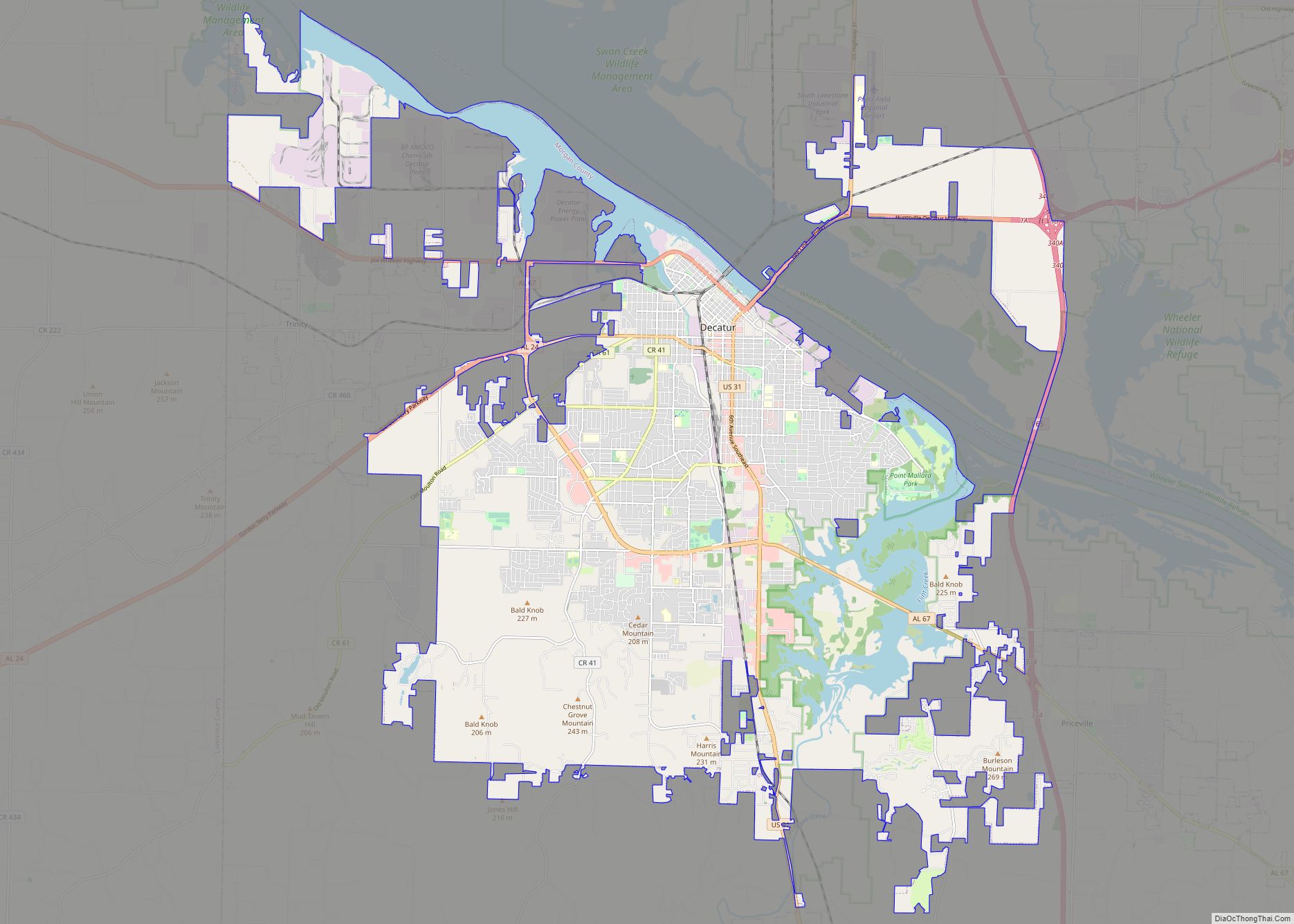
Priceville Road Map

Priceville city Satellite Map

Geography
Priceville is located in northern Morgan County at 34°31′16″N 86°52′47″W / 34.52111°N 86.87972°W / 34.52111; -86.87972 (34.521001, -86.879678). It is bordered to the west by Decatur, the county seat. State Route 67 runs through the town center, leading northwest 9 miles (14 km) to the center of Decatur and southeast 6 miles (10 km) to Somerville. Interstate 65 passes through the western portion of Priceville, connecting the town with Cullman 26 miles (42 km) to the south and Athens 19 miles (31 km) to the north. The Wheeler National Wildlife Refuge is situated between Priceville and Decatur. The Tennessee River (Wheeler Lake) passes just north of Priceville.
According to the U.S. Census Bureau, the town has a total area of 5.9 square miles (15 km), of which 0.03 square miles (0.08 km), or 0.52%, are water. Ginhouse Branch runs through the center of town, flowing north to the Tennessee River.
See also
Map of Alabama State and its subdivision:- Autauga
- Baldwin
- Barbour
- Bibb
- Blount
- Bullock
- Butler
- Calhoun
- Chambers
- Cherokee
- Chilton
- Choctaw
- Clarke
- Clay
- Cleburne
- Coffee
- Colbert
- Conecuh
- Coosa
- Covington
- Crenshaw
- Cullman
- Dale
- Dallas
- De Kalb
- Elmore
- Escambia
- Etowah
- Fayette
- Franklin
- Geneva
- Greene
- Hale
- Henry
- Houston
- Jackson
- Jefferson
- Lamar
- Lauderdale
- Lawrence
- Lee
- Limestone
- Lowndes
- Macon
- Madison
- Marengo
- Marion
- Marshall
- Mobile
- Monroe
- Montgomery
- Morgan
- Perry
- Pickens
- Pike
- Randolph
- Russell
- Saint Clair
- Shelby
- Sumter
- Talladega
- Tallapoosa
- Tuscaloosa
- Walker
- Washington
- Wilcox
- Winston
- Alabama
- Alaska
- Arizona
- Arkansas
- California
- Colorado
- Connecticut
- Delaware
- District of Columbia
- Florida
- Georgia
- Hawaii
- Idaho
- Illinois
- Indiana
- Iowa
- Kansas
- Kentucky
- Louisiana
- Maine
- Maryland
- Massachusetts
- Michigan
- Minnesota
- Mississippi
- Missouri
- Montana
- Nebraska
- Nevada
- New Hampshire
- New Jersey
- New Mexico
- New York
- North Carolina
- North Dakota
- Ohio
- Oklahoma
- Oregon
- Pennsylvania
- Rhode Island
- South Carolina
- South Dakota
- Tennessee
- Texas
- Utah
- Vermont
- Virginia
- Washington
- West Virginia
- Wisconsin
- Wyoming