Map of Wedowee town

Map of Wedowee town

Wedowee is a town in Randolph County, Alabama, United States. At the 2010 census the population was 823, up from 818 in 2000. The small town is the county seat of Randolph County. It was initially incorporated in 1836, but its charter lapsed by the late 19th century. It was reincorporated in 1901. Randolph County … Read more

Map of Webb town

Map of Webb town, Alabama

Webb is a town in Houston County, Alabama, United States. It is named for plantation owner B. F. Webb, who settled in the area around 1890. The town was incorporated in 1903. It is part of the Dothan, Alabama Metropolitan Statistical Area. As of the 2010 census, the population was 1,430, up from 1,298 in … Read more

Map of Weogufka CDP

Map of Weogufka CDP

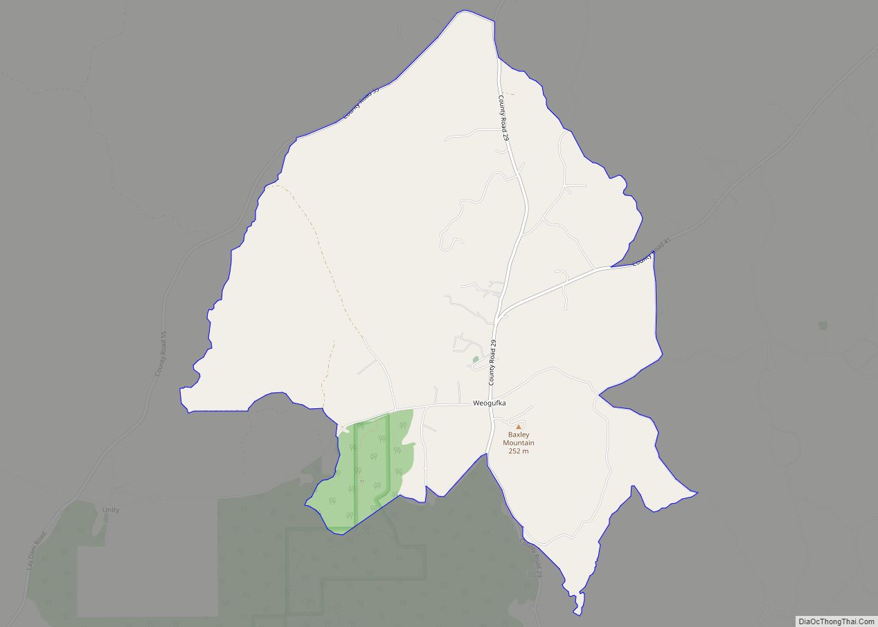
Weogufka is a census-designated place and unincorporated community in Coosa County, Alabama, United States. Its population was 207 as of the 2020 census. Weogufka CDP overview: Name: Weogufka CDP LSAD Code: 57 LSAD Description: CDP (suffix) State: Alabama County: Coosa County Elevation: 646 ft (197 m) Total Area: 5.19 sq mi (13.45 km²) Land Area: 5.13 sq mi (13.28 km²) Water Area: 0.06 sq mi … Read more

Map of West Jefferson town

Map of West Jefferson town, Alabama

West Jefferson is a town in Jefferson County, Alabama, United States. It incorporated in October 1964. At the 2010 census the population was 338, down from 344 in 2000. West Jefferson town overview: Name: West Jefferson town LSAD Code: 43 LSAD Description: town (suffix) State: Alabama County: Jefferson County Elevation: 410 ft (120 m) Total Area: 1.90 sq mi … Read more

Map of West End-Cobb Town CDP

Map of West End-Cobb Town CDP

West End-Cobb Town is a census-designated place (CDP) and unincorporated community in Calhoun County, Alabama, United States. At the 2020 census, the population was 3,128. It is included in the Anniston-Oxford Metropolitan Statistical Area. West End-Cobb Town CDP overview: Name: West End-Cobb Town CDP LSAD Code: 57 LSAD Description: CDP (suffix) State: Alabama County: Calhoun … Read more

Map of West Blocton town

Map of West Blocton town

West Blocton is a town in Bibb County, Alabama, United States. At the 2020 census, the population was 1,217. The current mayor is Daniel Sims. West Blocton town overview: Name: West Blocton town LSAD Code: 43 LSAD Description: town (suffix) State: Alabama County: Bibb County Elevation: 495 ft (151 m) Total Area: 4.82 sq mi (12.49 km²) Land Area: 4.80 sq mi … Read more

Map of Wetumpka city

Map of Wetumpka city

Wetumpka (US: /wɪˈtʌmkə/) is a city in and the county seat of Elmore County, Alabama, United States. At the 2020 census, the population was 7,220. In the early 21st century Elmore County became one of the fastest-growing counties in the state. The city is considered part of the Montgomery Metropolitan Area. Wetumpka identifies as “The … Read more

Map of Westover town

Map of Westover town, Alabama

Westover is a city in Shelby County, Alabama, United States. The city is part of the Birmingham Metropolitan Statistical Area. The city was officially incorporated on January 31, 2001 although it was established in 1901 and had a population of 961 when it was incorporated in 2001. Westover town overview: Name: Westover town LSAD Code: … Read more

Map of West Point town

Map of West Point town, Alabama

West Point is a town in Cullman County, Alabama, United States. At the 2010 census the population was 586, up from 295 in 2000. West Point was incorporated in October 1977. West Point town overview: Name: West Point town LSAD Code: 43 LSAD Description: town (suffix) State: Alabama County: Cullman County Elevation: 919 ft (280 m) Total … Read more

Map of White Plains CDP

Map of White Plains CDP, Alabama

White Plains is a census-designated place and unincorporated community in Calhoun County, Alabama, United States. Its population was 877 as of the 2020 census. The community is located in eastern Calhoun County along Alabama Highway 9. White Plains CDP overview: Name: White Plains CDP LSAD Code: 57 LSAD Description: CDP (suffix) State: Alabama County: Calhoun … Read more

Map of White Hall town

Map of White Hall town, Alabama

White Hall is a town in Lowndes County, Alabama, United States. The community was named for a plantation that was destroyed in an 1882 tornado. At the 2010 census the population was 858, down from its record high of 1,014 in 2000. It is part of the Montgomery Metropolitan Statistical Area. It was established during … Read more

Map of Whatley CDP

Map of Whatley CDP

Whatley is a census-designated place in Clarke County, Alabama, United States. As of the 2010 census, its population was 225. It is named in honor of Franklin Benjamin Whatley. It has one site on the National Register of Historic Places, the Whatley Historic District. Whatley CDP overview: Name: Whatley CDP LSAD Code: 57 LSAD Description: … Read more