Map of Wainwright city

Map of Wainwright city, Alaska

Wainwright (/ˈweɪnraɪt/; Ulġuniq in Iñupiaq), also known as Ulguniq or Kuuk, is a city in North Slope Borough, Alaska, United States. At the 2020 census the population was 628, making it the third largest city in the North Slope Borough, up from 556 in 2010. The community was named after Wainwright Lagoon, which in turn … Read more

Map of Venetie CDP

Map of Venetie CDP

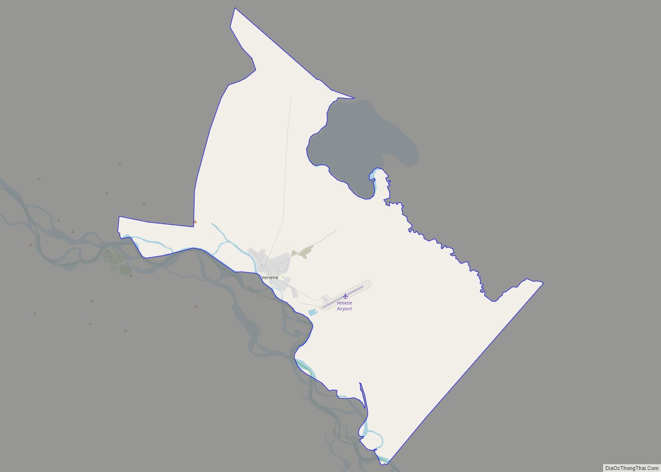
Venetie (/ˈviːnɪtaɪ/ VEEN-i-ty; Vįįhtąįį in Gwich’in), is a census-designated place (CDP) in Yukon–Koyukuk Census Area, Alaska. At the 2010 census, the population was 166, down from 202 in 2000. It includes the Village of Venetie, a Gwich’in tribal entity designated in the 1971 Alaska Native Claims Settlement Act. Venetie CDP overview: Name: Venetie CDP LSAD … Read more

Map of Valdez city

Map of Valdez city, Alaska

Valdez (/vælˈdiːz/ val-DEEZ; Alutiiq: Suacit) is a city in the Chugach Census Area in the U.S. state of Alaska. According to the 2020 US Census, the population of the city is 3,985, up from 3,976 in 2010. It is the third most populated city in Alaska’s Unorganized Borough. The city was named in 1790 after … Read more

Map of Wales city

Map of Wales city, Alaska

Wales (Inupiaq: Kiŋigin, IPA: [kiŋiɣin]; Russian: У́эйлс, romanized: Weyls) is a city in the Nome Census Area, Alaska, United States. At the 2010 census the population was 145, down from 152 in 2000. It is the westernmost city on the North American mainland, although Adak, located on Adak Island, is the westernmost city in Alaska. Wales Airport … Read more

Map of White Mountain city

Map of White Mountain city

White Mountain (Inupiaq: Nasirvik, Nachirvik, or Nachizrvik) is a city in Nome Census Area, Alaska, United States. The population was 190 at the 2010 census, down from 203 in 2000. The city is an Iġaluŋmiut (Fish River tribe) Inupiat village, with historical influences from and relationships with Qawiaraq (Mary’s Igloo Inupiat and Golovin and Elim … Read more

Map of Whale Pass city

Map of Whale Pass city

Whale Pass is a second class city in Prince of Wales-Hyder Census Area, Alaska, United States. The population was 31 at the 2010 census, down from 58 in 2000. Whale Pass city overview: Name: Whale Pass city LSAD Code: 25 LSAD Description: city (suffix) State: Alaska County: Prince of Wales-Hyder Census Area Elevation: 128 ft (39 m) … Read more

Map of Whittier city

Map of Whittier city, Alaska

Whittier is a city at the head of the Passage Canal in the U.S. state of Alaska, about 58 miles (93 km) southeast of Anchorage. The city is within the Chugach Census Area, one of the two entities established in 2019 when the former Valdez–Cordova Census Area was dissolved. It is also a port for the … Read more

Map of Whitestone CDP

Map of Whitestone CDP

Whitestone is an unincorporated community and census-designated place in Southeast Fairbanks Census Area, Alaska, United States. Its population was 71 as of the 2020 census. This is not to be confused with Whitestone Logging Camp CDP in the Alaskan panhandle. Whitestone CDP overview: Name: Whitestone CDP LSAD Code: 57 LSAD Description: CDP (suffix) State: Alaska … Read more

Map of Whitestone Logging Camp CDP

Map of Whitestone Logging Camp CDP

Whitestone Logging Camp (Lingít: Yan Kashada Tináa) is a census-designated place (CDP) on Chichagof Island in Hoonah-Angoon Census Area, Alaska, United States. In 2010, the population was 17, down from 116 in 2000. It is not to be confused with Whitestone, another CDP in Southeast Fairbanks Census Area. Whitestone Logging Camp CDP overview: Name: Whitestone … Read more

Map of Wiseman CDP

Map of Wiseman CDP

Wiseman is a census-designated place (CDP) in Yukon-Koyukuk Census Area, Alaska, United States. The full time resident population is 12 as of 2022. Wiseman is a small mining community along the Middle Fork Koyukuk River in the Brooks Range. It was founded by gold miners who abandoned the Slate Creek (later Coldfoot) settlement around 1908. … Read more

Map of Willow CDP

Map of Willow CDP, Alaska

Willow is a census-designated place (CDP) in the Matanuska-Susitna Borough in the U.S. state of Alaska. Located 26 miles northwest from Wasilla along the George Parks Highway, it is part of the Anchorage, Alaska Metropolitan Statistical Area. At the 2020 census the population was 2,196, up from 2,102 in 2010. Willow CDP overview: Name: Willow … Read more

Map of Willow Creek CDP

Map of Willow Creek CDP, Alaska

Willow Creek is a census-designated place (CDP) in Copper River Census Area, Alaska, United States. At the 2020 census the population was 190, down from 191 in 2010. Willow Creek CDP overview: Name: Willow Creek CDP LSAD Code: 57 LSAD Description: CDP (suffix) State: Alaska County: Valdez-Cordova Census Area Total Area: 37.91 sq mi (98.18 km²) Land Area: … Read more