Map of Marie town

Map of Marie town

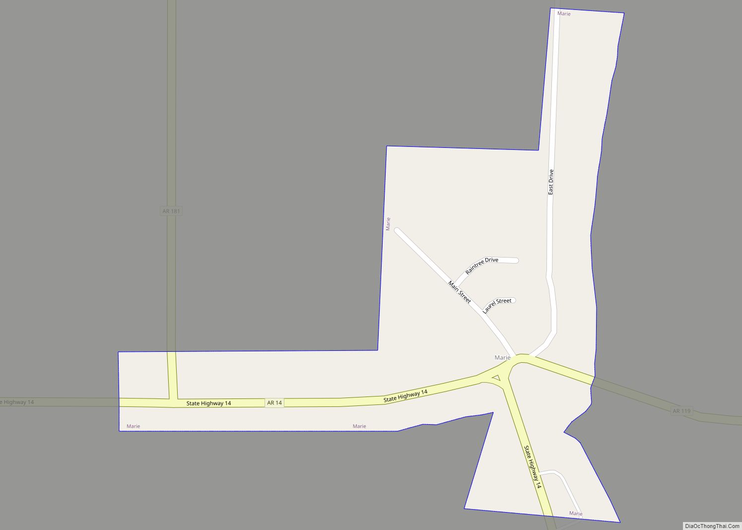
Marie is a town in Mississippi County, Arkansas, United States. It was founded by the R.E.L. Wilson cotton company. The population was 108 at the 2020 census. Marie town overview: Name: Marie town LSAD Code: 43 LSAD Description: town (suffix) State: Arkansas County: Mississippi County Elevation: 236 ft (72 m) Total Area: 0.15 sq mi (0.38 km²) Land Area: 0.15 sq mi … Read more

Map of Marianna city

Map of Marianna city, Arkansas

Marianna is a town in and the county seat of Lee County, Arkansas, United States. As of the 2010 census it had a population of 4,115, but by 2018 the population had dropped to an estimated 3,477. Located along the L’Anguille River in the Arkansas Delta just north of the St. Francis National Forest, the … Read more

Map of Marshall city, Arkansas

Map of Marshall city, Arkansas

Marshall is the largest city in and county seat of Searcy County. It is located in the Ozarks at the foot of the Boston Mountain Range 10.5 mi (16.9 km) south of America’s first National River, the Buffalo National River. Marshall serves as a hub for area tourism including camping, floating, hiking, bicycling and Dark Sky viewing. … Read more

Map of Marmaduke city

Map of Marmaduke city

Marmaduke is a city in Greene County, Arkansas, United States. The population was 1,212 in 2020. Marmaduke city overview: Name: Marmaduke city LSAD Code: 25 LSAD Description: city (suffix) State: Arkansas County: Greene County Elevation: 272 ft (83 m) Total Area: 1.40 sq mi (3.62 km²) Land Area: 1.40 sq mi (3.62 km²) Water Area: 0.00 sq mi (0.00 km²) Total Population: 1,212 Population Density: 866.95/sq mi … Read more

Map of Marked Tree city

Map of Marked Tree city

Marked Tree is a city in Poinsett County, Arkansas, United States, along the St. Francis River, at the mouth of the Little River. The population was 2,566 at the 2010 census. It is included in the Jonesboro, Arkansas, metropolitan statistical area. Geologically, the area marks the southern end of the New Madrid Fault. Marked Tree … Read more

Map of Marvell city

Map of Marvell city

Marvell is a city in Phillips County, Arkansas, United States. As of the 2010 census, the city population was 1,186. Marvell city overview: Name: Marvell city LSAD Code: 25 LSAD Description: city (suffix) State: Arkansas County: Phillips County Elevation: 210 ft (60 m) Total Area: 1.44 sq mi (3.72 km²) Land Area: 1.44 sq mi (3.72 km²) Water Area: 0.00 sq mi (0.00 km²) Total Population: … Read more

Map of Mayflower city

Map of Mayflower city

Mayflower is a city in Faulkner County, Arkansas, United States. The population was 2,234 at the 2010 census, up from 1,631 at the 2000 census. Mayflower city overview: Name: Mayflower city LSAD Code: 25 LSAD Description: city (suffix) State: Arkansas County: Faulkner County Elevation: 282 ft (86 m) Total Area: 4.05 sq mi (10.50 km²) Land Area: 3.94 sq mi (10.20 km²) Water … Read more

Map of Maumelle city

Map of Maumelle city

Maumelle is a city in Pulaski County, Arkansas, United States. As of the 2020 census, the city’s population was 19,251. The city is located northwest of Little Rock, bordering the opposite shore of the Arkansas River and is part of the Little Rock metropolitan area. Maumelle city overview: Name: Maumelle city LSAD Code: 25 LSAD … Read more

Map of McAlmont CDP

Map of McAlmont CDP

McAlmont, also referred to as “Mac Side”, is a census-designated place (CDP) in Pulaski County, Arkansas, United States. The population was 1,873 at the 2010 census. The community adjoins eastern North Little Rock, and is part of the Little Rock–North Little Rock–Conway Metropolitan Statistical Area. McAlmont CDP overview: Name: McAlmont CDP LSAD Code: 57 LSAD … Read more

Map of Maysville CDP

Map of Maysville CDP, Arkansas

Maysville is an unincorporated community and census-designated place (CDP) in Benton County, Arkansas, United States. It is the westernmost settlement in the state of Arkansas. Per the 2020 census, the population was 117. It is located in the Northwest Arkansas region. Maysville CDP overview: Name: Maysville CDP LSAD Code: 57 LSAD Description: CDP (suffix) State: … Read more

Map of Maynard town

Map of Maynard town, Arkansas

Maynard is a town in Randolph County, Arkansas, United States. The population was 379 at the 2020 census. Maynard is home to the Maynard Pioneer Museum and Park. A jail built in 1936 has a door made of wagon wheel rims. The last time it was used was in 1988, when it temporarily housed a … Read more

Map of McDougal town

Map of McDougal town

McDougal is a city in Clay County, Arkansas, United States. The population was 186 at the 2010 census. McDougal town overview: Name: McDougal town LSAD Code: 43 LSAD Description: town (suffix) State: Arkansas County: Clay County Elevation: 302 ft (92 m) Total Area: 0.37 sq mi (0.96 km²) Land Area: 0.37 sq mi (0.96 km²) Water Area: 0.00 sq mi (0.00 km²) Total Population: 134 Population … Read more