Maynard is a town in Randolph County, Arkansas, United States. The population was 379 at the 2020 census.
Maynard is home to the Maynard Pioneer Museum and Park. A jail built in 1936 has a door made of wagon wheel rims. The last time it was used was in 1988, when it temporarily housed a man charged with public intoxication. The jail is beside Maynard Community Center.
| Name: | Maynard town |
|---|---|
| LSAD Code: | 43 |
| LSAD Description: | town (suffix) |
| State: | Arkansas |
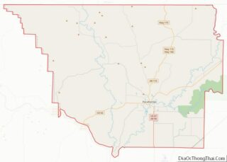
| County: | Randolph County |
| Elevation: | 433 ft (132 m) |
| Total Area: | 1.17 sq mi (3.03 km²) |
| Land Area: | 1.17 sq mi (3.03 km²) |
| Water Area: | 0.00 sq mi (0.00 km²) |
| Total Population: | 379 |
| Population Density: | 323.65/sq mi (124.97/km²) |
| ZIP code: | 72444 |
| Area code: | 870 |
| FIPS code: | 0544780 |
| GNISfeature ID: | 2406114 |
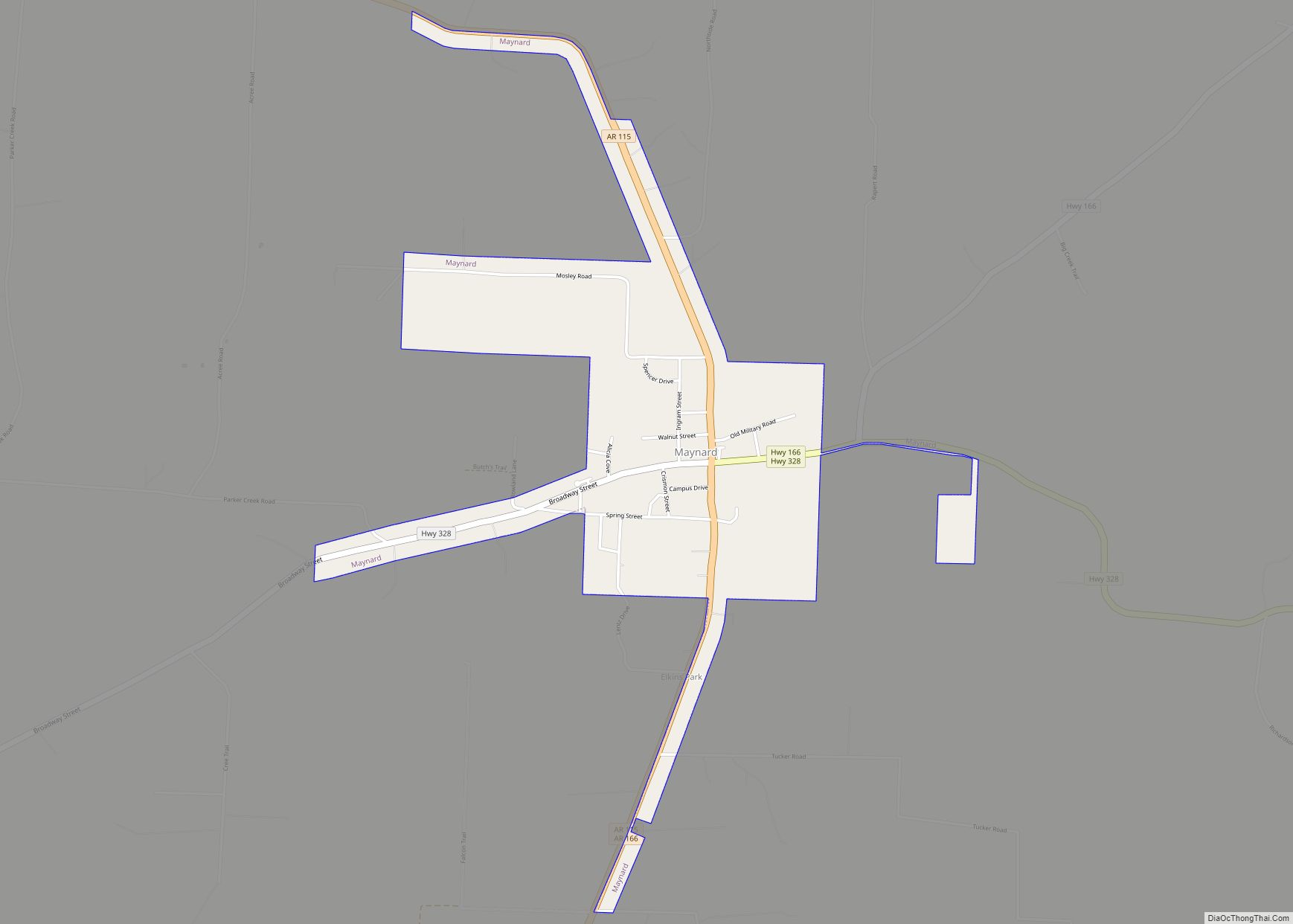
Online Interactive Map
Click on ![]() to view map in "full screen" mode.
to view map in "full screen" mode.
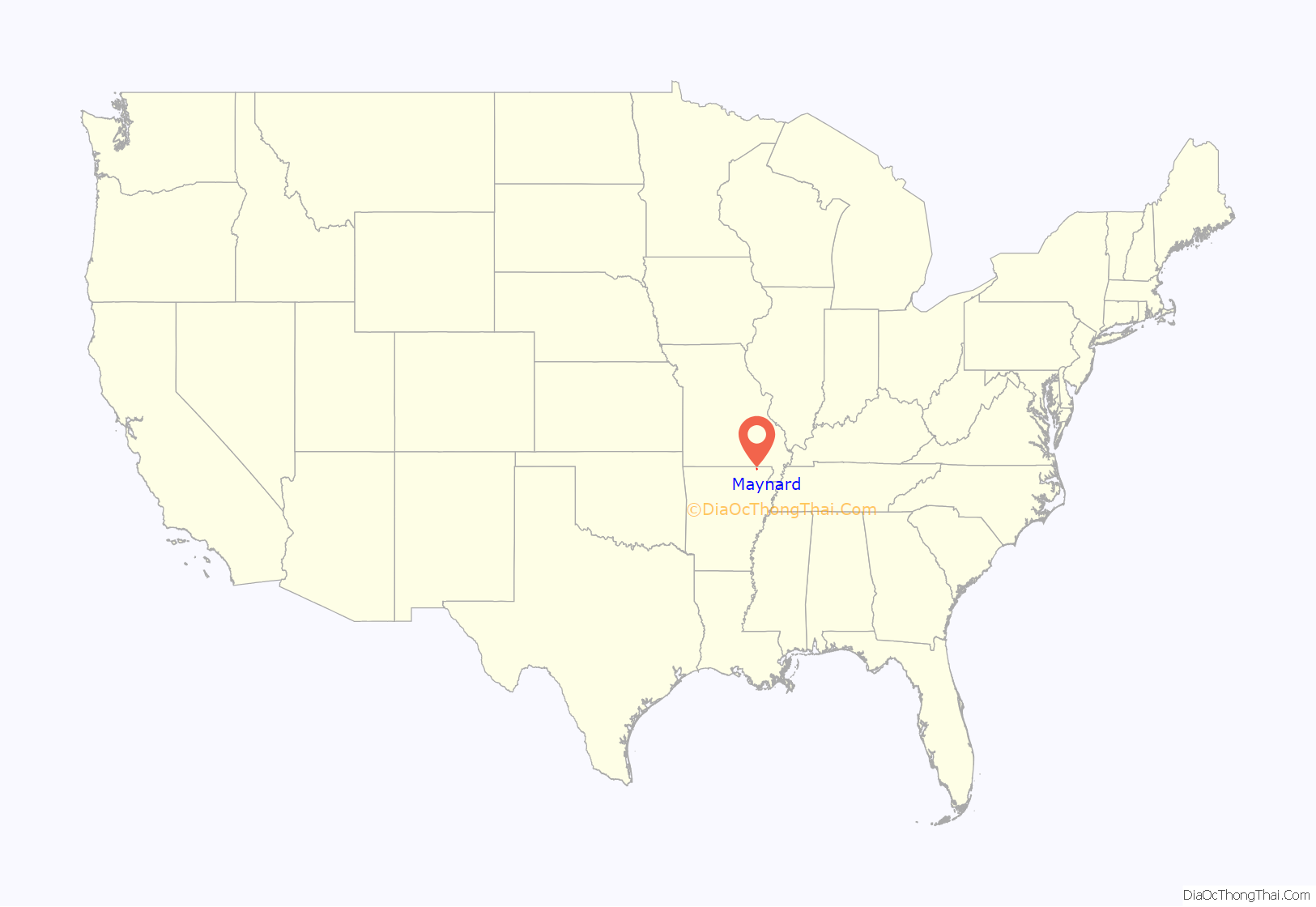
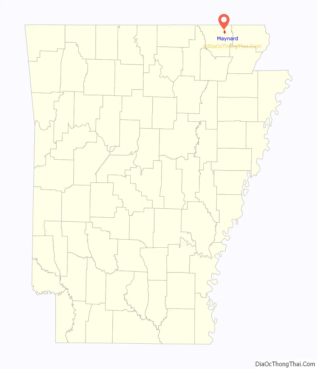
Maynard location map. Where is Maynard town?
History
Maynard was settled in the late 19th century. John Maynard, formerly a captain in the Confederate Army, spent some time in Texas before moving to Arkansas in 1872, where he opened a dry goods store, and farmed 900 acres, mostly cotton. Other families and businessmen joined him in the village they called New Prospect. When they applied for a post office in 1885 that name was rejected and the office was named ‘Maynard.’ The town incorporated as Maynard in 1895.
Abbott Institute — later known as Maynard Baptist Academy and Ouachita Baptist Academy — was a boarding school established in 1894. Abbott Institute joined a school network associated with a college now known as Ouachita Baptist University in Arkadelphia.
In 1928, Maynard Baptist Academy was sold to the Maynard School District. Its facilities were then used by the public school. All that remains of the academy today is an arch built by Maynard Baptist Academy’s class of 1927, its last class. In 2008, Maynard School Alumni Association restored the arch on the school grounds as a memorial to the academy.
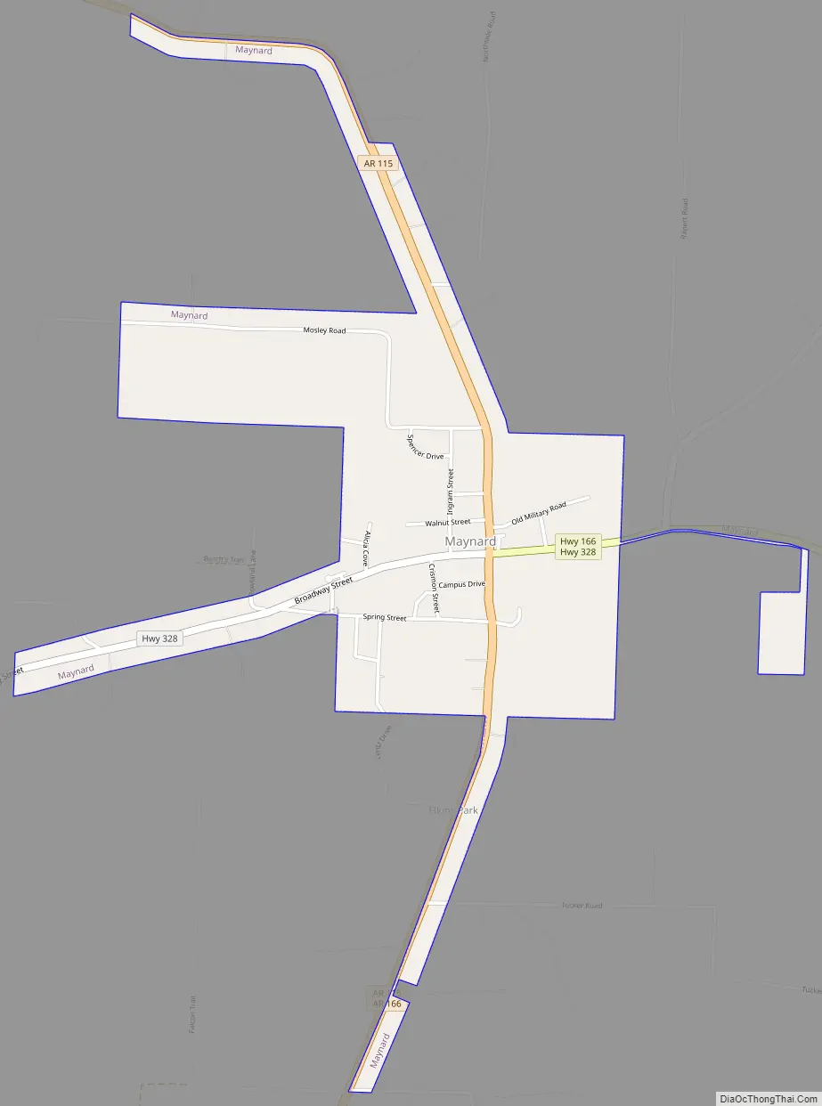
Maynard Road Map
Maynard city Satellite Map

Geography
According to the United States Census Bureau, the town has a total area of 2.9 km (1.1 mi), all land.
List of highways
- Highway 115
- Highway 166
- Highway 328
See also
Map of Arkansas State and its subdivision:- Arkansas
- Ashley
- Baxter
- Benton
- Boone
- Bradley
- Calhoun
- Carroll
- Chicot
- Clark
- Clay
- Cleburne
- Cleveland
- Columbia
- Conway
- Craighead
- Crawford
- Crittenden
- Cross
- Dallas
- Desha
- Drew
- Faulkner
- Franklin
- Fulton
- Garland
- Grant
- Greene
- Hempstead
- Hot Spring
- Howard
- Independence
- Izard
- Jackson
- Jefferson
- Johnson
- Lafayette
- Lawrence
- Lee
- Lincoln
- Little River
- Logan
- Lonoke
- Madison
- Marion
- Miller
- Mississippi
- Monroe
- Montgomery
- Nevada
- Newton
- Ouachita
- Perry
- Phillips
- Pike
- Poinsett
- Polk
- Pope
- Prairie
- Pulaski
- Randolph
- Saint Francis
- Saline
- Scott
- Searcy
- Sebastian
- Sevier
- Sharp
- Stone
- Union
- Van Buren
- Washington
- White
- Woodruff
- Yell
- Alabama
- Alaska
- Arizona
- Arkansas
- California
- Colorado
- Connecticut
- Delaware
- District of Columbia
- Florida
- Georgia
- Hawaii
- Idaho
- Illinois
- Indiana
- Iowa
- Kansas
- Kentucky
- Louisiana
- Maine
- Maryland
- Massachusetts
- Michigan
- Minnesota
- Mississippi
- Missouri
- Montana
- Nebraska
- Nevada
- New Hampshire
- New Jersey
- New Mexico
- New York
- North Carolina
- North Dakota
- Ohio
- Oklahoma
- Oregon
- Pennsylvania
- Rhode Island
- South Carolina
- South Dakota
- Tennessee
- Texas
- Utah
- Vermont
- Virginia
- Washington
- West Virginia
- Wisconsin
- Wyoming