Marshall is the largest city in and county seat of Searcy County. It is located in the Ozarks at the foot of the Boston Mountain Range 10.5 mi (16.9 km) south of America’s first National River, the Buffalo National River. Marshall serves as a hub for area tourism including camping, floating, hiking, bicycling and Dark Sky viewing.
| Name: | Marshall city |
|---|---|
| LSAD Code: | 25 |
| LSAD Description: | city (suffix) |
| State: | Arkansas |
| County: | Searcy County |
| Elevation: | 915 ft (279 m) |
| Total Area: | 4.08 sq mi (10.58 km²) |
| Land Area: | 4.07 sq mi (10.55 km²) |
| Water Area: | 0.01 sq mi (0.03 km²) |
| Total Population: | 1,329 |
| Population Density: | 326.30/sq mi (125.98/km²) |
| ZIP code: | 72650 |
| Area code: | 870 |
| FIPS code: | 0544300 |
| GNISfeature ID: | 2405029 |
| Website: | marshallar.net |
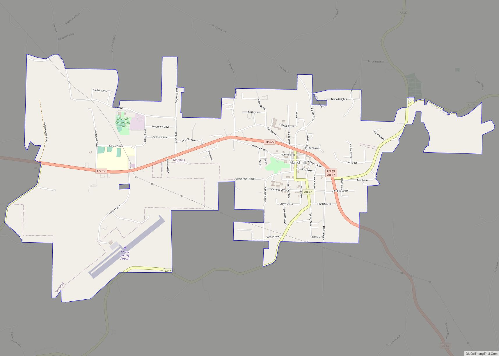
Online Interactive Map
Click on ![]() to view map in "full screen" mode.
to view map in "full screen" mode.
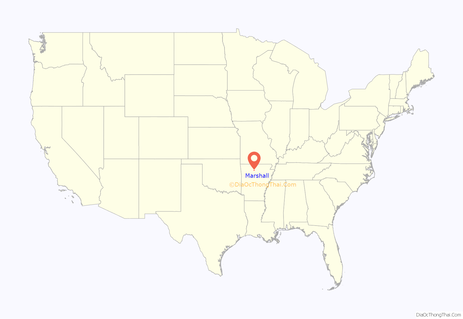
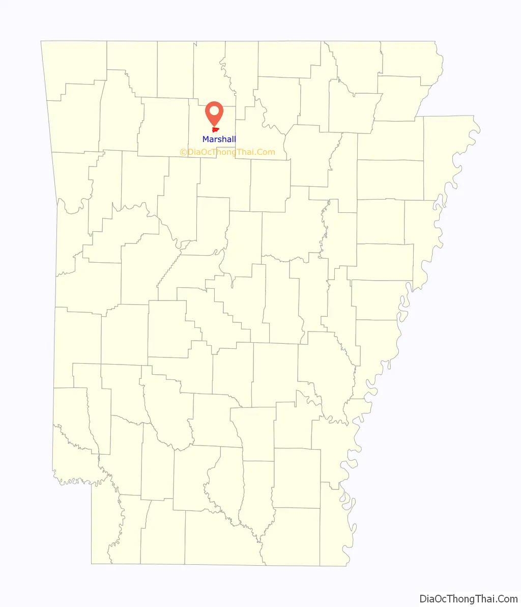
Marshall location map. Where is Marshall city?
History
Early history
The Paleo Indians, were the earliest known human inhabitants of the area. They marked their stay by leaving behind their unique Clovis spear points in caves and fields. Later, they became more advanced in creating shelters, clothing, and hunting weapons. In 1968 Don Dickson discovered lighter “heat treated” flint points at Calf Creek near Snowball. As a result of this first discovery all similar type projectiles are called Calf Creek Points.
A year after the Louisiana Purchase, Congress began efforts to remove all tribes west of the Mississippi. By 1810, at the urging of the Secretary of War, large groups of Cherokees voluntarily moved to Arkansas and immediately found themselves fighting with the Osage who claimed this area as their hunting grounds. The 1817 Treaty of the Cherokee Agency created a designated area in Northwest Arkansas and it became the first Cherokee Reservation west of the Mississippi. To help with the conflict with the Osage the Cherokees invited the Shawnee to settle in the area of the Buffalo River.
A Shawnee Village was established southwest of Marshall and was most likely Chief Peter Cornstalk’s village. (He was the Grandson, and name sake, of the great Chief of the Shawnee Nation during the American Revolutionary War.) In the 1830s Chief Cornstalk married Mary Adams, grand daughter of Robert Adams, a business partner of Indian Agent, Pierre Menard. Mary’s family was one of the first white settlers in the area.
By the 1840s, all tribes were removed to Indian Territory.
The first settlement here was at this location on a bench at the foot of the Devils Backbone Mountain at Raccoon Springs. In 1856, the county seat was moved from Lebanon to this site, and it was named Burrowville (sometimes spelled Burrowsville) after Napoleon Bonaparte Burrow, a Crawford County planter and politician.
Civil War
The Civil War was a significant transitional event for Marshall. It changed the name of the town, retarded its growth for years, and established a vibrant two-party political system in what was for many years a one-party state. It also caused desolation—much of Burrowville/Marshall was burned, including the courthouse and county records. On November 17, 1861, the Arkansas Confederate authorities discovered a secret pro-Union Peace Society in north-central Arkansas and tried to arrest all members. The captured Peace Society members were guarded in the courthouse. On December 9, 1861, seventy-seven prisoners were sent to Little Rock where they were encouraged to join the Confederate army. After the war, the political situation was still so volatile that U.S. troops were stationed in Burrowville for a few months to keep peace. County Unionists pushed to change the town’s name to Marshall after U.S. Chief Justice John Marshall, and the legislature approved the change on March 18, 1867.
Early 1900s
The discovery of lead and zinc ore in north central Arkansas along with the arrival of the Missouri and North Arkansas Railroad brought a brief boom period time to Marshall. During the early 1900s with the help of mining and timber Marshall grew and prospered. After World War I, a complex series of events combined to undermine the previous decades growth. By the 1929 stock market crash the region was experiencing severe economic hardships.
Post World War II
Following World War II Marshall was the primary trade center for service and retail for most of Searcy County serving as the hub for the timber, cattle, and other agricultural industries. In the 1950s strawberries became a major product for the area. During this time Marshall proclaimed itself as the “Strawberry Capital of the World”.
By the late 1960s the commercial strawberry industry was moving to California and Texas, general retail was being captured by national companies like Wal-Mart, and improved highway systems allowed people to travel to larger towns for all goods and services. These factors combined with others caused the beginning of a fundamental change in the Marshall economy.
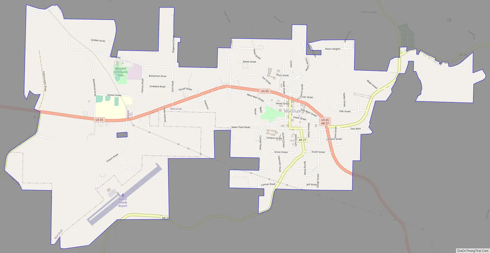
Marshall Road Map
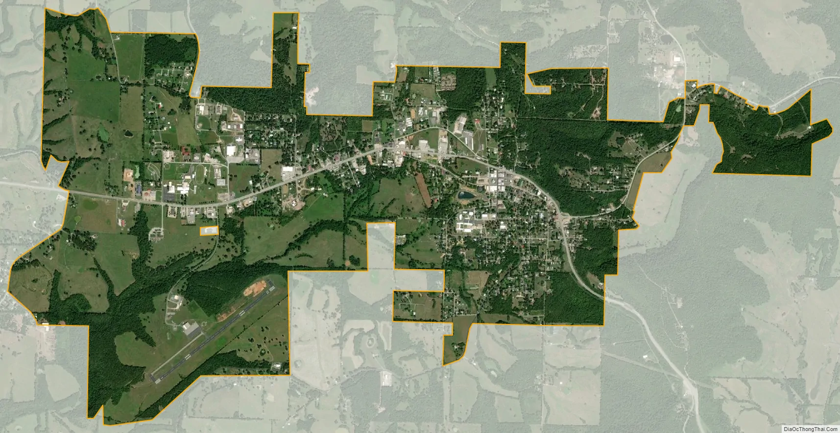
Marshall city Satellite Map
Geography
Marshall is located at 35°54′36″N 92°38′11″W / 35.909950°N 92.636370°W / 35.909950; -92.636370 situated in the Ozarks at the base of the northern escarpment of the rugged Boston Mountains.
According to the United States Census Bureau, the city has a total area of 2.6 square miles (6.7 km), all land.
Climate
The climate in this area is characterized by hot, humid summers and generally mild to cool winters. According to the Köppen Climate Classification system, Marshall has a humid subtropical climate, abbreviated “Cfa” on climate maps.
See also
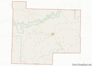
Map of Arkansas State and its subdivision:- Arkansas
- Ashley
- Baxter
- Benton
- Boone
- Bradley
- Calhoun
- Carroll
- Chicot
- Clark
- Clay
- Cleburne
- Cleveland
- Columbia
- Conway
- Craighead
- Crawford
- Crittenden
- Cross
- Dallas
- Desha
- Drew
- Faulkner
- Franklin
- Fulton
- Garland
- Grant
- Greene
- Hempstead
- Hot Spring
- Howard
- Independence
- Izard
- Jackson
- Jefferson
- Johnson
- Lafayette
- Lawrence
- Lee
- Lincoln
- Little River
- Logan
- Lonoke
- Madison
- Marion
- Miller
- Mississippi
- Monroe
- Montgomery
- Nevada
- Newton
- Ouachita
- Perry
- Phillips
- Pike
- Poinsett
- Polk
- Pope
- Prairie
- Pulaski
- Randolph
- Saint Francis
- Saline
- Scott
- Searcy
- Sebastian
- Sevier
- Sharp
- Stone
- Union
- Van Buren
- Washington
- White
- Woodruff
- Yell
- Alabama
- Alaska
- Arizona
- Arkansas
- California
- Colorado
- Connecticut
- Delaware
- District of Columbia
- Florida
- Georgia
- Hawaii
- Idaho
- Illinois
- Indiana
- Iowa
- Kansas
- Kentucky
- Louisiana
- Maine
- Maryland
- Massachusetts
- Michigan
- Minnesota
- Mississippi
- Missouri
- Montana
- Nebraska
- Nevada
- New Hampshire
- New Jersey
- New Mexico
- New York
- North Carolina
- North Dakota
- Ohio
- Oklahoma
- Oregon
- Pennsylvania
- Rhode Island
- South Carolina
- South Dakota
- Tennessee
- Texas
- Utah
- Vermont
- Virginia
- Washington
- West Virginia
- Wisconsin
- Wyoming