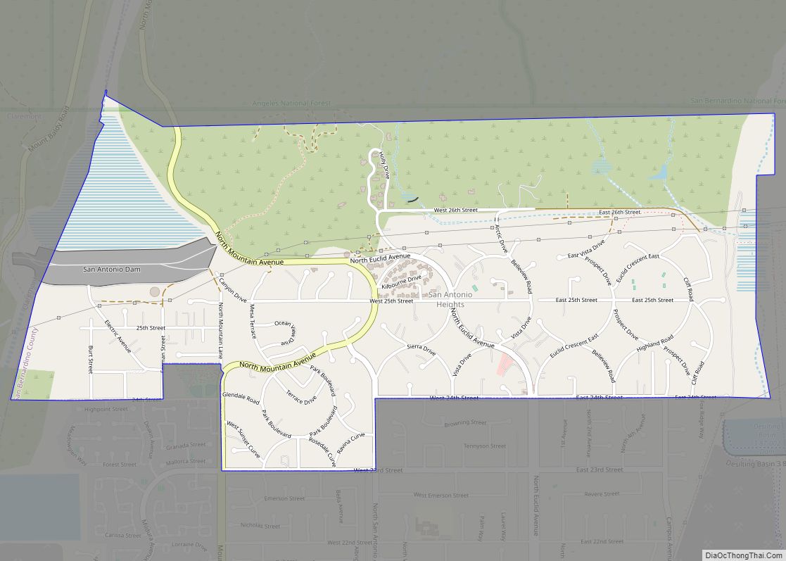
Map of San Diego Country Estates CDP

Map of San Diego Country Estates CDP

San Diego Country Estates, commonly referred to as the Estates, is a valley resort populace composed of several neighborhoods associated with the unincorporated community of Ramona, California. The Estates are a census-designated place in North County, a region of the San Diego metropolitan area. The Estates is just east of the North County city of … Read more

Map of San Clemente city

Map of San Clemente city

San Clemente (/ˌsæn kləˈmɛnti/; Spanish for “St. Clement”) is a city in Orange County, California. Located in the Orange Coast region of the South Coast of California, San Clemente’s population was 64,293 in at the 2020 census. Situated roughly midway between Los Angeles and San Diego, San Clemente is a popular tourist destination in Southern … Read more

Map of San Carlos city, California

Map of San Carlos city, California

San Carlos (Spanish for “St. Charles”) is a city in San Mateo County, California, United States. The population is 30,722 per the 2020 census. San Carlos city overview: Name: San Carlos city LSAD Code: 25 LSAD Description: city (suffix) State: California County: San Mateo County Incorporated: July 8, 1925 Elevation: 33 ft (10 m) Total Area: 5.41 sq mi … Read more

Map of San Dimas city

Map of San Dimas city

San Dimas (Spanish for “Saint Dismas”) is a city in the San Gabriel Valley of Los Angeles County, California, United States. At the 2020 census, its population was 34,924. It historically took its name from San Dimas Canyon in the San Gabriel Mountains above the northern section of present-day San Dimas. San Dimas is bordered … Read more

Map of San Gabriel city

Map of San Gabriel city

San Gabriel (Spanish for “St. Gabriel”) is a city located in the San Gabriel Valley of Los Angeles County, California. At the 2010 census, the population was 39,718. San Gabriel was founded by the Spanish in 1771, when Mission San Gabriel Arcángel was established by Saint Junípero Serra. Through the Spanish and Mexican periods, San … Read more

Map of San Fernando city

Map of San Fernando city, California

San Fernando (Spanish for “St. Ferdinand”) is a general-law city in the San Fernando Valley region of Los Angeles County, California, in the Los Angeles metropolitan area. It is bordered on all sides by the City of Los Angeles. As of the 2010 census the population of San Fernando was 23,645. San Fernando city overview: … Read more

Map of San Joaquin city

Map of San Joaquin city

San Joaquin (Spanish: San Joaquín, meaning “St. Joachim”) is a city in Fresno County, California, United States. The population was 4,001 at the 2010 census, up from 3,270 at the 2000 census. The nearest high school in the area is Tranquillity High School in Tranquillity. San Joaquin is located 11 miles (18 km) southwest of Kerman, … Read more

Map of San Jacinto city

Map of San Jacinto city

San Jacinto (/ˌsæn həˈsɪntoʊ, jəˈsɪntoʊ/ SAN hə-SIN-toh, yə-SIN-toh; Spanish: [san xaˈsinto]; Spanish for “St. Hyacinth”) is a city in Riverside County, California. It is located at the north end of the San Jacinto Valley, with Hemet to its south and Beaumont, California, to its north. The mountains associated with the valley are the San Jacinto Mountains. … Read more

Map of San Geronimo CDP

Map of San Geronimo CDP

San Geronimo (Spanish: San Gerónimo, meaning “St. Jerome”) is a census-designated place (CDP) located in the San Geronimo Valley in Marin County, California in the United States. San Geronimo is bordered by Lagunitas-Forest Knolls to its west and Woodacre to its east. It is 8 miles (13 km) southwest of downtown Novato at an elevation of … Read more

Map of San Leandro city

Map of San Leandro city

San Leandro (Spanish for “St. Leander”) is a city in Alameda County, California, United States. It is located in the East Bay of the San Francisco Bay Area; between Oakland to the northwest, and Ashland, Castro Valley, and Hayward to the southeast. The population was 91,008 as of the 2020 census. San Leandro city overview: … Read more

Map of San Juan Capistrano city

Map of San Juan Capistrano city

San Juan Capistrano (Spanish for “St. John of Capistrano”) is a city in Orange County, California, located along the Orange Coast. The population was 34,593 at the 2010 census. San Juan Capistrano was founded by the Spanish in 1776, when St. Junípero Serra established Mission San Juan Capistrano. Extensive damage caused by the 1812 Capistrano … Read more

Map of San Juan Bautista city

Map of San Juan Bautista city

San Juan Bautista (Spanish for “Saint John the Baptist”) is a city in San Benito County, in the U.S. state of California. The population was 2,089 as of the 2020 census. San Juan Bautista was founded in 1797 by the Spanish under Fermín de Lasuén, with the establishment of Mission San Juan Bautista. Following the … Read more