San Dimas (Spanish for “Saint Dismas”) is a city in the San Gabriel Valley of Los Angeles County, California, United States. At the 2020 census, its population was 34,924. It historically took its name from San Dimas Canyon in the San Gabriel Mountains above the northern section of present-day San Dimas.
San Dimas is bordered by the San Gabriel Mountains range to the north, Glendora and Covina to the west, La Verne to its north and east side, Pomona to its south and east side, Walnut and the unincorporated community of Ramona to the southwest, and the unincorporated community of West San Dimas, which is an enclave in the southwestern portion of the city.
| Name: | San Dimas city |
|---|---|
| LSAD Code: | 25 |
| LSAD Description: | city (suffix) |
| State: | California |
| County: | Los Angeles County |
| Incorporated: | August 4, 1960 |
| Elevation: | 955 ft (291 m) |
| Total Area: | 15.43 sq mi (39.96 km²) |
| Land Area: | 15.04 sq mi (38.95 km²) |
| Water Area: | 0.39 sq mi (1.01 km²) 2.53% |
| Total Population: | 34,924 |
| Population Density: | 2,322.07/sq mi (896.64/km²) |
| ZIP code: | 91773 |
| Area code: | 909 |
| FIPS code: | 0666070 |
| Website: | sandimasca.gov |
Online Interactive Map
Click on ![]() to view map in "full screen" mode.
to view map in "full screen" mode.
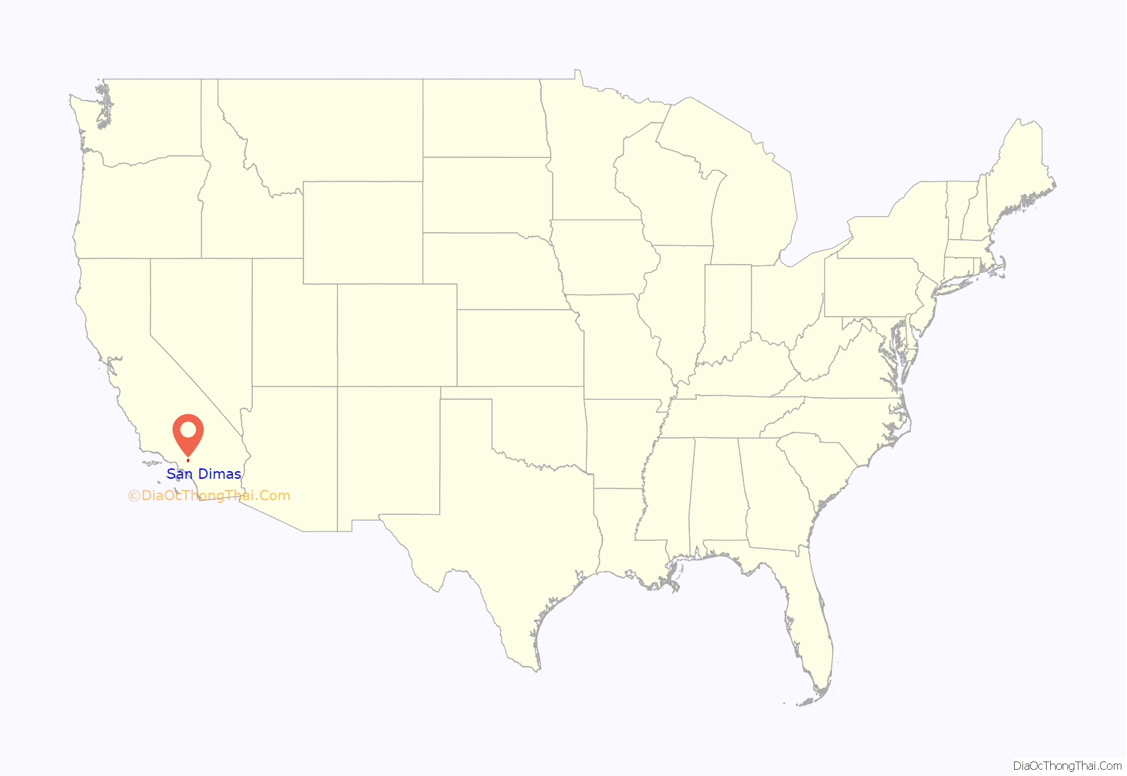
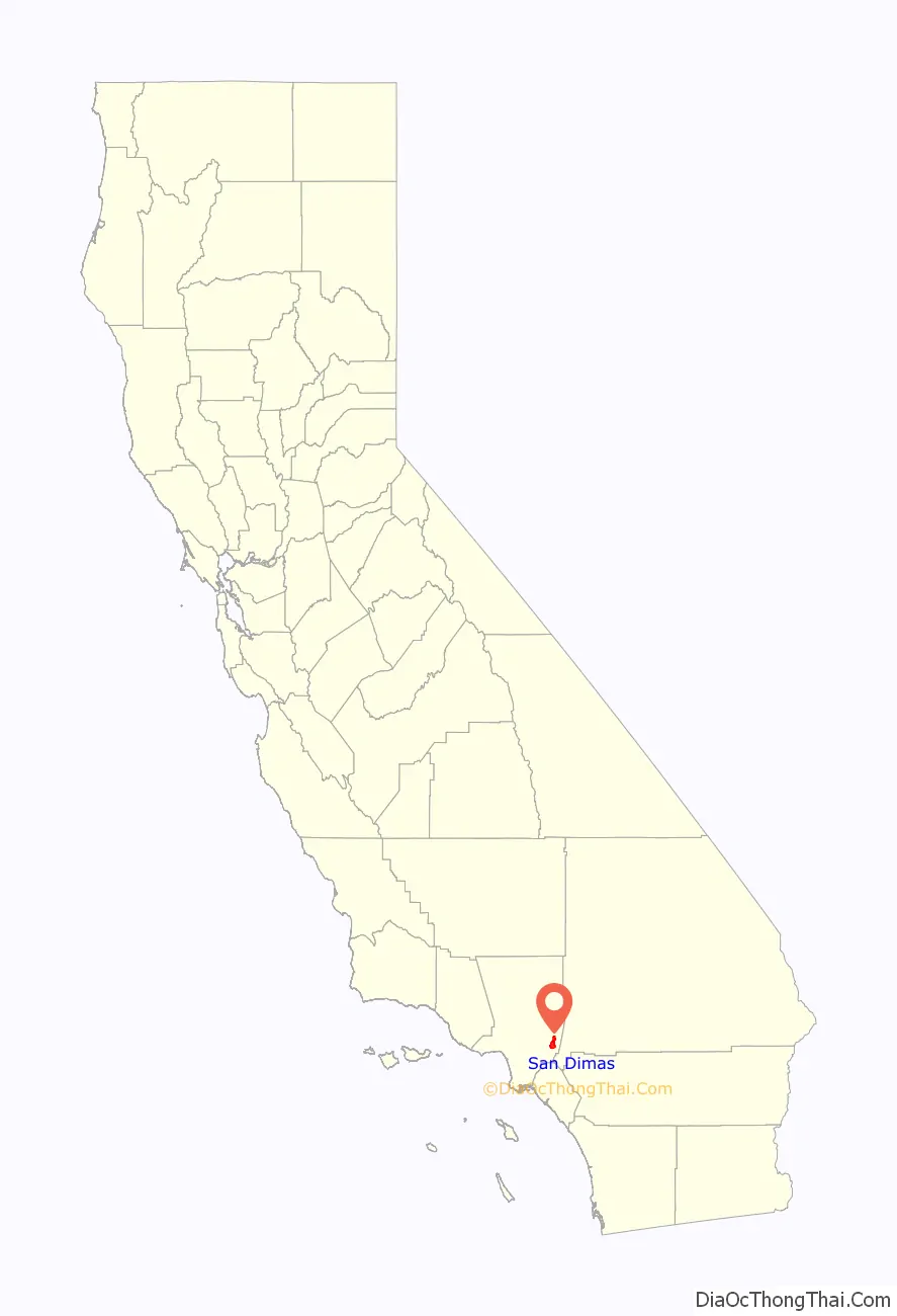
San Dimas location map. Where is San Dimas city?
History
The first known European exploration of the area was in 1774, when Juan Bautista de Anza passed through on the first overland expedition of Las Californias, from New Spain-Mexico towards Monterey Bay. The area was originally developed in 1837 with the Mexican land grant from Governor Juan Bautista Alvarado to Ygnacio Palomares and Ricardo Vejar for the Rancho San Jose, then in Alta California. It later became known as La Cienega Mud Springs, so named because of local mud springs that created a riparian marsh and healing place. Palomares and Vejar conducted sheep and cattle operations on Rancho San Jose, also growing crops for consumption by the residents of the rancho. In the early 1860s, a severe drought decimated the ranch’s population of sheep and cattle. Ygnacio Palomares died in 1864, and his widow began selling the ranch land in 1865. Vejar lost his share by foreclosure to two Los Angeles merchants, Isaac Schlesinger and Hyman Tischler, in 1864. In 1866, Schlesinger and Tischler sold the ranch to Louis Phillips.
The arrival of the Los Angeles and San Gabriel Valley Railroad in 1887, later purchased by Santa Fe Railroad, led to La Cienega Mud Springs being first mapped. The ensuing land boom resulted in the formation of the San Jose Ranch Company, which first laid out streets. Small businesses began to open soon thereafter, and the city took on a new name: San Dimas. Growth was rapid, and San Dimas soon became an agricultural community. Wheat and other Midwestern United States crops were planted first; then orange and lemon groves covered the town and the San Gabriel Valley. At one time, four citrus packing houses and a marmalade factory were located in San Dimas. The Sunkist name originated here, first spelled “Sunkissed”. Oranges were the major crop and business in San Dimas until the mid-20th century.
San Dimas incorporated as a city in 1960, and is now known for its Western art, small-town feel, and equestrian qualities. In the 1990s, San Dimas was also host to the Miss Rodeo California State Pageant, run by A. F. “Shorty” Feldbush and various other city volunteers. The week-long pageant was held in conjunction with the city’s Western Days and Rodeo, until the pageant moved to its new home in central California.
In 1971, the San Dimas Golf Course was purchased. In 1972, San Dimas Community Hospital opened its 92-bed facility. In 1981, the San Dimas Swim and Racquet Club was built next to San Dimas High School, according to the San Dimas Historical Society.
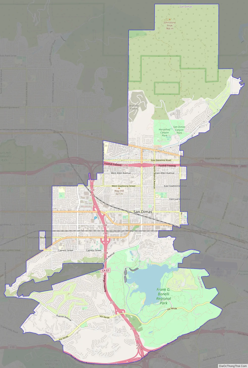
San Dimas Road Map
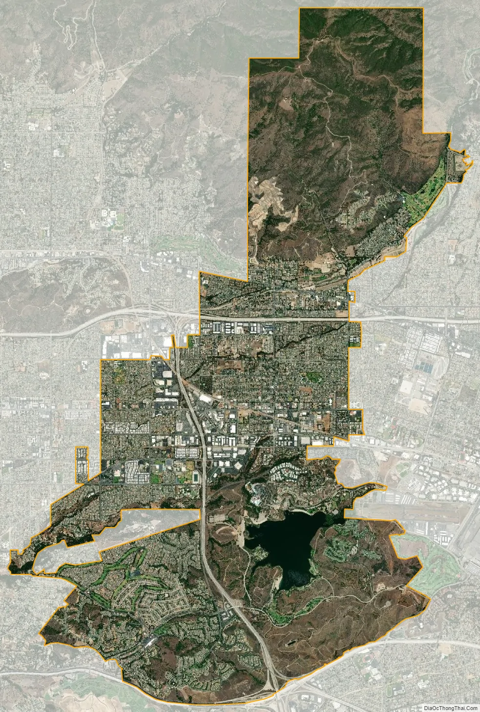
San Dimas city Satellite Map
Geography
San Dimas is a suburb of Los Angeles County nestled along the foothills of the San Gabriel Mountains, about 28 miles (45 km) east/northeast of downtown Los Angeles and north of the Pacific Ocean. According to the United States Census Bureau, the city has a total area of 15.4 sq mi, of which 0.39 sq mi (1.0 km) is covered by water. Cinnamon Creek crosses the city, roughly parallel to the Arrow Highway, before reaching Cinnamon Falls near San Dimas Avenue.
San Dimas runs along and southward from historic U.S. Route 66, another part of its development in the earlier 20th century. Other major arteries include Arrow Highway (east–west) and San Dimas Avenue (north–south). The Foothill Freeway (I-210) connects the city to Pasadena and the San Fernando Valley, with California State Route 57 connecting to Orange County and the beaches.
Climate
This region experiences hot and dry summers, with no average monthly temperatures above 71.6 °F (22.0 °C). According to the Köppen climate classification, San Dimas has a warm-summer Mediterranean climate, Csb on climate maps.
See also
Map of California State and its subdivision:- Alameda
- Alpine
- Amador
- Butte
- Calaveras
- Colusa
- Contra Costa
- Del Norte
- El Dorado
- Fresno
- Glenn
- Humboldt
- Imperial
- Inyo
- Kern
- Kings
- Lake
- Lassen
- Los Angeles
- Madera
- Marin
- Mariposa
- Mendocino
- Merced
- Modoc
- Mono
- Monterey
- Napa
- Nevada
- Orange
- Placer
- Plumas
- Riverside
- Sacramento
- San Benito
- San Bernardino
- San Diego
- San Francisco
- San Joaquin
- San Luis Obispo
- San Mateo
- Santa Barbara
- Santa Clara
- Santa Cruz
- Shasta
- Sierra
- Siskiyou
- Solano
- Sonoma
- Stanislaus
- Sutter
- Tehama
- Trinity
- Tulare
- Tuolumne
- Ventura
- Yolo
- Yuba
- Alabama
- Alaska
- Arizona
- Arkansas
- California
- Colorado
- Connecticut
- Delaware
- District of Columbia
- Florida
- Georgia
- Hawaii
- Idaho
- Illinois
- Indiana
- Iowa
- Kansas
- Kentucky
- Louisiana
- Maine
- Maryland
- Massachusetts
- Michigan
- Minnesota
- Mississippi
- Missouri
- Montana
- Nebraska
- Nevada
- New Hampshire
- New Jersey
- New Mexico
- New York
- North Carolina
- North Dakota
- Ohio
- Oklahoma
- Oregon
- Pennsylvania
- Rhode Island
- South Carolina
- South Dakota
- Tennessee
- Texas
- Utah
- Vermont
- Virginia
- Washington
- West Virginia
- Wisconsin
- Wyoming


