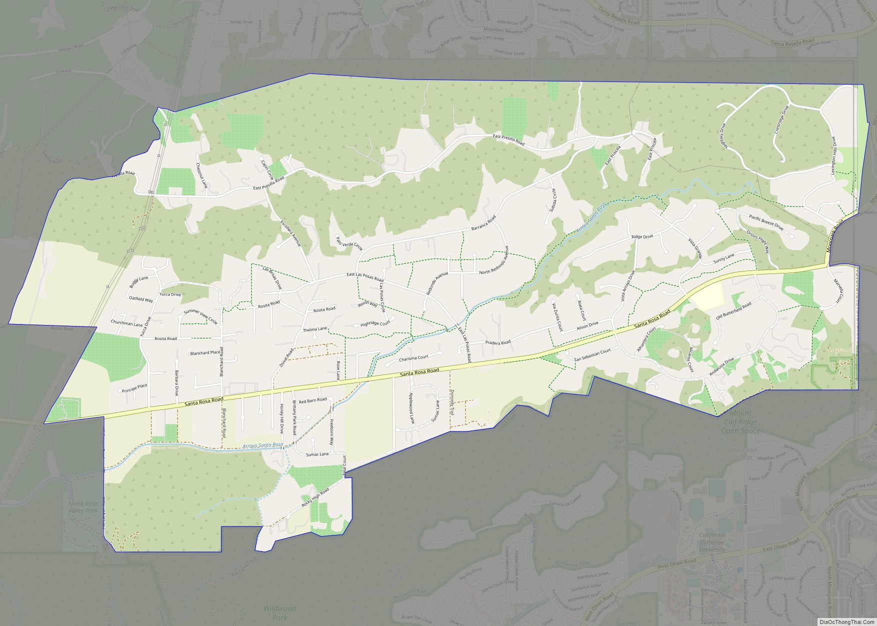
Map of Saranap CDP

Map of Saranap CDP

Saranap (until 1913, Dewing Park) is a residential census-designated place (CDP) within central Contra Costa County, California. Lying at an elevation of 180 feet (55 m), it is bounded on the south and east by portions of Walnut Creek (including the gated senior residential development Rossmoor) and on the north and west by Lafayette. Saranap’s … Read more

Map of Santee city

Map of Santee city, California

Santee is a suburban city in San Diego County, California, with a population of 60,037 at the 2020 census. Although it is a part of the East County region, Santee is located just 18 miles (29 km) from the Pacific Ocean. The city is connected to the coastline by State Route 52, a six-lane freeway that … Read more

Map of Santa Ynez CDP

Map of Santa Ynez CDP

Santa Ynez (/ɪˈnɛz/; Spanish for “St. Agnes”) is a census-designated place (CDP) in the Santa Ynez Valley of Santa Barbara County, California. The town of Santa Ynez is one of the communities of the Santa Ynez Valley. It features the Santa Ynez Airport for general aviation, with a paved 2,804 by 75 feet (855 m × 23 m) … Read more

Map of Sattley CDP

Map of Sattley CDP

Sattley, formerly known as Church’s Corners, is a census-designated place in Sierra County, California, United States. Sattley is located on California State Route 49 and California State Route 89 southwest of Loyalton. According to the Sattley-Sierraville community association, it was named after resident Harriet Sattley Church. The community board also states that the town was … Read more

Map of Saticoy CDP

Map of Saticoy CDP

Saticoy (/ˈsætɪkɔɪ/ (listen); Chumash: Sa’aqtik’oy) is an unincorporated community in Ventura County, California, United States. The settlement was laid out in 1887 along the railroad line that was being built from Los Angeles through the Santa Clara River Valley to the town of San Buenaventura. Although the town was 10 miles (16 km) distant at that … Read more

Map of Saratoga city

Map of Saratoga city, California

Saratoga is a city in Santa Clara County, California. Located in Silicon Valley, in the southern Bay Area, its population was 31,051 at the 2020 census. Saratoga is an affluent residential community, known for its wineries, restaurants, and attractions like Villa Montalvo, Mountain Winery, and Hakone Gardens. Saratoga city overview: Name: Saratoga city LSAD Code: … Read more

Map of Scotts Valley city

Map of Scotts Valley city

Scotts Valley is a small city in Santa Cruz County, California, United States, about thirty miles (48 km) south of downtown San Jose and six miles (9.7 km) north of the city of Santa Cruz, in the upland slope of the Santa Cruz Mountains. As of the 2020 census, the city population was 12,224. Principal access to … Read more

Map of Scotia CDP

Map of Scotia CDP, California

Scotia, formerly known as Forestville until 1888, is a census-designated place in Humboldt County, California. It is located on the Eel River along U.S. Route 101, 8.5 miles (13.7 km) southeast of Fortuna and 244 miles (393 km) north of San Francisco. Scotia has a population of 850 (2010 census). Scotia is a company town founded by … Read more

Map of Sausalito city

Map of Sausalito city

Sausalito (Spanish for “small willow grove”) is a city in Marin County, California, United States, located 1.5 miles (2.4 kilometers) southeast of Marin City, 8 miles (13 km) south-southeast of San Rafael, and about 4 miles (6 km) north of San Francisco from the Golden Gate Bridge. Sausalito’s population was 7,269 as of the 2020 census. The … Read more

Map of Seal Beach city

Map of Seal Beach city

Seal Beach is a coastal city in Orange County, California, United States. As of the 2020 census, the population was 25,242, up from 24,168 at the 2010 census. Seal Beach is located in the westernmost corner of Orange County. To the northwest, just across the border with Los Angeles County, lies the city of Long … Read more

Map of Seacliff CDP

Map of Seacliff CDP

Seacliff is an unincorporated community in Santa Cruz County, California, United States that includes Seacliff State Beach. It is identified as one of several small communities with a combined population of 24,402 forming the unincorporated town of Aptos by the local Chamber of Commerce along with: Aptos Hills-Larkin Valley, a rural area north of State … Read more

Map of Sea Ranch CDP

Map of Sea Ranch CDP

Sea Ranch is an unincorporated community in Sonoma County, California, United States that was developed as planned community beginning in the 1960s. It is known for its distinctive timber-frame structures designed by several noted American architects. The first unit built at Sea Ranch, Condominium 1, was placed on the National Register of Historic Places in … Read more