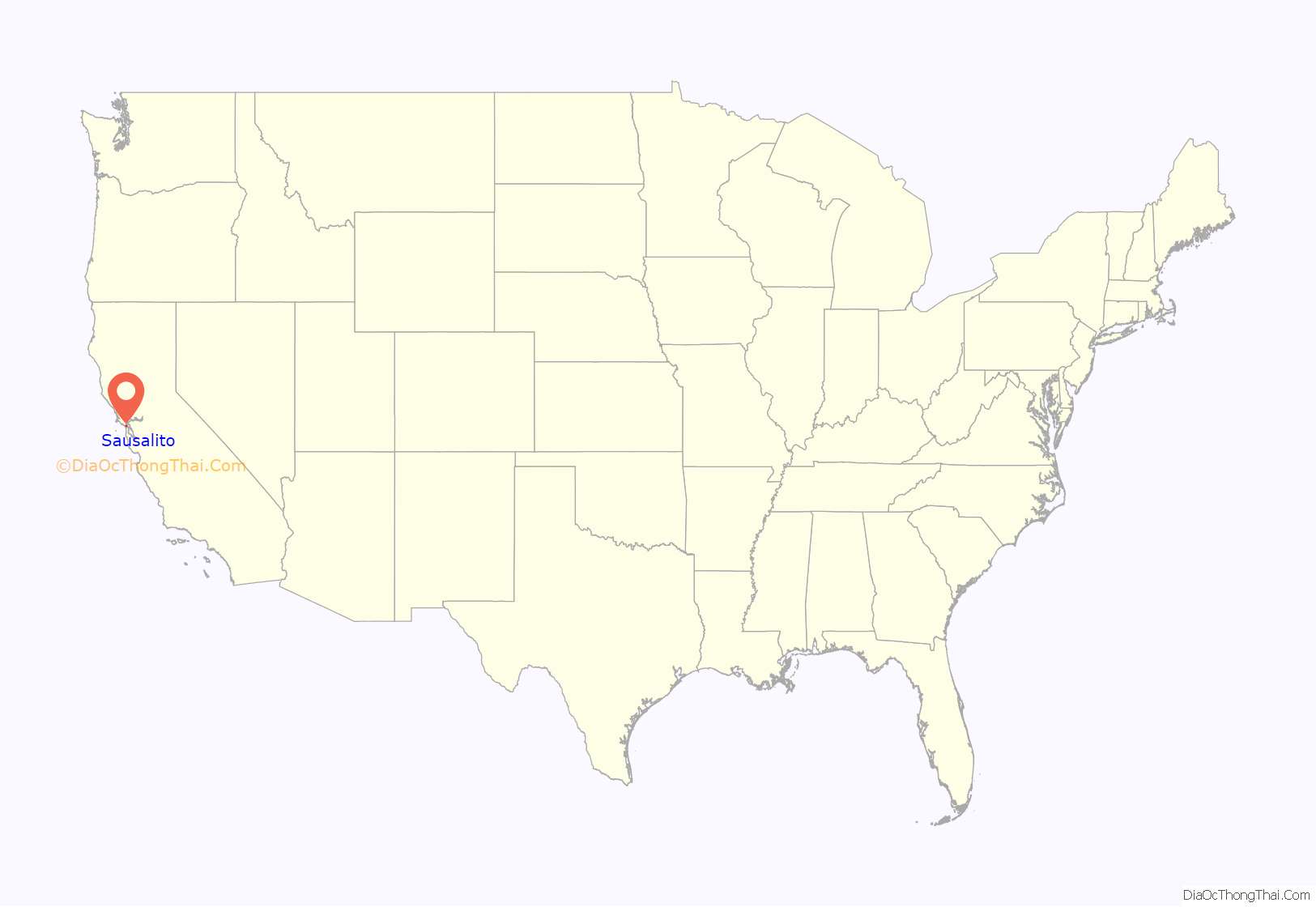
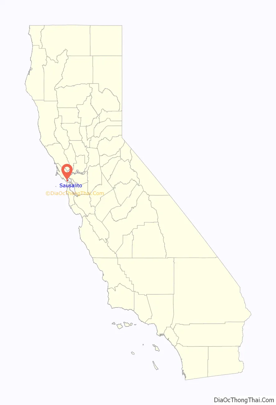
Sausalito (Spanish for “small willow grove”) is a city in Marin County, California, United States, located 1.5 miles (2.4 kilometers) southeast of Marin City, 8 miles (13 km) south-southeast of San Rafael, and about 4 miles (6 km) north of San Francisco from the Golden Gate Bridge.
Sausalito’s population was 7,269 as of the 2020 census. The community is situated near the northern end of the Golden Gate Bridge, and prior to the building of that bridge served as a terminus for rail, car, and ferry traffic.
Sausalito developed rapidly as a shipbuilding center in World War II, with its industrial character giving way in postwar years to a reputation as a wealthy and artistic enclave, a picturesque residential community (incorporating large numbers of houseboats), and a tourist destination. The city is adjacent to, and largely bounded by, the protected spaces of the Golden Gate National Recreation Area as well as the San Francisco Bay.
| Name: | Sausalito city |
|---|---|
| LSAD Code: | 25 |
| LSAD Description: | city (suffix) |
| State: | California |
| County: | Marin County |
| Incorporated: | September 4, 1893 |
| Elevation: | 10 ft (3 m) |
| Total Area: | 2.26 sq mi (5.9 km²) |
| Land Area: | 1.76 sq mi (4.6 km²) |
| Water Area: | 0.49 sq mi (1.3 km²) 21.54% |
| Total Population: | 7,269 |
| Population Density: | 4,120.74/sq mi (1,591.03/km²) |
| ZIP code: | 94965, 94966 |
| FIPS code: | 0670364 |
| Website: | www.ci.sausalito.ca.us |
Online Interactive Map
Click on ![]() to view map in "full screen" mode.
to view map in "full screen" mode.
Sausalito location map. Where is Sausalito city?
History
Indigenous culture
Sausalito was once the site of a Coast Miwok settlement known as Liwanelowa. The branch of the Coast Miwok living in this area were known as the Huimen (or as Nación de Uimen to the Spanish). Early explorers of the area described them as friendly and hospitable. According to Juan de Ayala, “To all these advantages must be added the best of all, which is that the heathen Indians of the port are so faithful in their friendship and so docile in their disposition that I was greatly pleased to receive them on board.” European settlers took advantage of the Huimen’s kindness and hospitality, and completely massacred them within the span of a few generations. As historian Jack Tracy has observed, “Their dwellings on the site of Sausalito were explored and mapped in 1907, nearly a century and a half later, by an archaeological survey. By that time, nothing was left of the culture of those who had first enjoyed the natural treasures of the bay. The life of the Coastal Miwoks had been reduced to archaeological remnants, as though thousands of years had passed since their existence.”
European arrival and settlement
The first European known to visit the present-day location of Sausalito was Don José de Cañizares, on August 5, 1775. Cañizares was head of an advance party dispatched by longboat from the ship San Carlos, searching for a suitable anchorage for the larger vessel. The crew of the San Carlos came ashore soon after, reporting friendly natives and teeming populations of deer, elk, bear, sea lions, seals and otters. More significantly for maritime purposes, they reported an abundance of large, mature timber in the hills, a valuable commodity for shipwrights in need of raw materials for masts, braces and planking.
Despite these and later positive reports, the Spanish colonial government of Upper California did little to establish a presence in the area. When a military garrison (now the Presidio of San Francisco) and a Franciscan mission (Mission Dolores) were founded the following year, they were situated on the opposite, southern shore of the bay, where no portage was necessary for overland traffic to and from Monterey, the regional capitol. As a result, the far shore of the Golden Gate strait would remain largely wilderness for another half-century.
The development of the area began at the instigation of William A. Richardson, who arrived in Upper California in 1822, shortly after Mexico had won its independence from Spain. An English mariner who had picked up a fluency in Spanish during his travels, he quickly became an influential presence in the now-Mexican territory. By 1825, Richardson had assumed Mexican citizenship, converted to Catholicism and married the daughter of Don Ignacio Martínez, commandant of the Presidio and holder of a large land grant. His ambitions now expanding to land holdings of his own, Richardson submitted a petition to Governor Echienda for a rancho in the headlands across the water from the Presidio, to be called “Rancho Saucelito”. Sausalito is believed to refer to a small cluster of willows, a moist-soil tree, indicating the presence of a freshwater spring.
Even before filing his claim, Richardson had used the spring as a watering station on the shores of what is now called Richardson Bay (an arm of the larger San Francisco Bay), selling fresh water to visiting vessels. However, his ownership of the land was legally tenuous: other claims had been submitted for the same region, and at any rate Mexican law reserved headlands for military uses, not private ownership. Richardson temporarily abandoned his claim and settled instead outside the Presidio, building the first permanent civilian home and laying out the street plan for the pueblo of Yerba Buena (present-day San Francisco). After years of lobbying and legal wrangling, Richardson was given clear title to all 19,751 acres (79.93 km) of Rancho del Sausalito on February 11, 1838.
Fishing village and sybaritic enclave
In the post-Gold Rush era, Sausalito’s unusual location became a key factor in its formation as a community. It was San Francisco’s nearest neighbor, less than two miles (3 km) away at the nearest point and easily seen from city streets, yet transportation factors rendered it effectively isolated. A boat could sail there in under half an hour, but wagons and carriages required an arduous skirting of the entire bay, a journey that could well exceed a hundred miles. As a result, the region was largely dominated by two disparate classes of people, both with ready access to boats: commercial fishermen and wealthy yachting enthusiasts.
Mining town
In the 1870s, manganese was discovered in the hills west of Old Town that was rich enough to justify small-scale mining. Tunnels were dug near the springs between present-day Prospect Avenue and Sausalito Boulevard. Henry Eames, an opportunistic inventor, built an ore reduction plant at the foot of Main Street to process the manganese ore. This location would become the later site of Sally Stanford’s infamous bordello, Valhalla. However, by 1880 the Saucelito Smelting Works was producing only about fifty tons of black oxide annually, hardly enough to make Sausalito a true mining center.
Transit hub
The first post office opened in 1870 as “Saucelito” and changed its name to the present spelling in 1887.
In the 1870s, the North Pacific Coast Railroad (NPC) extended its tracks southward to a new terminus in Sausalito, where a rail yard and ferry to San Francisco were established. The NPC was acquired by the North Shore Railroad in 1902, which in turn was absorbed in 1907 by the Southern Pacific affiliate, the Northwestern Pacific.
By 1926, a major auto ferry across the Golden Gate was established from the Sausalito Ferry Terminal, running to the Hyde Street Pier in San Francisco. This ferry was an integral part of old U.S. Highway 101, and a large influx of automobile traffic, often parked or idling in long queues, became a dominant characteristic of the town. Northwestern Pacific commuter train service also expanded to serve the increased traffic volume, and Sausalito became known primarily as a transportation hub.
This era came to an end in May 1937 with the opening of the Golden Gate Bridge. The bridge made large-scale ferry operations redundant, and since the new route of Highway 101 bypassed Sausalito entirely, in-town traffic was quickly reduced to a trickle. Car ferry service ended in March 1941 (passenger ferry service, however, continues to this day, linking downtown Sausalito with both the San Francisco Ferry Building in the Embarcadero, and Pier 39 in at Fisherman’s Wharf). Northwestern Pacific also closed its Sausalito terminal in March 1941, although some tracks remained in use as “spur tracks” for freight trains as late as 1971.
Bootlegging and rum runners
Sausalito was a center for bootlegging during the era of Prohibition in the United States. Because of its location facing the Golden Gate and isolated from San Francisco by the same waterway, it was also a favorite landing spot for rum runners. The 1942 film China Girl has some footage of Sally Stanford’s Valhalla restaurant on the waterfront. The scene shows the docks and illustrates rum running.
Industrialization during World War II
When the United States entered World War II, Fort Barry on Point Bonita was reoccupied. Fort Baker also hosted large numbers of troops. Barracks and other housing were constructed for soldiers. Few of these buildings remain.
A major shipyard of the Bechtel Corporation called Marinship was sited along the shoreline of Sausalito. The thousands of laborers who worked here were largely housed in a nearby community constructed for them called Marin City. The soil which supports this area is dredgings from Richardson Bay that were placed during World War II as part of the Marin shipyards for the United States Navy. A total of 202 acres (0.8 km) were condemned by the government. A portion of this total area was formed in the shape of a peninsula and this peninsula became known as Schoonmaker Point. In honor of the city’s contribution to the war effort, a Tacoma-class frigate was christened the USS Sausalito (PF-4) in 1943. The ship Sausalito, however, was not built in Sausalito but at one of the Kaiser Shipyards in Richmond, California, also on the San Francisco Bay.
The Marinship Shipyards were the site of incidents that provided a key early milestone in the civil rights movement. In 1944 in the case of James v. Marinship the California Supreme Court held that African Americans could not be excluded from jobs based on their race, even if the employer took no discriminatory actions. In the case of Joseph James, on whose behalf the suit was brought, the local Boilermakers Union excluded Blacks from membership and had a “closed shop” contract, forbidding the shipbuilder from employing anyone who was not a member of the union. African American workers could join an auxiliary of the union, which offered access to fewer jobs at lower pay. Future US Supreme Court justice Thurgood Marshall successfully argued the case, winning a ruling that the union be required to offer equal membership to African Americans. The court extended the ruling to apply explicitly to all unions and all workers in California.
Postwar years
Following World War II, a lively waterfront community grew out of the abandoned shipyards. By the late 1960s at least three houseboat communities occupied the waterfront along and adjacent to Sausalito’s shore. Beginning in the 1970s, an intense struggle erupted between houseboat residents and developers, dubbed the “Houseboat Wars”. Forced removals by county authorities and sabotage by some on the waterfront characterized this struggle. This long fight pitted the waterfront against the “Hill People” – the rich on the hill looking down on the waterfront. Today three houseboat communities still exist — Galilee Harbor in Sausalito, Waldo Point Harbor and the Gates Cooperative, just outside the city limit.
In 1965, the City of Sausalito sued the County of Marin and a private developer for illegally zoning 2,000 acres (809 ha) of land to build a city named Marincello adjacent to Sausalito. The city won the lawsuit in 1970, and the land was transferred as open space to the Golden Gate National Recreation Area. In 1997, The New York Times compared Sausalito to Devonport in Auckland due to its setting and scenery.
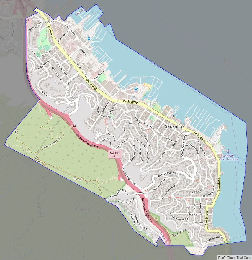
Sausalito Road Map
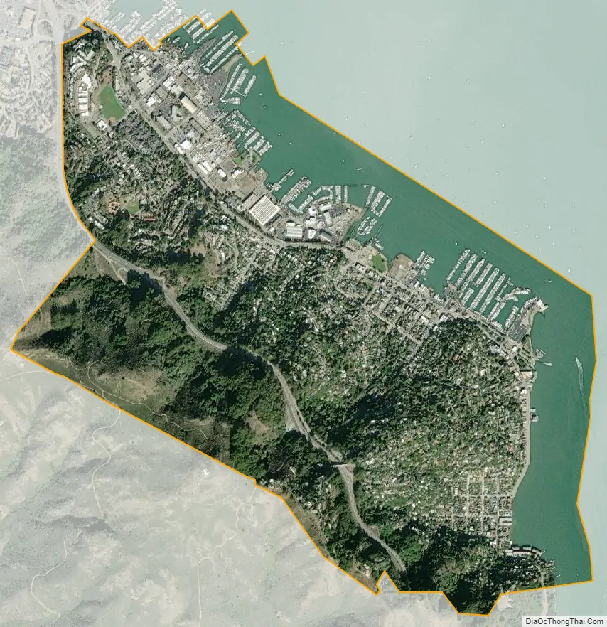
Sausalito city Satellite Map
Geography
Located at 37°51′33″N 122°29′07″W / 37.85917°N 122.48528°W / 37.85917; -122.48528, Sausalito encompasses both steep, wooded hillside and shoreline tidal flats. According to the United States Census Bureau, the city has a total area of 2.2 square miles (5.7 km). Notably, only 1.8 square miles (4.7 km) of it is land. A full 21.54% of the city (0.5 square miles, or 1.3 km) is under water, and has been so since its founding in 1868. Prominent geographic features associated with Sausalito include Richardson Bay and Pine Point.
When Sausalito was formally platted, it was anticipated that future development might extend the shoreline with landfill, as had been the practice in neighboring San Francisco. As a result, entire streets, demarcated and given names like Pescadero, Eureka and Teutonia, remain beneath the surface of Richardson Bay. The legal, if not actual, presence of these streets has proved a contentious factor in public policy, because some houseboats float directly above them. According to the San Francisco Chronicle, “State agencies say privately owned houseboats can’t be located above the underwater streets because the streets are public trust lands intended for public benefit.” The California State Lands Commission is reportedly pursuing a compromise which would move not the houseboats, but the theoretical streets instead.
Climate
Sausalito has a Mediterranean climate (Köppen climate classification Csb) with far lower temperatures than expected because of its adjacency to San Francisco Bay and the resultant onshore breezes.
See also
Map of California State and its subdivision:- Alameda
- Alpine
- Amador
- Butte
- Calaveras
- Colusa
- Contra Costa
- Del Norte
- El Dorado
- Fresno
- Glenn
- Humboldt
- Imperial
- Inyo
- Kern
- Kings
- Lake
- Lassen
- Los Angeles
- Madera
- Marin
- Mariposa
- Mendocino
- Merced
- Modoc
- Mono
- Monterey
- Napa
- Nevada
- Orange
- Placer
- Plumas
- Riverside
- Sacramento
- San Benito
- San Bernardino
- San Diego
- San Francisco
- San Joaquin
- San Luis Obispo
- San Mateo
- Santa Barbara
- Santa Clara
- Santa Cruz
- Shasta
- Sierra
- Siskiyou
- Solano
- Sonoma
- Stanislaus
- Sutter
- Tehama
- Trinity
- Tulare
- Tuolumne
- Ventura
- Yolo
- Yuba
- Alabama
- Alaska
- Arizona
- Arkansas
- California
- Colorado
- Connecticut
- Delaware
- District of Columbia
- Florida
- Georgia
- Hawaii
- Idaho
- Illinois
- Indiana
- Iowa
- Kansas
- Kentucky
- Louisiana
- Maine
- Maryland
- Massachusetts
- Michigan
- Minnesota
- Mississippi
- Missouri
- Montana
- Nebraska
- Nevada
- New Hampshire
- New Jersey
- New Mexico
- New York
- North Carolina
- North Dakota
- Ohio
- Oklahoma
- Oregon
- Pennsylvania
- Rhode Island
- South Carolina
- South Dakota
- Tennessee
- Texas
- Utah
- Vermont
- Virginia
- Washington
- West Virginia
- Wisconsin
- Wyoming


