Seal Beach is a coastal city in Orange County, California, United States. As of the 2020 census, the population was 25,242, up from 24,168 at the 2010 census.
Seal Beach is located in the westernmost corner of Orange County. To the northwest, just across the border with Los Angeles County, lies the city of Long Beach and the adjacent San Pedro Bay. To the southeast are Huntington Harbour, a neighborhood of Huntington Beach, and Sunset Beach, also part of Huntington Beach. To the east lie the city of Westminster and the neighborhood of West Garden Grove, part of the city of Garden Grove. To the north lie the unincorporated community of Rossmoor and the city of Los Alamitos. A majority of the city’s acreage is devoted to the Naval Weapons Station Seal Beach military base.
| Name: | Seal Beach city |
|---|---|
| LSAD Code: | 25 |
| LSAD Description: | city (suffix) |
| State: | California |
| County: | Orange County |
| Incorporated: | October 27, 1915 |
| Elevation: | 13 ft (4 m) |
| Total Area: | 11.80 sq mi (30.56 km²) |
| Land Area: | 11.27 sq mi (29.19 km²) |
| Water Area: | 0.53 sq mi (1.38 km²) 13.45% |
| Total Population: | 25,242 |
| Population Density: | 2,100/sq mi (830/km²) |
| ZIP code: | 90740 |
| Area code: | 562 |
| FIPS code: | 0670686 |
| Website: | www.sealbeachca.gov |
Online Interactive Map
Click on ![]() to view map in "full screen" mode.
to view map in "full screen" mode.
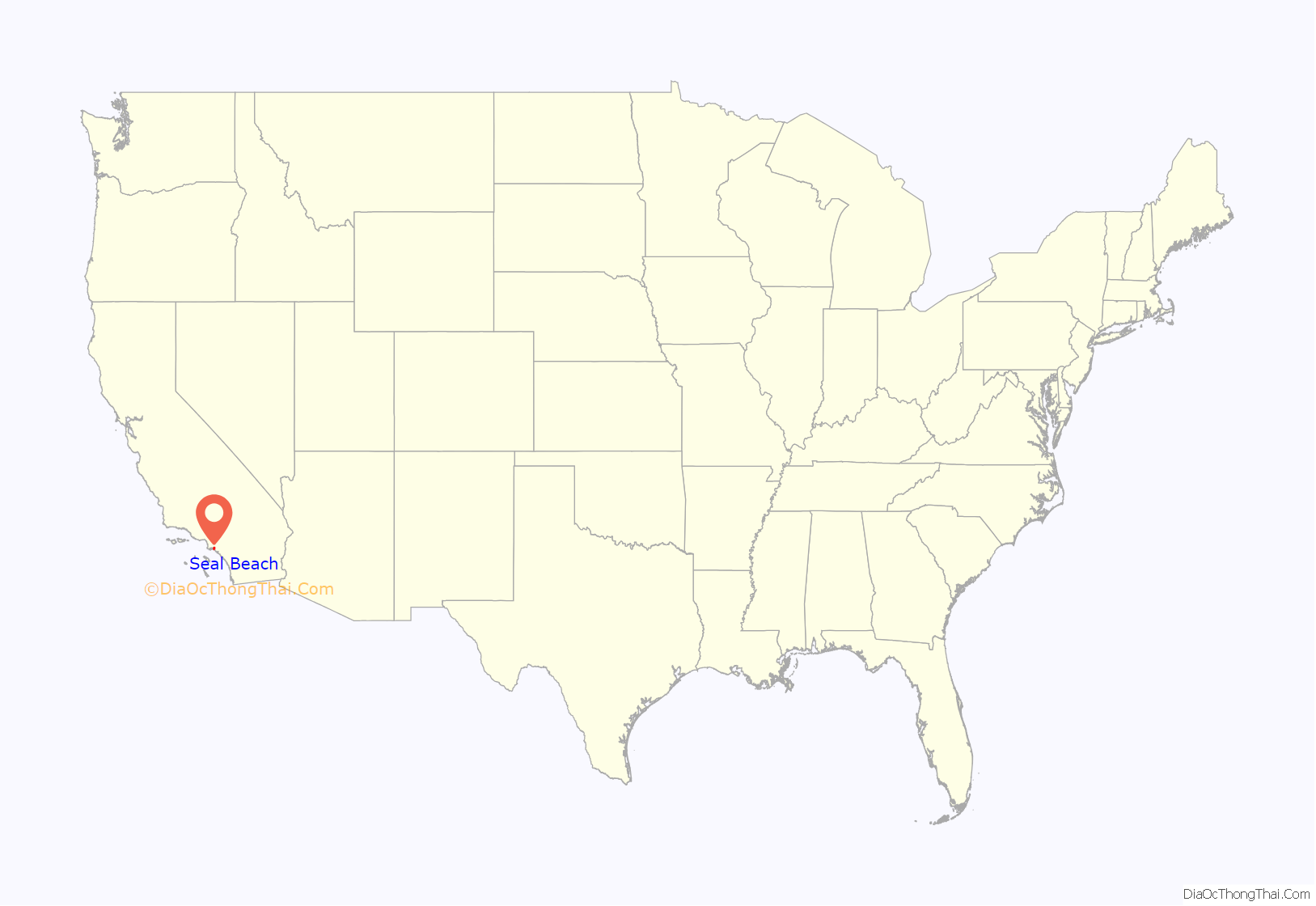
Seal Beach location map. Where is Seal Beach city?
History
Indigenous
The Tongva village of Motuucheyngna was located in what is now Seal Beach in the area of the Los Cerritos Wetlands. It was part of the greater area of Puvungna, which was a major ceremonial and regional trading center for the Tongva and Acjachemen. Villagers used te’aats to travel out to villages on Pimu (Santa Catalina Island) and other islands off the coast, now referred to as the Channel Islands. In 2003, a burial site of the village was disturbed in a 196-acre (79 ha) Seal Beach residential development, Hellman Ranch, that was met with opposition from the Tongva.
Anaheim Landing
Beginning in the mid-1860s, the eastern area of what is now Old Town Seal Beach became known as Anaheim Landing. A warehouse and wharf had been built on a small bay where Anaheim Creek emptied into the Pacific Ocean. It was established by farmers and merchants in the newly settled town of Anaheim who wanted a closer, more convenient port to ship the wine they were growing and also to receive items they needed to help build homes and buildings in their new town.
For a few years Anaheim Landing came close to rivaling San Pedro for its volume of shipping, but the arrival of the railroad in Anaheim in 1875 made it easier to ship product via the rails than by hauling a wagon overland across 12 miles of soft soil to the Landing. However, the beaches and surrounding rolling Anaheim Landing had by this time also become popular as a getaway from hot summer days. Los Angeles newspapers talk of a permanent summer population of as many as 400 and even more on special days.
Throughout the year, the landing was also home to a number of fishing boats that plied the local fishing areas. This activity was written about by Nobel-prize winning author Henryk Sienkiewicz in a short essay, “The Cranes.” The site of Anaheim Landing is now registered as a California Historical Landmark.
In 1903 Los Angeles realtor Philip A. Stanton, very familiar with the area from his time selling land in Anaheim, and Huntington Beach and also from representing the local real estate interests of banker (and Pacific Electric Railroad co-owner) Isaias W. Hellman, put together a syndicate to lay out the town of Bayside on the land between Anaheim Landing and Anaheim Bay and the eastern edge of Alamitos Bay.
Real estate development
The new town would be along the still not-announced leg of the Pacific Electric which would run from Long Beach to Newport Beach. As there was already a town called Bayside in Northern California (by Eureka) Stanton’s group instead called their new town Bay City. Due to many factors—including competition from other beach resort areas (Long Beach, Redondo Beach and Venice/Ocean Park/Santa Monica), some national financial crises, and the 1906 San Francisco Earthquake which sent most investment dollars to the more lucrative rebuilding of San Francisco—Bay City failed miserably as a real estate investment.
In 1913, Stanton optioned the land to real estate promoter Guy M. Rush who invested in building a renovated pier with pavilions on either side. Rush also re-branded the town as Seal Beach and marketed it via postcards and advertisements around the country. This too failed and by early 1915 Rush had let his options lapse. In 1915 Stanton tried again, arranging to obtain some amusements from the closing San Francisco Panama-Pacific International Exposition and rebuild them as part of new amusement area which would be called The Joy Zone.
As part of this plan, the Bayside Land Company led a campaign to incorporate the town (October 27, 1915) and then had the new city council approve legal drinking in the town. This made it different from the Pike at Long Beach which was a “dry city.” The Joy Zone, a beach-side amusement park built in 1916, was the first in Orange County. It achieved some brief popularity, but the US entry into World War I and the resulting restrictions on rubber and metal dramatically impacted the amusement area.
After the war, Prohibition impacted the town’s value as an amusement resort. After 1920, the town’s location on two Bays with many inlets to offload bootleg liquor, its small police department, and its location on the county line, allowed it to become a popular place for rumrunners and then gamblers. From 1928 to 1939, the town had as many as six gambling establishments on Main Street. In addition most of Southern California’s famous gambling ships (Johanna Smith, Rose Isle, Johanna Smith II, SS Caliente, SS Tango, Showboat, Mt. Baker) operated off the Seal Beach just over the line from Long Beach.
With gambling being a misdemeanor, the trials were held in the town’s municipal court and a Seal Beach jury never returned a guilty verdict, to the dismay of Orange County and Long Beach officials. But around 1941, with significant pressure being put on the gamblers by State Attorney General Earl Warren, most of the Seal Beach and gambling ship ended Their absence was soon filled by a former Los Angeles police detective named William L. Robertson.
World War II
In early 1944. during World War II, the Navy purchased most of the land around Anaheim Landing to construct the United States Navy’s Naval Weapons Station Seal Beach for loading, unloading, and storing of ammunition for the Pacific Fleet, and especially those US Navy warships home-ported in Long Beach and San Diego. With closure of the Concord Naval Weapons Station in Northern California, it has become the primary source of munitions for a majority of the United States Pacific Fleet. The arrival of the Navy catalyzed a growth in population which eventually succeeded in shutting down Robertson’s gambling operations.
Surfing has always had a presence in Seal Beach. Newspaper advertisements showing surfers were part of Guy M. Rush’s “Seal Beach” campaign of 1913. The town hosted the mainland’s first surfing competition—it was at a private gathering of the annual Minnesota Picnic. But its popularity really took off after the war with the arrival of legendary surfer Blackie August, who taught many of the local kids how to surf. August’s son, Robert, was one of the pair of surfers featured in the classic surf film, Endless Summer. Local legends Jack Haley and Mike Haley were the winners of the first two national surfing championships.
Seal Beach amusement park, 1920.
Anaheim Landing aerial photo, circa 1930s
Anaheim Landing 1891
2011 shooting
The deadliest mass killing in Orange County history occurred in Seal Beach. On October 12, 2011, a mass shooting took place at the local Salon Meritage hair salon. Eight people inside the salon and one person in the parking lot were shot, and only one victim survived. The suspect in the shooting, 41-year-old Scott Evans Dekraai, was arrested without incident and charged with eight counts of murder and one count of attempted murder. Prior to the shooting, there had been only one murder in Seal Beach during the previous four years.
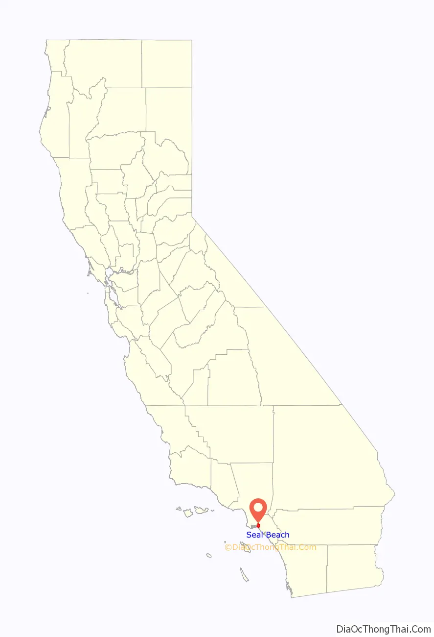
Seal Beach Road Map

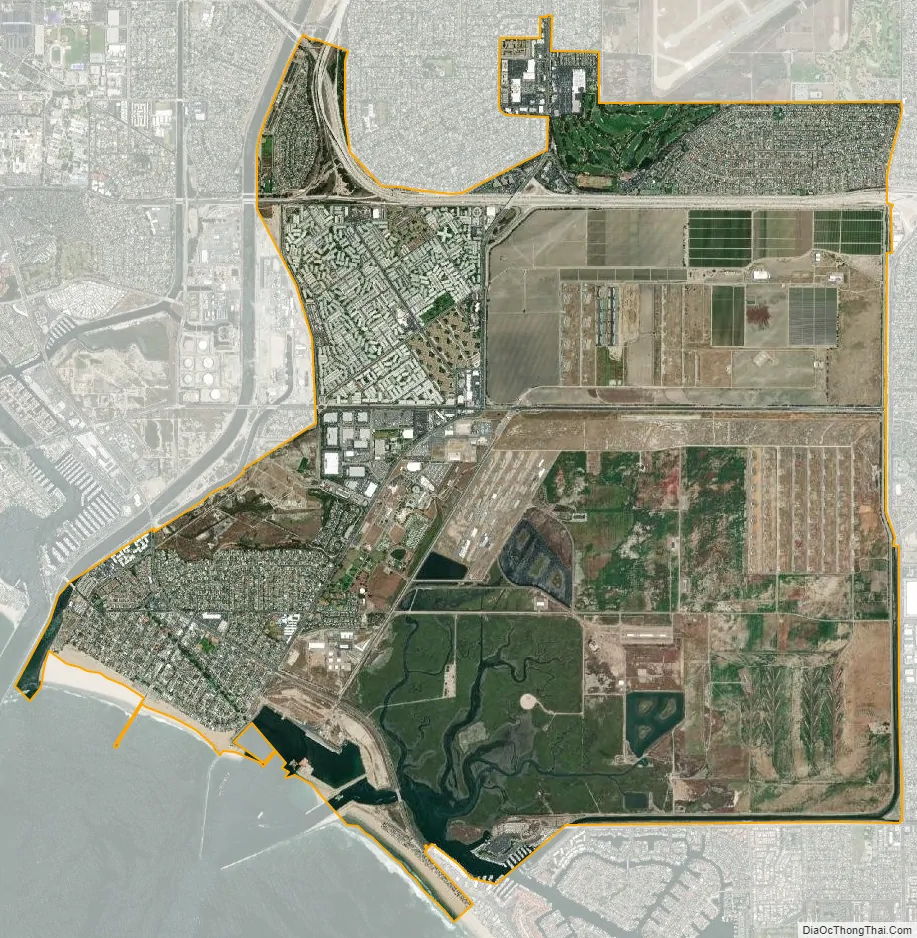
Seal Beach city Satellite Map
Geography
Seal Beach is located at 33°45′33″N 118°4′57″W / 33.75917°N 118.08250°W / 33.75917; -118.08250 (33.759283, -118.082396).
According to the United States Census Bureau, the city has a total area of 13.0 square miles (34 km). 11.3 square miles (29 km) of it is land and 1.8 square miles (4.7 km) of it (13.45%) is water.
Seal Beach is bounded by the CDP of Rossmoor and the city of Los Alamitos to the north, the West Garden Grove neighborhood and city of Westminster to the east, Huntington Beach to the east and south, and the Pacific Ocean to the west.
Climate
Seal Beach has a semi-arid climate (Köppen climate classification BSh) with Mediterranean characteristics.
See also
Map of California State and its subdivision:- Alameda
- Alpine
- Amador
- Butte
- Calaveras
- Colusa
- Contra Costa
- Del Norte
- El Dorado
- Fresno
- Glenn
- Humboldt
- Imperial
- Inyo
- Kern
- Kings
- Lake
- Lassen
- Los Angeles
- Madera
- Marin
- Mariposa
- Mendocino
- Merced
- Modoc
- Mono
- Monterey
- Napa
- Nevada
- Orange
- Placer
- Plumas
- Riverside
- Sacramento
- San Benito
- San Bernardino
- San Diego
- San Francisco
- San Joaquin
- San Luis Obispo
- San Mateo
- Santa Barbara
- Santa Clara
- Santa Cruz
- Shasta
- Sierra
- Siskiyou
- Solano
- Sonoma
- Stanislaus
- Sutter
- Tehama
- Trinity
- Tulare
- Tuolumne
- Ventura
- Yolo
- Yuba
- Alabama
- Alaska
- Arizona
- Arkansas
- California
- Colorado
- Connecticut
- Delaware
- District of Columbia
- Florida
- Georgia
- Hawaii
- Idaho
- Illinois
- Indiana
- Iowa
- Kansas
- Kentucky
- Louisiana
- Maine
- Maryland
- Massachusetts
- Michigan
- Minnesota
- Mississippi
- Missouri
- Montana
- Nebraska
- Nevada
- New Hampshire
- New Jersey
- New Mexico
- New York
- North Carolina
- North Dakota
- Ohio
- Oklahoma
- Oregon
- Pennsylvania
- Rhode Island
- South Carolina
- South Dakota
- Tennessee
- Texas
- Utah
- Vermont
- Virginia
- Washington
- West Virginia
- Wisconsin
- Wyoming


