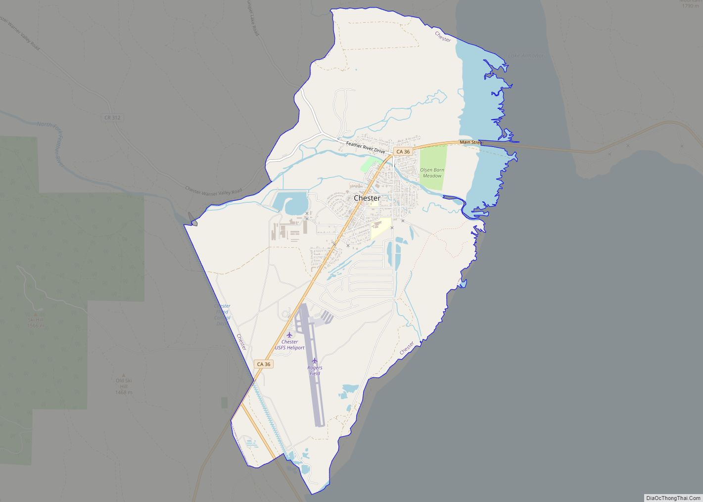
Map of Chino Hills city

Map of Chino Hills city

Chino Hills (Chino, Spanish for “Curly”) is a city located in the southwestern corner of San Bernardino County, California, United States. The city borders Los Angeles County on its northwest side, Orange County to its south and southwest, and Riverside County to its southeast. Chino Hills city overview: Name: Chino Hills city LSAD Code: 25 … Read more

Map of Chinese Camp CDP

Map of Chinese Camp CDP

Chinese Camp is a census-designated place (CDP) in Tuolumne County, California, United States. The population was 126 at the 2010 census, down from 146 at the 2000 census. It lies in the grassy foothills of the Sierra Nevada near the southern end of California’s Gold Country. Chinese Camp is California Historical Landmark #423, since 1949. … Read more

Map of China Lake Acres CDP

Map of China Lake Acres CDP

China Lake Acres is a census-designated place (CDP) in Kern County, California, United States. The population was 1,876 at the 2010 census, up from 1,761 at the 2000 census. China Lake Acres CDP overview: Name: China Lake Acres CDP LSAD Code: 57 LSAD Description: CDP (suffix) State: California County: Kern County Elevation: 2,431 ft (741 m) Total … Read more

Map of Chualar CDP

Map of Chualar CDP

Chualar (Spanish for “Pigweed grove”) is an unincorporated community and census-designated place (CDP) in the Salinas Valley of Monterey County, California, United States. Chualar is located 10 miles (16 km) southeast of Salinas, at an elevation of 115 feet (35 m). The population was 1,185 at the 2020 census. Chualar CDP overview: Name: Chualar CDP LSAD Code: … Read more

Map of Chowchilla city

Map of Chowchilla city

Chowchilla is a city in Madera County, California, United States. The city’s population was 19,039 at the 2020 census. Chowchilla is located 16 miles (26 km) northwest of Madera, at an elevation of 240 feet (73 m). The city is the location of two prisons: Central California Women’s Facility and Valley State Prison. Chowchilla city overview: Name: … Read more

Map of Chino city

Map of Chino city

Chino (/ˈtʃiːnoʊ/ CHEE-noh; Spanish for “Curly”) is a city in the western end of San Bernardino County, California, United States, with Los Angeles County to its west and Orange County to its south in the Southern California region. Chino is adjacent to Chino Hills. Chino’s surroundings have long been a center of agriculture and dairy … Read more

Map of Claremont city

Map of Claremont city, California

Claremont (/ˈklɛərmɒnt/) is a suburban city on the eastern edge of Los Angeles County, California, United States, 30 miles (48 km) east of downtown Los Angeles. It is in the Pomona Valley, at the foothills of the San Gabriel Mountains. As of the 2010 census it had a population of 34,926, and in 2019 the estimated … Read more

Map of Citrus CDP

Map of Citrus CDP

Citrus is a census-designated place (CDP) in Los Angeles County, California, United States. It is located in the San Gabriel Valley between Azusa to the north and west, Glendora to the east, and Covina to the south. The population was 10,866 at the 2010 census, up from 10,581 at the 2000 census. Citrus is named … Read more

Map of Citrus Heights city

Map of Citrus Heights city

Citrus Heights is a city in Sacramento County, California, United States. As of the 2020 U.S. Census, the city had a population of 87,583, up from 83,301 at the 2010 U.S. Census. Citrus Heights city overview: Name: Citrus Heights city LSAD Code: 25 LSAD Description: city (suffix) State: California County: Sacramento County Incorporated: January 1, … Read more

Map of Clayton city, California

Map of Clayton city, California

Clayton (formerly Clayton’s and Claytonville) is a city in Contra Costa County, California, United States. The population was 10,897 as of the 2010 census. Clayton city overview: Name: Clayton city LSAD Code: 25 LSAD Description: city (suffix) State: California County: Contra Costa County Incorporated: March 18, 1964 Elevation: 394 ft (120 m) Total Area: 3.84 sq mi (9.95 km²) Land … Read more

Map of Clay CDP, California

Map of Clay CDP, California

Clay is a census-designated place in Sacramento County, California. Clay sits at an elevation of 135 feet (41 m). The 2010 United States census reported Clay’s population was 1,195. Clay CDP overview: Name: Clay CDP LSAD Code: 57 LSAD Description: CDP (suffix) State: California County: Sacramento County Elevation: 135 ft (41 m) Total Area: 6.76 sq mi (17.50 km²) Land Area: … Read more

Map of Clarksburg CDP

Map of Clarksburg CDP, California

Clarksburg (formerly, Clarksburgh) is a census-designated place in Yolo County, California. It is located on the Sacramento River, in the extreme southeastern corner of the county. It lies at an elevation of 10 feet (3 m) in ZIP code 95612 and area codes 916 and 279. Clarksburg CDP overview: Name: Clarksburg CDP LSAD Code: 57 … Read more