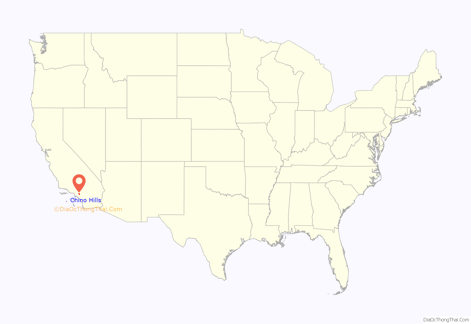
Chino Hills (Chino, Spanish for “Curly”) is a city located in the southwestern corner of San Bernardino County, California, United States. The city borders Los Angeles County on its northwest side, Orange County to its south and southwest, and Riverside County to its southeast.
| Name: | Chino Hills city |
|---|---|
| LSAD Code: | 25 |
| LSAD Description: | city (suffix) |
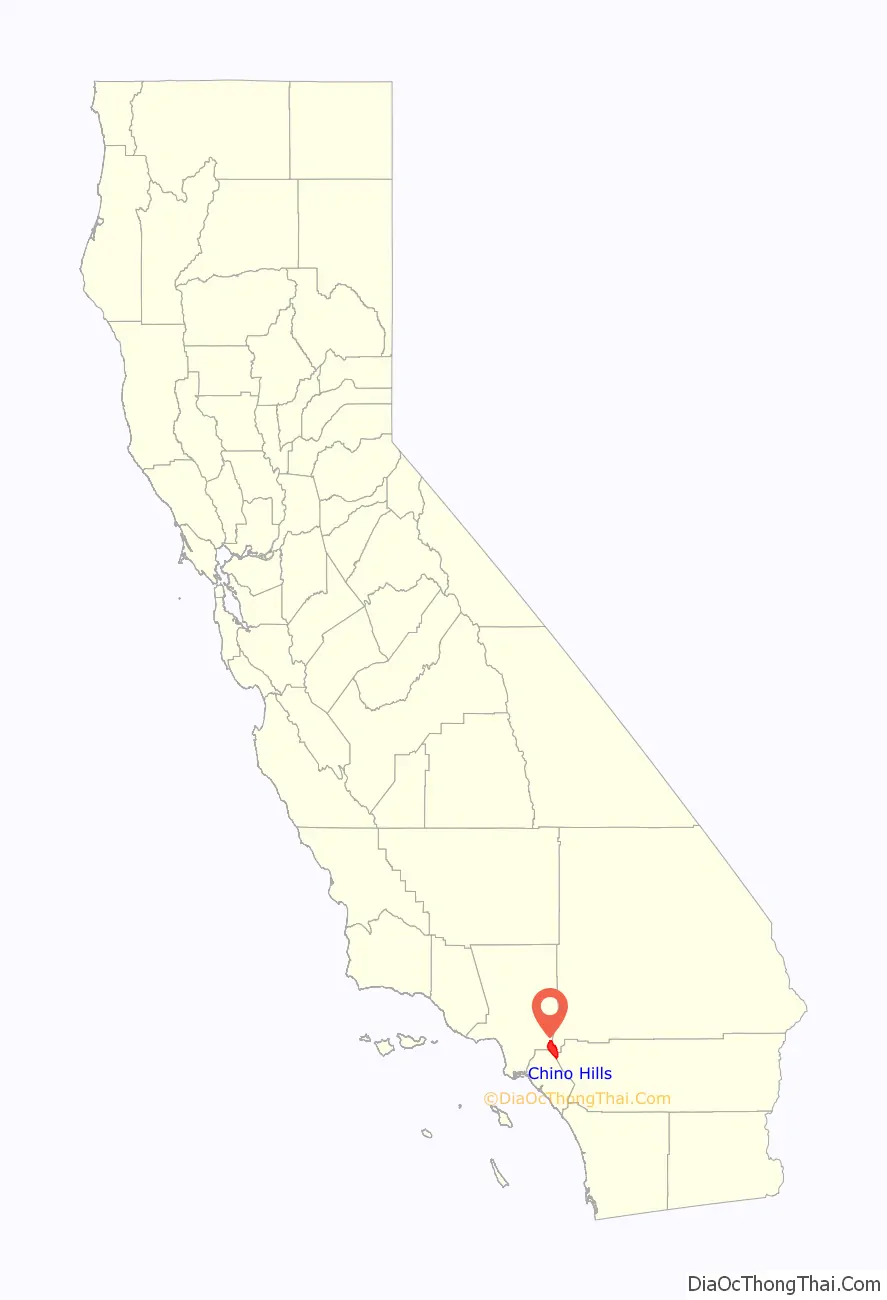
| State: | California |
| County: | San Bernardino County |
| Elevation: | 860 ft (262 m) |
| Total Area: | 44.70 sq mi (115.77 km²) |
| Land Area: | 44.65 sq mi (115.64 km²) |
| Water Area: | 0.05 sq mi (0.12 km²) 0.15% |
| Total Population: | 78,411 |
| Population Density: | 1,756.13/sq mi (678.05/km²) |
| ZIP code: | 91709 |
| Area code: | 909 |
| FIPS code: | 0613214 |
| Website: | www.chinohills.org |
Online Interactive Map
Click on ![]() to view map in "full screen" mode.
to view map in "full screen" mode.
Chino Hills location map. Where is Chino Hills city?
History
Indigenous
Prior to the colonization of the area by the Spanish Empire in the late 18th century, the Tongva village of Wapijanga was the major point of influence in what would become referred to as Chino Hills. The village was an important point of connection between the Tongva and Serrano.
Spanish and Mexican eras
After the Spanish founded Mission San Gabriel in 1771, the Chino Hills region was used extensively for grazing by mission cattle. During the Mexican Republic era, the hills were used as spillover grazing from such surrounding Mexican ranchos as Santa Ana del Chino and Rancho La Sierra (Yorba).
Early American era
This land was sold to Richard Gird, the founder of nearby Chino subdivision and from which the town of Chino sprung in 1910. With the building of the Carbon Canyon Mineral Springs in the modern-day Sleepy Hollow region of the city and the new Los Serranos Country Club in Los Serranos, Chino Hills, California, the area became a destination for both Los Angeles tourists and bootleggers during the prohibition because of its isolation. For the same reason, Sleepy Hollow became a destination for hippies and artists during the 1960s. During the late 1980s, an incorporation effort began and in 1991, the city was incorporated with a population of 42,000.
Development
Due to its topography of rolling hills, Chino Hills was primarily rural prior to the mid-1970s; most land was utilized for equestrian purposes and for dairies, except for the multi-use purposes of the State of California, promoting jobs for the community through day labor from the Chino Institute for Men on Central Avenue. Rapid and extensive housing developments followed throughout the 1980s and early 1990s, only slowing down in recent years. Most neighborhoods are arranged in a village-type format with strategically placed shopping centers and parks designed to be within walking distance of nearby homes.
Chino Hills is home to the Vellano Country Club, a private golf course and housing development designed by golf champion Greg Norman, his first project in the Greater Los Angeles area.
Chino Hills also includes the developed golf course development neighborhood of Los Serranos. Other large master-planned subdivisions without amenities include Woodview/Village Crossing, Gordon Ranch, LaBand Village, Butterfield Ranch, Rolling Ridge, Fairfield Ranch, and Payne Ranch.
Contemporary era
On July 29, the 2008 Chino Hills earthquake, a 5.4 magnitude earthquake, occurred at approximately 11:42:15 am PDT (18:42:15 UTC). Some incidents of damage were reported, but no fatalities or severe injuries occurred as a result. The earthquake was felt as far south as San Diego and as far north as Las Vegas. The quake was reported to have interrupted a taping of the show Judge Judy, as well as a first-day taping of the new show Judge Penny. The epicenter was located in the southeast portion of the Yorba Linda Fault.
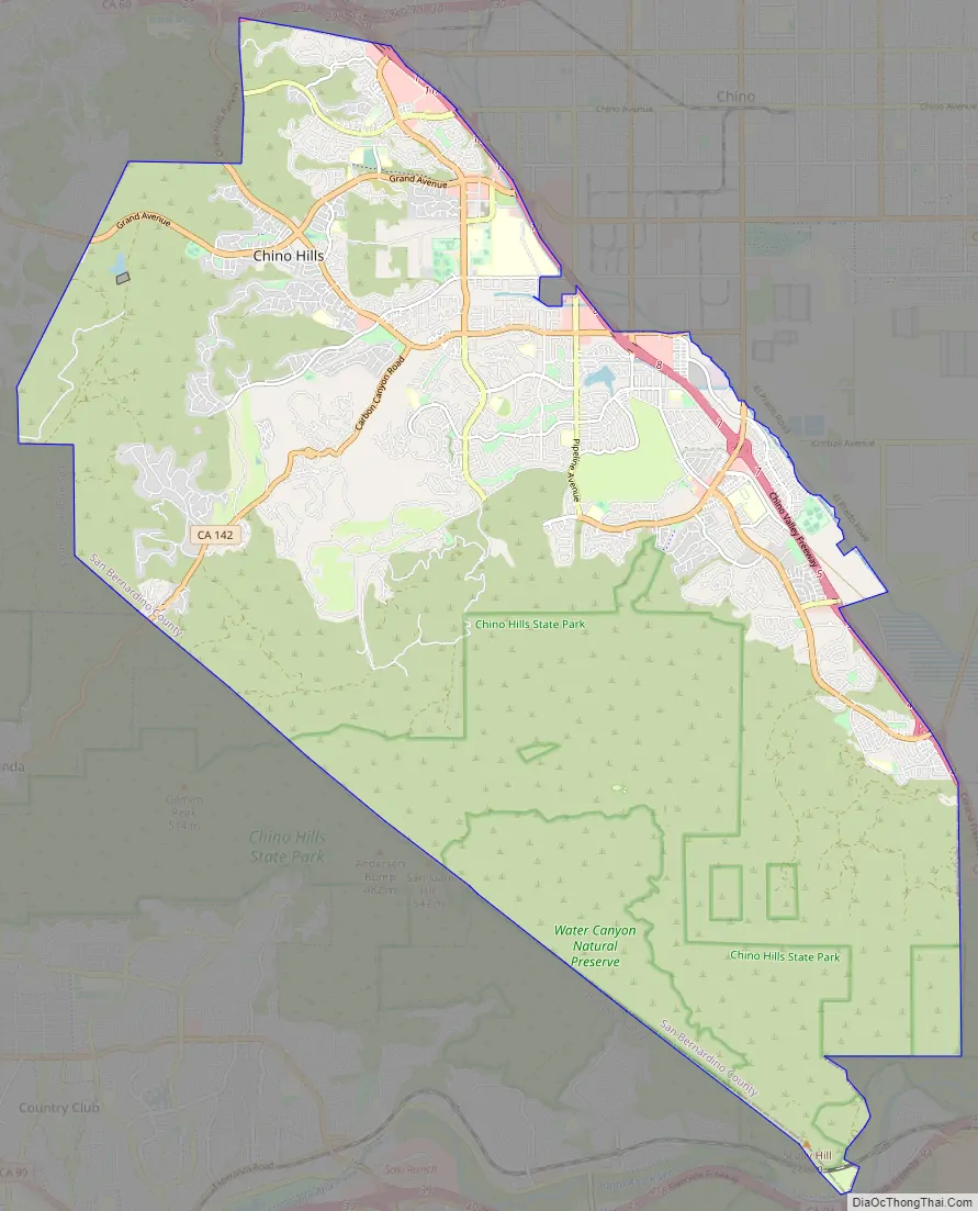
Chino Hills Road Map
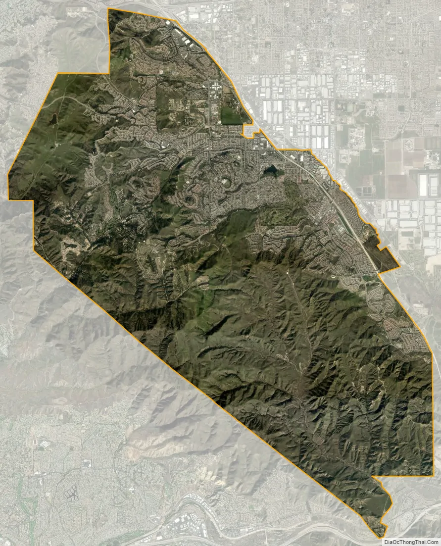
Chino Hills city Satellite Map
Geography
Physical geography
Chino Hills is a part of the Chino Valley. According to the United States Census Bureau, the city has a total area of 44.8 square miles (116 km), much of which is undeveloped rolling hills, including the Chino Hills State Park. 44.7 square miles (116 km) of it is land and 0.1 square miles (0.26 km) of it (0.15%) is water.
City layout
The city of Chino Hills is bounded by the Los Angeles County cities of Pomona and Diamond Bar to the north and to the northwest, the Los Angeles County unincorporated area of South Diamond Bar to the west, the San Bernardino County city of Chino to the east, unincorporated Riverside County near Corona to the southeast, and the Orange County cities of Brea and Yorba Linda to the west and southwest, respectively, as well as an unincorporated area of Orange County between Brea and Yorba Linda and a small unincorporated area between Yorba Linda and Anaheim, to the southwest and south, respectively.
The eastern border of Chino Hills roughly follows the Chino Valley Freeway (SR 71), which offers access to the Pomona Freeway (SR 60) to the north and the Riverside Freeway (SR 91) to the south. Undeveloped hills form the western border, which also serves as the San Bernardino – Orange County line. Because this area is mostly undeveloped, there is only one road directly connecting Chino Hills and Orange County, Carbon Canyon Road (SR 142), which is long, winding, and prone to landslides.
See also
Map of California State and its subdivision:- Alameda
- Alpine
- Amador
- Butte
- Calaveras
- Colusa
- Contra Costa
- Del Norte
- El Dorado
- Fresno
- Glenn
- Humboldt
- Imperial
- Inyo
- Kern
- Kings
- Lake
- Lassen
- Los Angeles
- Madera
- Marin
- Mariposa
- Mendocino
- Merced
- Modoc
- Mono
- Monterey
- Napa
- Nevada
- Orange
- Placer
- Plumas
- Riverside
- Sacramento
- San Benito
- San Bernardino
- San Diego
- San Francisco
- San Joaquin
- San Luis Obispo
- San Mateo
- Santa Barbara
- Santa Clara
- Santa Cruz
- Shasta
- Sierra
- Siskiyou
- Solano
- Sonoma
- Stanislaus
- Sutter
- Tehama
- Trinity
- Tulare
- Tuolumne
- Ventura
- Yolo
- Yuba
- Alabama
- Alaska
- Arizona
- Arkansas
- California
- Colorado
- Connecticut
- Delaware
- District of Columbia
- Florida
- Georgia
- Hawaii
- Idaho
- Illinois
- Indiana
- Iowa
- Kansas
- Kentucky
- Louisiana
- Maine
- Maryland
- Massachusetts
- Michigan
- Minnesota
- Mississippi
- Missouri
- Montana
- Nebraska
- Nevada
- New Hampshire
- New Jersey
- New Mexico
- New York
- North Carolina
- North Dakota
- Ohio
- Oklahoma
- Oregon
- Pennsylvania
- Rhode Island
- South Carolina
- South Dakota
- Tennessee
- Texas
- Utah
- Vermont
- Virginia
- Washington
- West Virginia
- Wisconsin
- Wyoming


