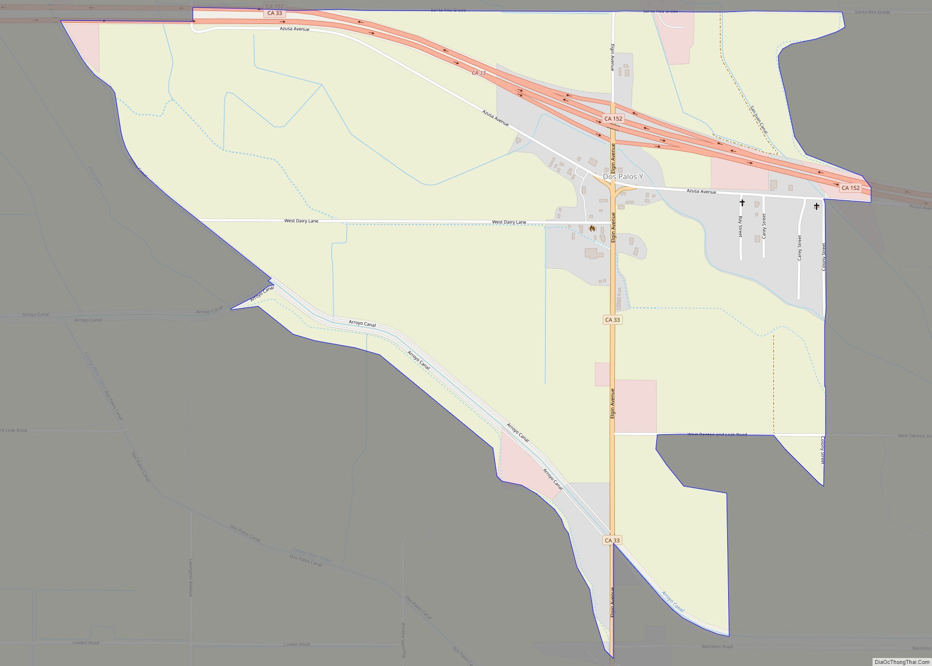
Map of Drytown CDP

Map of Drytown CDP

Drytown (formerly, Dry Town) is a census-designated place in Amador County, California. It is located 2.5 miles (4.0 km) south of Plymouth on Dry Creek, at an elevation of 646 feet (197 m). The population at the 2010 census was 167. The town is registered as a California Historical Landmark. The community is in ZIP code … Read more

Map of Doyle CDP

Map of Doyle CDP, California

Doyle is a rural small town in Lassen County, California. It is located 40 miles (64 km) southeast of Susanville, at an elevation of 4275 feet (1303 m). It is located 45 miles (72 km) northwest of Reno, Nevada. The ZIP Code is 96109. The community is inside area code 530. It is located within a census-designated … Read more

Map of Downieville CDP

Map of Downieville CDP

Downieville is a census-designated place in and the county seat of Sierra County, California, United States. Downieville is on the North Fork of the Yuba River, at an elevation of 2,966 feet (904 m). The 2020 United States census reported Downieville’s population was 290. Downieville CDP overview: Name: Downieville CDP LSAD Code: 57 LSAD Description: CDP … Read more

Map of Ducor CDP

Map of Ducor CDP

Ducor is a census-designated place (CDP) in Tulare County, California, United States. The population was 616 at the 2020 census, up from 612 at the 2010 census. Ducor is an abbreviation of an earlier name, Dutch Corners, which was given because several early settler families were German. The word “Dutch” in this case derives from … Read more

Map of Dublin city

Map of Dublin city, California

Dublin (formerly, Amador and Dougherty’s Station) is a suburban city of the East Bay in California. It is located within the Amador Valley of Alameda County‘s Tri-Valley region. It is located along the north side of Interstate 580 at the intersection with Interstate 680, roughly 35 miles (56 km) east of downtown San Francisco, 23 miles … Read more

Map of Duarte city

Map of Duarte city

Duarte (/ˈdwɑːrti, duˈɑːrteɪ/) is a city in Los Angeles County, California, United States. As of the 2020 census, the city population was 21,727. It is bounded to the north by the San Gabriel Mountains, to the north and west by the cities of Bradbury and Monrovia, to the south by the city of Irwindale, and … Read more

Map of Dunsmuir city

Map of Dunsmuir city

Dunsmuir is a city in Siskiyou County, northern California. It is on the upper Sacramento River. Its population is 1,707 as of the 2020 census, up from 1,650 from the 2010 census. Dunsmuir is currently a hub for tourism in Northern California, with Interstate 5 passing through it. Visitors enjoy fishing, skiing, climbing, or sight-seeing. … Read more

Map of Dunnigan CDP

Map of Dunnigan CDP

Dunnigan (formerly, Antelope) is a census-designated place in Yolo County, California on Interstate 5. The population was 1,416 at the 2010 census. Dunnigan’s ZIP code is 95937 and its area code 530. It lies at an elevation of 69 feet (21 m). Dunnigan CDP overview: Name: Dunnigan CDP LSAD Code: 57 LSAD Description: CDP (suffix) … Read more

Map of Durham city

Map of Durham CDP, California

Durham is a census-designated place (CDP) in Butte County, California, United States. The population was 5,518 at the 2010 census. Durham CDP overview: Name: Durham CDP LSAD Code: 57 LSAD Description: CDP (suffix) State: California County: Butte County Elevation: 161 ft (49 m) Total Area: 81.84 sq mi (211.96 km²) Land Area: 81.69 sq mi (211.57 km²) Water Area: 0.15 sq mi (0.39 km²)  0.19% Total … Read more

Map of Eagleville CDP

Map of Eagleville CDP, California

Eagleville is a census-designated place in Modoc County, California. It is located 25 miles (40 km) east-southeast of Alturas, at an elevation of 4642 feet (1415 m). Its population is 45 as of the 2020 census, down from 59 from the 2010 census. Located in Surprise Valley, Eagleville is a small community south of Cedarville. The … Read more

Map of Dutch Flat CDP

Map of Dutch Flat CDP

Dutch Flat (also, Dutchman’s Flat, Dutch Charlie’s Flat, and Charley’s Flat) is a small unincorporated community and census-designated place (CDP) in Placer County, California, United States, about 30 miles (48 km) northeast of Auburn along Interstate 80. It was founded by German immigrants in 1851 and was once one of the richest gold mining locations in … Read more

Map of Dustin Acres CDP

Map of Dustin Acres CDP

Dustin Acres is a census-designated place (CDP) in Kern County, California, United States. Dustin Acres is located 6.5 miles (10 km) north-northeast of Taft, at an elevation of 384 feet (117 m). The population was 652 at the 2010 census, up from 585 at the 2000 census. Dustin Acres CDP overview: Name: Dustin Acres CDP LSAD Code: … Read more