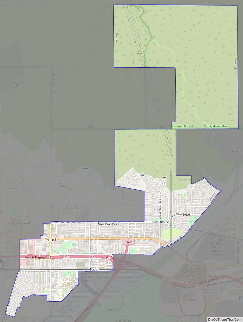
Duarte (/ˈdwɑːrti, duˈɑːrteɪ/) is a city in Los Angeles County, California, United States. As of the 2020 census, the city population was 21,727. It is bounded to the north by the San Gabriel Mountains, to the north and west by the cities of Bradbury and Monrovia, to the south by the city of Irwindale, and to the east by the cities of Irwindale and Azusa. Duarte is located on historic U.S. Route 66 which today follows Huntington Drive through the middle of the city. The town is named after Andrés Avelino Duarte, a Californio ranchero who founded the community.
| Name: | Duarte city |
|---|---|
| LSAD Code: | 25 |
| LSAD Description: | city (suffix) |
| State: | California |
| County: | Los Angeles County |
| Incorporated: | August 22, 1957 |
| Elevation: | 512 ft (156 m) |
| Total Area: | 6.71 sq mi (17.38 km²) |
| Land Area: | 6.71 sq mi (17.38 km²) |
| Water Area: | 0.00 sq mi (0.00 km²) 0% |
| Total Population: | 21,727 |
| Population Density: | 3,238.49/sq mi (1,250.39/km²) |
| ZIP code: | 91008-91010 |
| Area code: | 626 |
| FIPS code: | 0619990 |
| GNISfeature ID: | 1652699 |
| Website: | www.accessduarte.com |
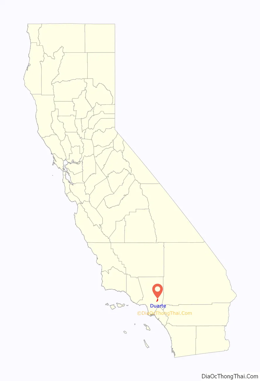
Online Interactive Map
Click on ![]() to view map in "full screen" mode.
to view map in "full screen" mode.
Duarte location map. Where is Duarte city?

History
Around 500 B.C., a band of Shoshonean-speaking Indians established settlements in what is now the San Gabriel Valley. These Native Americans came to be called the Gabrieliño Indians (after San Gabriel, the local mission) by early Spanish explorers, but now prefer to be called the Tongva. Since the San Gabriel Valley area was home to large numbers of oak trees such as coast live oak and interior live oak, a staple of the Tongva diet was an acorn meal made by boiling acorn flour.
Spanish era
Duarte’s history with Europeans dates back to 1769, when all land in California was claimed by the king of Spain. The first Europeans visited the San Gabriel Valley, including Duarte, during a 1769 expedition from San Diego to Monterey Bay commanded by Don Gaspar de Portolà. Accompanying Portolà was a Franciscan priest from Junípero Serra’s order in Mexico, Juan Crespí, who served as the diarist of the expedition. Much of what is known of early California is known only from the detailed descriptions recorded by Crespi.
On September 8, 1771, the Franciscans established the Mission San Gabriel Arcangel in the San Gabriel Valley. The mission was a resting point for early California travelers and gathered most of the native Tongva into an agricultural lifestyle. Following Mexican independence in 1821, the mission lands were nationalized.
Mexican era
On May 10, 1841, the governor of Alta California, Juan Bautista Alvarado, granted to former Mexican corporal Andrés Avelino Duarte and his wife nearly 7,000 acres (28 km) of prime land in the central-northern San Gabriel Valley. Duarte named his new holdings “Rancho Azusa de Duarte”. The name Azusa was derived from Asuksa-gna, the name of the Tongva settlement on the Foothills of California, on the western side of the alluvial fan where the San Gabriel River exits the San Gabriel Mountains; a portion of this area forms the northeasternmost corner of Duarte. That land grant now comprises portions of Arcadia, portions of Monrovia, all of Bradbury, all of Duarte, portions of Irwindale, portions of Azusa and a portion of Baldwin Park. Corporal Duarte had the local Indians build a small hut for his family and help him plant a kitchen garden and orchards near “the Indian Springs of the Asuksas” (in what is now Fish Canyon).
Post-Conquest era
Following the American Conquest of California, the territory was given to the United States in 1848 at the end of the Mexican–American War. In 1851, Congress passed a bill that established a Board of Land Commissioners whose duty was to determine the validity of all grants of Alta California land by Spanish and Mexican authorities.
Corporal Duarte began incurring legal expenses and other debts, which he defrayed by selling portions of his Rancho. This first sale was a 225-acre (0.91 km) parcel at the southern end of the Rancho to Michael Whistler and two unidentified colleagues. Whistler later bought out his colleagues and sold the entire parcel to Dr. Nehemiah Beardslee, who started the first school in Duarte (which now bears his surname) and laid out the first section of Duarte’s water lines. Corporal Duarte divided much of the Rancho’s remainder into 40-acre (16 ha) plots and sold them individually. Corporal Duarte finally won a favorable ruling from the Supreme Court for his land grant case in 1878, but by then he had sold the entire Rancho.
Many of Duarte’s earliest pioneer families came to Duarte in the mid-19th century for their health, the pleasant climate, and the fertile soil. English settlers, Americans from the Midwest and Deep South, Latinos who remained from the Rancho and Japanese immigrants enabled Duarte to grow into a thriving agricultural community specializing in citrus production. The first recorded avocado tree grown in California was planted in Duarte by William Chappelow, Sr. grown from one of four seeds sent to him by the Division of Pomology of the United States Department of Agriculture in 1893.
Modern era
Two medical institutions were started in Duarte in the early part of the 20th century. In 1913, the Jewish Consumptive Relief Association started a tuberculosis sanitarium in the form of a small tent city on 40 acres (16 ha) of land south of Duarte Road. This later evolved into the world-renowned City of Hope National Medical Center, a recognized leader in fighting cancer and other catastrophic diseases. In 1930, a group of Carmelite nuns known as the Carmelite Sisters of the Most Sacred Heart of Los Angeles established what is now the Santa Teresita Rest Home, known until recently as Santa Teresita Medical Center. After decades as a full-service hospital, Santa Teresita was downgraded to “medical center” in the early 21st century, after financial problems, caused both by administrative missteps as well as the costs of providing medical coverage to the uninsured, forced the hospital to close its emergency room. Santa Teresita now operates as an “outpatient services only” facility.
In 1957, a dedicated group of community members, fearing annexation by neighboring cities, led a fight for incorporation. Indeed, parts of the original Rancho had already been annexed by neighboring Monrovia, Azusa, Irwindale, and Baldwin Park. At the same time, a rival group representing an affluent enclave in the foothills started a competing drive for incorporation, and broke off to form the separate City of Bradbury. A 2001 Los Angeles Times article stated that their petition for incorporation arrived in Sacramento on August 22, 1957, “mere moments” before the petition that would have included them in the City of Duarte. Still, many ties between the two communities remain in that they both form the Duarte Unified School District; they both share the same post office and the 91008 ZIP code; and they both share combined public services such as the Los Angeles County Sheriff’s Department and Los Angeles County Fire Department, and garbage pickup (provided by Burrtec Waste Services).
The original city logo was created by Bill Botts Sr. in 1957. It consisted of a double-circular seal, with the inner circle containing an adobe arch featuring the Rancho Azusa de Duarte “d” brand (inside the arch is the original date of the Rancho’s establishment, 1841) while the outer circle features the year of Duarte’s incorporation (1957). The current city logo was created in early 1982 to mark Duarte’s 25th anniversary of cityhood.
Like many of its neighbors, modern Duarte is a bedroom community. The City of Duarte is geographically isolated from population centers to the east and south due to the San Gabriel River and rock quarry operations in Irwindale and Azusa. These factors have proven to be an ongoing economic challenge for local businesses as the city attracts little outside spending, and most residents spend their money elsewhere. Due to air quality and noise concerns, the City of Duarte has sought repeatedly to halt the expansion of neighboring quarry operations, but has had no success against the monied interests behind the quarries and the neighboring city governments beholden to them. Still, over the past few decades, the city leadership has succeeded in bringing retail development to the western portion of Duarte.
In September 2010, Forbes magazine placed the ZIP code of 91008 at #1 on its annual list of America’s most expensive ZIP codes, containing the parts of Duarte immediately north of neighboring Bradbury.
Duarte Road Map
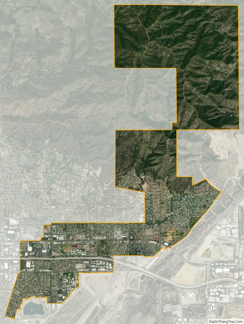
Duarte city Satellite Map
Geography
Duarte is located at 34°08′25″N 117°57′42″W / 34.140416°N 117.961678°W / 34.140416; -117.961678.
According to the United States Census Bureau, the city has a total area of 6.7 square miles (17 km), all land.
See also
Map of California State and its subdivision:- Alameda
- Alpine
- Amador
- Butte
- Calaveras
- Colusa
- Contra Costa
- Del Norte
- El Dorado
- Fresno
- Glenn
- Humboldt
- Imperial
- Inyo
- Kern
- Kings
- Lake
- Lassen
- Los Angeles
- Madera
- Marin
- Mariposa
- Mendocino
- Merced
- Modoc
- Mono
- Monterey
- Napa
- Nevada
- Orange
- Placer
- Plumas
- Riverside
- Sacramento
- San Benito
- San Bernardino
- San Diego
- San Francisco
- San Joaquin
- San Luis Obispo
- San Mateo
- Santa Barbara
- Santa Clara
- Santa Cruz
- Shasta
- Sierra
- Siskiyou
- Solano
- Sonoma
- Stanislaus
- Sutter
- Tehama
- Trinity
- Tulare
- Tuolumne
- Ventura
- Yolo
- Yuba
- Alabama
- Alaska
- Arizona
- Arkansas
- California
- Colorado
- Connecticut
- Delaware
- District of Columbia
- Florida
- Georgia
- Hawaii
- Idaho
- Illinois
- Indiana
- Iowa
- Kansas
- Kentucky
- Louisiana
- Maine
- Maryland
- Massachusetts
- Michigan
- Minnesota
- Mississippi
- Missouri
- Montana
- Nebraska
- Nevada
- New Hampshire
- New Jersey
- New Mexico
- New York
- North Carolina
- North Dakota
- Ohio
- Oklahoma
- Oregon
- Pennsylvania
- Rhode Island
- South Carolina
- South Dakota
- Tennessee
- Texas
- Utah
- Vermont
- Virginia
- Washington
- West Virginia
- Wisconsin
- Wyoming


